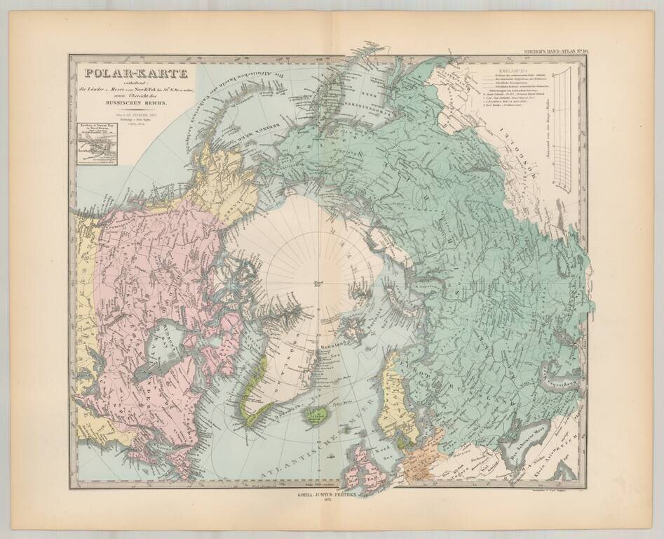
Striking map of the polar region, extending south to 50 degrees. Nice detail in Alaska and Canada, including forts, several routes and other interesting details.
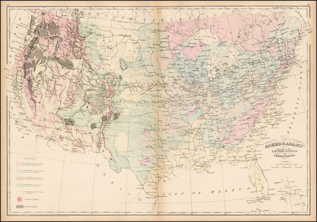
Striking geological map of the United States exhibiting geological regions including Eozoic, Paleozoic, Carboniferous, Mesozoic, Cenozoic, and volcanic regions.
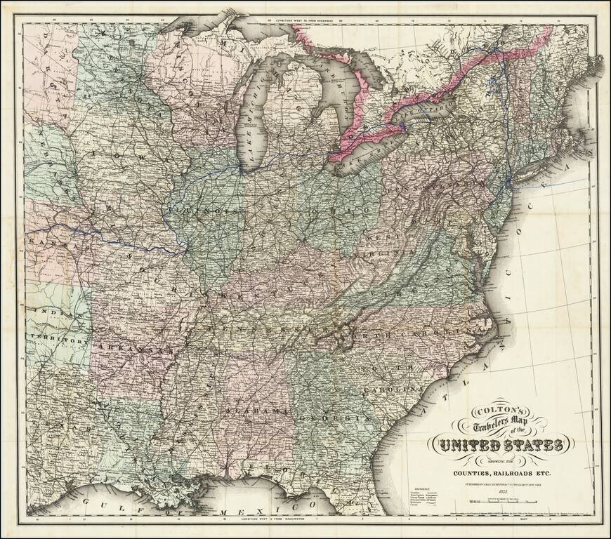
Detailed map of the United States, extending west to just before the Rocky Mountains. Includes an excellent overview of the railroads then in operation.
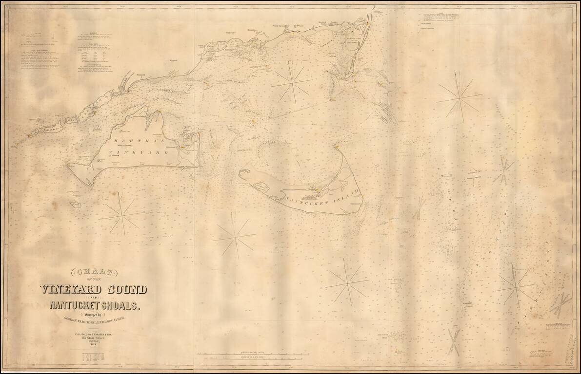
Fine large format sea chart of the waters around Martha's Vineyard and Nantucket, by George Eldridge, the leading private American chartmaker of the era. This mammoth chart depicts, in detail, the waters around the Elizabeth Islands, Martha's...
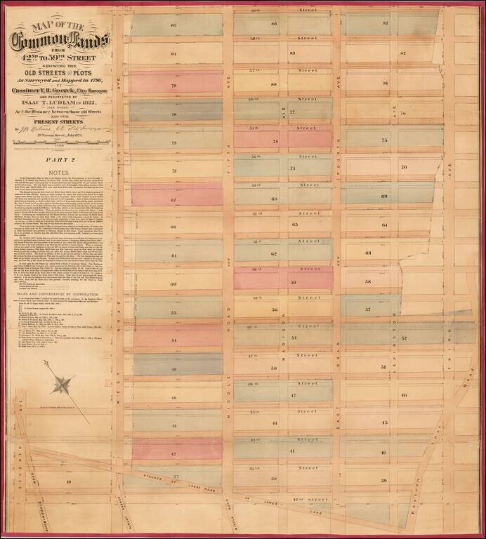
![[Upper East Side - Manhattan -- 79th Street to 93rd Street] Map of the Common Lands from 76th to 93rd Street Showing the Old Streets and Plots As Surveyed and Mapped in 1796, By Cassimer T. H. Goerck, City Surveyor and Resurveyed by Isaac T. Ludlam in 1](/map/small/61033.jpg)
Upper East Side - Manhattan (79th Street to 93rd Street) This is a John Bute Holmes 1874 cadastral map of the Upper East Side neighborhood of Manhattan - the only specific map of this area to appear in the 19th century. The map depicts the region...
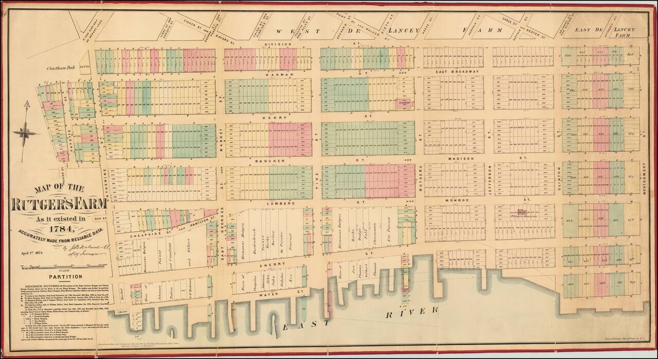
Excellent separately-issued 1874 map of the Lower East Side and Two Bridges neighborhoods of Manhattan. The map covers Oliver Street to Montgomery street and from Division to the East River. The Rutgers Farm The Rutgers Farm, which occupied the...
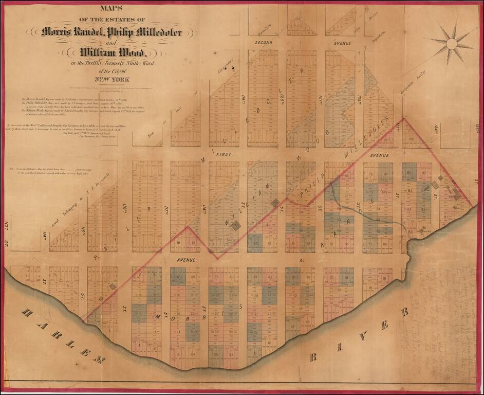
Rare cadastral map of New York City's Spanish Harlem. A rare cadastral or property map of northeastern Manhattan, New York City, between Second Avenue and the Harlem River, and from 113th to 125th Streets. This area is today generally considered part...
Fascinating map of the Upper East Side by one of New York's most eccentric mapmakers. Superb large format, separately issued map of part of the Fashion District in Manhattan, by one of New York's most fascinating mapmakers, John Bute Holmes. This...
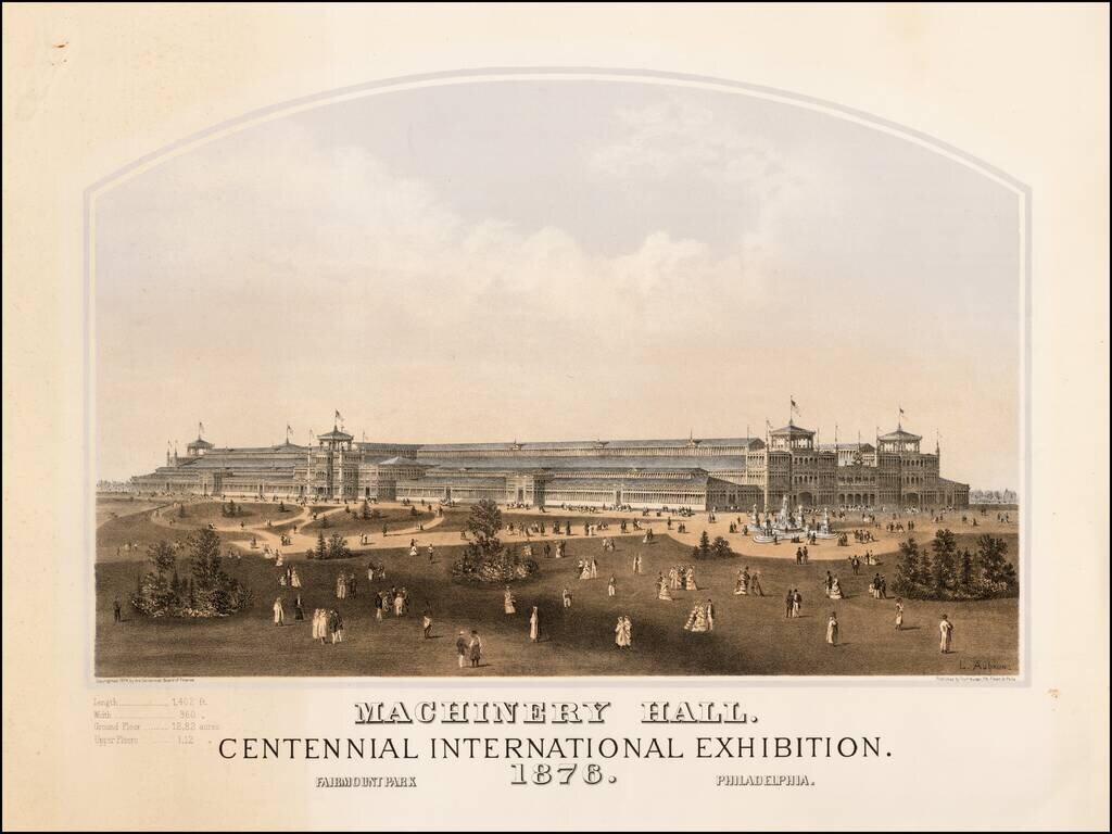
Fine example of Louis Aubrun's view of Machinery Hall, one of the primary exhibition buildings constructed for the 1876 Centennial Exhibition in Philadelphia. This fine tinted lithographic view was one of a group of views commissioned in 1874 by the...
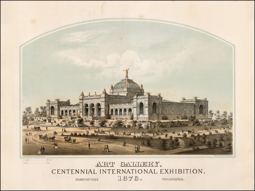
Fine example of Thomas Hunter's view of the Art Gallery, one of the primary exhibition buildings constructed for the 1876 Centennial Exhibition in Philadelphia. This fine tinted lithographic view was one of a group of views commissioned in 1874 by the...
![County Map of Florida [with inset of Mobile]](/map/small/65016.jpg)
Attractive post-civil war map of Florida, colored by county. Includes large inset of Mobile, Alabama. Shows towns, rivers, railroads, lakes, keys, forts, swamps, etc. The county configurations are still incomplete.
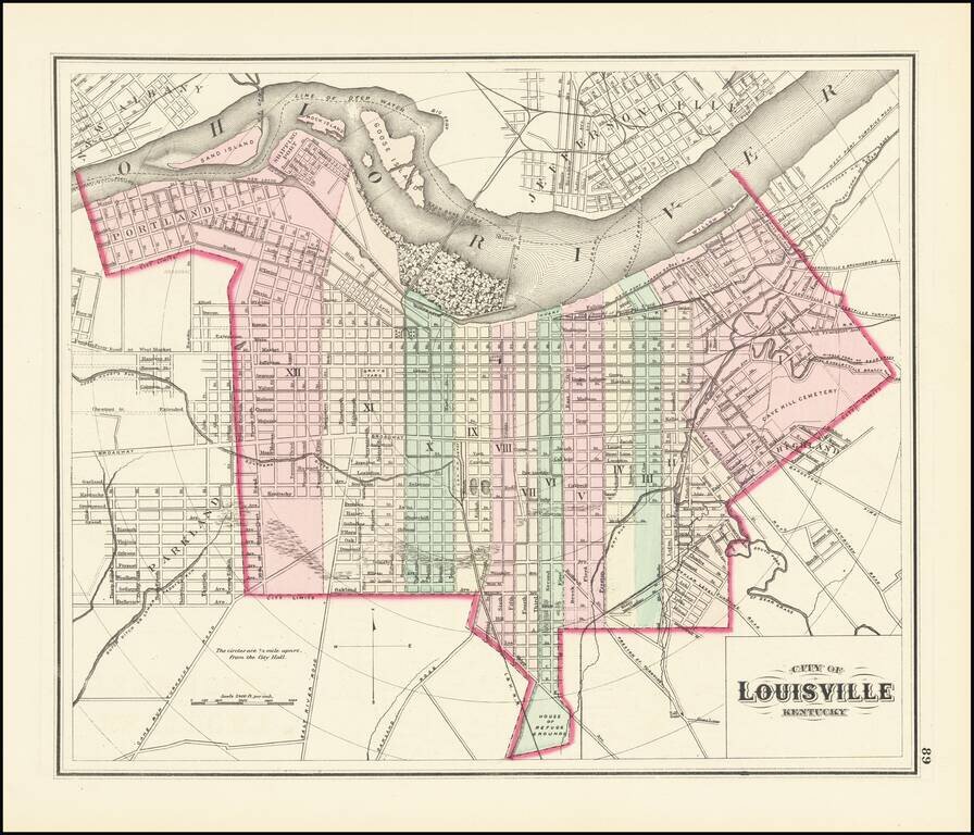
First Printed Atlas Map of Louisville Gorgeous map of Louisville, Kentucky, hand colored by wards, published by OW Gray. This is the earliest map of Louisville to appear in a commercial atlas.
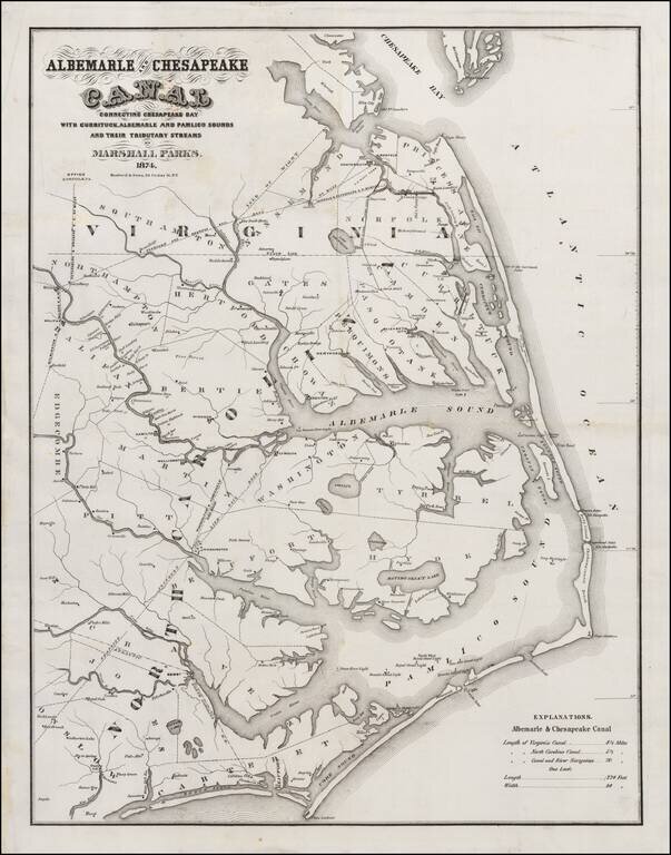
Unrecorded Edition! Rare separately issued map of the Ablemarle and Chesapeake Canal, one of the major engineering projects of the period south of the Mason Dixon. The map illustrates the region between Cape Charles and Cape Lookout, showing the...
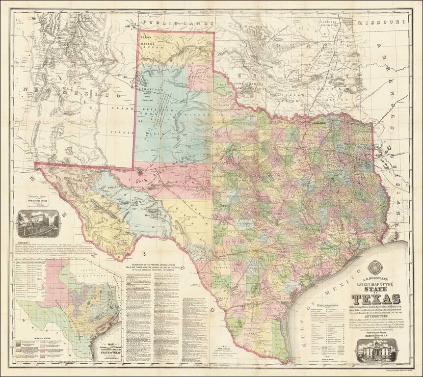
“Texas is, or will be, the wealthiest state in the Union, possessing as she does great agricultural capabilities, all the varieties of soils, minerals and useful rocks known to exist in the world.” (Roessler, “Some Account of the Mineral Wealth...
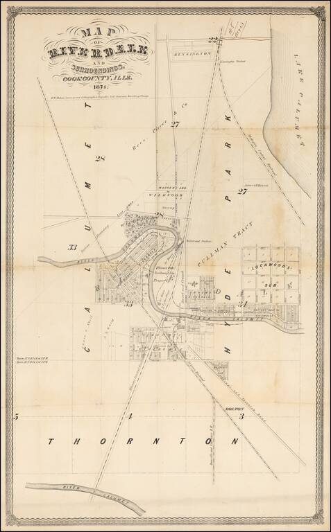
Early Promotional Map for Riverdale, Illinois -- One Year After Its First Post Office Was Established An exceptionally rare 1874 survey map of Riverdale, Illinois, a suburb of Chicago. The map is centered on a bend in the Little Calumet River just...
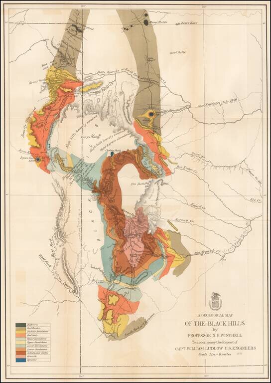
Important early geological survey map of the Black Hills region, undertaken by William Ludlow, while under the command of George Custer. In 1874, a large group of cavalrymen under the command of Lt. Col. George Armstrong Custer moved into the Black...