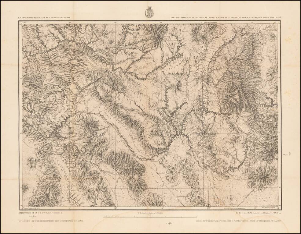
Detailed topographical map showing southwestern New Mexico and southeastern Arizona. Shows towns, roads, mountains, rivers, lakes, hydrographical details, etc. The map was generated during the Wheeler Survey. The Wheeler Survey was a survey of a...
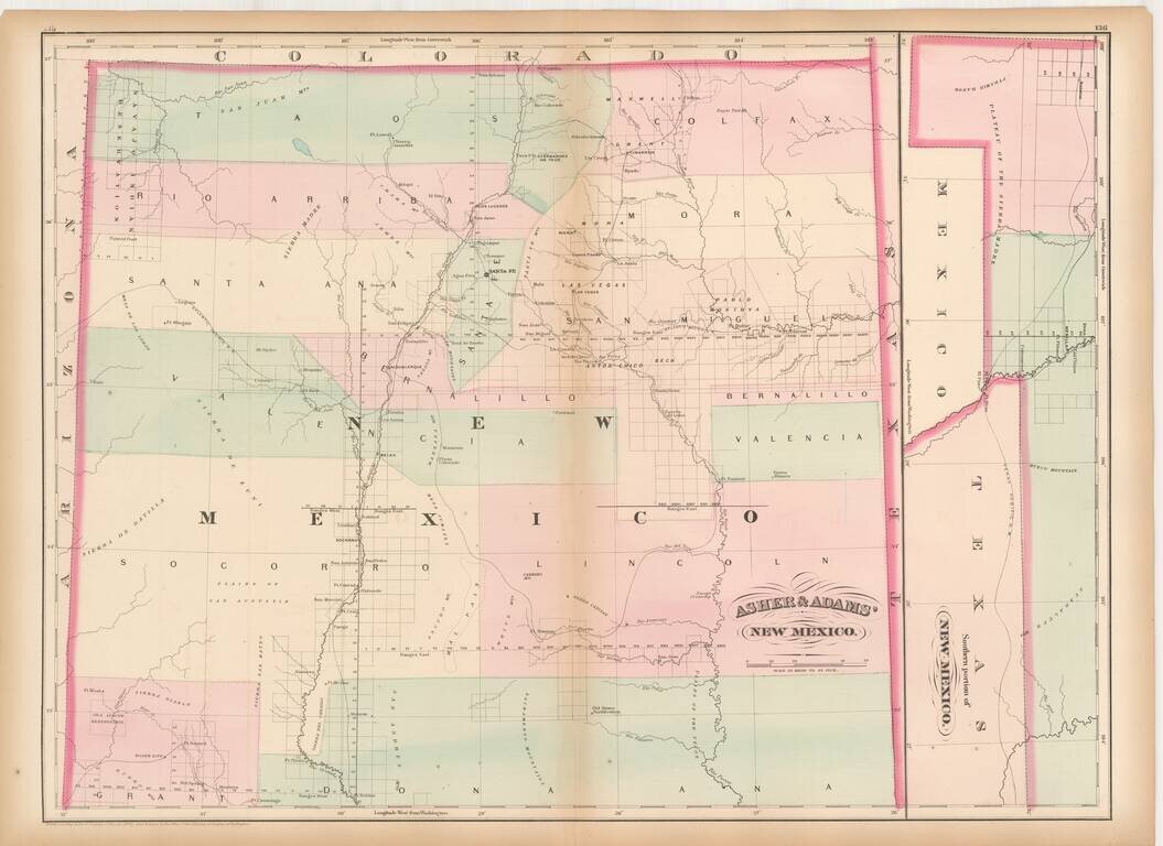
Remarkable large format railroad map of New Mexico Territory. The earliest separately issued map of New Mexico Territory in its modern configuration to appear in a commercial atlas . The map illustrates the early railroads, settlements, mining...
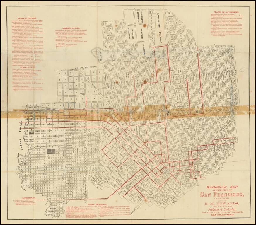
Scarce folding map of San Francisco, with west at the top, printed in black and red, focusing on the city's budding urban rail system. Rumsey (258) dates his example to 1874 on the basis of the "new mint" at 5th and Mission. The first successful San...
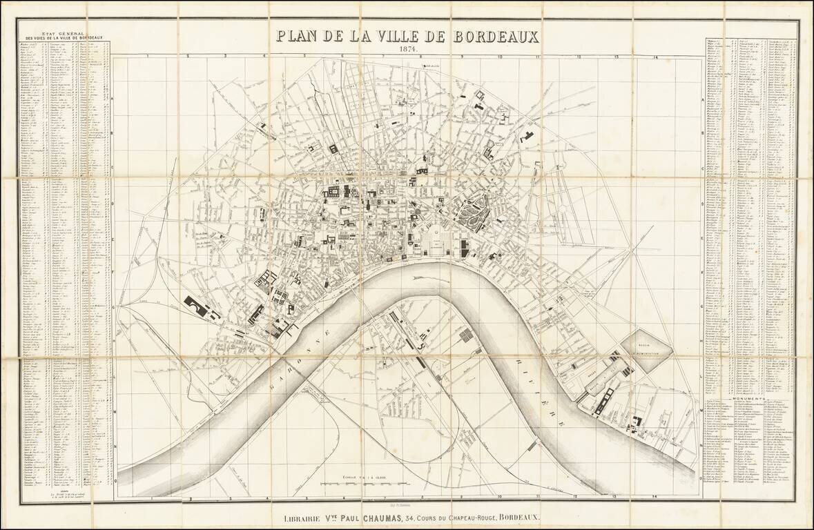
Highly detailed map of Bordeaux, published in Bordeaux in 1874. The map is oriented with east at the top, and includes a detailed index on either side of the map. The map illustrates the major buildings and squares, along with the town lay out along...
![[Shanghai, Hangzhou, Ningbo, Suzhou] Carte du Tche-kiang dressee ar les Missionaires sous la direction de Mgr Guierry de la Congregation de St. Lazare Vicaire Apostque du Tach-Kiang](/map/small/64426.jpg)
Rare Missionary map of China, showing the region from Shanghai in the north to Ningde. The map illustrates the province of Tche-kiang. As noted by the text which accompanied the map, it was drawn up by the missionaries working in province, under the...
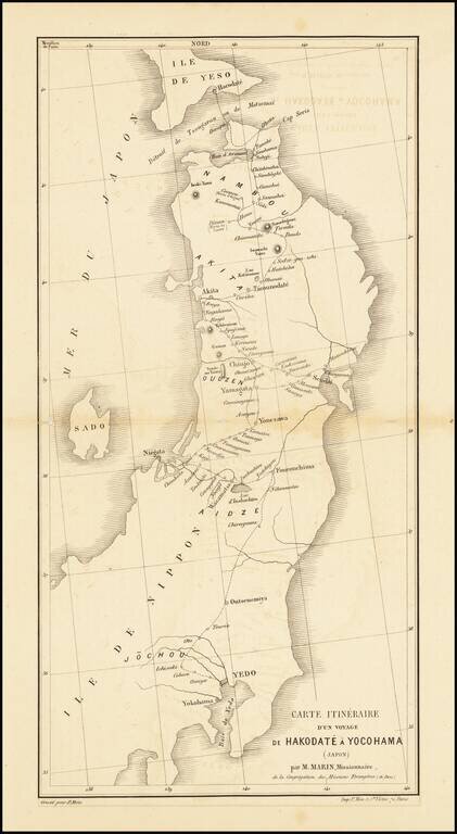
Scarce missionary map showing a portion of Japan, published in Paris. Includes the route taken by the Missionary Marin through Yokohama and Hokkaido.
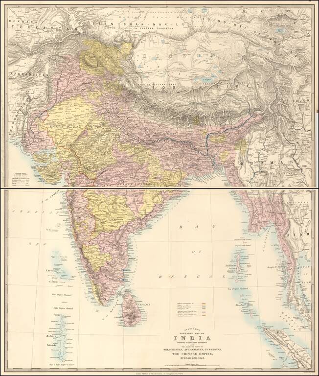
Showing political and administrative divisions, cities, towns, roads, railroads, mountains and rivers. Relief shown by hachures. Prime meridian is Greenwich. A fine detailed map of India and the Burmese coast. The map extends from Turkestan and...
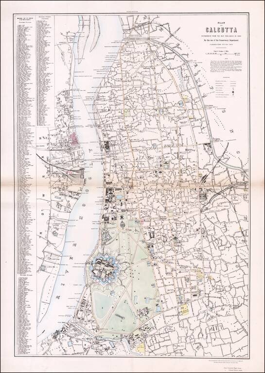
Rare Plan of Calcutta (now Kolkata, India) at the End of East India Company Rule Colored version of the detailed plan of Calcutta commissioned by the Conservancy Department. Corrected to 1874, this is the third edition of the plan and the only known...
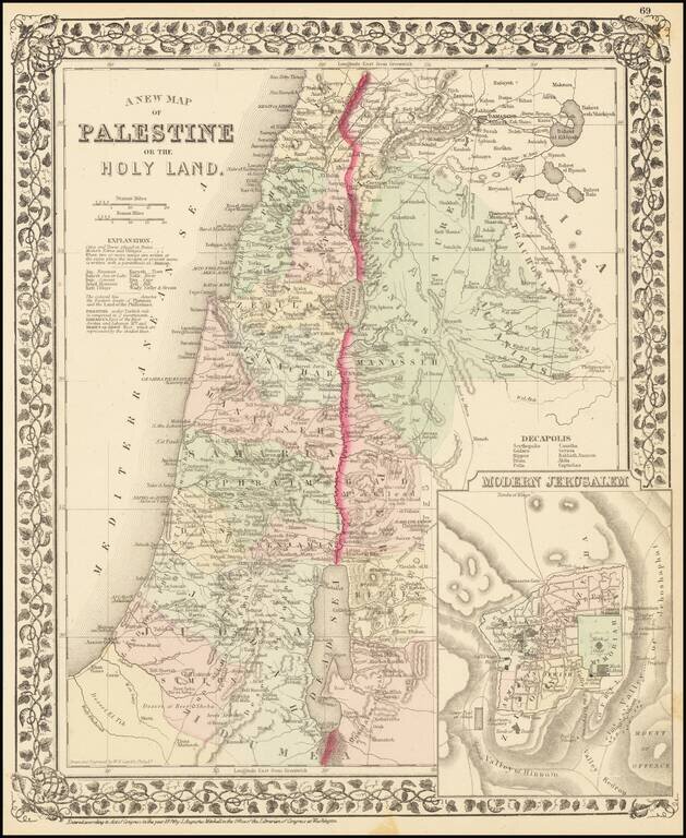
Interesting map of the Holy Land, hand colored by the 13 tribes, with an inset of modern Jerusalem. Key shows cities, towns, roads, etc.
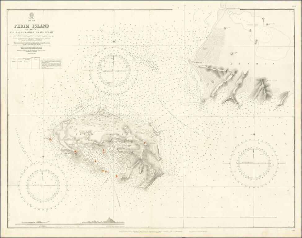
Extremely detailed chart of Perim Island (also called Mayyun in Arabic) in the Strait of Mandeb, at the southern entrance to the Red Sea. Perim is a small but geopolitically important island at the entrance to the Red Sea. With the beginning of the...
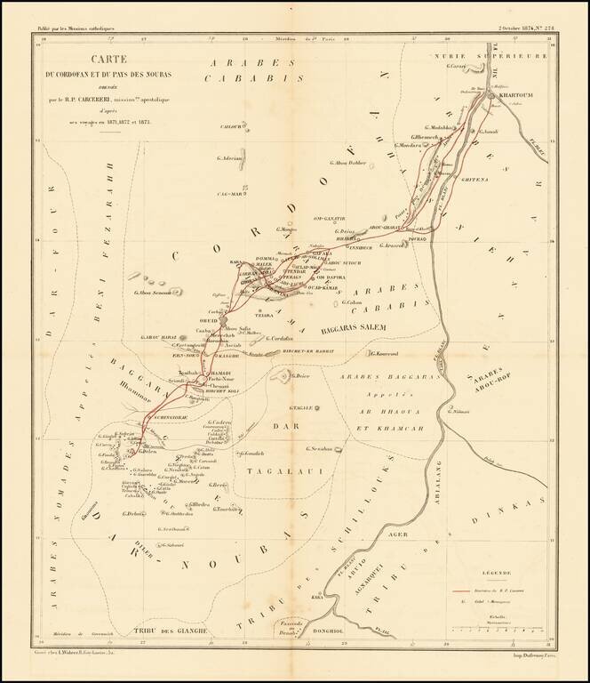
Scarce map of the Upper Nile and White Region, illustrating the travels of Stanislaus Carcereri in 1871-1873. Father Stanislaus Carcereri (1840-1899), along with six members of his order, played a vital role in the beginnings of missionary work...
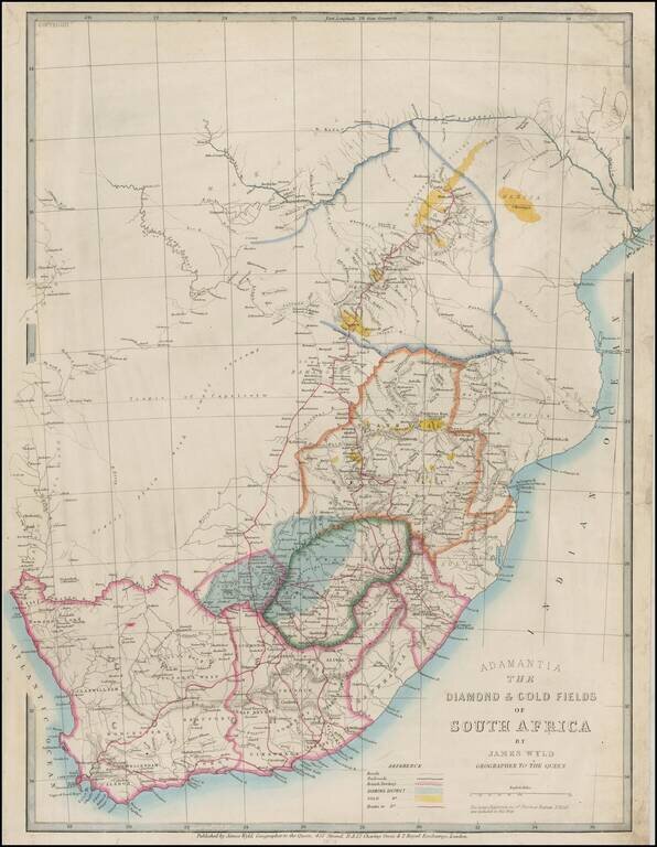
Rare map of the Adamantia region of South Africa, published by James Wyld in 1874. A very early map of the diamond fields. Pniel is shown but not Kimberley. The gold fields indicated are the Manica and Northern Gold Fields. The gold fields of the...
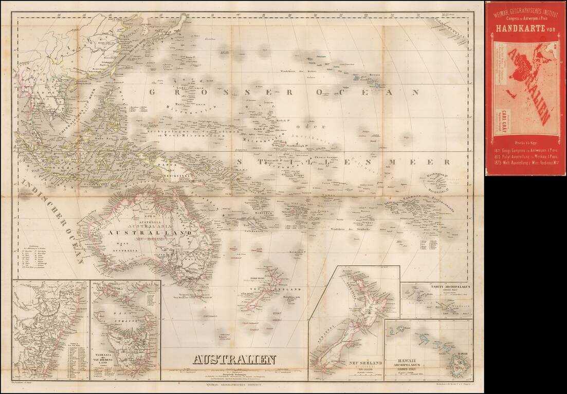
Separately published map of Oceana, bearing the imprint of Carl Graf. Includes inset maps of Hawaii, New Zealand, Oceana, Tahiti, Van Diemens Land and New South Wales.