![Повстанцы 1863 Года [(Polish) Insurgents of 1863]](/map/small/52719.jpg)
Three Vilnius-Published Prints of the January Uprising -- Polish National Uprising in 1863. A highly unusual, early Lubki (popular graphic) series, locally-published in Vilnius, Lithuania and depicting a contemporary nationalist revolt by the...

First Edition. One of the more attractive and differentiated American atlases of the 1860s. Schonberg favored heavy coloring, and in some cases loose cartography. The map of the West is interesting for its very large Idaho Territory, which at the...
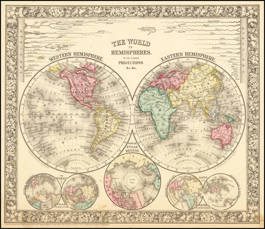
Decorative double hemisphere map of the world, with a number of other smaller hemispheric projections and projections of the world's rivers from this famous American Atlas. SA Mitchell Jr. acquired his father's former business from DeSilver in 1860...
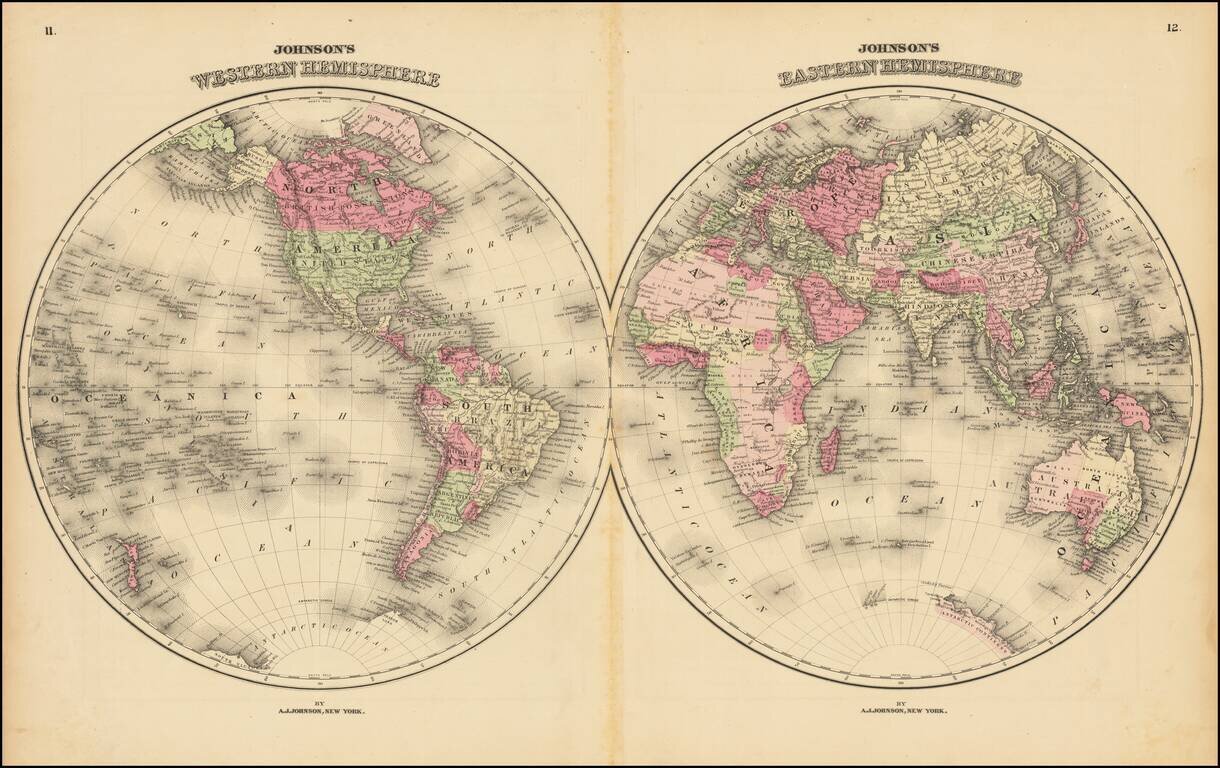
Large and detailed double hemisphere map of the World, in nice wash colors. Shows early (but still quite limited) knowledge of the Antarctic Coastline and the NW Passage. From one of the major American map publishers, during the second half of the...
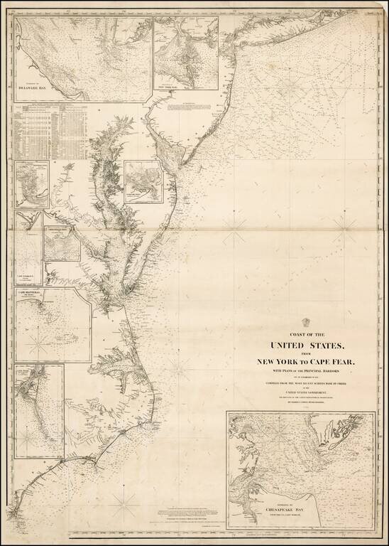
Extremely rare separately issued chart of the eastern part of the United States, from Long Island to Cape Fear, published in New York by Charles Copley. Includes an extensive table of tides and inset maps showing bays and entrances, including...
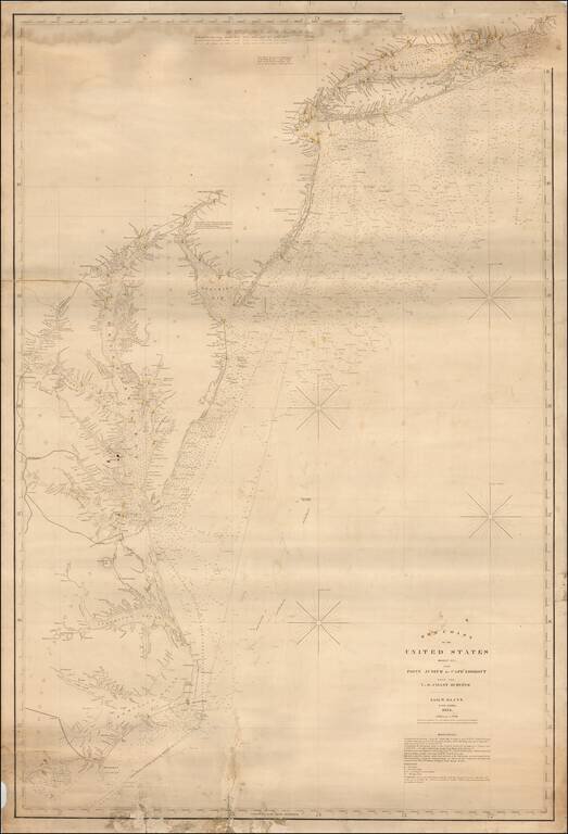
Fine large format sea chart of the coastline from Long Island Sound to the Outer Banks of North Carolina, published by Blunt in New York City, the most famous of American Chart makers of the period. The map shows light houses, light ships and channel...
![Johnson's Delaware and Maryland [Inset map of Washington DC]](/map/small/54984.jpg)
Detailed map of Maryland and Delaware, hand colored by counties. Includes vignettes of the Post Office, Treasury Building, Patent Office, Harpers Ferry and the Capitol. The map shows towns, railroads, roads, post offices, rivers and a host of other...
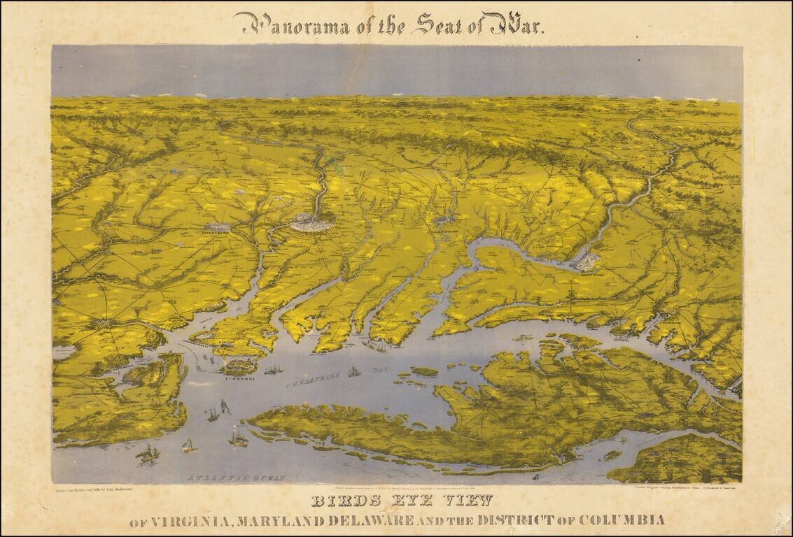
Bachman's Panorama of the Chesapeake Region Striking combination map and view of the northernmost part of the east coast of the Confederacy, and the southernmost areas of the Union, including Washington: this third issue, printed after the smoke that...
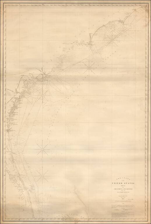
Fine large format sea chart of the coastline from the Outer Banks of North Carolina to central Florida, published by Blunt in New York City, the most famous of American Chart makers of the period. Includes an early pencil annotation near Savannah,...
![[Charleston] Preliminary Chart of Charleston Harbor And Its Approaches From a Trigonometric Survey . . . Published in 1858 . . . 1864](/map/small/50361.jpg)
Rare separately issued and colored example of this important chart of Charleston Harbor and the most detailed and accurate chart of the harbor to date. The present chart is called by the Library of Congress the "resurvey" chart, reflecting the...
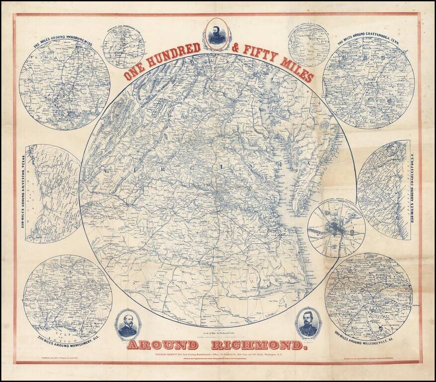
Scarce regional map of the area around Richmond, with 9 inset maps showing the 100 miles around Milledgeville, GA; 250 miles around Charleston, SC; 100 miles around Chattanooga, Tenn; Fortifications around Richmond; 200 miles around Montgomery, Ala,...
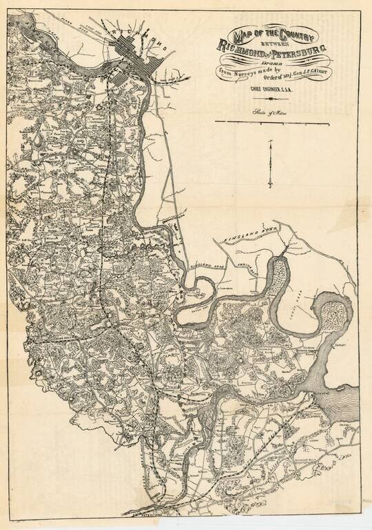
Rare Confederate States of America map of the region between Richmond and Petersburg, prepared by the Chief Engineer of the CSA, J.F. Gilmer. The map provides excellent detail, including town, roads, railroads, woods, rivers, forts, landowners and a...
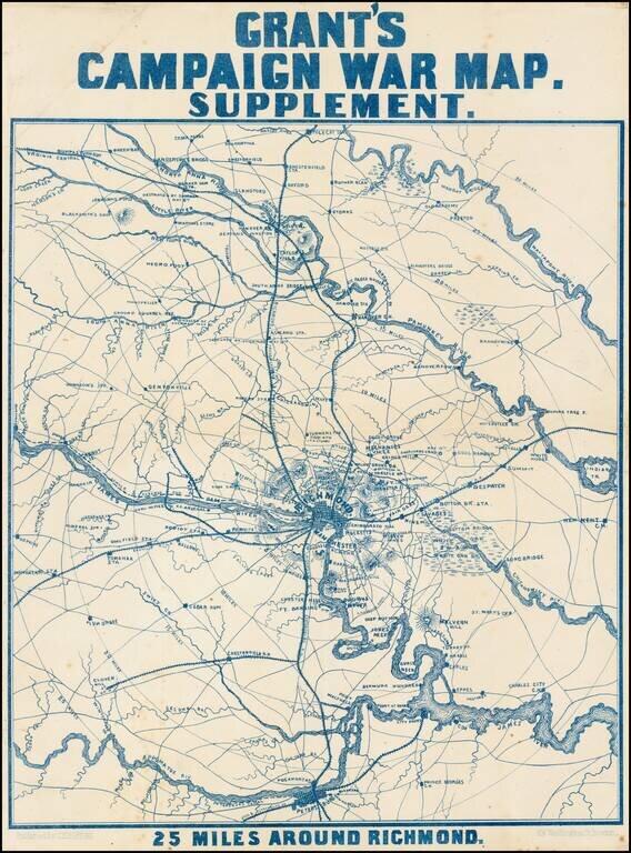
Scarce map of the area around Richmond, showing towns, railroad lines, roads, rivers, bridges, court houses, and other details. Notes show the US Arsenal, Sherman's Crossing of the South Anna and subsequent capture on May 11, and other details....
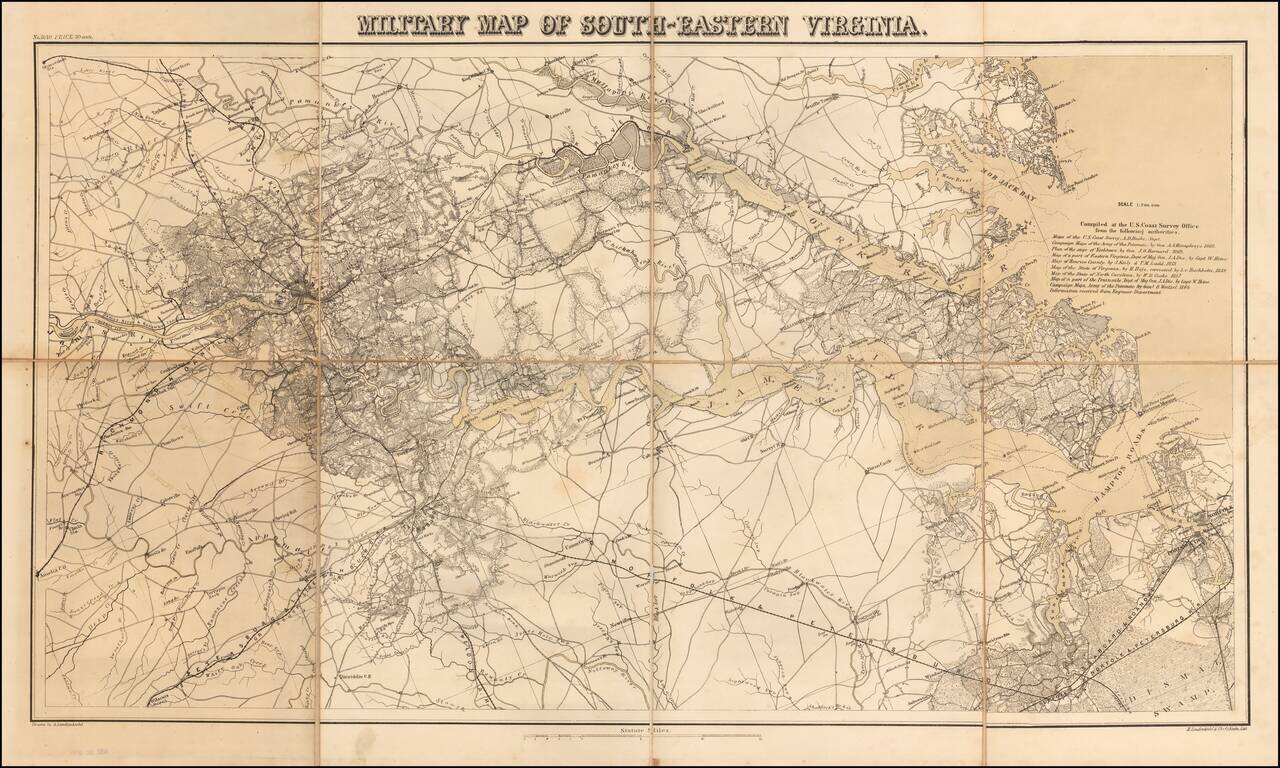
Rare separately issued map Southeastern Virginia, produced by Lindenkohl and lithographed by Krebs at the direction of the US War Department in 1864. The map depicts the towns, courthouses, lines of communication and other militarily significant...
![[Defending The Southern Coast During the Spanish American War] Map of Sea Islands. Coast of Georgia. from St. Mary's River to Savannah River compiled from the best Authorities 1864 / Map of Sea Islands. Coast of Georgia. from St. Mary's River to Sav](/map/small/59563.jpg)
Defending the Southern Coastline Against Spanish Attacks From Cuba Finely executed manuscript map of the Sea Islands of Georgia and Sea Islands of South Carolina, created by Robert Deas Gignilliat during the Spanish-American war, 1898. The map is...
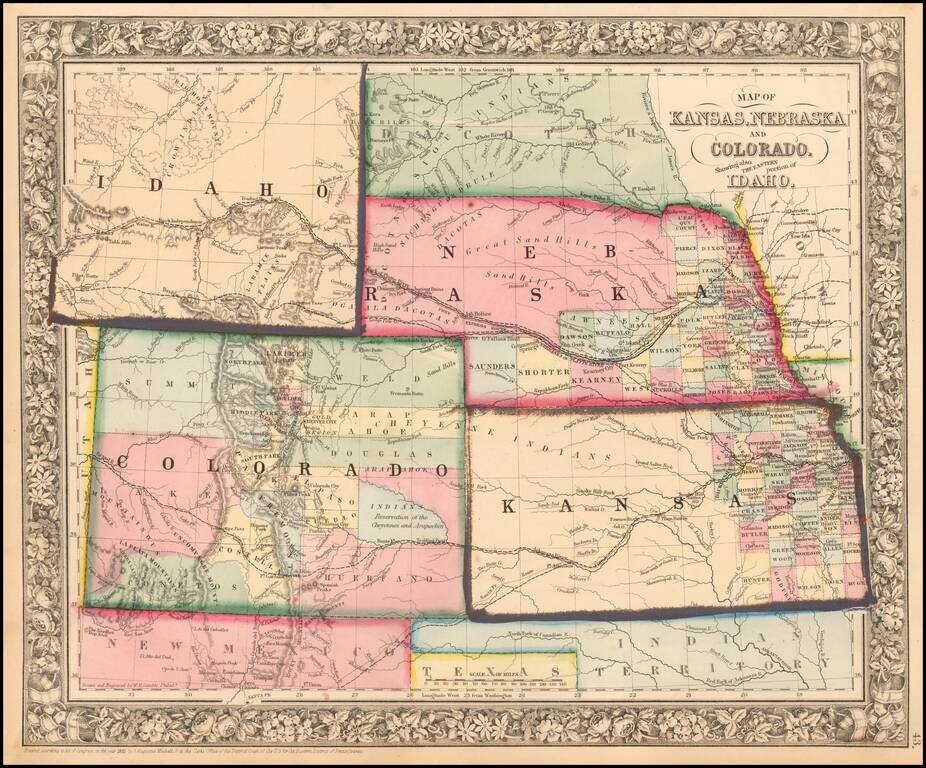
Excellent early map of the region, including an early appearance of Idaho Territory, one of the earliest appearances of this Territory (formed March 1863), on a printed map. Kansas counties cover only the eastern third of the state. Nebraska counties...