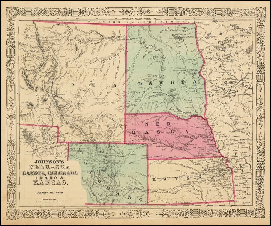
The Earliest Appearance of Idaho Territory--Including The Future Montana & Wyoming Territories Third in series of Johnson maps showing evolution of the mapping of these western territories. The most notable feature of the map is the massive...
![(Northern Half) [Bancroft's Map of the Pacific States]](/map/small/54923.jpg)
Rare Early State with a Massive Idaho Territory Upper half of HH Bancroft's rare map of the Pacific States, first published in 1863. The map includes all of Oregon, Washington, Idaho, and most of Montana and Wyoming, with a large inset of Hawaii. The...
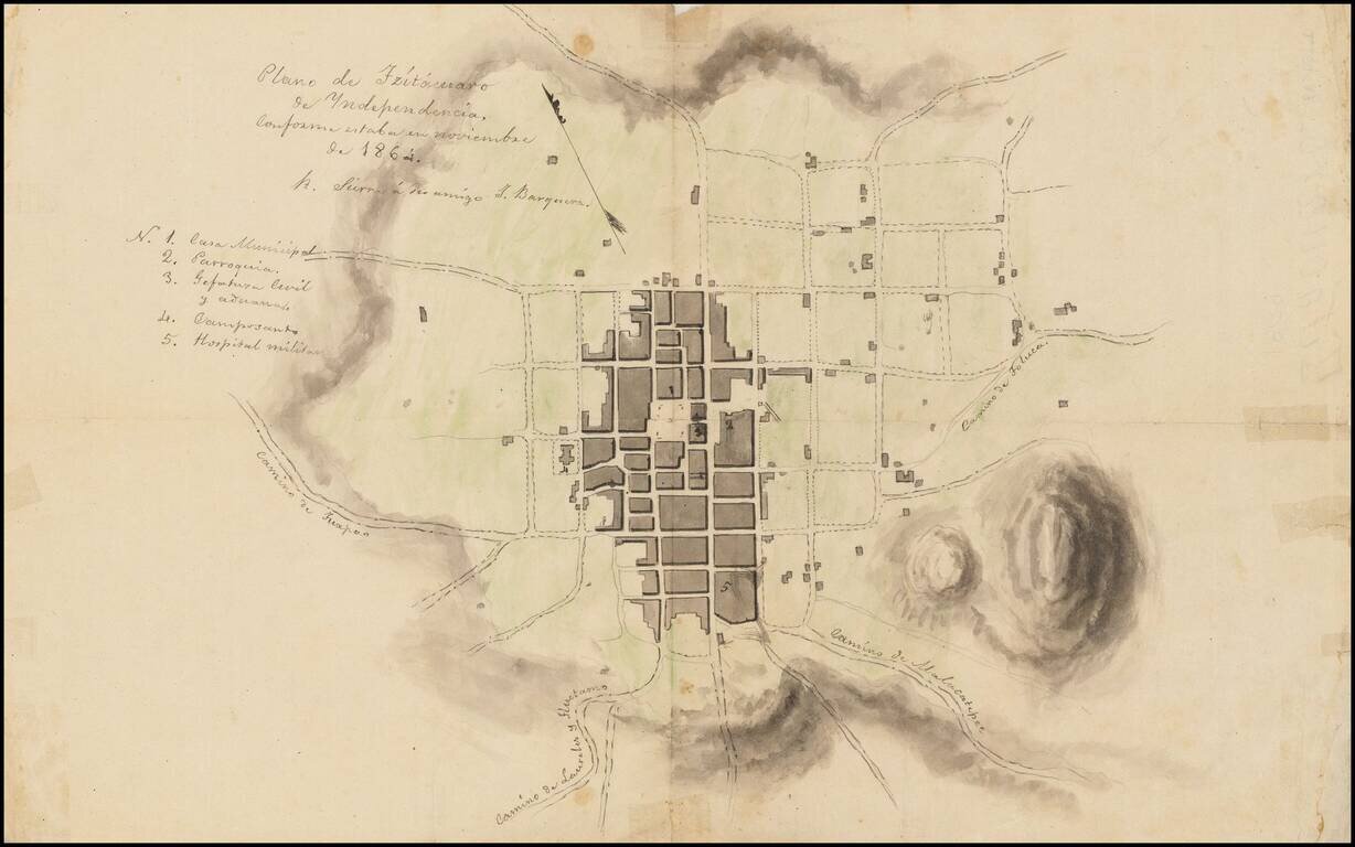
Town Plan of Zitácuaro de Independencia with Manuscript Notes This is a sketch of a plan of Zitácuaro, another copy of which is available at /gallery/detail/49465ba . It is not an exact copy, however, as it has some manuscript notes, including one...
![[Galapagos] Carte de la Cote Occidentale D'Amerique Comprise Entre Le Golfe de Tehuantepec et le Golfe de Guayaquil (Amerique Centrale, Nlle Grenade, Equateru) . . . .1864](/map/small/57942.jpg)
Scarce sea chart of Central America and the coasts of Colombia, Equador and Peru, published by the French Hydrographical Office. Includes a relatively large treatment of the Galapagos Islands, just five years after Charles Darwin's publication of his...
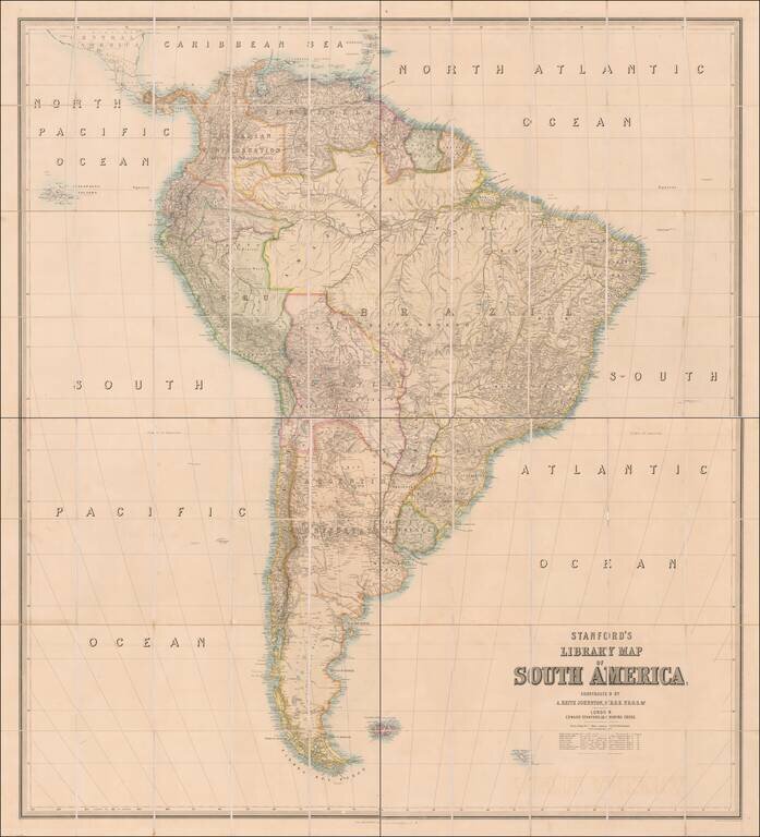
Early State of Edward Stanford's Wall Map of South America Nice example of Edward Stanford's large format library map of South America. In the early 1850s Edward Stanford commissioned Alexander Keith Johnston to prepare a set of large wall maps of...
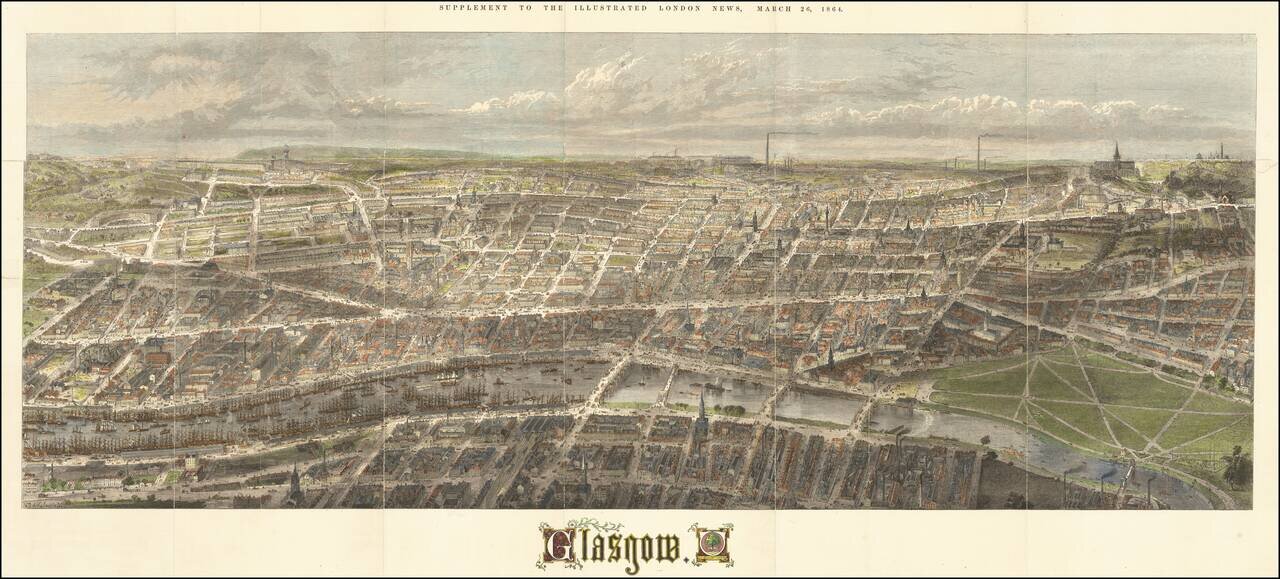
Fine 19th Century birdseye view of Glasgow, published as a supplement the The Illustrated London News in the March of 1864. A remarkably detailed panorama, illustrating the central part of Glasgow, with heavy commercial traffic seen in the streets,...
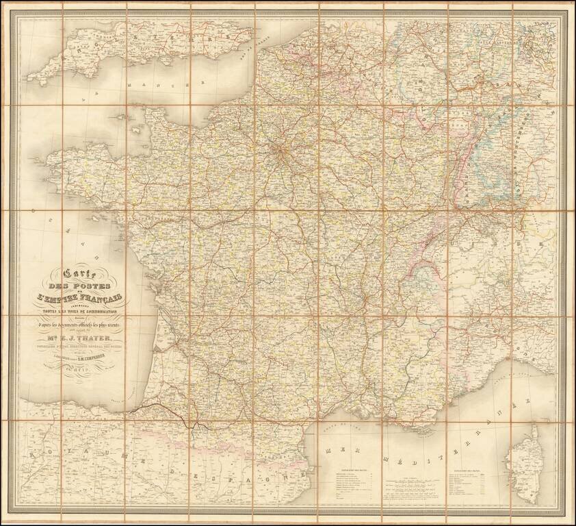
Detailed railroad and postal map of France from the 1860s. The map differentiates between operating railroads and those that are in construction or had been granted concessions. The map illustrates the State, Department, and Arrondissement. Special...
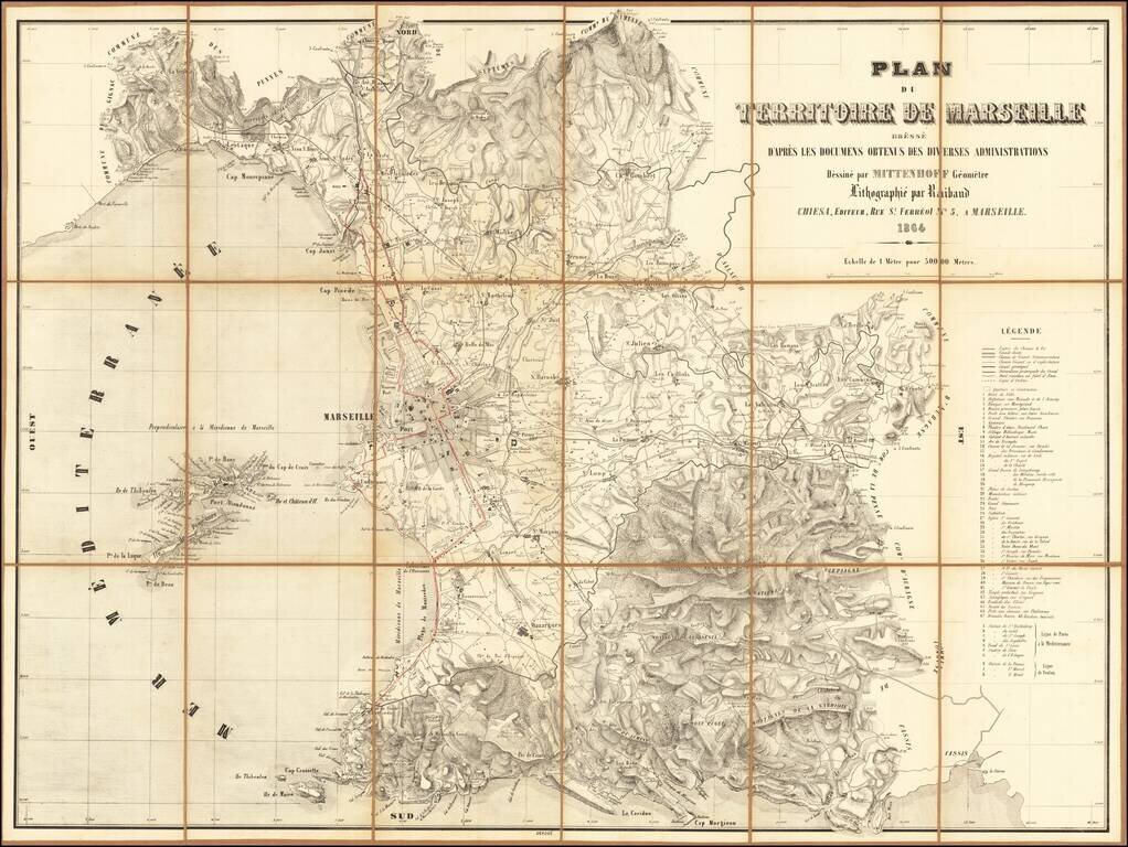
Rare map of the environs of Marseille, published in Marseille in 1864. Includes a detailed legend at the right side of the map.
![[Vienna - Siege of 1683] Illustriss.mo et excell.mo domino domino Rutgero Ernesto Comitia Stahremberg, aurei velleris equiti, sac. caes. regiaeque mai. camerario, campi marescallo generali, consiliario aulico bellico, commendanti Viennae. Viennam Austria](/map/small/63249.jpg)
1683 Siege of Vienna Panoramic View Map Rare separately issued plan / view of Vienna, published in Vienna by Heinrich Schmidt and Albert Camesina. This unusual work presents a rounded view of the area outside of Vienna's city walls, at the time of...
![[Odessa] ПЛАНЪ ГОРОДА ОДЕССЫ Составл. Землемѣр. Крыловымъ [Plan of the City of Odessa. Compiled by the Surveyor Krylov.]](/map/small/56510.jpg)
One of the Great Maps of Odessa. A stunning lithographed map of Odessa, Ukraine, published in Odessa in 1864. The map separates Odessa by its constituent neighborhoods and depicts land classifications pictorially. The map has four detailed inset...
![Denmark [with inset of Iceland]](/map/small/67362.jpg)
A striking map of Denmark, published by John Arrowsmith. This map shows the Jutland Peninsula, Zealand [Sieland] Islands, and Iceland, as well as parts of adjacent regions including Sweden, Hanover, and Mecklenberg. Several enclaves of German...
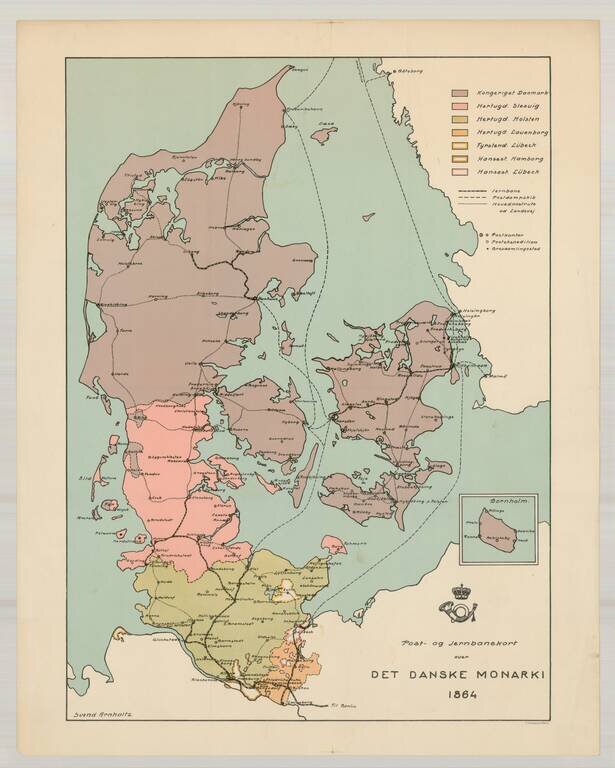
Rare postal and railroad map of the Danish Monarchy, dated 1864. The map identifes Svend Arnholtz as the mapmaker. We have located no information about the map.
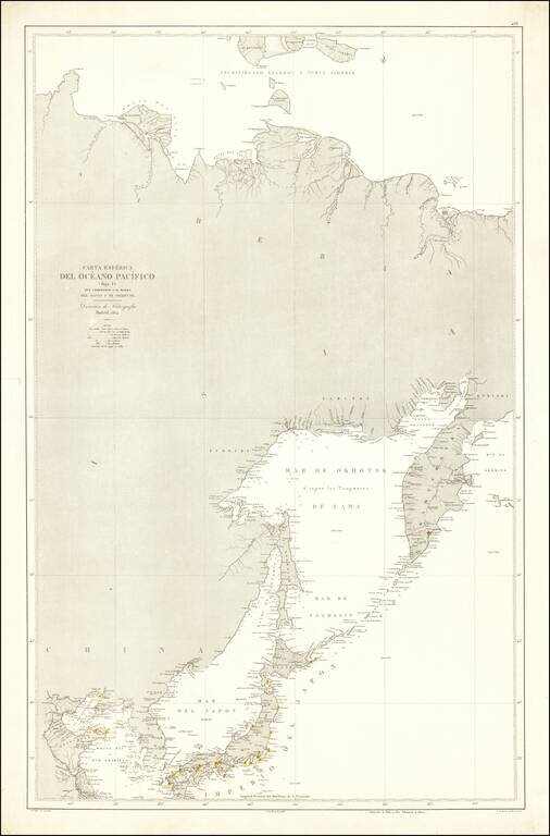
Rare Spanish Sea Chart of the Northeast Coast of Asia, published by the Spanish Hydrographical Department. The chart extends from Korea and the Yellow River to Kamtchatka.
![Taisei Kyō Saiken Ezu [Detailed and illustrated map of Kyoto]](/map/small/58218.jpg)
Detailed map of Kyoto, published in 1864. The map was prepared for tax administration and locates imperial properties, noble properties, temples and commoners.
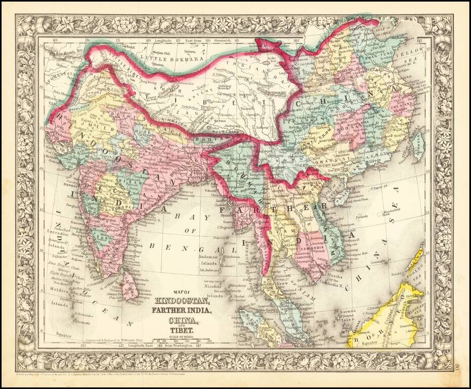
Nice mid-19th century map of India and Southeast Asia, including Cambodia, Siam, Burmah, Tonquin, Cochin China, and British Tenasserim. Shows roads, towns, rivers, mountains, etc. Decorative border.
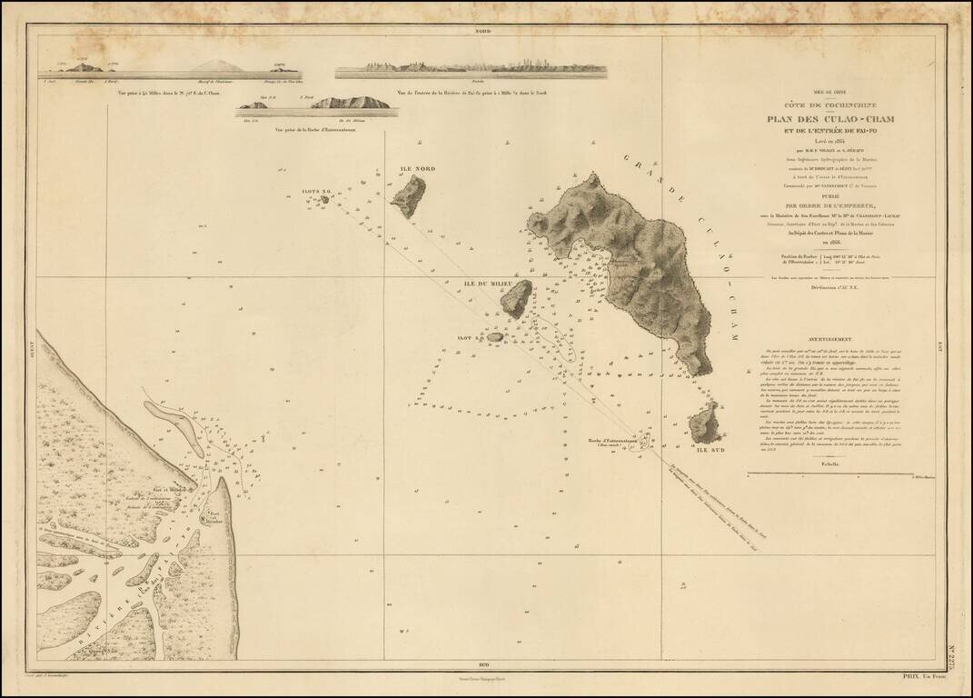
Detailed French chart of the entrance to Hội An, in Vietnam. Hội An has an interesting history related to foreign attempts to establish trade in Vietnam. In 1535, the Portuguese explorer and sea captain António de Faria attempted to establish a...