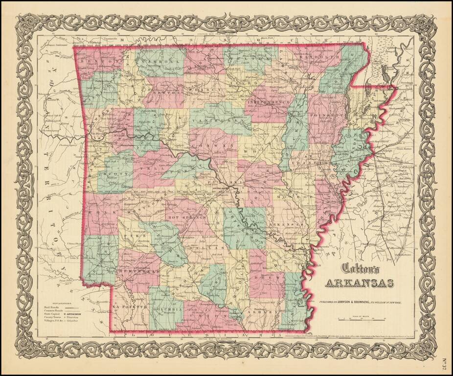
Detailed map of Arkansas, colored by counties. Shows roads, railroads, towns, villages, post offices, canals, rivers, lakes, stations and a host of other details.
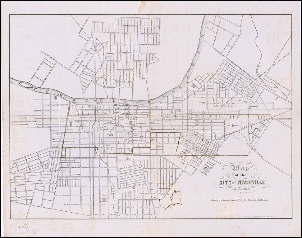
One of the Earliest Printed Maps of Nashville Rare Confederate Imprint Plan of Nashville Fine early plan of Nashville showing a detailed street grid and railroad. The map identifies prominent buildings, public spaces, waterways and suburbs. Shows...
![[Matagorda Bay: Pictorial Letter Sheet]](/map/small/40810.jpg)
Rare Letter Sheet View Drawn From Original Sketches By Helmuth Holtz Fine early Texas lettersheet, with 6 views of Matagorda, Texas. The views show six buildings, with eagle and flags at top of page. The buildings represented are: a church...
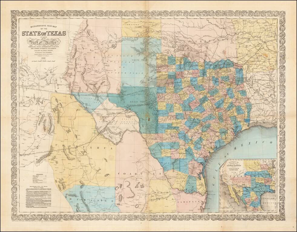
Fine large format map of Texas, published in 1860. Richardson's map was one of the best and most accurate maps of Texas on the eve of the Civil War. Hand Colored by counties, it is of particular not for its excellent depiction of the existing and...
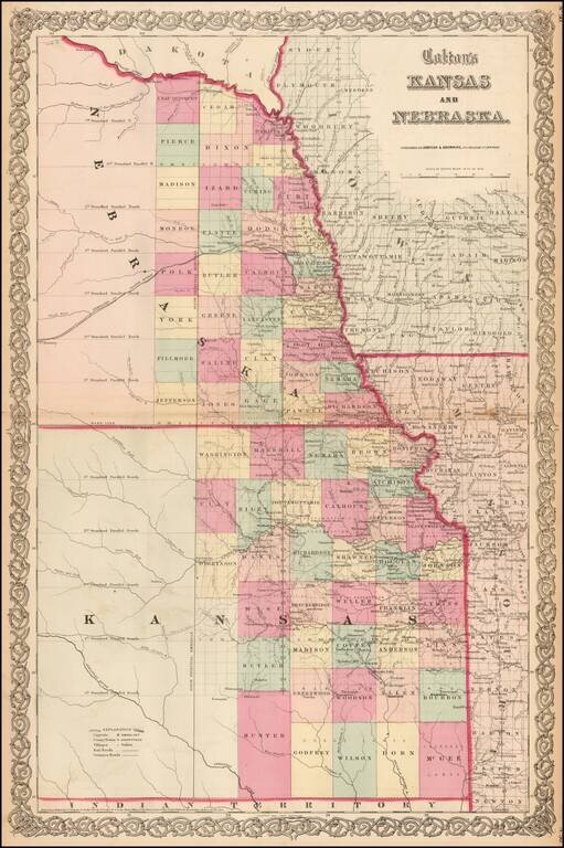
Vibrant example of this early map of Kansas and Nebraska, which was only issued in the vertical format for a few years. Primitive County configurations in the west and south. Multiple proposed railroad routes throughout the map.
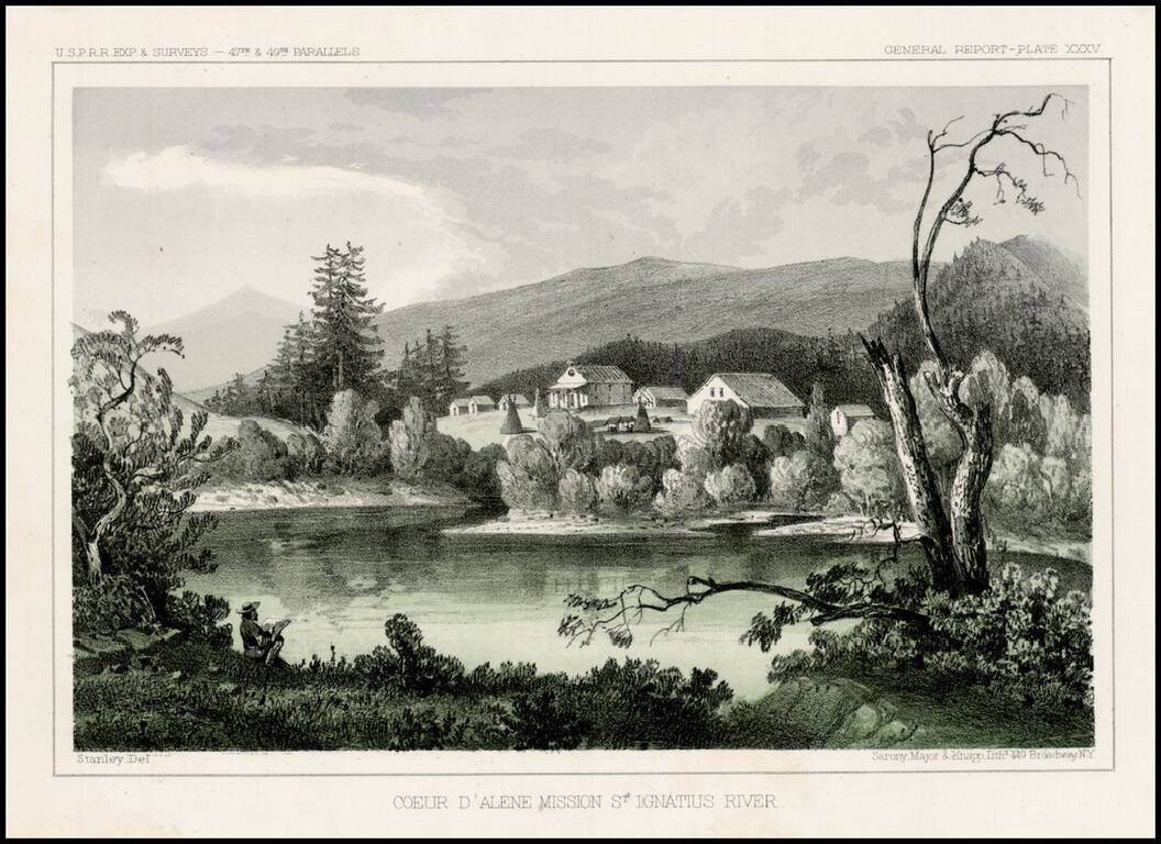
Striking view from the Pacific Railroad Surveys. The survey notes: "The mission is located upon a hill overlooking extensive prairies stretching to the east and west toward the Coeur D'Alene Mountains and the Columbia River. About a hundred acres...
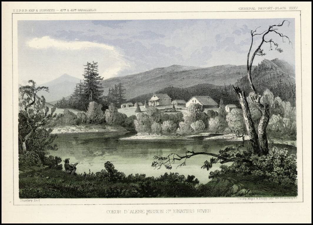
Striking view from the Pacific Railroad Surveys. The survey notes: "The mission is located upon a hill overlooking extensive prairies stretching to the east and west toward the Coeur D'Alene Mountains and the Columbia River. About a hundred acres of...
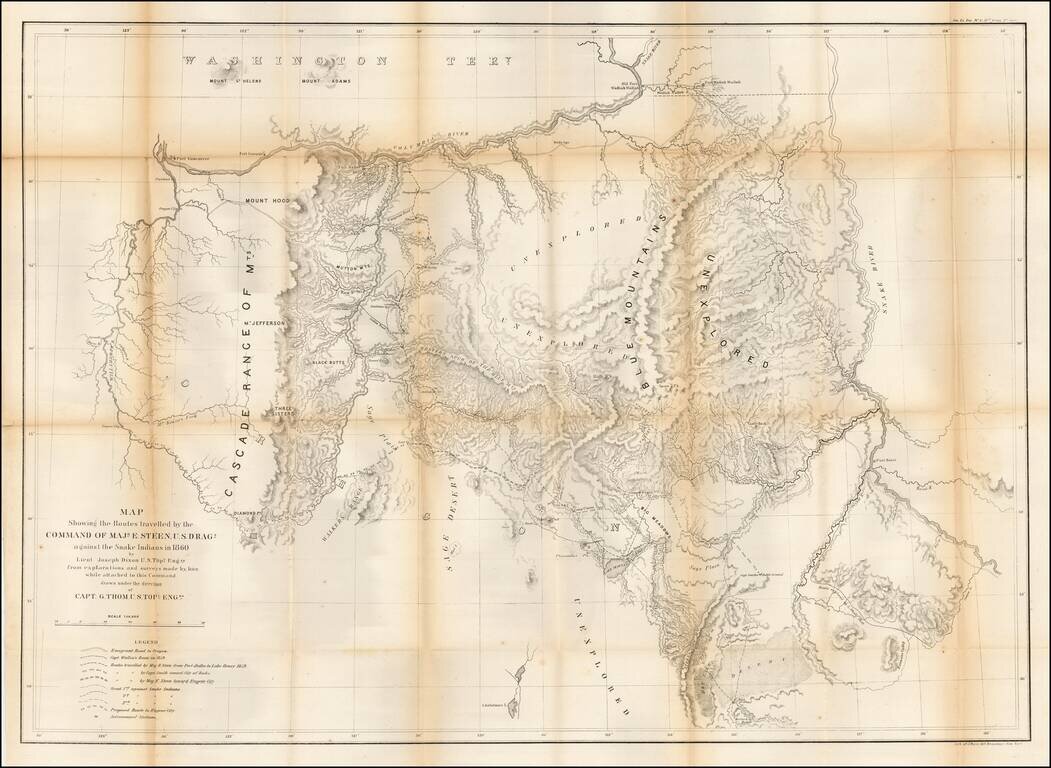
Important early map of Eastern Oregon, bounded by the Willamette, Columbia, and Snake Rivers. Major Enoch Steen, commander of the U.S. Dragoons, was sent to the area in 1860 to determine the feasibility of routes from the Willamette Valley to...
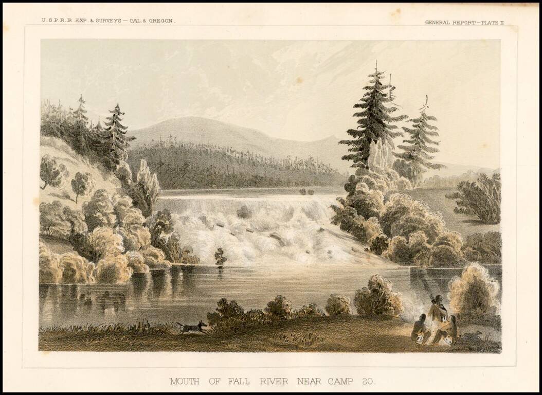
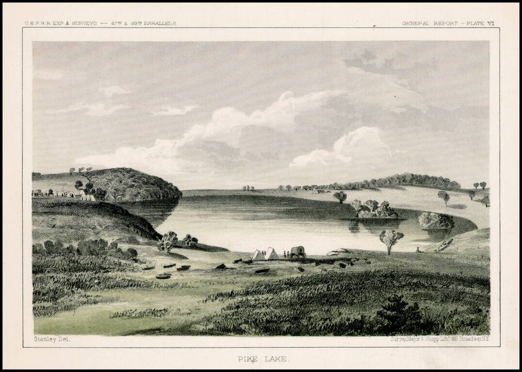
Striking view of Fall River near Camp 20, from the Pacific Railroad Surveys.
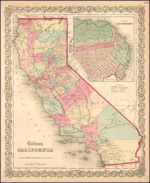
Scarce example of Colton's map of California, from Colton's Atlas of the United States. Hand colored by county. Only 6 counties in Southern California, including San Diego, Los Angeles, San Bernardino, Buena Vista, Santa Barbara and San Luis Obispo....
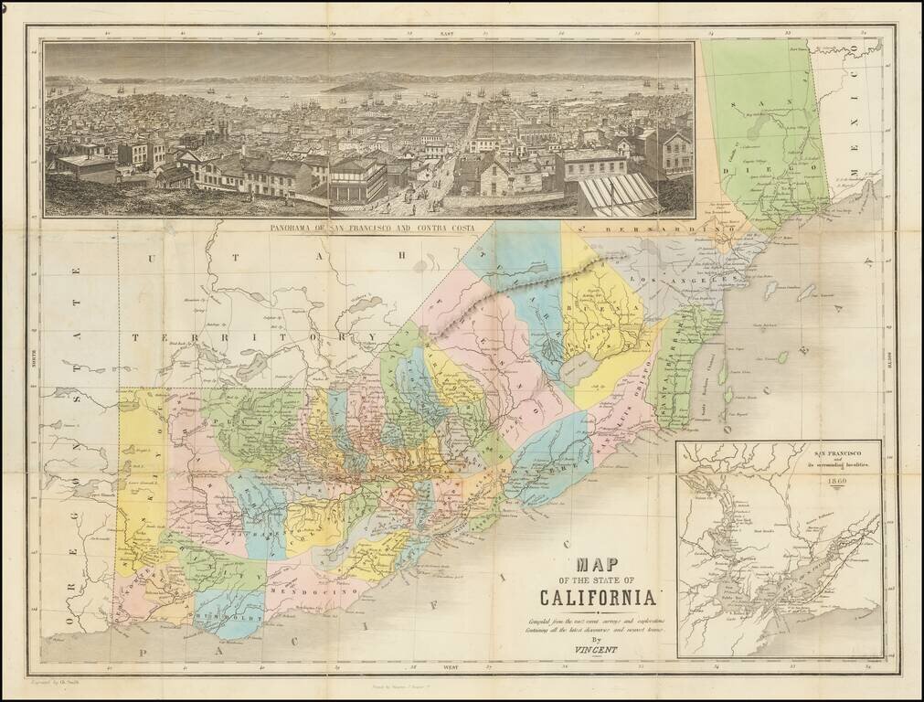
The Thomas Winthrop Streeter Copy Rare hand-colored engraved map of California with east at the top. The map includes a very nice inset view of San Francisco ("Panorama of San Francisco and Contra Costa") and a further inset of "San Francisco and its...
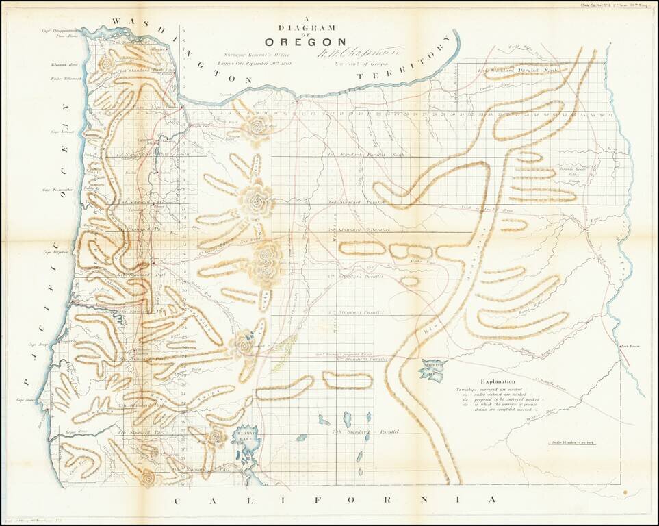
One of the earliest obtainable maps showing the progress of the public surveys in the State of Oregon. The map includes townships surveyed to 1863, towns, early roads, topographical details, Fort Boise, Mountains and other details.
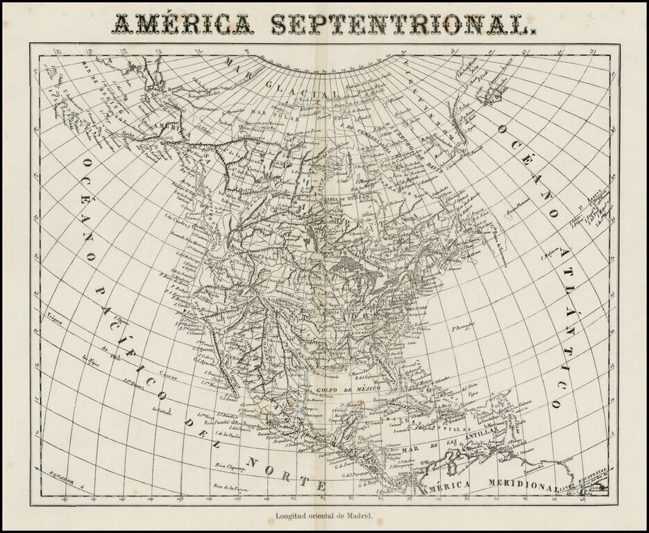
Very unusual Spanish map of North America, apparently issued some time in the middle of the 19th Century. While the paper suggests that it was published in the 2nd half of the 19th Century, the map's cartography is circa 1830, showing Russian America,...
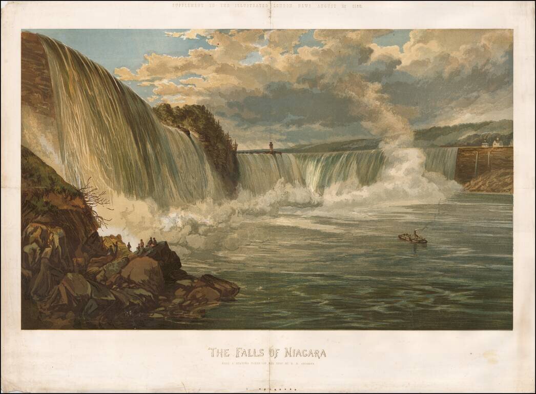
Rare color chromolithograph of Niagara Falls, with a small steamship in the center and several buildings visible at the top of the falls. The image was issued as a supplement to the Illustrated London News on August 25, 1860.
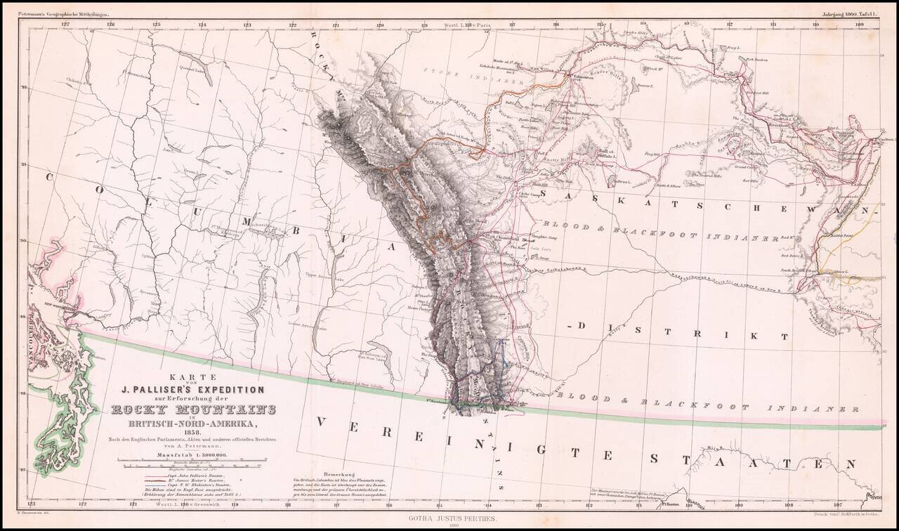
Detailed map of Western Canada illustrating the western part of Captain John Palliser's explorations in Western Canada, based upon Palliser's virtually unobtainable map published about three years earlier. The map shows the disputed boundary claim...