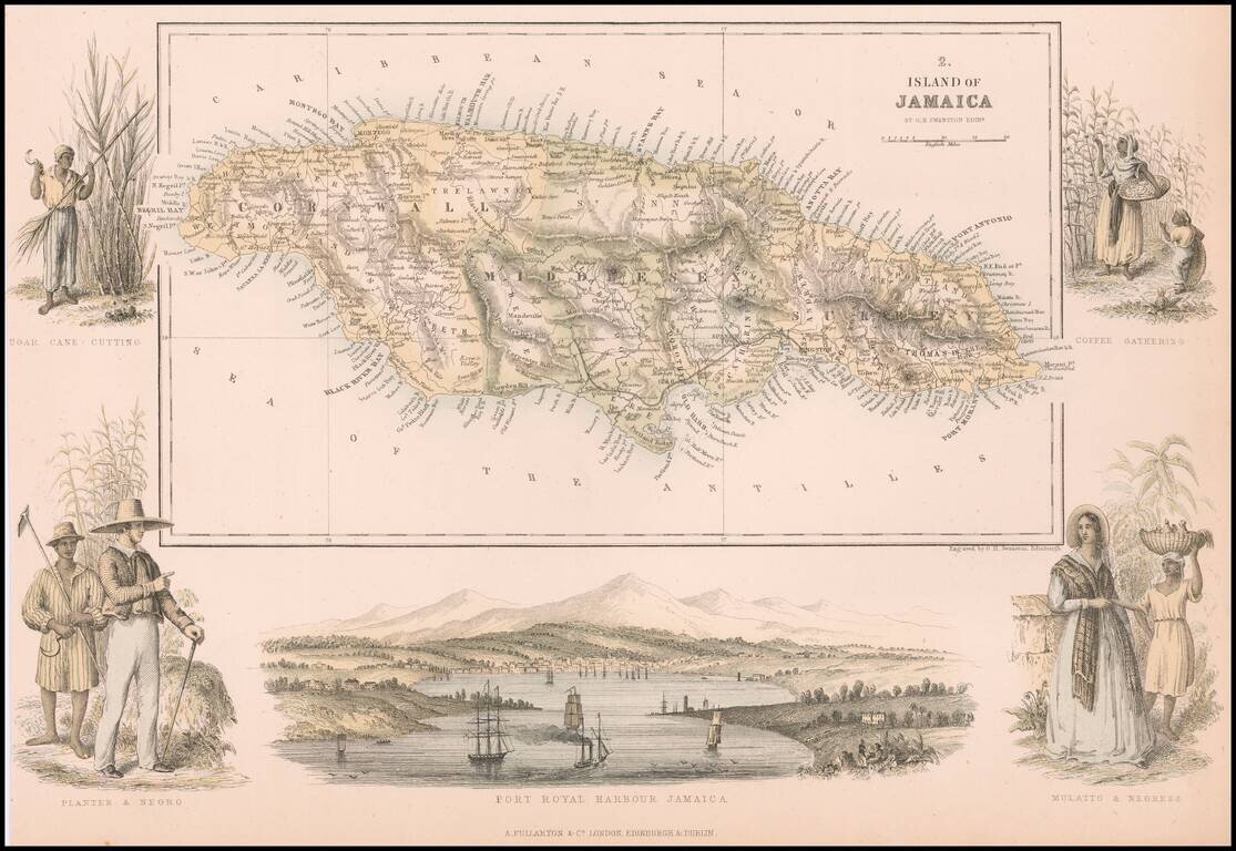
Decorative map of Jamaica, embellished with a view of Fort Royal and vignettes showing different types of Jamaican people.
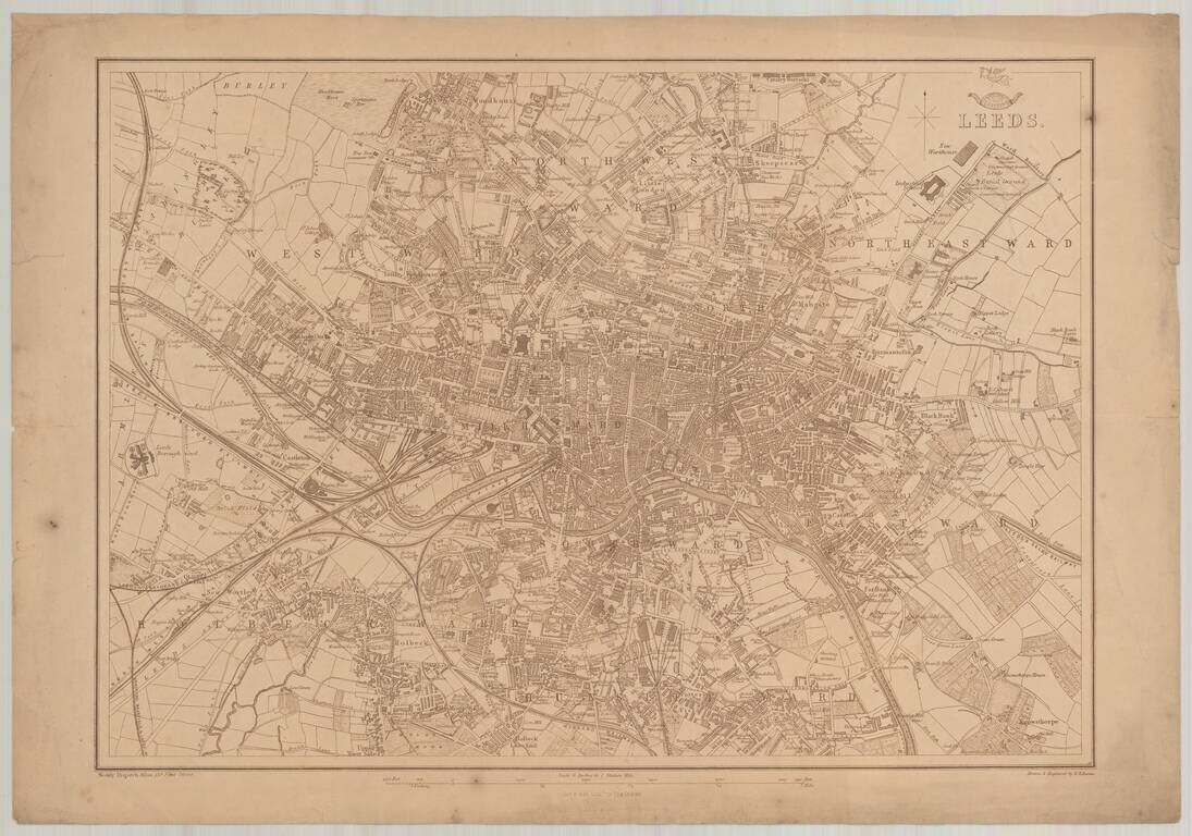
Detailed map of Leeds, which appeared in the Dispatch Atlas, published by the Weekly Dispatch and engraved by Edward Weller in London.
![(Karamanli Turkish-Language Map) Ṫζεζαϊρι Πριταnια [Great Britain / British Isles?]](/map/small/66716.jpg)
Fascinating and highly unusual map of the British Isles, written in Karamanli Turkish, and published in Istanbul in the 1860s or 1870s. Karamanli Turkish (called Kαραμανλήδικα in Greece) is a dialect of written and spoken Turkish that uses...
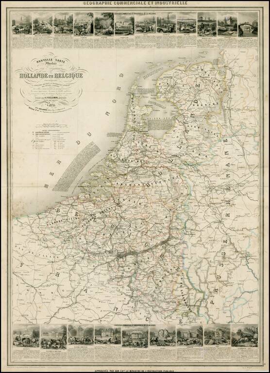
Scarce decorative large format map of the Low Countries, including 21 decorative side panel vignettes showing indigenous scenes. Finely engraved by Gerin and illustrated by A. Testard.
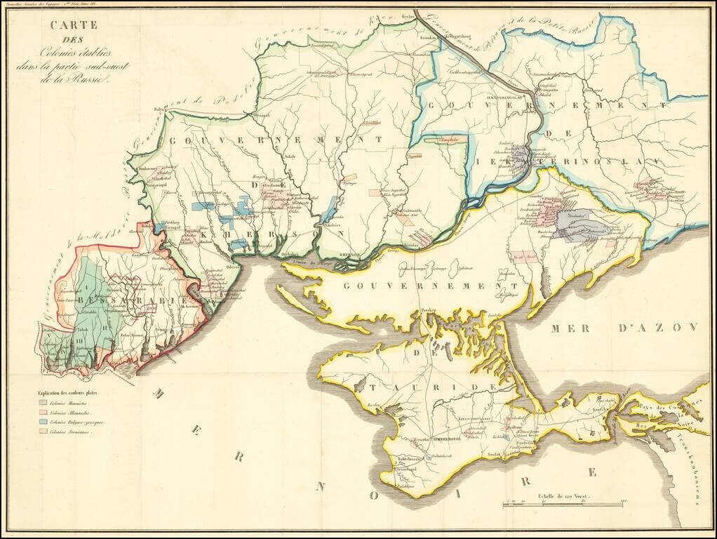
Detailed map of the Crimea and northern part of the Black Sea and Sea of Azof, locating colonial settlement in the region. The map is divided by Governments as created by the Imperial Russian Government in 1802 (and abolished in 1925). The...
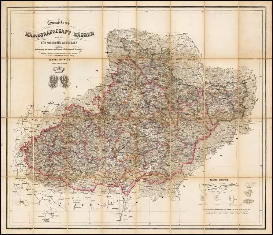
Rare map of the Moravia and Schliesen, depicting the region in remarkable and exacting detail. Includes tables, coats of arms and graphic details.
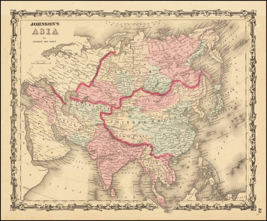
An attractive antique map of the continent of Asia, hand-colored by country and province. The map shows major cities, lakes, rivers, mountains. Includes a decorative border. This map was likely derived from Johnson's earlier wall map. The Russian...
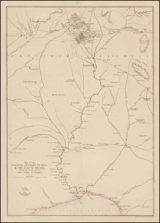
Detailed map of the area around Beijing, showing roads, rivers, towns, etc. 'The Weekly Dispatch' newspaper between the years 1856 and 1862 included in each edition a map of a part of the world. During this period a total of 118 maps were issued. The...
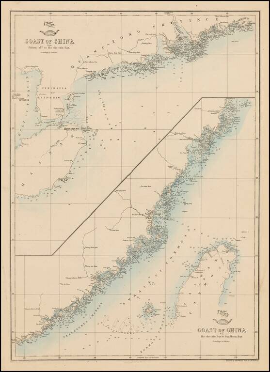
Fine pair of charts of the Chinese coast on one sheet. 'The Weekly Dispatch' newspaper between the years 1856 and 1862 included in each edition a map of a part of the world. During this period a total of 118 maps were issued. The maps bear the...
![[USS Powhatan Carrying the First Japanese Embassy to America.]](/map/small/55550.jpg)
The First Japanese Embassy to the United States. Woodcut kawaraban sheet showing the USS Powhatan serving in its role transporting the first Japanese Embassy to the United States in 1860. First Japanese Embassy to the United States The Japanese...
![[Concerning the Names of the [Japanese] Delegates to America.] [America-koku gojoshi on'namae duke]](/map/small/55555.jpg)
Treaty of Amity and Commerce between Japan and the United States. This image shows two ships with the Japanese delegates on board leaving Yokohama in January 1860 bound for the United States. Their mission was to exchange the instruments of...
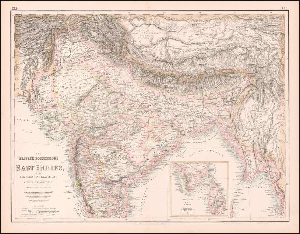
Highly detailed map of India, Pakistan, Afganistan, Tibet and the Himalayas, extending east to Siam. Inset of the southern tip of India and Ceylon.
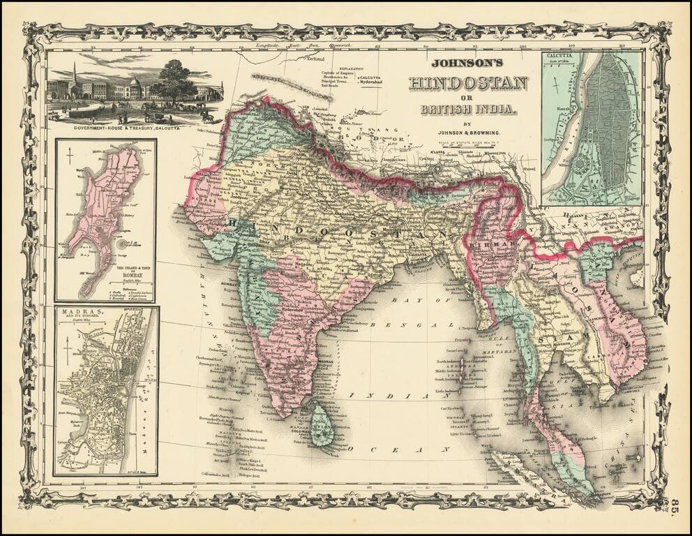
Scarce first edition of Johnson & Browning's map of India, Ceylon, Birmah, Laos, Vietnam, Cambodia, Thailand and part of Malaysia and Sumatra. Insets of Bombay, Madras and Calcutta. Vignette of Government House and Treasury in Calcutta. Colored by...
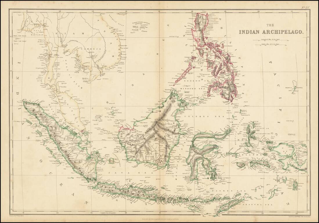
Nice map of Southeast Asia, centered on Borneo. Extends from Siam, Sumatra and the Malaysian Peninsula to Papua or New Guinea and the Philippines.
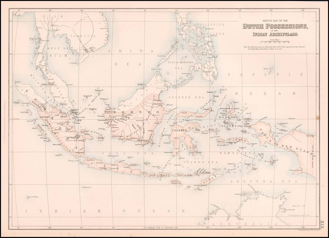
Highly detailed map of the Indian Archipelago, from the Philippines to Java to Sumatra and Pegu. 'The Weekly Dispatch' newspaper between the years 1856 and 1862 included in each edition a map of a part of the world. During this period a total of 118...
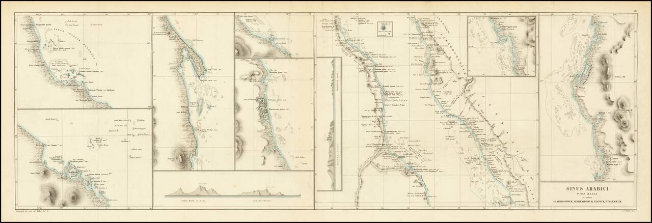
This is an antique map of the middle portion of the Red Sea, referred to on the map as the Sea of Arabia, stretching from approximately the latitude of Medina to the northern coast of Eritrea. This region, one of the most important shipping lanes in...