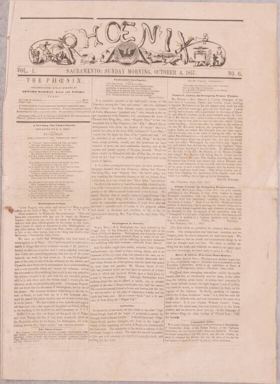
A Nearly-Complete Run of One of the Great Rarities of California Newspaper Collecting - the Sacramento Phoenix. Ned McGowan's Initial Response to the San Francisco Vigilance Committee. A substantially complete run of fifteen issues (numbers 6-20 and...
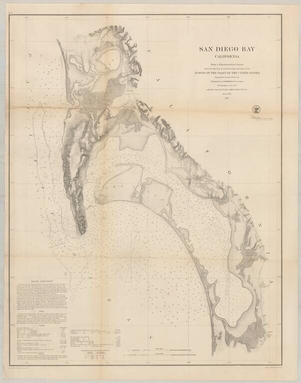
Nice example of the much sought after large format survey of San Diego Bay, form the US Coast Survey. Extends from False (Mission) Bay and the Pacific Beach area, south to Imperial Beach and the Mexican border. Hundreds of soundings. Shows several of...
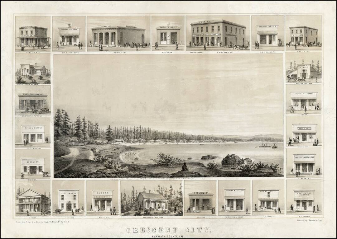
Decorative example of Kuchel & Dresel's view of Crescent City, published in San Francisco in 1857. Charles C. Kuchel & Emil Dresel were among the earliest western view makers. The pair published approximately 50 views between 1855 and 1859, of...
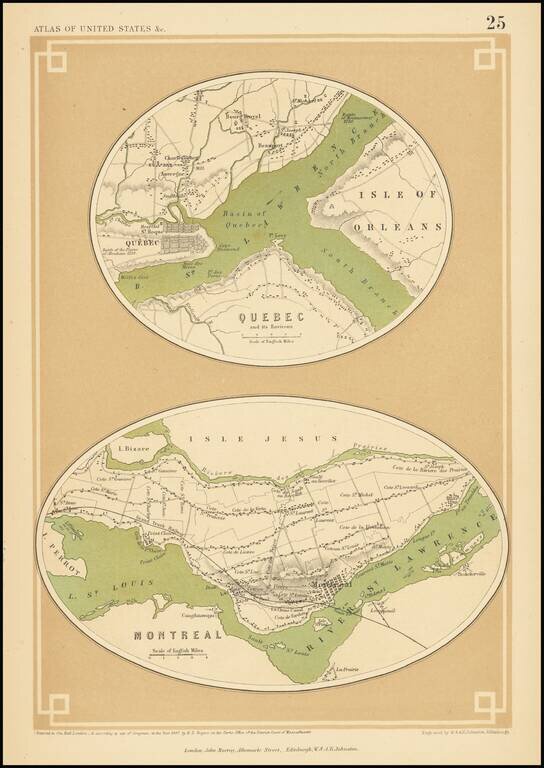
A rare map of Quebec and Montreal, from Rogers & Johnston's Atlas of the United States. The map shows the layout of the two cities including streets, neighborhoods, and other major features. Both cities are mapped on a large scale, showing towns...
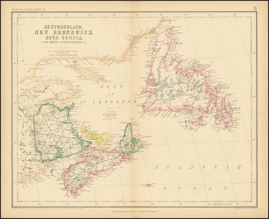
A rare antique map of eastern Canada from Rogers & Johnston's Atlas of the United States, one of the most attractive American atlases of the 19th century. This atlas was an unusual collaboration between an American, Englishman, and Scot. The map is...
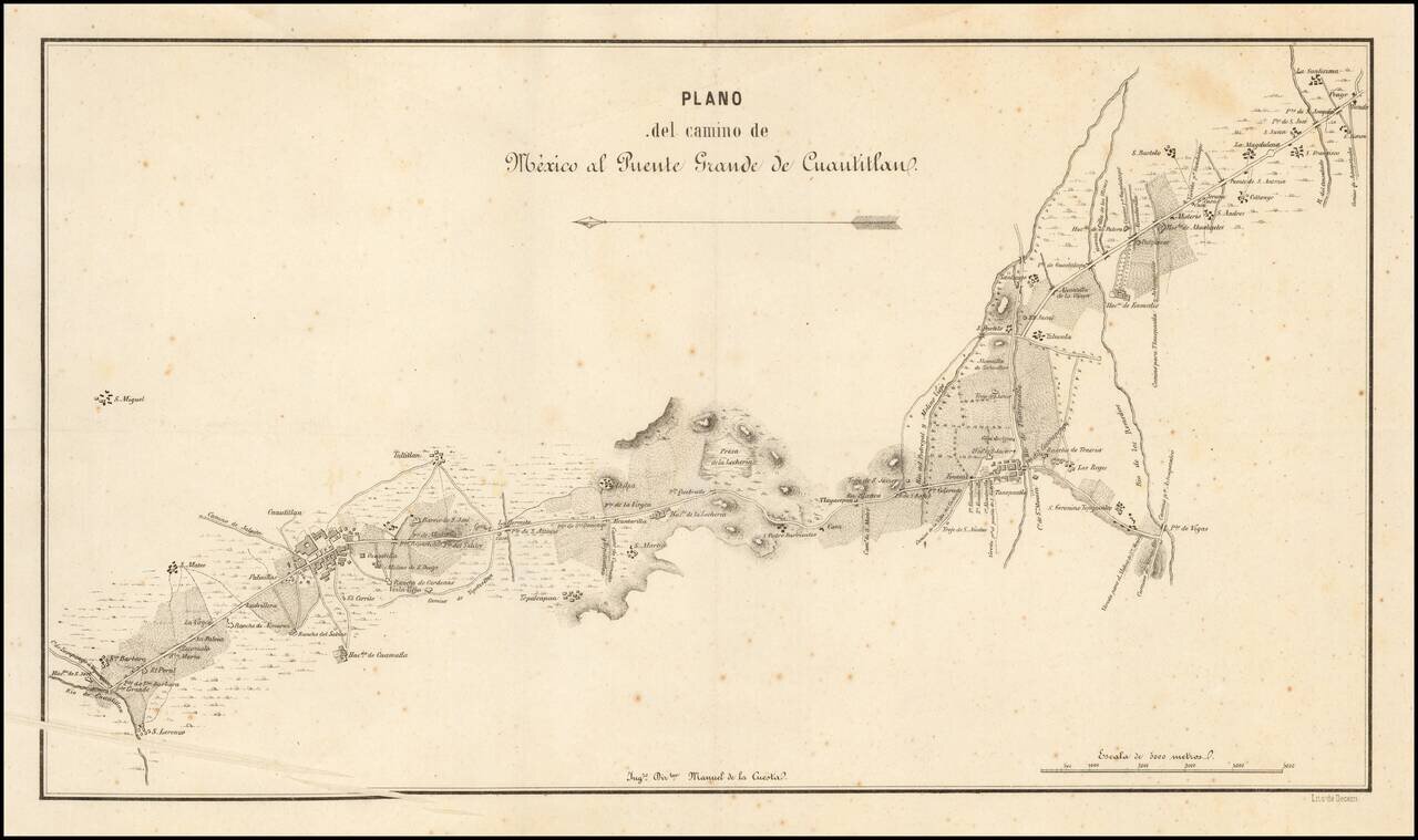
The Southernmost Portion of the Camino Real de Tierra Adentro (Road to Santa Fe). Rare map showing the southernmost portion of the Camino Real, proceeding north from the outskirts of Mexico City toward Santa Fe. The map is oriented with east at the...
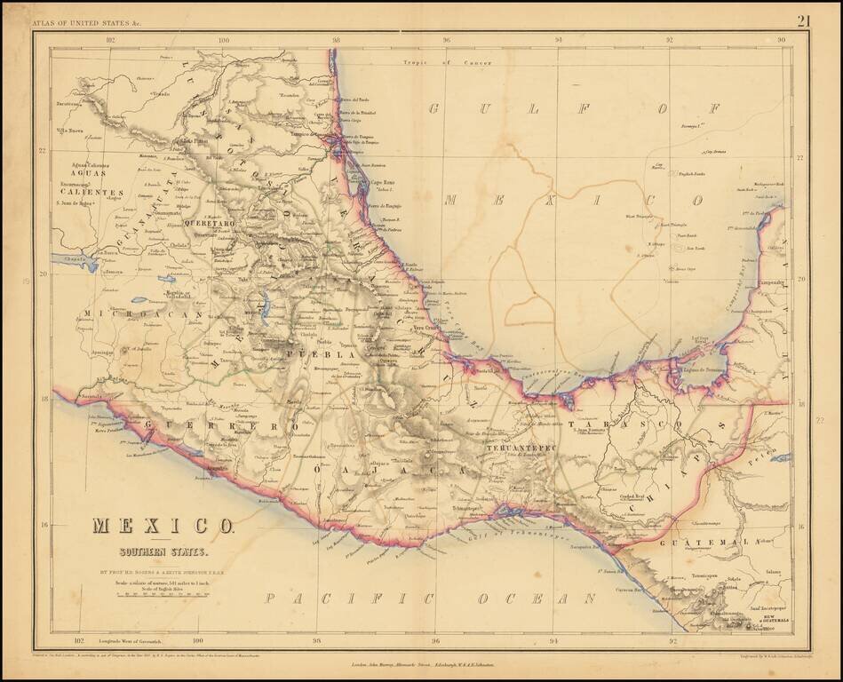
Lithographed map of Southern Mexico by Rogers & Johnston. The map covers the states of Queretaro, Mexico, Puebla, Veracruz, Oajaca, Guerrero, Tehuantepec, Tabasco, Chiapas.
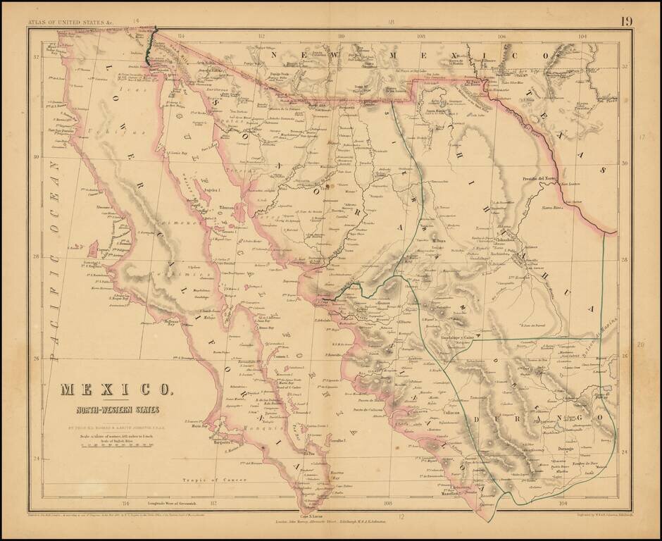
Rare map of Northern Mexico, from Rogers & Johnston's rare Atlas of the United States. The map is part of a wall map of the United States & Mexico, published by Rogers & Johnston. Conceived as a collaborative effort between W & AK...
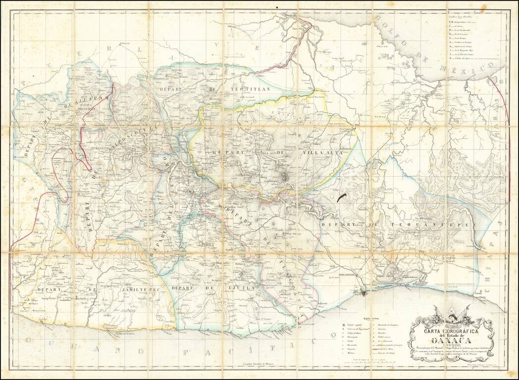
Early Modern Map of the State of Oaxaca Finely executed map of the State of Oaxaca, prepared by C. Manuel Ortega and lithographed by Litog de Salazar, on Calle de la Palma in Mexico City. Drawn from Ortega's original map of Oaxaca (#787 in the...
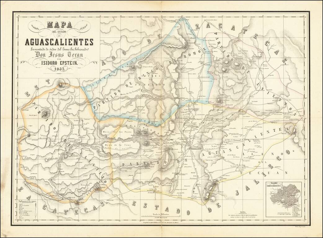
Detailed Map of the State of Aguascalientes Fine map of Aguascalientes, drawn by German mapmaker Isidoro Epstein, under direction by Governor Jesús Terán and published by the lithography shop of Decaen. This is one of the first separately published...
Detailed and attractive map of the southern portion of Florida and the Caribbean, in Charles Desilver's Universal Atlas. The map shows the various European Powers possessions, including Spanish, British, French, Dutch, Danish and Swedish, along with...
![Colton's West Indies [Bermuda and Havana insets]](/map/small/67374.jpg)
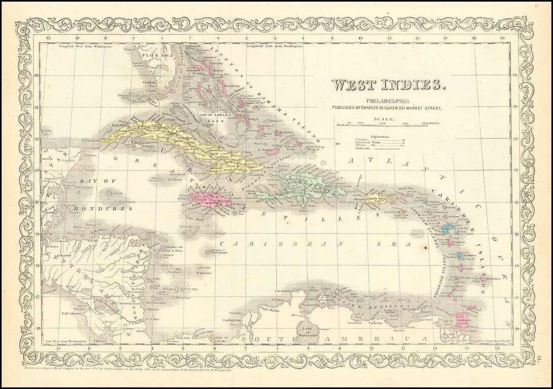
An 1857 edition of Colton's map of the West Indies which was published nearly yearly from 1855 to 1865 and more occasionally until at least 1874. It is a detailed map of the islands of the Caribbean showing Florida and Central America. The map includes...
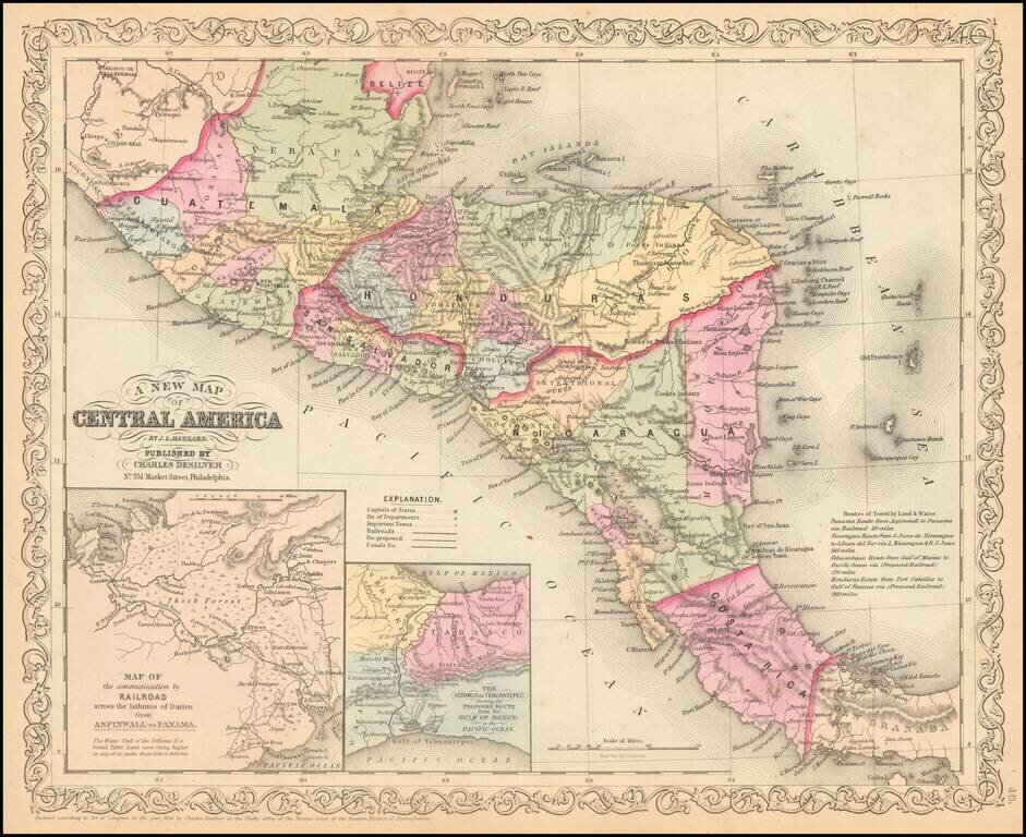
Detailed map of Central America, colored by country and states, with insets of the Railroad across the Isthmus of Darien and The Isthmus of Tehuantepec. Text annotations and other interesting details are noted.
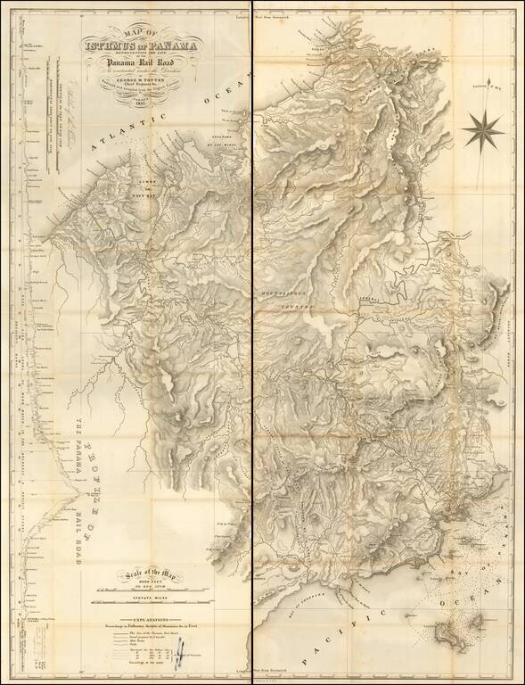
A Jamaican Surveyor's Map of the Panama Rail Road Highly detailed map of the Panama Railroad, published two years after its completion in 1857. This is one of the earliest maps to show in detail the successful completion of the Railroad line...
![Canal De La Providence (Bancs De Bahama) . . . 1857 [with] Mouillage De La Point Du Trou Dans Mur (Ile Abaco) . . . [with] Cay Gun (Grand Banc De Bahama)](/map/small/63072.jpg)
Rare set of 3 regional charts of the Bahamas. The largest map shows Little Bahama Bank, Little Abaco, Grand Abaco, Bahama Island, and the region extending southward to New Providence and Andros Island. The Second map shows the southern part of Grand...
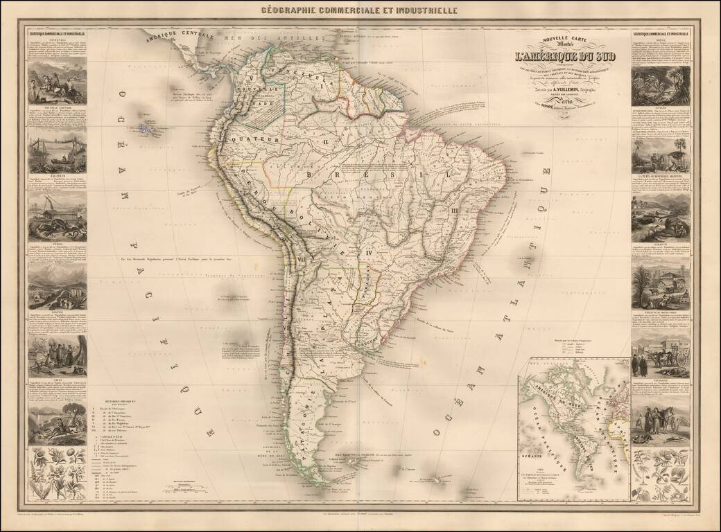
Scarce decorative map of South America, published in Paris by Vuillemin. The map includes 14 decorative side panel vignettes showing indigenous scenes in America, flora and fauna. The map provides a fine large format depiction of South America in the...