Map size in jpg-format: 17.5577MiB
Click to open in high resolution (open in new tab).
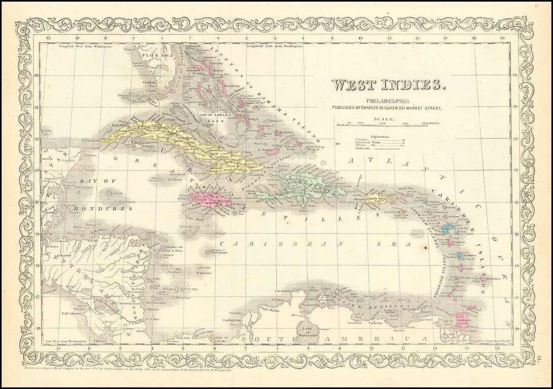
Detailed and attractive map of the southern portion of Florida and the Caribbean, in Charles Desilver's Universal Atlas.
The map shows the various European Powers possessions, including Spanish, British, French, Dutch, Danish and Swedish, along with substantial detail and other explanatory notes.
If you are a student, write to us in telegram: @antiquemaps and indicate what material you need and for what work you need a map in high detail. We are ready to provide material on special terms. For students only!


![[Wall Map] West-Indische Paskaert waer in de graden der breedde over weder zyden vande middelyn wassende so vergrooten dat die geproportioneert syn tegen hunne nevenstaende graden de lengde.](/map/small/60169.jpg)