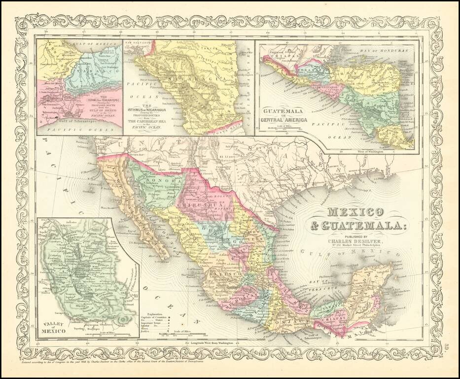
Scarce Charles Desilver map of Mexico and the Southwest. Many of the early place names in Texas still appear. Pre-Gadsden Purchase border with Mexico. Large insets of the Valley of Mexcio, Ithmus of Tehuantepeci, Isthmus of Nicaragua and Guatemala.
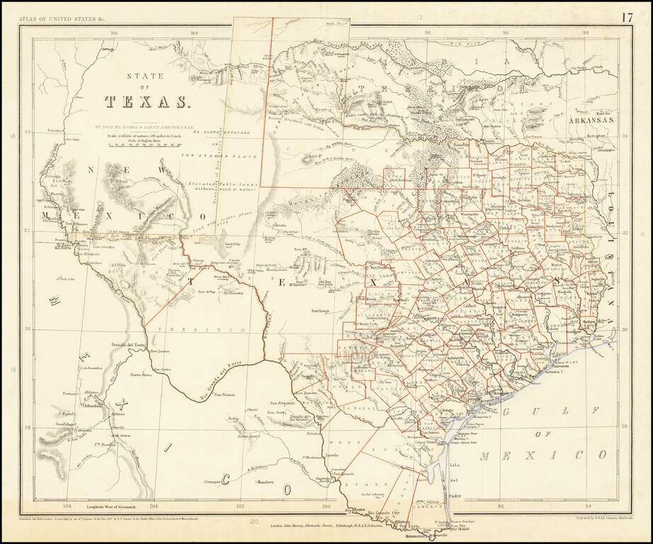
A Texas Rarity One of the rarest English Language maps of Texas to appear in a commercial Atlas. Rogers & Johnstons' map of Texas appeared in the extremely rare Atlas of the United States. The map was derived from the monumental and equally rare...
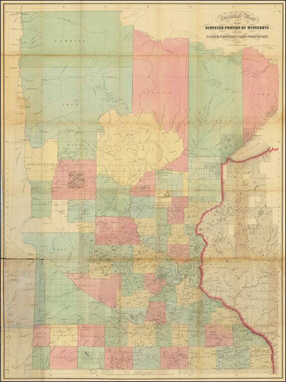
Scarce St. Paul-published pocket map of Minnesota depicting the state from the Lake of the Wood to the Iowa border. The map extends eastward towards Wisconsin's Bayfield Peninsula. Sewall was publishing maps out of St. Paul at the time of statehood....
![The City of St. Louis [with] The City of Chicago](/map/small/70257.jpg)
Two detailed maps of the cities of Chicago and St. Louis, published by JH Colton in New York. The maps are each colored by ward, and showing streets, rail lines, parks, buildings and other details.
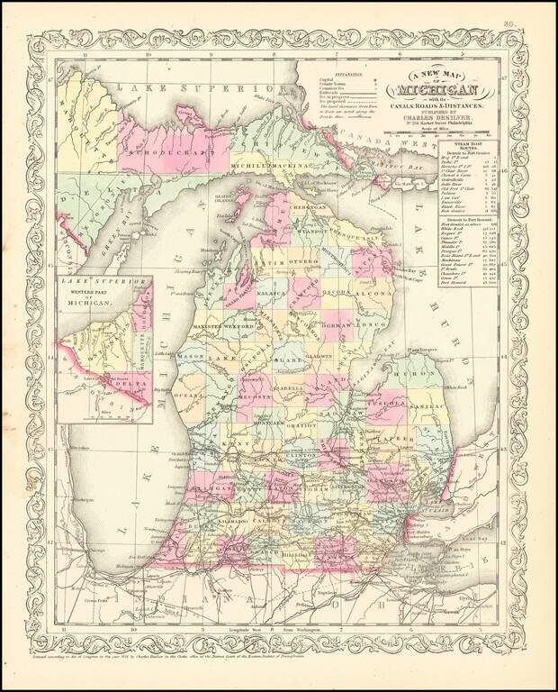
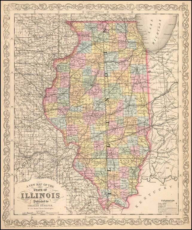
Scarce Charles Desliver map of Michigan, hand colored by county and showing towns, rivers, bays, lakes, railroads, roads, distances, etc. Tables of Steam Boat routes and distances. A number of Michigan Counties still not yet formed. Railroads are...
![The Minnesota Handbook, for 1856-7 [with] Minnesota Published by J.H. Colton & Co... 1857.](/map/small/68854.jpg)
1857 Edition of Parker's Handbook to Minnesota, along with the Special Edition of Colton's Map, with "Corrections Furnished by N.H. Parker." This Example from the James J. Hill Library. First and only edition of Parker's important early treatment of...
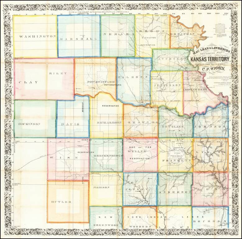
The First Great Map of Kansas Territory Fine large map of the soon to be "settled part" of Kansas Territory, drawn from the work of C.P. Wiggin. and lithographed by William Schuchman & Bro in Pittsburgh. The map illustrates the earliest...
![Territory of Nebraska [includes parts of Montana, Wyoming, Colorado and Dakota]](/map/small/66957.jpg)
Rare map of the Territory of Nebraska, from Rogers & Johnston's Atlas of the United States. Rogers & Johnston's map is the only commercial atlas map to show Nebraska Territory on a single map. The map was derived from the monumental and...
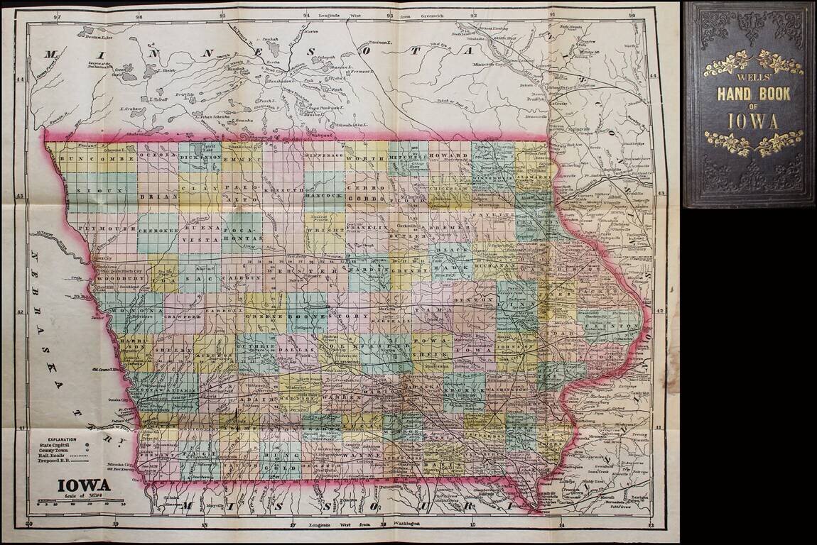
Scarce map and guide for Iowa, published by John G. Wells. Includes material on pre-emption of public lands, "Instructions to Settlers," mineral productions, "Various Avenues to Wealth" (including wool-growing and stock-raising), etc. The full title...
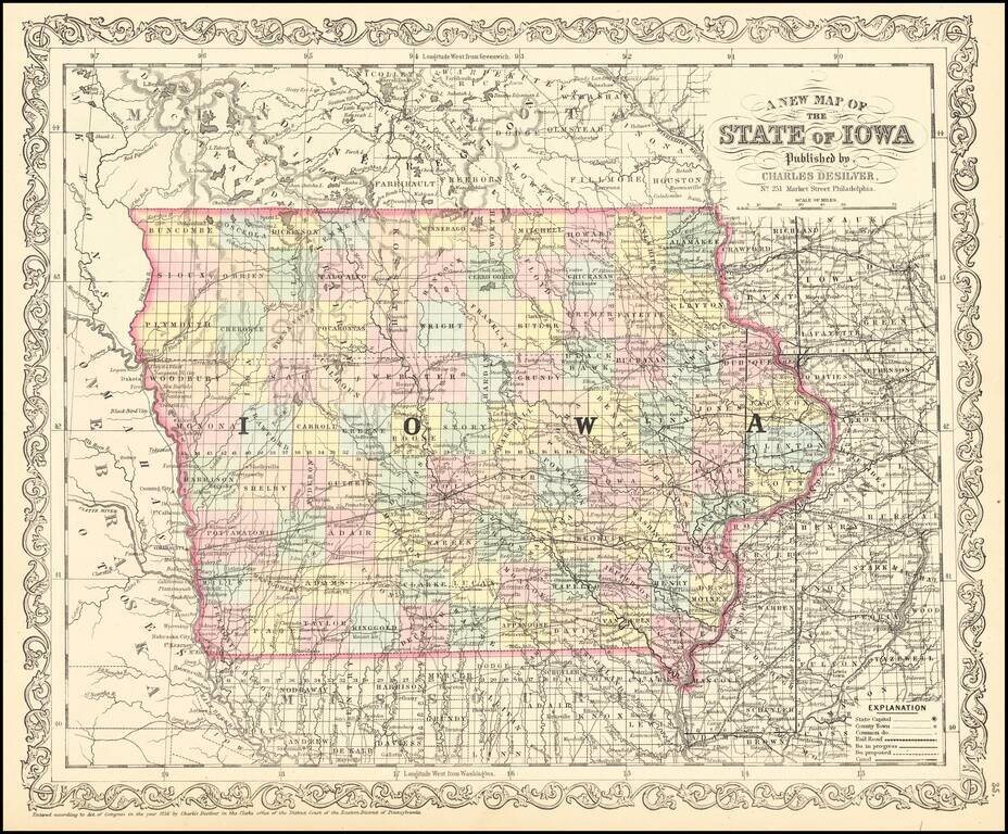
Scarce 1857 edition of this detailed map of Iowa. The map is hand colored by counties, showing railroads, stage lines, canals, roads, rivers, lakes, forts and other details.
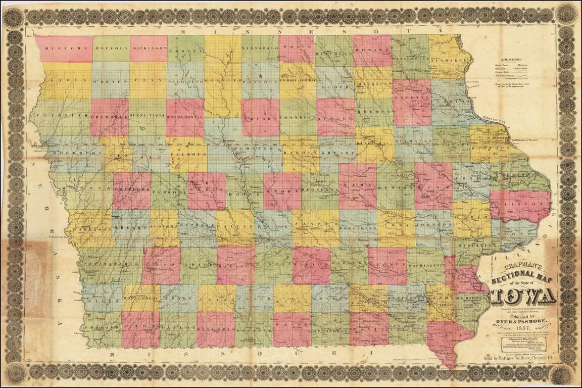
Iowa in 1857 Rare separately published antique map of Iowa, published in Milwaukee by Silas Chapman and drawn by James A. Reid of Dubuque. The map is colored by counties and shows township surveys, county towns, completed railroads, railroads in...
A cornerstone map, exceptionally detailed and showing many routes and places of interest in the settlement of the American West. This map was published several times from the mid-1850s through the 1870s. This map shows Fremont's 1844 and 1845 routes,...
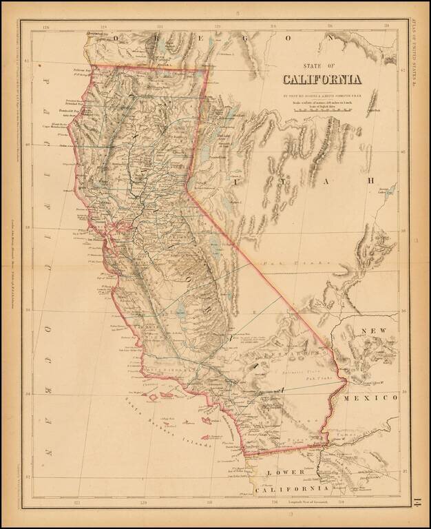
Rogers & Johnston' rare map of California, from the Atlas of the United States, perhaps the most coveted of all mid 19th Century American Atlases. This now rare atlas derives from a Wall Map first published in 1857 as a collaboration between...
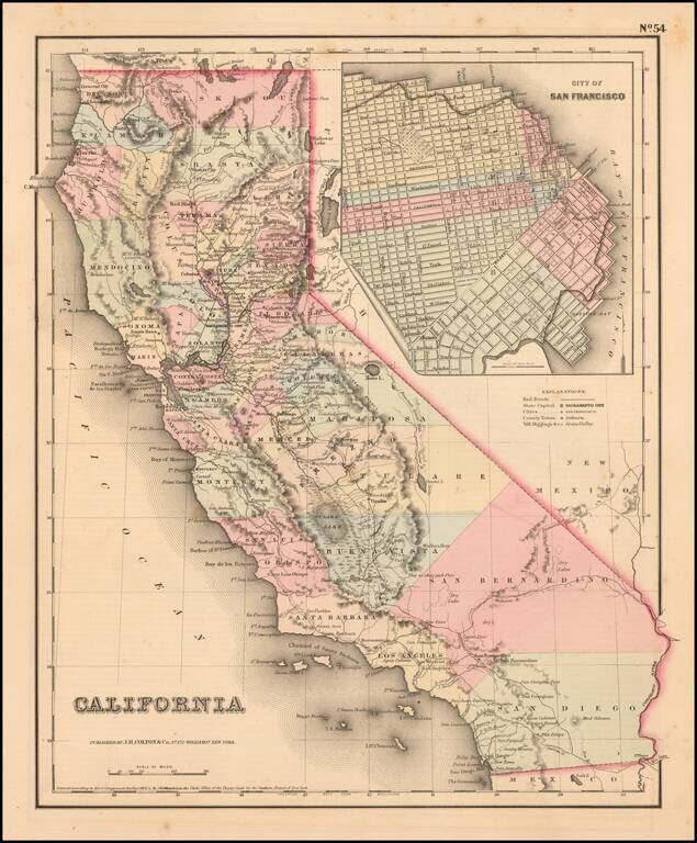
Scarce example of Colton's map of California, from Colton's Atlas of the United States. Hand colored by county. Only 6 counties in Southern California, including San Diego, Los Angeles, San Bernardino, Buena Vista, Santa Barbara and San Luis Obispo....
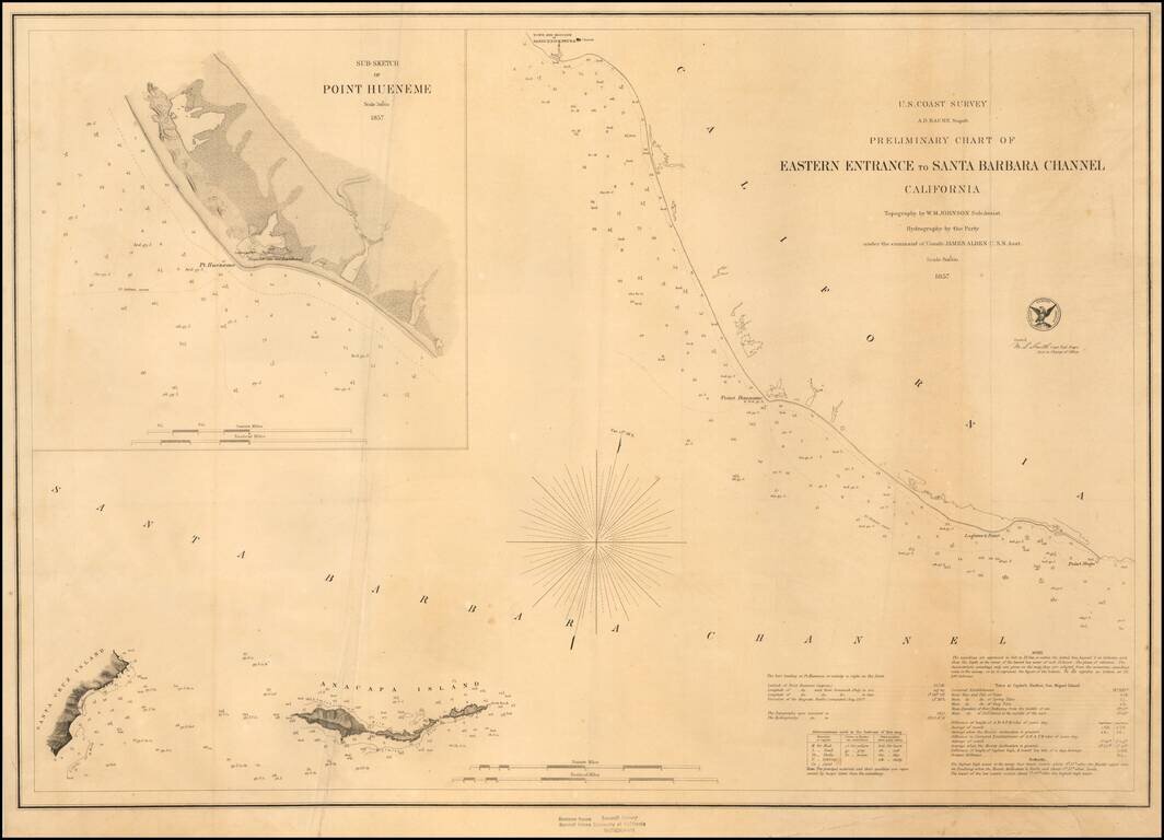
Fine Example on Thick Paper Early sketch chart, showing the Santa Barbara Channel from the Town and Mission of Santa Buenaventura (Ventura) to Point Magu and extending east to Anacapa Island and the western coastline of Santa Cruz Island. Includes...