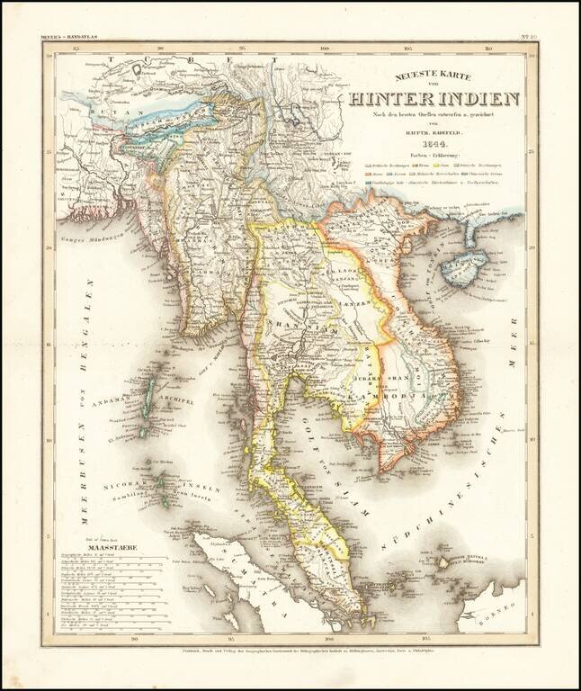
Detailed regional map of the Malay Peninsula, Vietnam, Cambodia, etc. extending from the Straits of Malacca and Singapore north to Hainan and the Gulf of Tonquin. From Meyer's Hand-Atlas. A bit toned and soiled. Extremely detailed regional map. A...
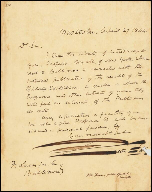
Letter of introduction from Peter Force to Fielding Lucas Jr., concerning the prospective publication of the Reports of the United States Exploring Expedition (Wilkes Expedition). Force had previously published a short summary of Charles Wilkes' 5...

Remarkable image showing Choctaw Indians playing lacrosse, from George Catlin's North American Indian Portfolio. In 1834, George Catlin witnessed Choctaw lacrosse in Indian Territory near present-day Oklahoma, and was captivated by the game. Ball-play...
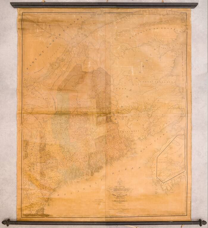
1844 Edition of Moses Greenleaf Junior's Important Early Antique Map of Maine Moses Greenleaf’s wall map of Maine is a continuation of his tradition of important early wall maps. Greenleaf's map is without question the largest and most detailed map...
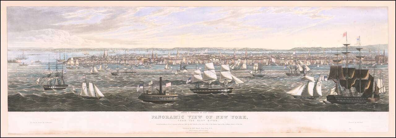
Havell Aquatint View of New York From the East River Rare separately published view of New York City, painted and engraved by Robert Havell. The ships were drawn by J. Pringle. Beginning in the second quarter of the 19th century, a significant...
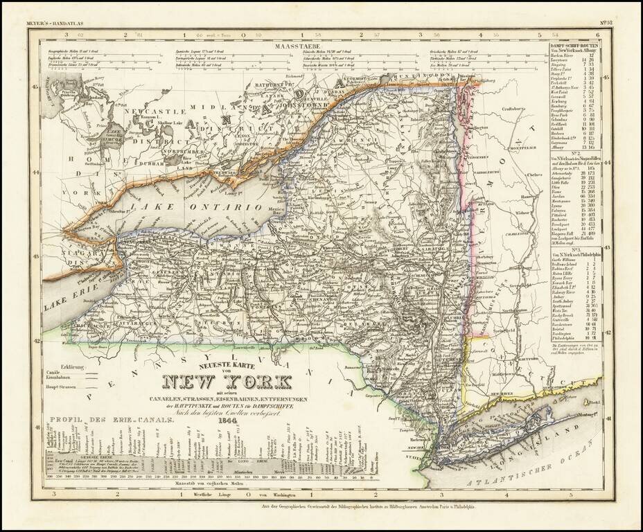
One of the First Maps of New York State Printed in Germany Detailed map of New York State, published during a period of great German interest in America and a boom in German emigration to the United States. The map shows the routes, railroads, and...
![Maryland and Delaware [with Inset of the District of Columbia]](/map/small/60553.jpg)
Marvelous and highly detailed map, from Morse's important Atlas of North America, the first cerographic atlas. Shows towns, roads, rivers, etc. Includes a plan of Washington, Georgetown, etc. Morse & Breese's North American Atlas was a landmark in...
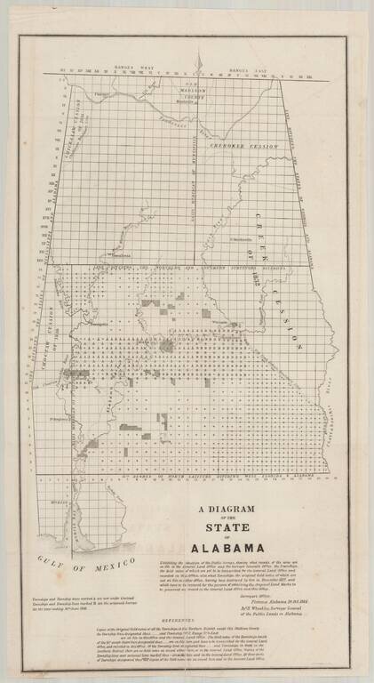
Detailed map of Alabama, illustrating the progress of the General Land Office Surveys as of October 10, 1844. Based upon a report signed in Florence, Alabama, on October 10, 1844, this map details both the progress on the surveys to date and those...
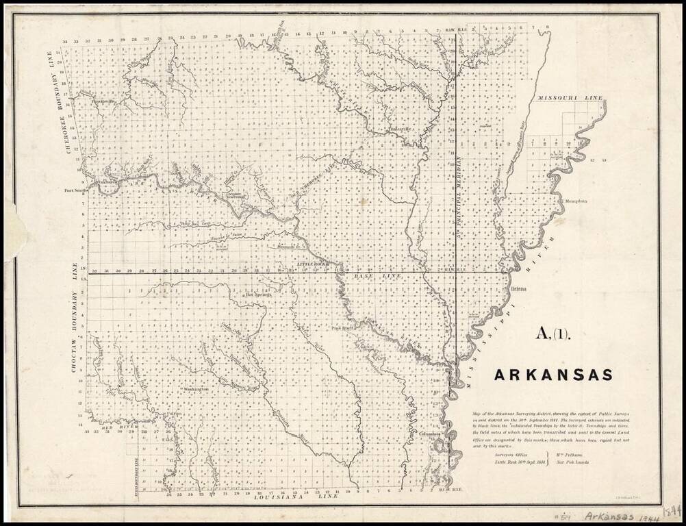
Map of the Arkansas Surveying district, shewing the extent of Public surveys in said district on the 30th September 1844. Shows the progress of the public land surveys. Indicates townships to be resurveyed, incomplete, those under contract but...
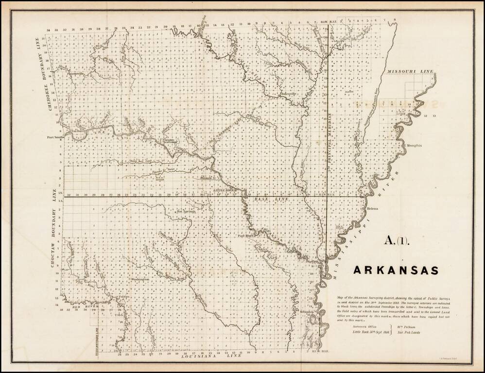
Interesting early survey map of Arkansas, showing the progress of the township survey work through 1844, along with a detailed explanation of the progress of the surveys through September 30, 1844, by William Pelham, the Surveyor General of Arkansas.
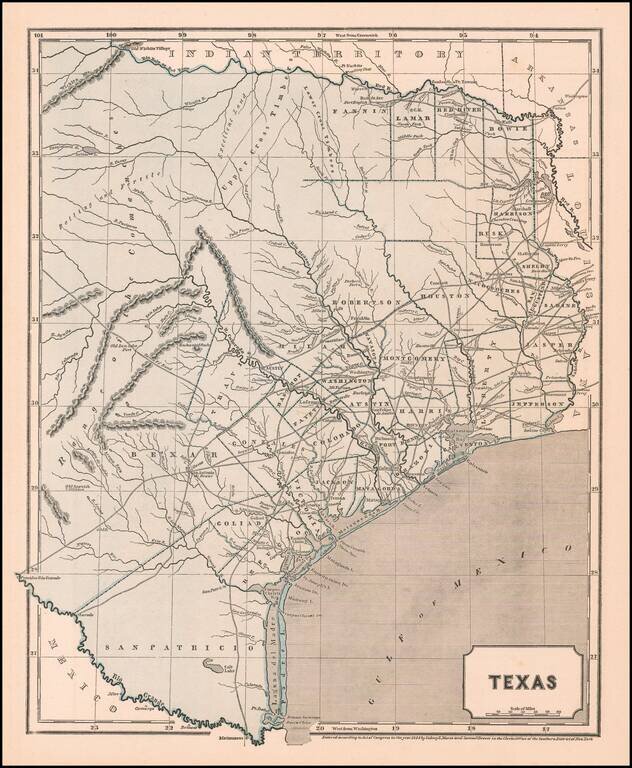
A Separate Map of the Republic of Texas Scarce map of the Republic of Texas, extending west to the Presidio Rio Grande and the Rio Colorado and its tributaries. Shows early land grants and counties, towns, roads, forts, rivers and other details....
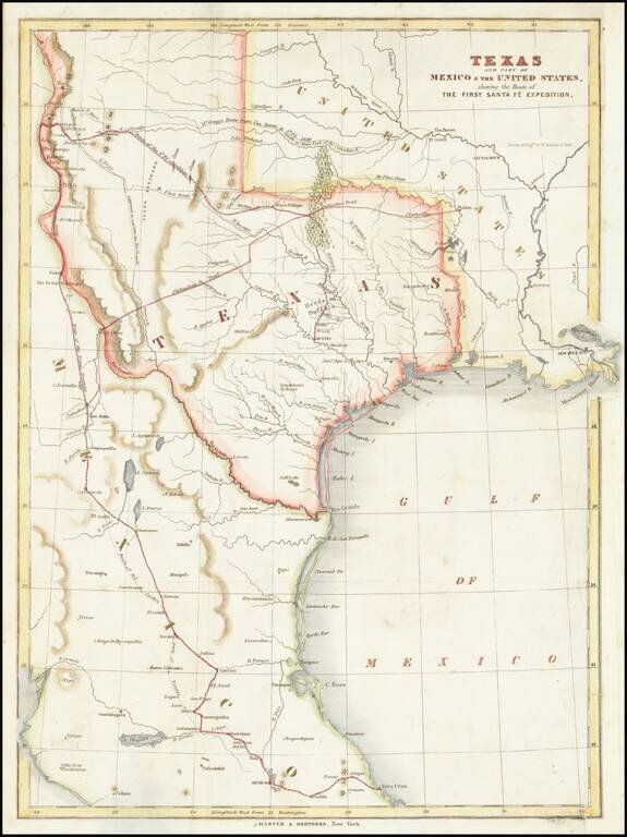
Map of the Republic of Texas, which appeared in Kendall's Narrative Of The Texan Santa Fe Expedition .... This map shows efforts of the Republic of Texas, under President Mirabeau Lamar, seeking to take control over Santa Fe and develop trade links...
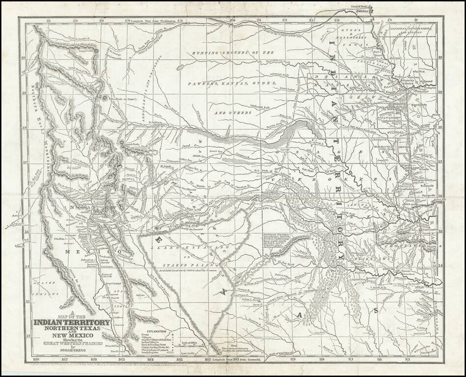
Josiah Gregg's Landmark Map of the Southwest & Northern Texas Fine example of Josiah Gregg's monumental map of Northern Texas & the Plains, from his monumental Commerce Of The Prairies, one of the classic accounts of the Transmississippi West...
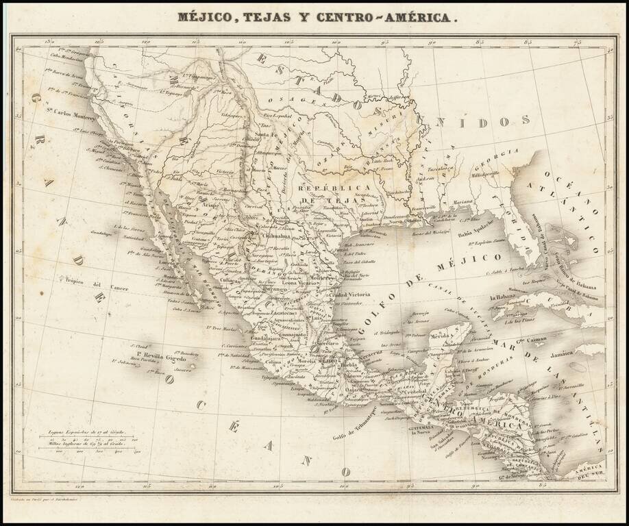
Rare map showing the Republic of Texas (República de Tejas), one of only a few maps to specifically refer to Texas as "Republic of Texas," during the period between 1836 and 1845. The map was originally published in Sanchez de Bustamante's Nuevo...
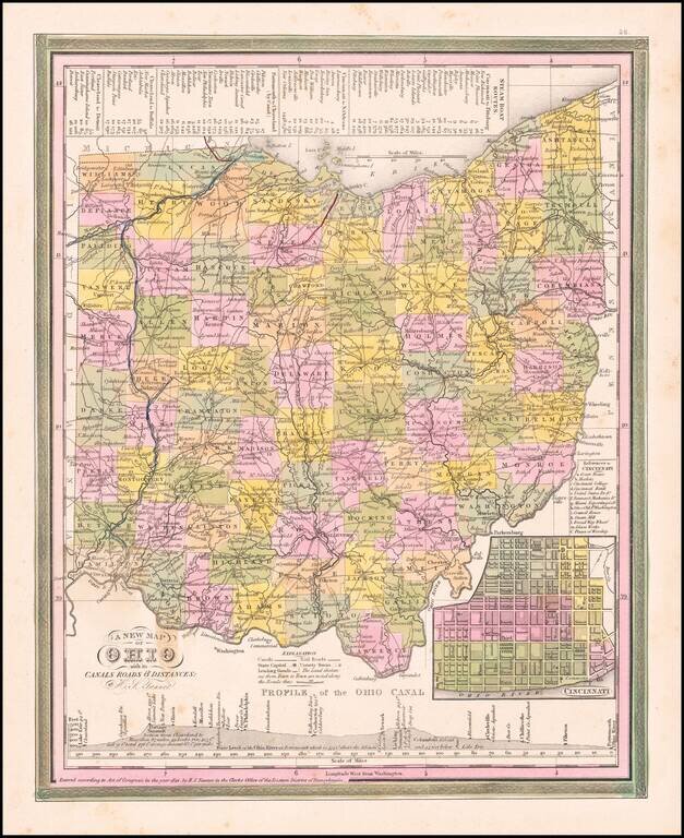
Nice example of Tanner's map of Ohio, hand colored by county, showing roads, canals, towns, steamship routes and other interesting details. An inset shows the city plan for Cincinnati and a profile of the Ohio Canal. One spot in the border at the...
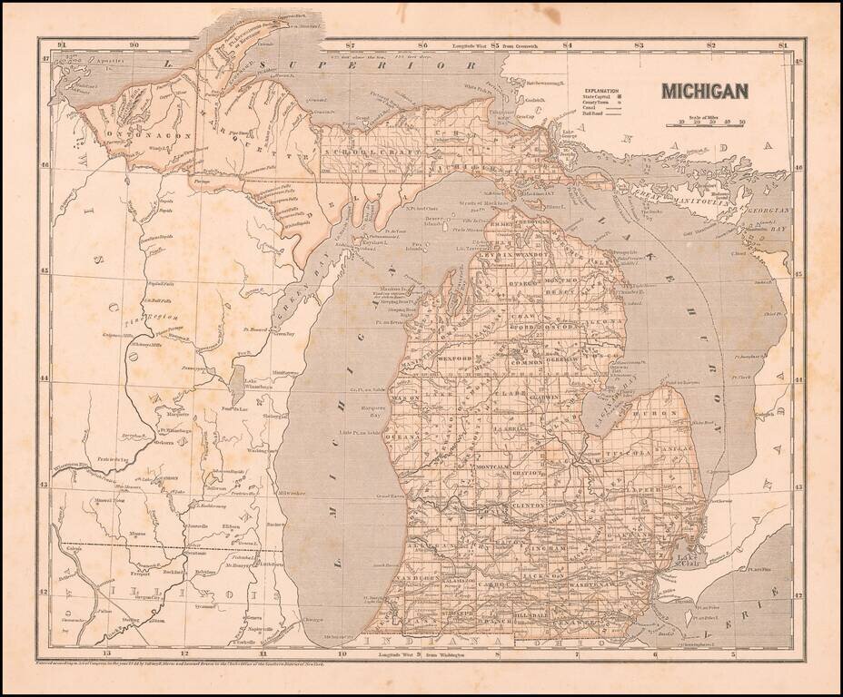
Marvelous and highly detailed map from Morse's important Atlas of North America, the first cerographic atlas. Shows towns, roads, rivers, townships, etc. Morse & Breese's North American Atlas was a landmark in American Cartography, being the first...