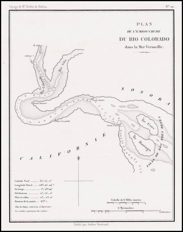
Rare early map showing the confluence of the Gila River and the Colorado River, along with the Northern tip of the Gulf of California, then also known as the Red Sea, because of the color of the water which flowed from the Rio Colorado (Red River) into...
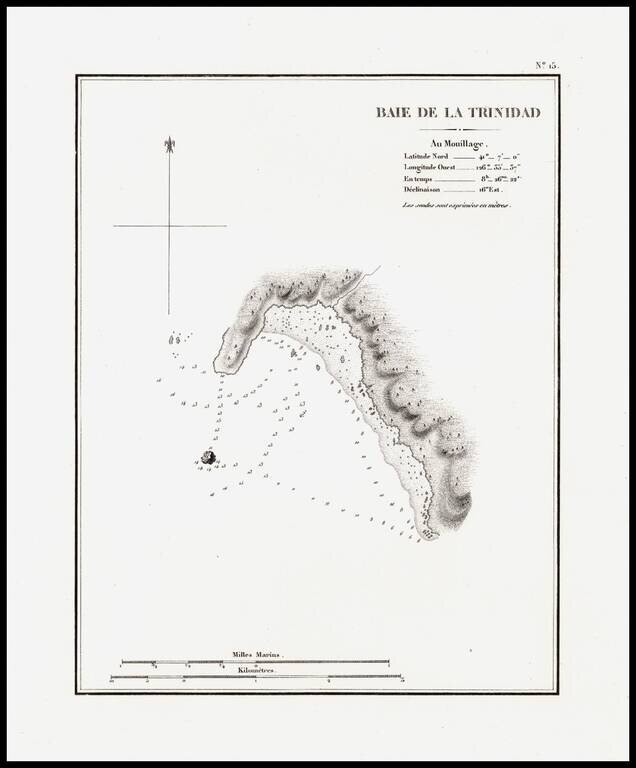
The earliest separately issued map of Trinity Bay, which appeared in Duflot de Mofras' report of his travels on the West Coast of North America. In 1839, Eugene Duflot de Mofras, was assigned to the embassy in Mexico City and instructed to visit the...
The earliest separately issued map of Trinity Bay, which appeared in Duflot de Mofras' report of his travels on the West Coast of North America. In 1839, Eugene Duflot de Mofras, was assigned to the embassy in Mexico City and instructed to visit the...
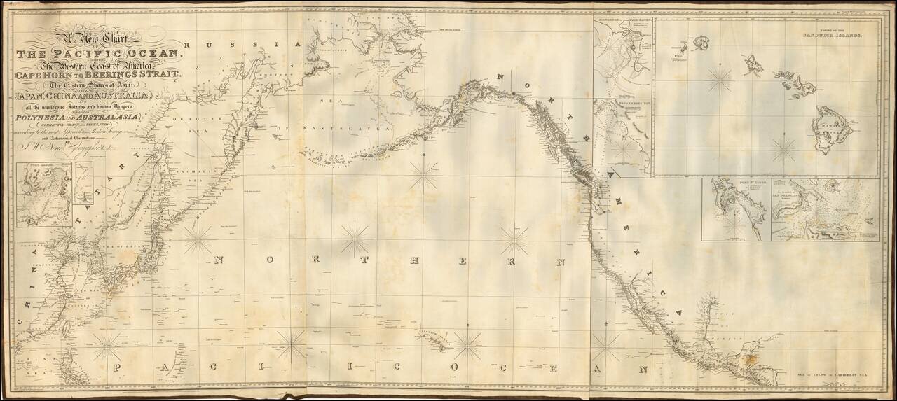
Fine example of Norie's monumental sea chart of the northern part of the Pacific Ocean. The chart is noteworthy for the large inset views of San Francisco, San Diego, Hawaii, Honolulu and Karakakoa Bay in Hawaii. Issued with revisions up to 1844,...
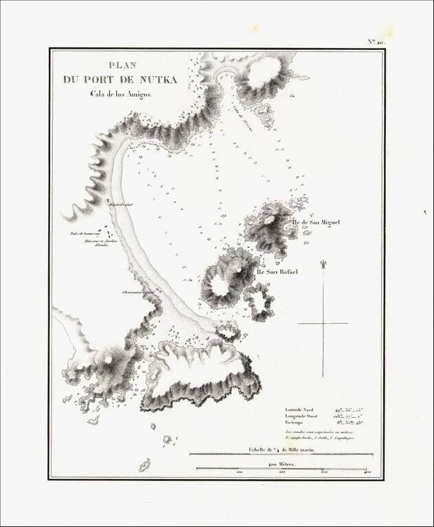
Detailed map of Nootka Bay, from Duflot de Mofras' momumental work. In 1839, Eugene Duflot de Mofras, was assigned to the embassy in Mexico City and instructed to visit the northwestern provinces of Mexico, report on potential commerce, observe U. S.,...
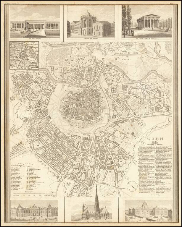
Decorative map of Vienna, published by Joseph Meyer. The map includes 6 large decorative vignettes.
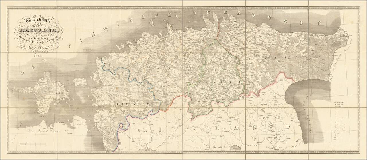
Interesting and scarce map of old Estonia (the old Duchy of Estonia, or Ehstland in German), stretching from the St. Petersburg Government in the east to Hiiumaa Island in the west. To the south of the map is "Livland", which is today part of modern...
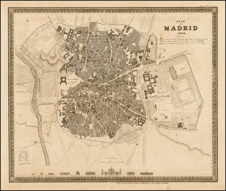
Striking town plan of Madrid, with vignettes showing 9 major churches and buildings.
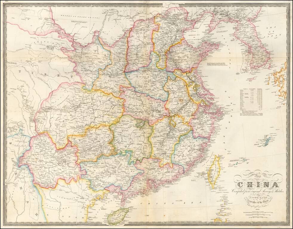
Early State of Wyld's Large Map of China Highly detailed map of China, published shortly after the conclusion of the First Opium War, reflecting Britain's new commercial interest in China. An early state of James Wyld influential map of China,...
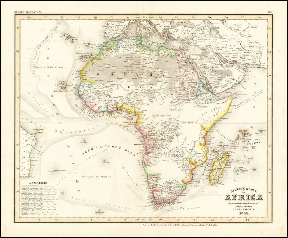
Detailed map of Africa, from Meyer's Hand Atlas. Provides a fine representation of the extent of the known regions of Africa (mostly along the coastlines), with fast expanses of unknown and little known regions.
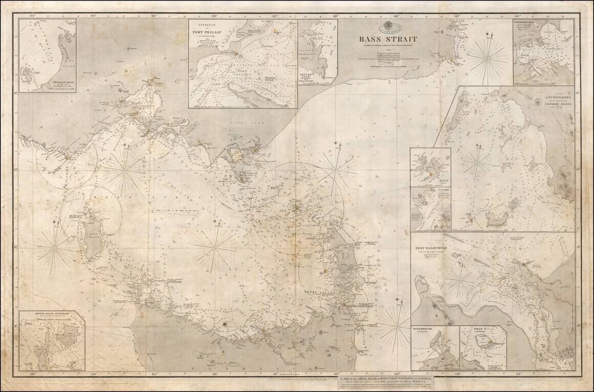
With Hand Drawn Annotations Showing Contemporary Use At Sea Annotated example of the 1843 edition of the British Admiralty Chart of the strait between Melbourne and Tasmania, revised and improved to 1844 and 1858. The map is based upon the...