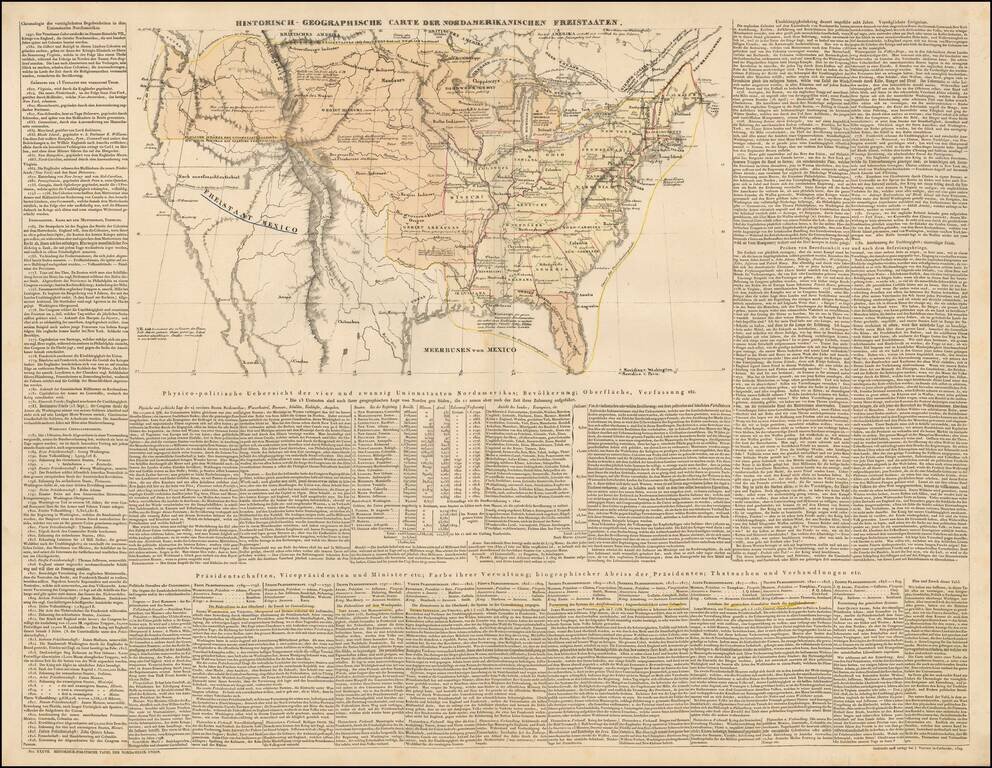
Scarce engraved map of the United States, with coverage of the recent discoveries in the west, and extensive descriptive text in German. There are some printed annotations scattered around the map in German as well. The map shows numerous Indian...
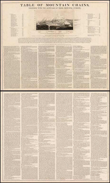
Unusual two sheet table of principal mountains, with an illustration and remarkably detailed list of mountains from all parts of the known world. Includes a list of he tallest Island Mountains, Mountain Passes, Table Lands and Elevated Human...
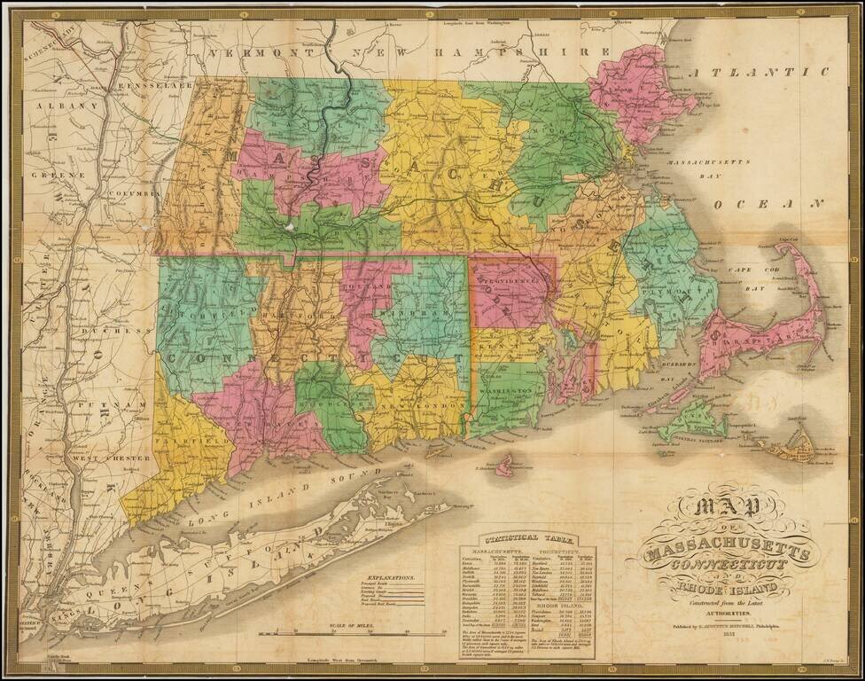
Highly detailed large format map of New England, from a folding version of Mitchell's rare American Atlas, published in 1831. The map is hand colored by counties and shows towns, rivers, roads, lakes, mountains, islands, canals, etc. Excellent...
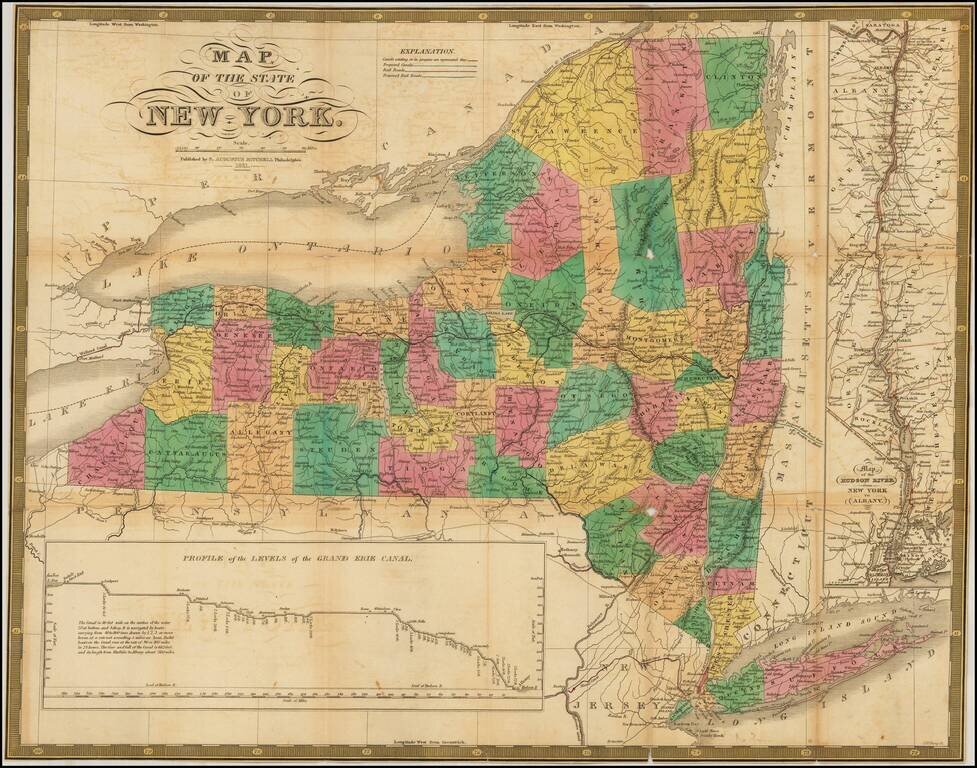
Highly detailed large format map of New York, from Finley's rare American Atlas, published in 1826. The map is hand colored by counties and shows towns, rivers, roads, lakes, mountains, islands, canals, etc. Excellent detail. Includes a profile of the...
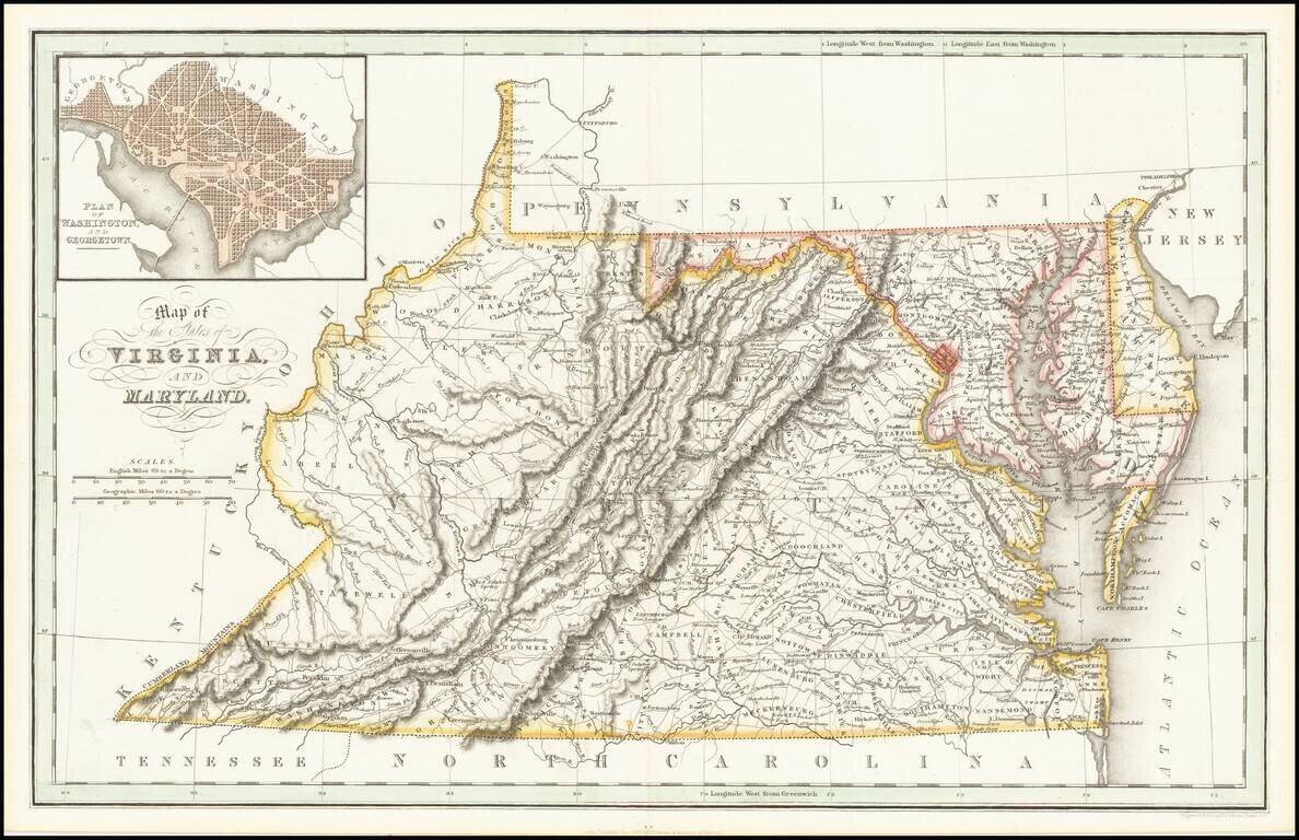
Scarce early map of Virginia and Maryland, showing counties, rivers, towns, mountains, lakes, etc. Includes early roads. This is one of the earliest British publications to show the US by states. Inset of Washington DC.
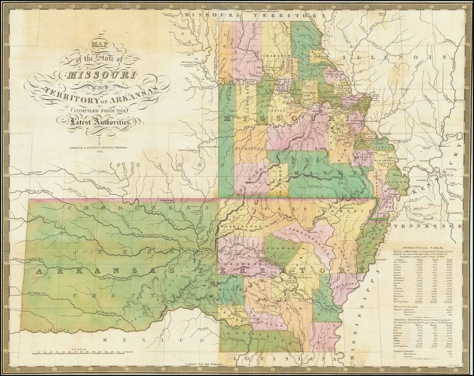
Nice example of the 1831 Mitchell edition of Finley's map of Arkansas and Missouri, being one of the earliest separately issued regional maps to show Arkansas in its double-width configuration (including most of Oklahoma). A number of counties in the...
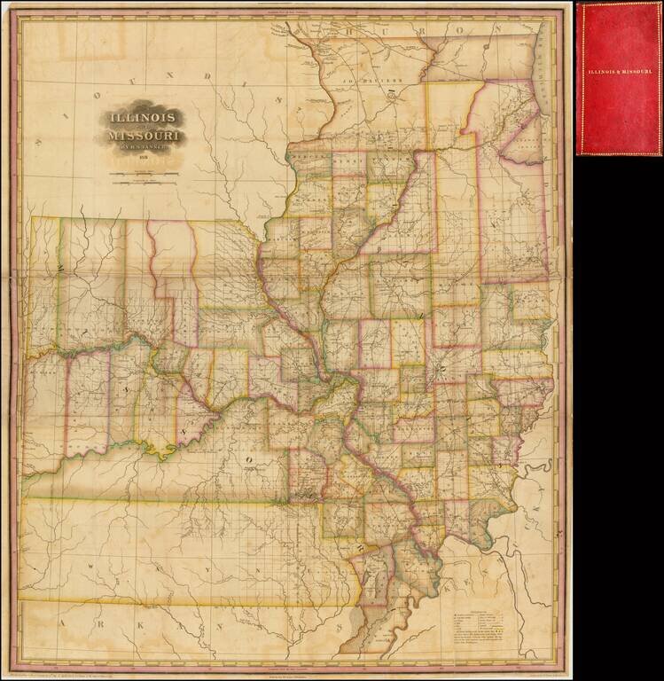
Significantly revised and updated version of HS Tanner's large format map of Missouri and Illinois Territories, first issued in 1821. The map includes remarkable detail where there had been relatively little detailed cartographic work to date. The...
![[Manuscript Survey of the a portion of the State Road from New Albany to Princeton, Indiana in 1831]](/map/small/21225.jpg)
Fascinating manuscript map with contemporary annotations, showing a portion of the proposed route of the State Road between New Albany, Indiana and Princeton, Indiana, prepared by John L. Smith at the direction of the Indiana General Assembly (and in...
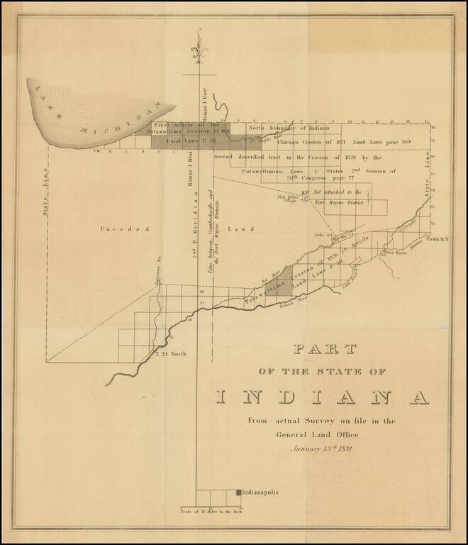
Important early survey map of Indiana, published by the General Land Office. Shows the area from Indianapolis north to Lake Michigan. The map identifies on a regional basis a number of early Indian Treaties and the lands impacted thereby, along with...
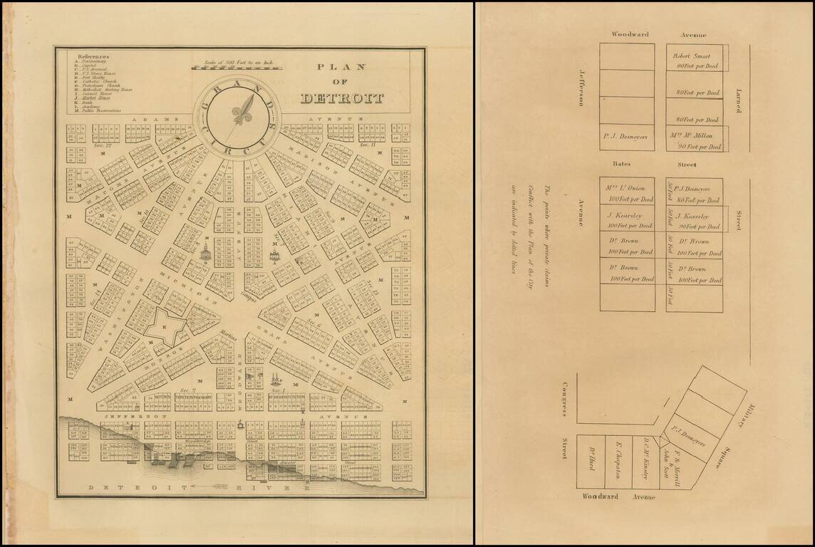
Rare early plan of Detroit from the first edition of the American State Papers. A highly desirable early plan of Detroit. With the additional leaf showing plots off of Larned Street and Bates Street.
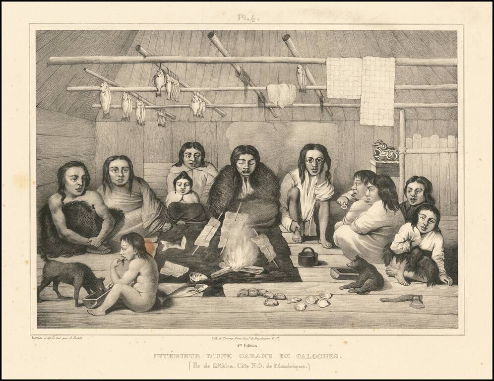
Beautiful antique lithograph of the interior of a Tlingit cabin, from an image drawn by Alexander Filippovich Postels near Sitka, which was then part of Russian America. The scene depicts 11 individuals sitting around a central fire, with fish cooking...
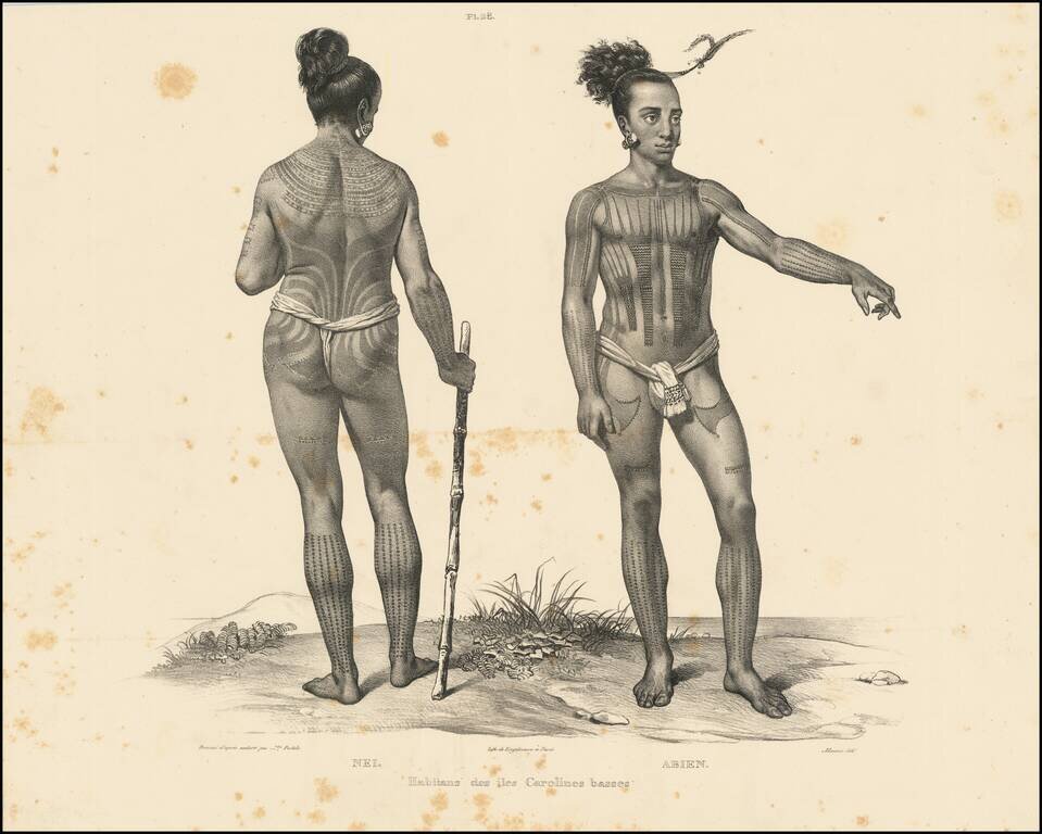
Beautiful antique lithograph of a tattooed Caroline Islander, from an image drawn by Alexander Filippovich Postels, during Fréderic Lütke's circumnavigation in the 1820s. The Caroline Islands are in the South Pacific, north of New Guinea, and were...
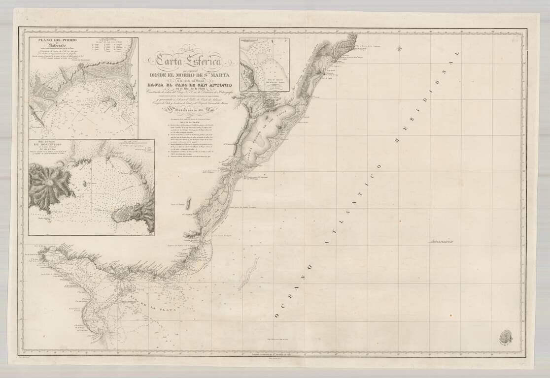
Scarce Spanish Sea Chart of the southern coast of Brazil and the Rio de la Plata, published by the Spanish Hydrographical Department. The chart includes large insets of Montevideo, Buenos Ayres and Puerto Maldonado.
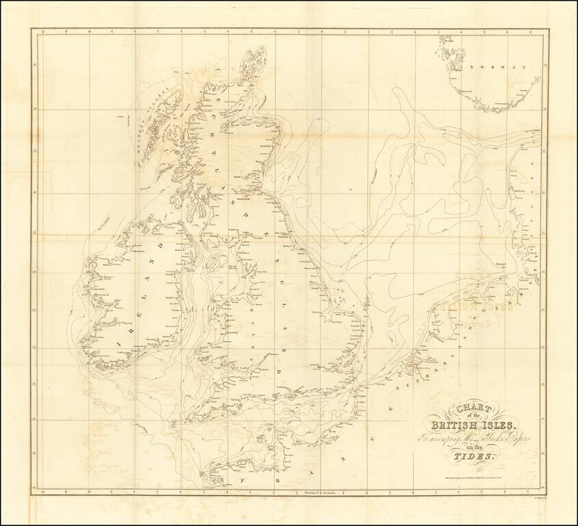
Lubbock’s Map of the Tides—the Early Work of a Skilled Man of Science Finely-engraved map of the British Isles and its tides, published to illustrate a paper on tidal flows presented by John William Lubbock to the Royal Society of London in 1831....
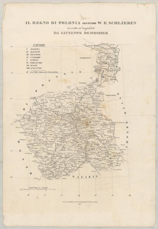
Very rare separately published map of Poland, drawn from W.E. Schlieben's map. The size is for the full sheet. The map shows the towns, roads, rivers, lakes and other details in Poland.
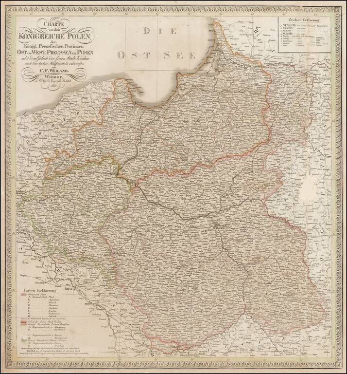
Scarce map of Poland and East and West Prussia, published by Weiland. The map includes the Free State of Cracow.