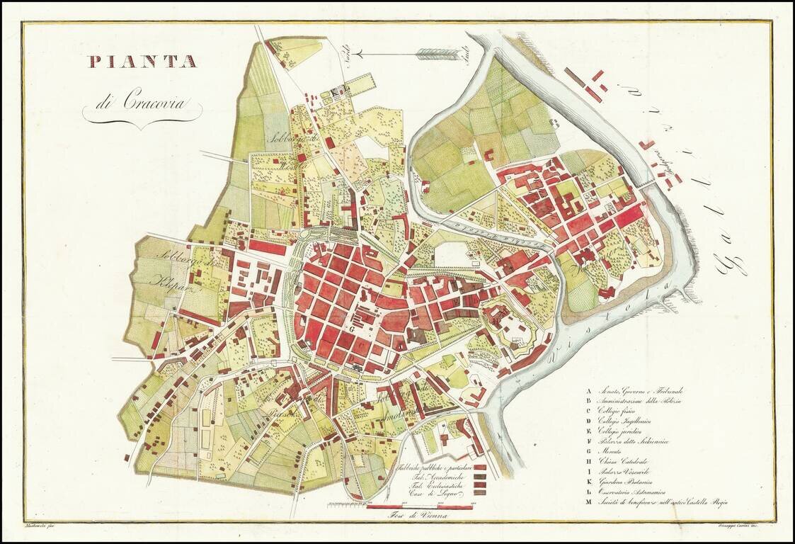
Rare plan of Krakow, published in Florence by Giuseppe Carini. The second name on the map shows the name Mostowski. This is the second time in more than 20 years we have offered the map for sale.
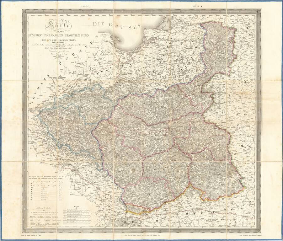
Large folding map of Poland and environs, published in Berlin. The map is subdivided into region, A to K. Includes towns, rivers, forests, postal roads and a host of other details.
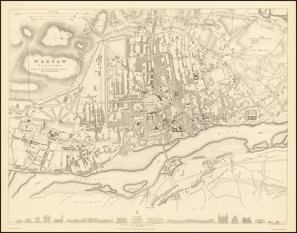
A highly detailed town plan of Warsaw which includes profile views of 16 major buildings across the bottom of the map. This forms part of the first edition of the best published commercial atlases of the 19th century. This map was published during the...
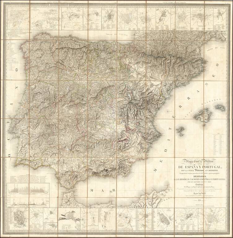
Fine large Civil and Military map of the Iberian Peninsula, published in Paris by the Catastro Real de Francia and the French Geographical Society. The map includes small plans of: Puerte (sic) of Mahon, Tudela, Mahon, Zaragoza, Lerida, Porto, Toledo,...
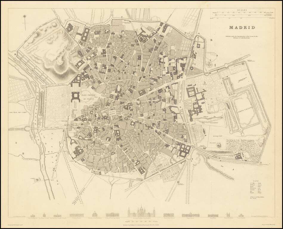
A highly detailed plan of Madrid, with a series of building profiles at the bottom. The map shows bridges, roads, rivers, gates, prados, plazas, streets, buildings, castles, gardens, and more. This is of the best plans of Madrid published in a...

An Important Early Sea Chart of the Area around Hong Kong and the Pearl River Delta Updated To Incorporate Placenames in Chinese Rare separately published chart of the areas between Canton (Guangzhou), Hong Kong to the islands around Hong Kong, with a...
Remarkable Manuscript Collection of the French Invasion of Algeria, From the Collection of the Duke of Orléans Striking collection of 46 manuscript maps, and a few documents, showing northern Algeria. The maps date from the French invasion of Algeria...