
Rare early lithographic portait of the 16th Century explorer, Sir Francis Drake, celebrating his discovery of the Potato, which he brought from America to Europe in 1544. Smaller copies of the 1817 lithographica edition are noted in the Hampton L....
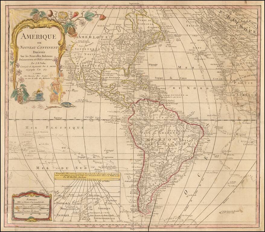
Rare late edition of Johanne Baptiste Nolin's map of America, first issued nearly 100 years earlier. The present example is noteworthy for its use of extremely old/dated cartographic detail. The map was updated in the latter part of the 18th Century...
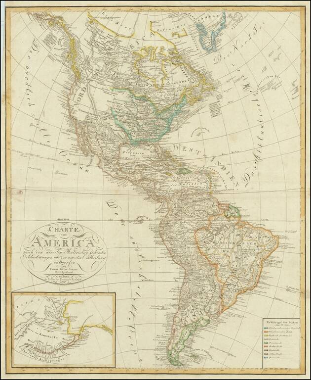
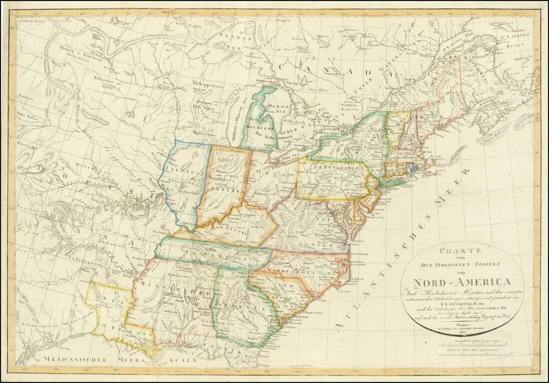
Fine-Lewis & Clark era map of America, reflecting the geo-political boundaries immediately after the Louisiana Purchase. Mississippi Territory is shown prior to the creation of Alabama. Massive Indiana Territory pre-dates the creation of Michigan...
![Northern Hindostan [with] Nepaul [with] Cabul](/map/small/62805.jpg)
Fascinating regional map of Northern India, colored by regions and showing the lands controlled by the British, Nabob of Oude, Berar Rajah, Nizam, Nysore Rajah, Mahrattas, Travancore, and King of Candy. Large insets of Cabul and Nepal. The map of...
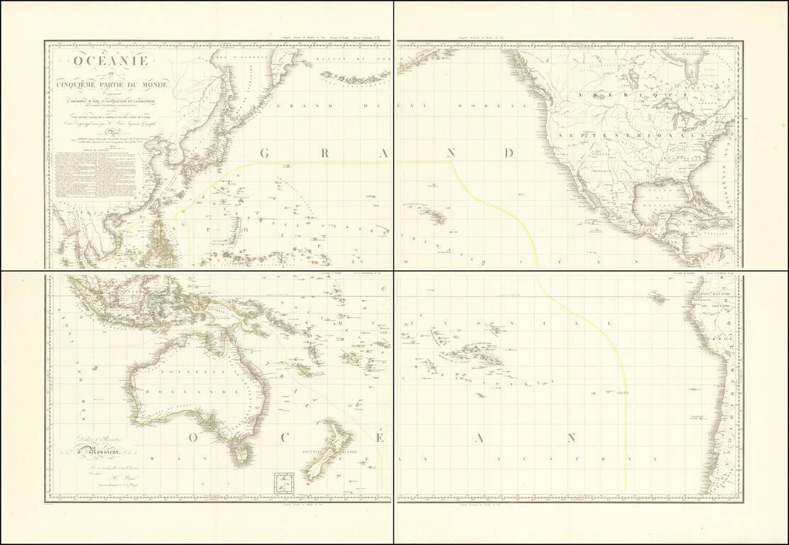
Stunning, Large-Format Map of the Pacific, the Origin of the Toponym Oceania Fine example of A.H. Brué's four-sheet map of the Pacific Ocean, first published in Paris in 1814 and here updated to 1817. The title in the upper left corner indicates...
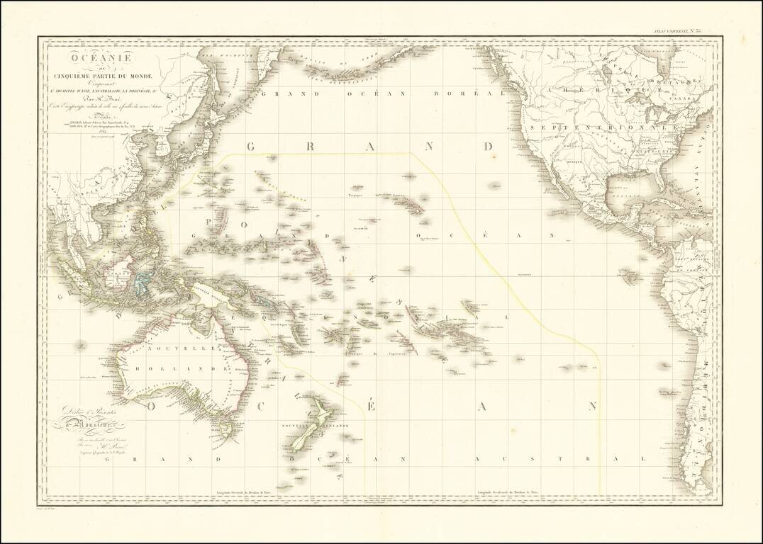
Striking Map of the Pacific, the Origin of the Toponym Oceania Fine example of A.H. Brué's distinctive map of the Pacific Ocean, first published in Paris in 1814 and here updated to 1816. The title in the upper left corner indicates that this map...

Rare Edition in Handsome Original Outline Hand-Color. A beautiful example of this very rare edition of Carey's General Atlas, published in Philadelphia in 1817, one year before the final edition of 1818. This is the 58-map version of the atlas; there...
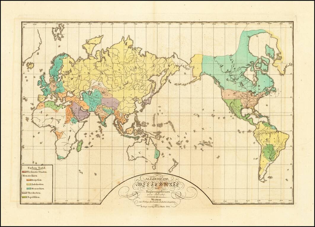
A World Map of Despots, Theocrats, Monarchs and Autocrats, etc. Rare map of the world, illustrating the the different governments of the world in 1817. The key locates 6 typles of Government: Federated States Monarchies - Despots Monarchies -...
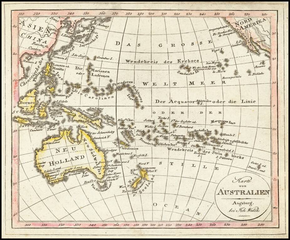
Interesting map of the Southern Part of the Pacific Ocean, published in Augsburg by Walch. Includes Hawaii and fascinating early configurations for Australia and New Zealand.
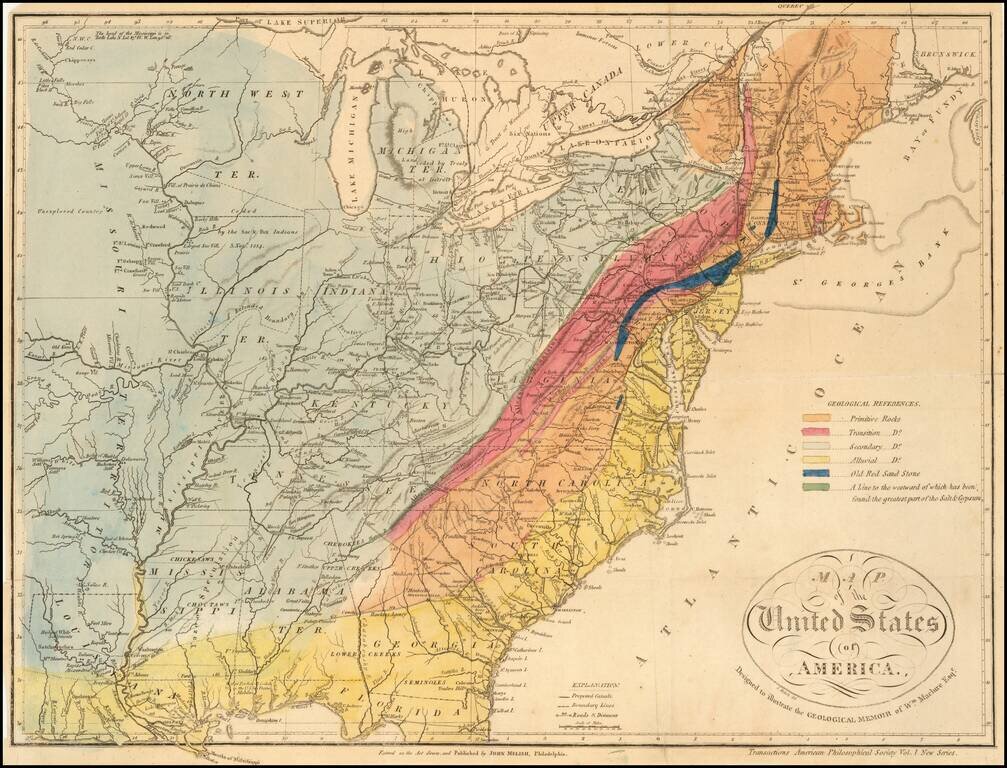
A Geological Map of the United State By The Father of American Geology The Melish-Maclure map of the United States is one of the first geological map of the United States published in America. This scarce map of the United States, was issued in...
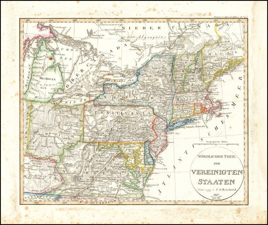
Rare early map of a portion of the Midwest and regions to the East, from Lake Michigan to Kentucky and Virginia to Maine. Early depiction of Michigan Territory.
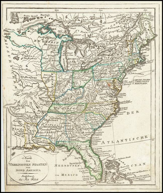
Mississippi Territory ! Rare early state of Walch's map of the United States, showing a number of early and transitional territorial configurations. This map vividly illustrates the fluid nature of American territorial boundaries between the Louisiana...
With an unusual appearance of "Neu Orleans" Territory. Rare late state of Gussefeld's map of the United States, published in the same year as the Louisiana Purchase and highlighting Jefferson's United States on the eve of the expeditions of Lewis...
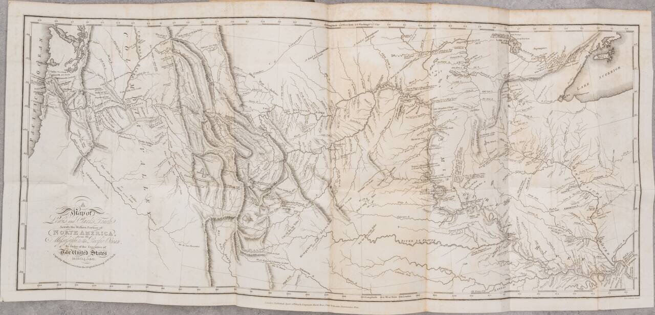
London edition of Lewis & Clark's map of the Northwestern US, based upon William Clark's original manuscript map of the expedition, along with the complete 3 volume text and maps of the 1817 London edition of Lewis & Clark's Travels to the...
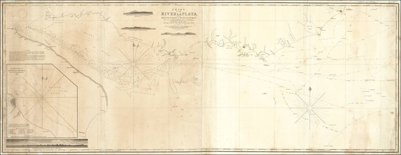
Extremely rare British chart of the entrance to the Río de la Plata, published by William Faden in London in 1817, based on surveys made by John Warner in 1810-1814. The chart covers from Sierra de Buena Vista mountain at the far northeast, to Buenos...
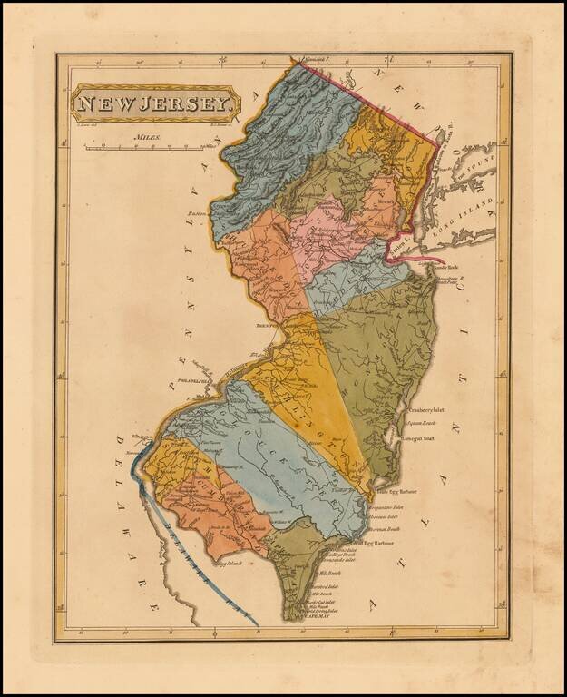
Rare First Edition of The Lucas Map of New Jersey Nice example of Fielding Lucas' early map of New Jersey, from his New & Elegant General Atlas of the United States . . . Hand colored by counties, this is one of the first maps of New Jersey...