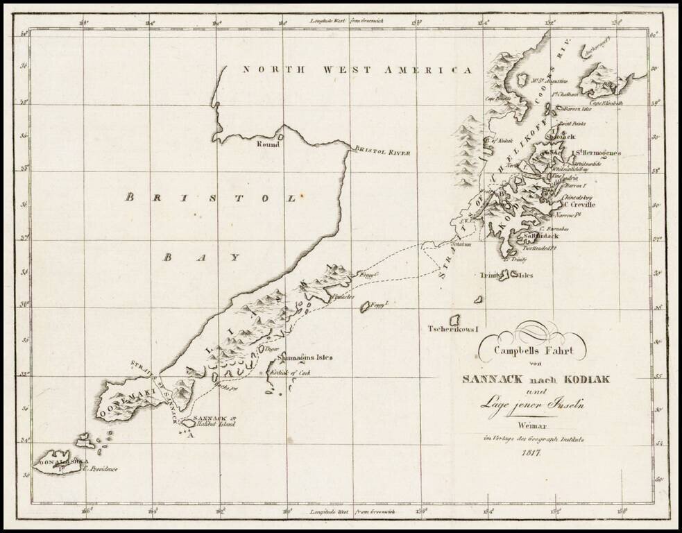
Rare map showing the tracks of Archibald Campbell's long boat trip from Sannack to Kodiak (then Russian America) in 1807. This map, showing the southwestern tip of Alaska and several Aleutian Islands, is from a German Serial containing numerous...
![West India Islands [Curacao, Trinidad, Grenada and Tobago] [4 maps on 1 sheet]](/map/small/48137.jpg)
Nice example of this detailed set of 4 maps, each in outline color with a compass rose. Excellent detail in each of the islands, includng roads, rivers, towns, bays, harbors and topographical details.
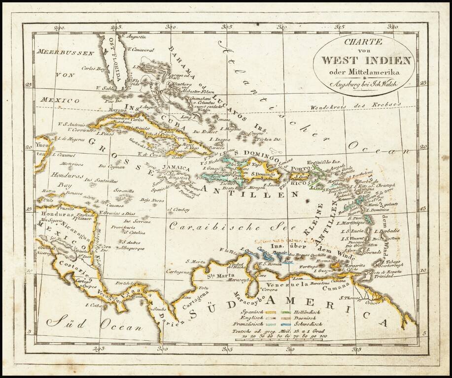
Interesting map of the West Indies, published in Augsburg by Walch. The map is colored by Colonies and includes some early annotations in a contemporary German hand.
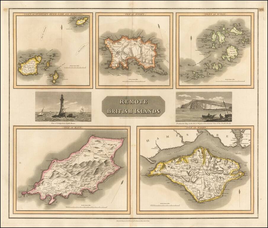
Group of 5 maps of the Channel Islands, Scilly, Jersey, the Isle of Mann and the Isle of Wight. Engraved views of the Eddystone Lighthouse and Freshwater Bay on the Isle of Wight, with Needle Rock in the background.
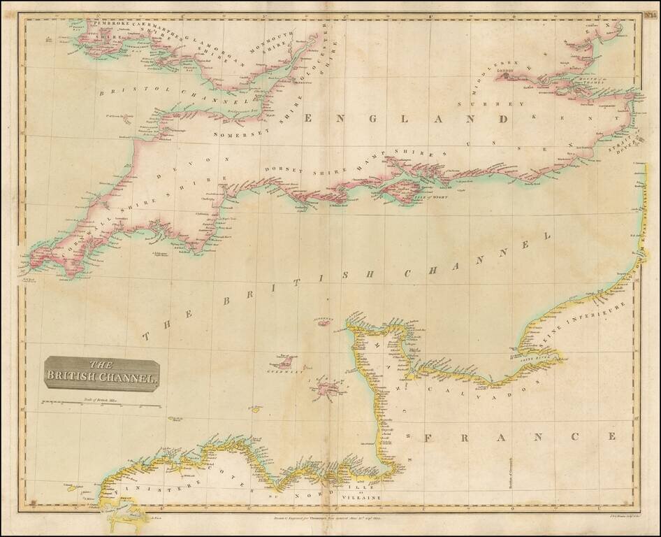
Detailed map of the Channel and the features along the French and British Coastlines. Large detailed map.
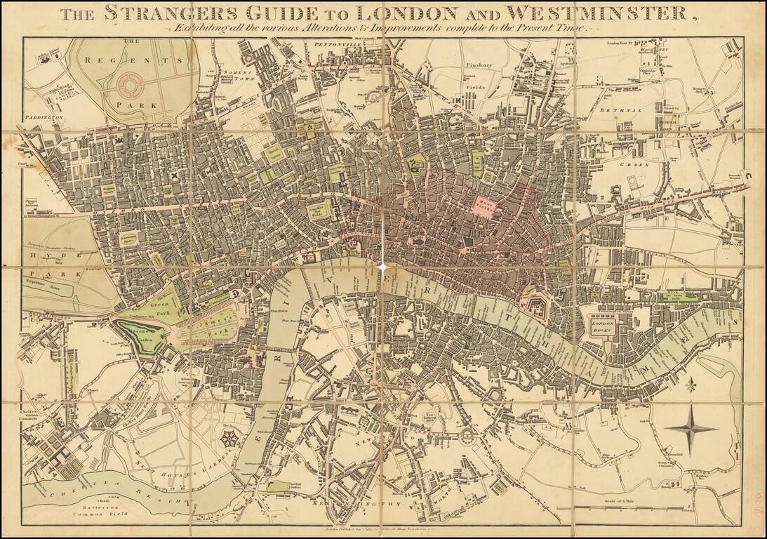
Unrecorded Early Edition of Mogg's Map of London. Antique map of London issued by Edward Mogg in London in 1817. Detailed plan of Georgian London, which at the time extended from Hyde Park to just east of the Tower of London. The City of London is...
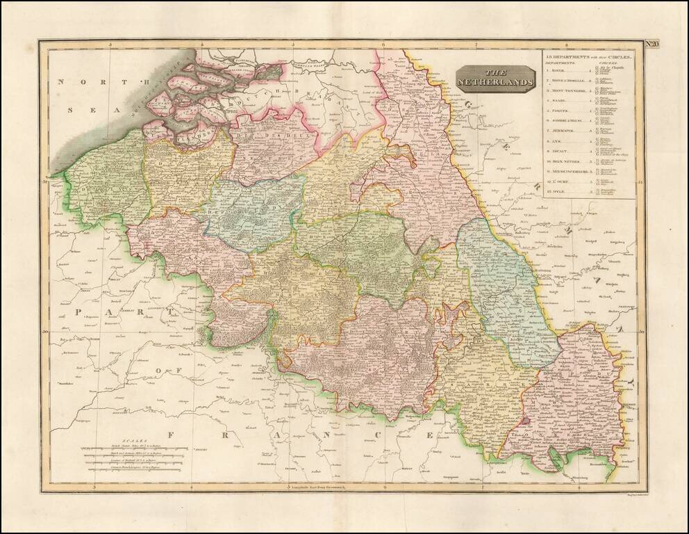
Detailed map of the Belgian Netherlands, including Roer, Rhin & Moselle, Mont-Tonnerre, Saare, Fortes, Sambre & Meuse, Jemmapes, Lys, Escaut, Deux-Nethes, Meuse Inferieure, L'Ourt, and Dyle. Large detailed map.
![Chart of the Mediterranean Sea [Cyprus]](/map/small/45182.jpg)
Nice example of the Mediterranean chart from Thomson's New General Atlas. The chart focuses on coastlines and coastal cities in the manner of early Discovery Era portolan charts. The main chart of the Mediterranean basin is surrounded by seven inset...
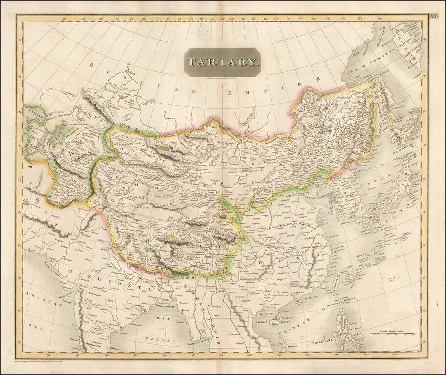
Detailed large format map of Tartary, extending from China, Japan and the Northeastern Russian Regions of Asia to Hindoostan and Beloochistan. One of the most detailed and interesting large format maps of the early 19th Century. A fine example with...