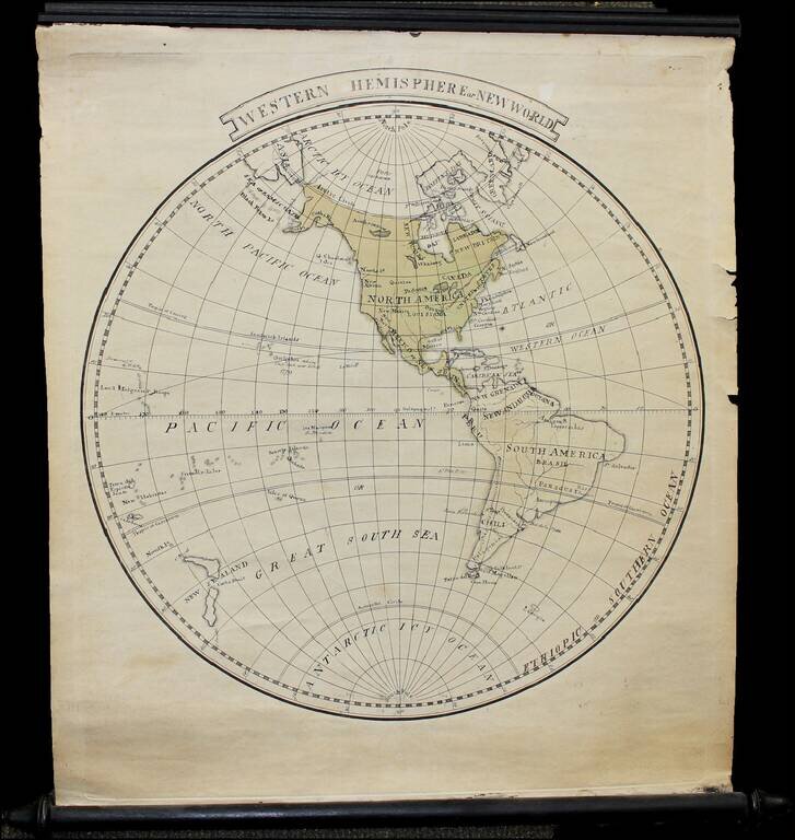
Finely executed manuscript small wall map of the Western Hemisphere on original rods, drawn shortly after Cook's last voyage. The map notes Louisiana as still not yet part of the United States. Hawail is shown (Sandwich Islands), with Owyhee named --...

Restructuring Germany Two rare German regional atlases, published by J.C. Lange in Leipzig in 1803 and 1804. The collation of the first work is very difficult. The title calls for 12 maps, but only 11 map sheets are present. All but the first map...

Nice example of Reinecke's map of the Western Pacific Ocean, Australia, Southeast Asia, etc. Neu Holland vormals Ulimaroa is named, along with an New South Wales. The coastline of Australia is incomplete. New Zealand is shown as two islands. Hawaii...
![[Greenwich Village] New York Octbr 29, 1803 Surveyed by Charles Loss City Surveyor](/map/small/63070.jpg)
Greenwich Manuscript Survey By New York City Surveyor Charles Loss Finely executed hand drawn survey map of the area between Herring Street, Barton Street and Houston Street (then called Village Street, and later Hamersly Street, before later becoming...
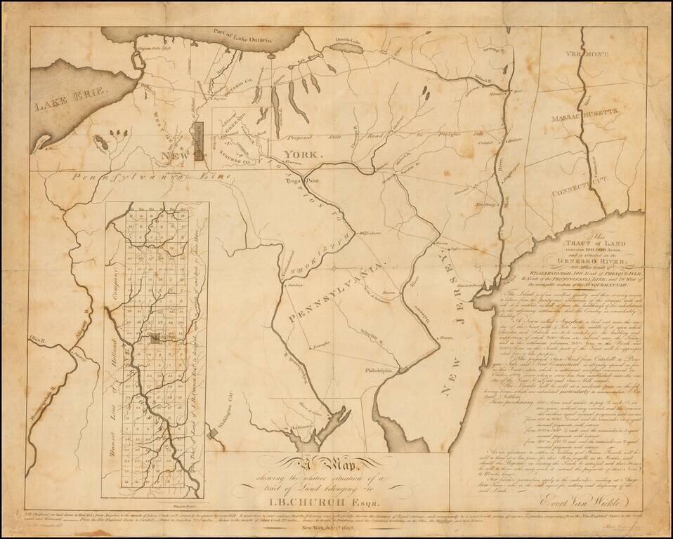
Rare early 19th Century map relating to the early settlement of western New York. This undeveloped 100,000-acre tract on the Genesee River in western New York had been used to repay a debt to John Barker Church from financier Robert Morris. Church was...
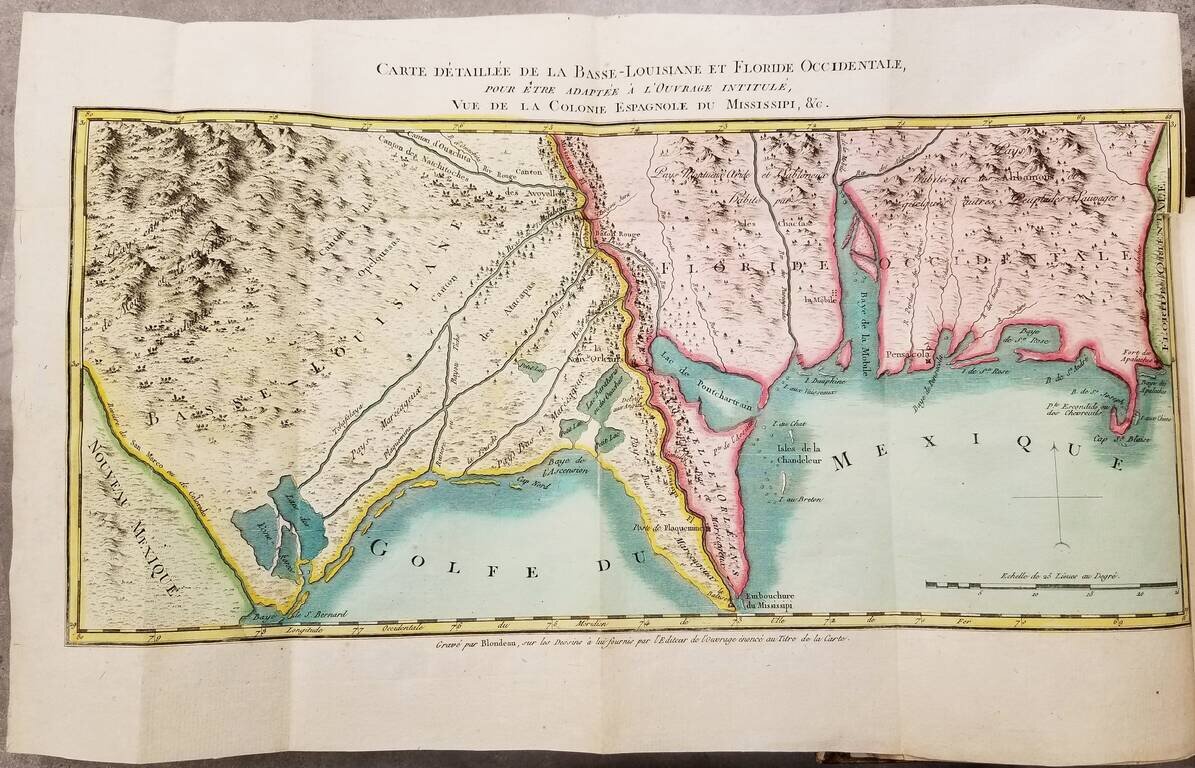
First Edition. Contemporary hand-color. First edition (1803) of this detailed work on Louisiana just before its acquisition by the United States in the Louisiana Purchase. The book was authored Pierre-Louis Berquin Duvallon, who was procureur du roi...
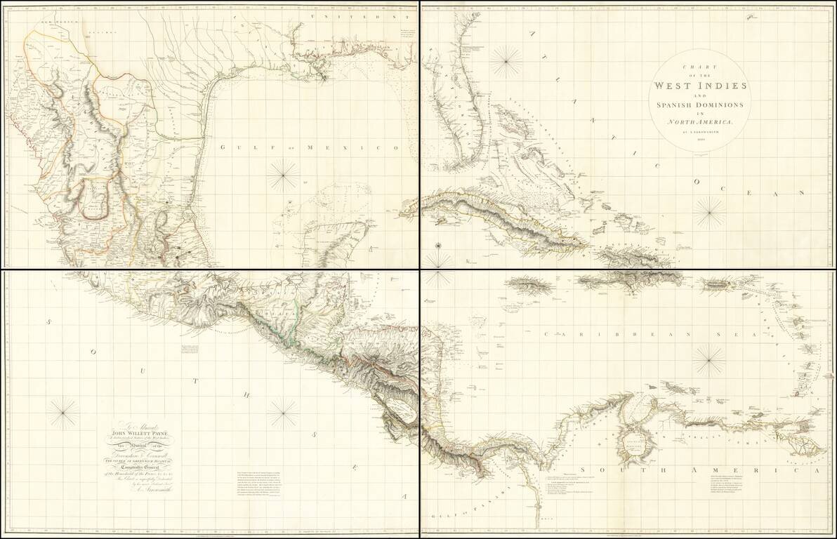
A Seminal Map of Florida, The Caribbean and Texas! First edition of Arrowsmith's map of Mexico & the West Indies, and the only edition to extend to the Pacific, thereby showing modern Texas and parts of New Mexico and Arizona. The map is...
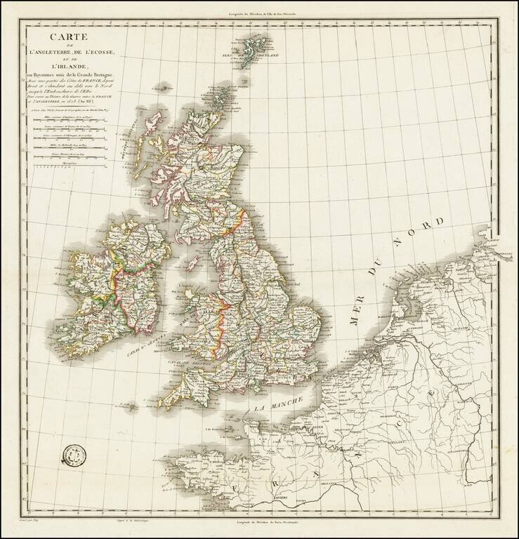
A handsome example of Vicq's rare engraved map of the British Isles, prepared during the Napoleonic Wars. 1st issue, 1st state. The Bibliotheque National de France has a later state (1808) which includes insets of Gibraltar and Portugal.
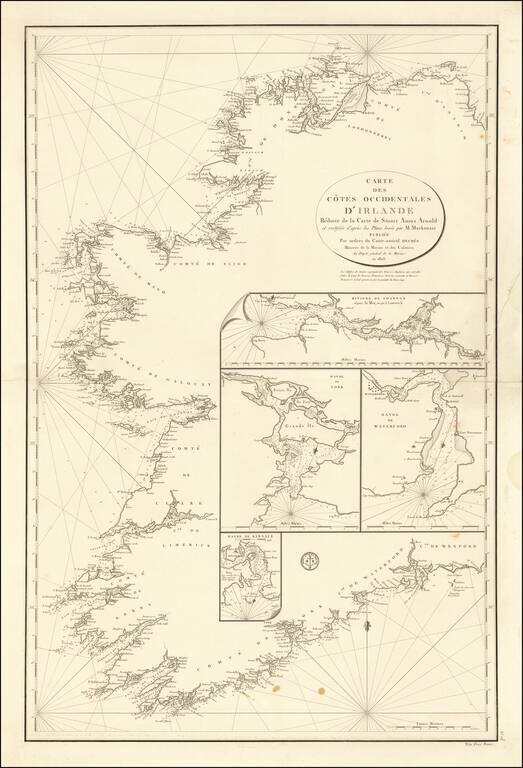
Scarce early 19th Century Sea Chart of Ireland, published by the French Depot De La Marine. Stuart Amos Arnold is credited as the source of the chart. Arnold published several commercial works on Navigation in the 18th Century, before losing an arm,...
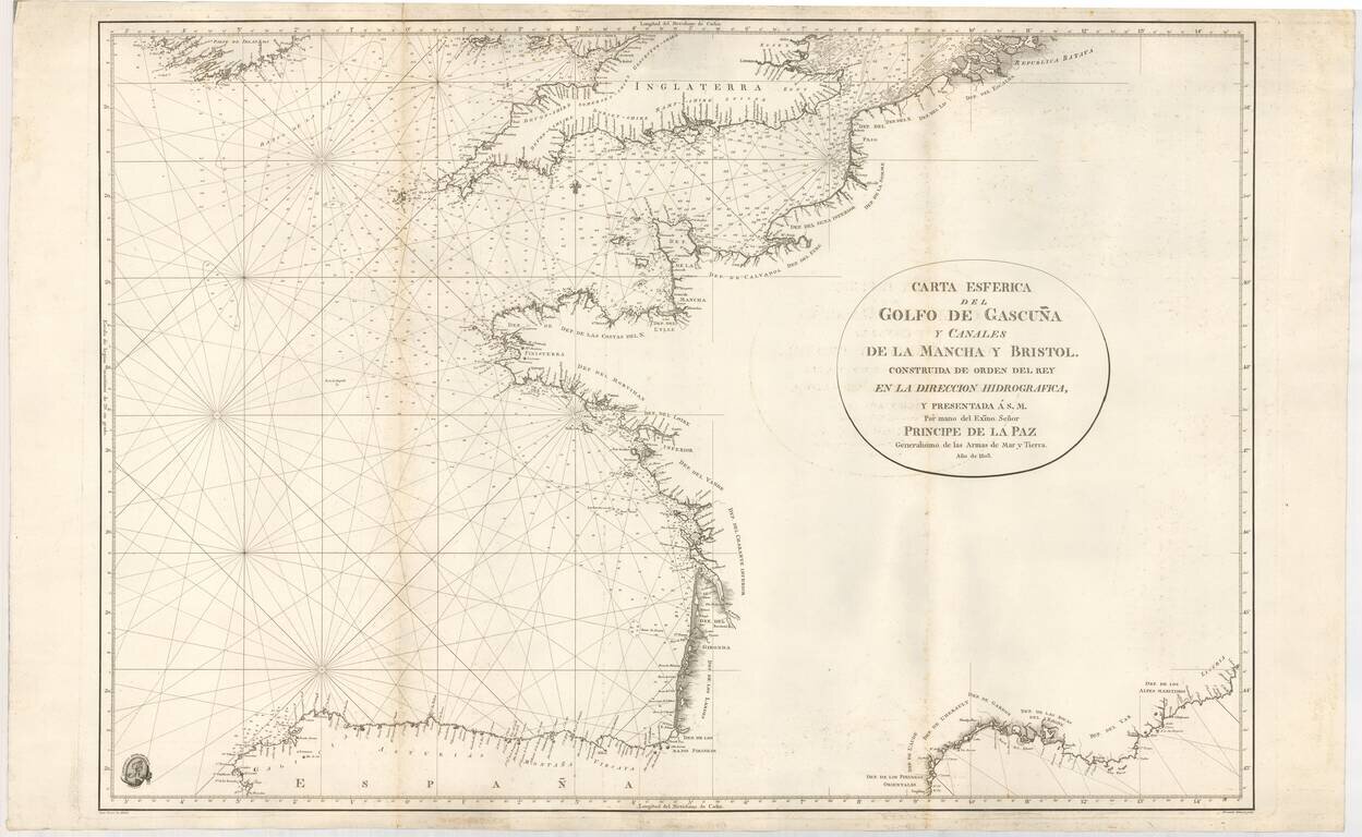
Rare Official Spanish Blue Backed Sea Chart of the Bay of Biscay (Biscaya) First edition of this fine sea chart, created by Juan Ferrer and engraved by Fernando Selma for the Spanish Hydrographical Department in 1803. The chart extends from the...
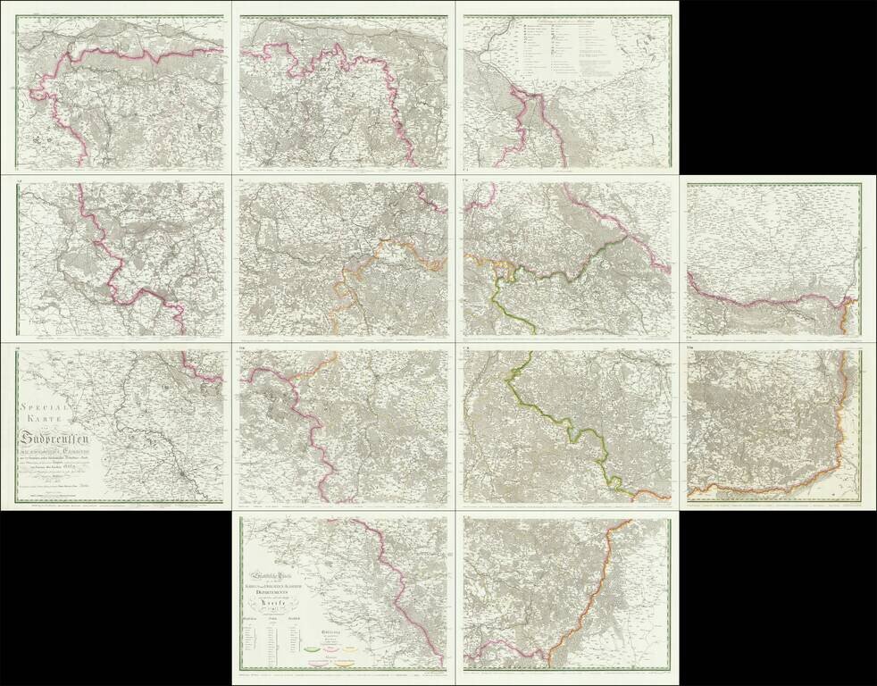
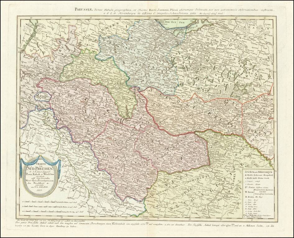
An Important Early Postal Route Map of South Prussia. -- The First Scientific Survey of South Prussia Special map of South Prussia prepared under royal decree by renowned architect and civil engineer, David Gilly after the final Partition of Poland....
Rare map of western Poland, published by Gussefeld. At the bottom left the title cartouche, with explanations and representation of the new political affiliation of the districts and areas that had fallen to Prussia after the division in 1793.
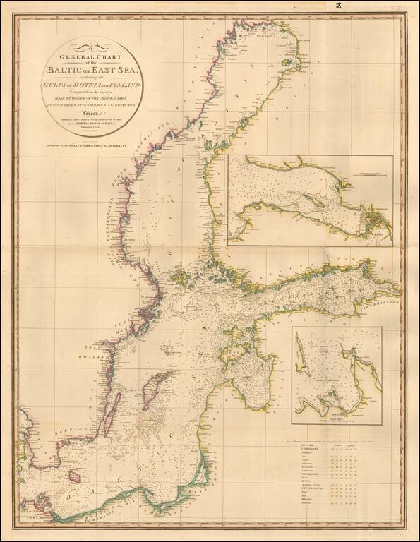
Highly detailed chart of the Baltic and contiguous coasts, from Faden's general atlas. Includes detailed insets of the areas around Revel and St. Petersburg. One of the most detailed general charts of the Baltic to appear in an English Commercial...
![КАРТА ВСЕГО АЗОВСКАГО МОРЯ сочинена съ описи, вновь учиненной 1803 года, на компасъ имѣющей склоненіе 8, Западное. Глубииa моряозначена футами. [Map of the Whole Azov Sea...]](/map/small/56511.jpg)
Detailed Map of the Sea of Azov, issued Upon the Creation of the Taurida Governate by Alexander I. Separately issued Russian engraved map of the Sea of Azov, published in 1803, after a period of improved surveying of the body of water. The map far...
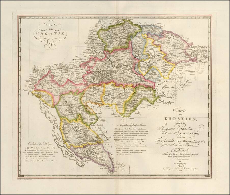
Fine large format map of Croatia and Krajina, which appeared in Kipferling's rare Atlas des Österreichischen Kaiserthums, published in by the Kunst und Industrie Comptoirs in Vienna in 1805. The map was issued shortly after the Venetian Republic in...
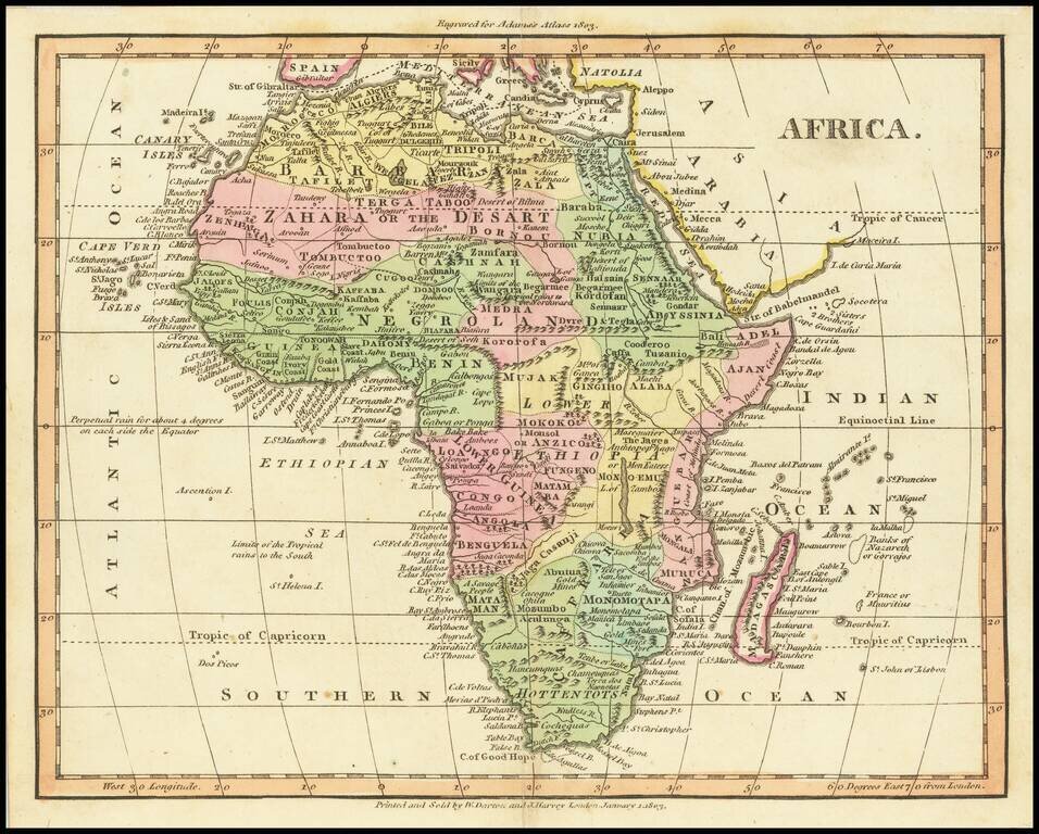
Attractive small map of Africa, from Adam's Atlas (title at the top), published in 1803.