Map size in jpg-format: 725407B
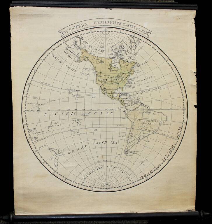
Finely executed manuscript small wall map of the Western Hemisphere on original rods, drawn shortly after Cook's last voyage.
The map notes Louisiana as still not yet part of the United States.
Hawail is shown (Sandwich Islands), with Owyhee named -- where Cook was killed 1779.
Philadelphia is named (Capital of the United States until 1800), but not Washington D.C.
In the west, New Albion, Quivira and New Mexico are shown.
If you are a student, write to us in telegram: @antiquemaps and indicate what material you need and for what work you need a map in high detail. We are ready to provide material on special terms. For students only!


