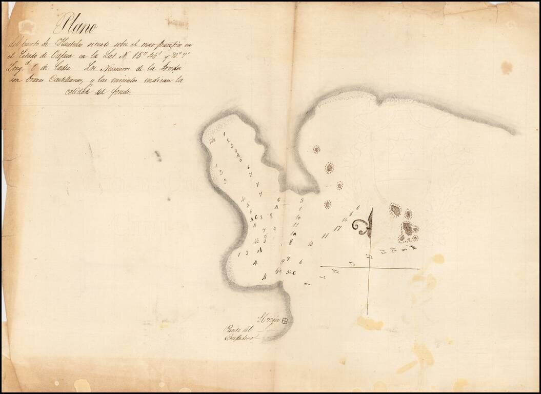
Detailed, Early Manuscript Plan of Huatulco, Oaxaca Finely-executed sketch of the port of Huatulco in the state of Oaxaca, Mexico. The north-oriented plan shows sounding depths and sea-floor quality indications, one of the earliest surveys to show...
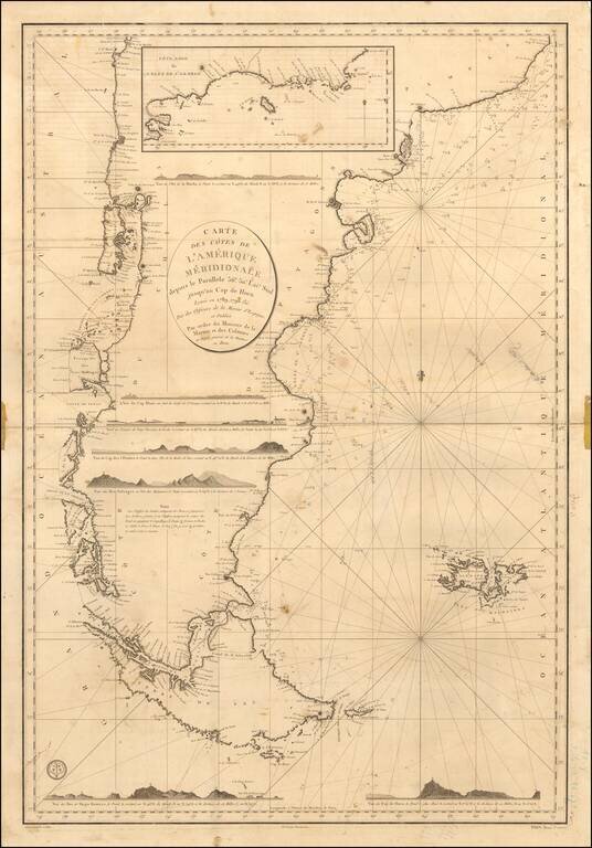
Annotated with the notes of a voyage to around the Tierra del Fuego. First state of this scarce French Sea chart of the southernmost part of South America, first published by the Depot de la Marine in 1800. Fine sea chart of the Southernmost coasts...
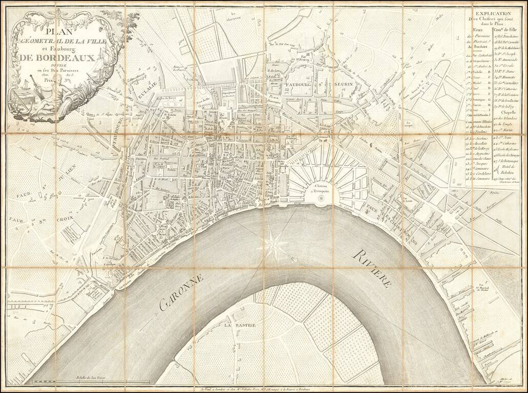
Rare and highly detailed plan of Bordeaux, published and sold by Mrs. Filliatre Frere, a print and bookseller active in Bordeaux in the first half of the 19th century. The map is apparently quite rare, as we were not able track any other examples...
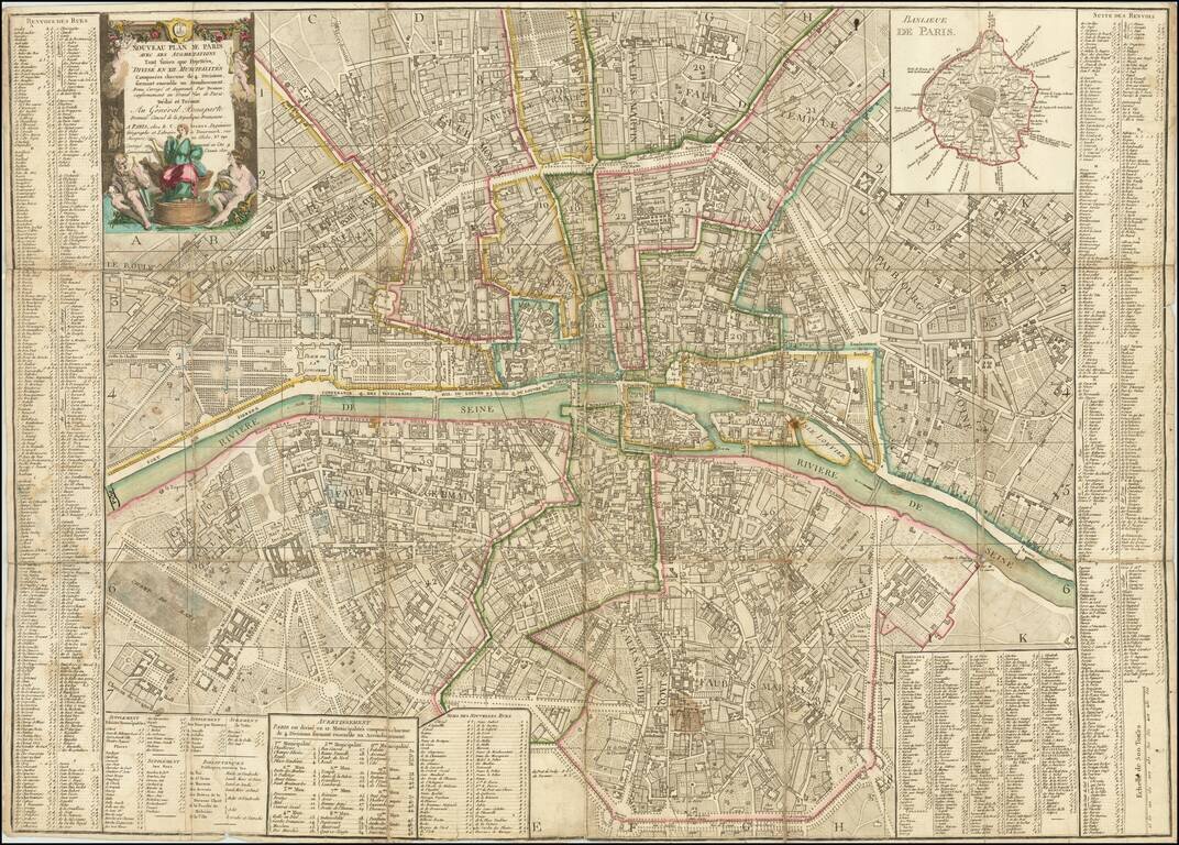
A Rare Republic of France Imprint Dedicated to General Bonaparte Premier Consul de la Republique Francaise Decorative plan of Paris on the eve of the French Revolution, published by Louis Brion de la Tour. The plan is centered on the Seine River and...
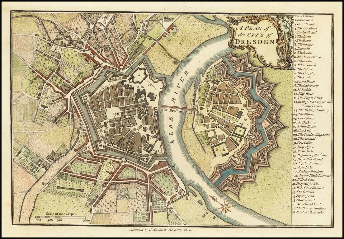
Finely colored map of Dresden at the end of the 18th Century. The map illustrates the fortified old and new towns on either side of the Elbe River, with an extensive key locating 48 places.
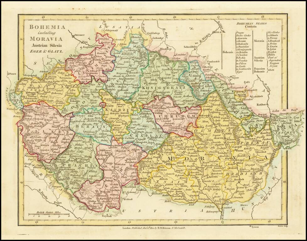
A fabulous regional map of Bohemia, Moravia, Silesia, Eger and Glatz, showing many long lost provincial borders, including Pilsen, Saatz, Leutmeritz, Buntzlau, Konigsgratz, Glatz, Olmutz, Chrudim, Cazslau, Kaurzim, Beraun, Rakonitz, Prachin, Bechin,...
![[Part of Hungary]](/map/small/0009gh.jpg)
One sheet from a larger map, covering Hungary in remarkable detail. The map bears the stamp of a German Jesuit Library and may have been from a map of the Austro-Hungarian Empire.
Lower sheet of this rare 2 (?) sheet map focusing on the navigable rivers, post roads and geology of Southern Hungary. The map primarily covers the regions between the Tisza River and Danube River,, to the south of Budapest. The map extends along the...
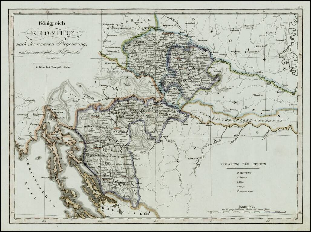
Rare regional map of the Kingdom of Croatia and neighboring regions, published in Vienna at the begnning of the 19th Century. One of the few regional maps of the period to focus on this region.
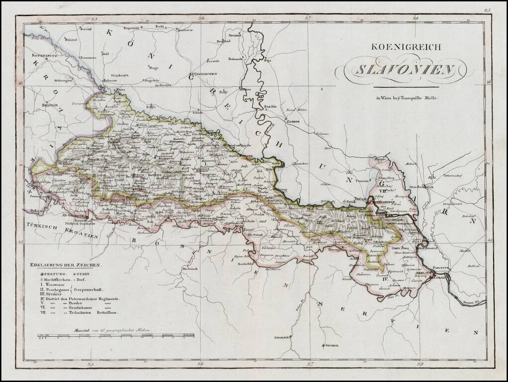
Rare regional map of the Kingdom of Slovenia and neighboring regions, published in Vienna at the begnning of the 19th Century. One of the few regional maps of the period to focus on this region.
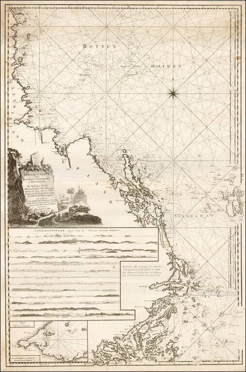
Fine regional Sea Chart of the Coast of Sweden from Soderhamn to Stockholm, published by Swedish Admiral Johann Nordenankar in his Sveriges Sjo-Atlas, the first modern sea atlas of the Baltic. The chart includes a number of profile recognition views...
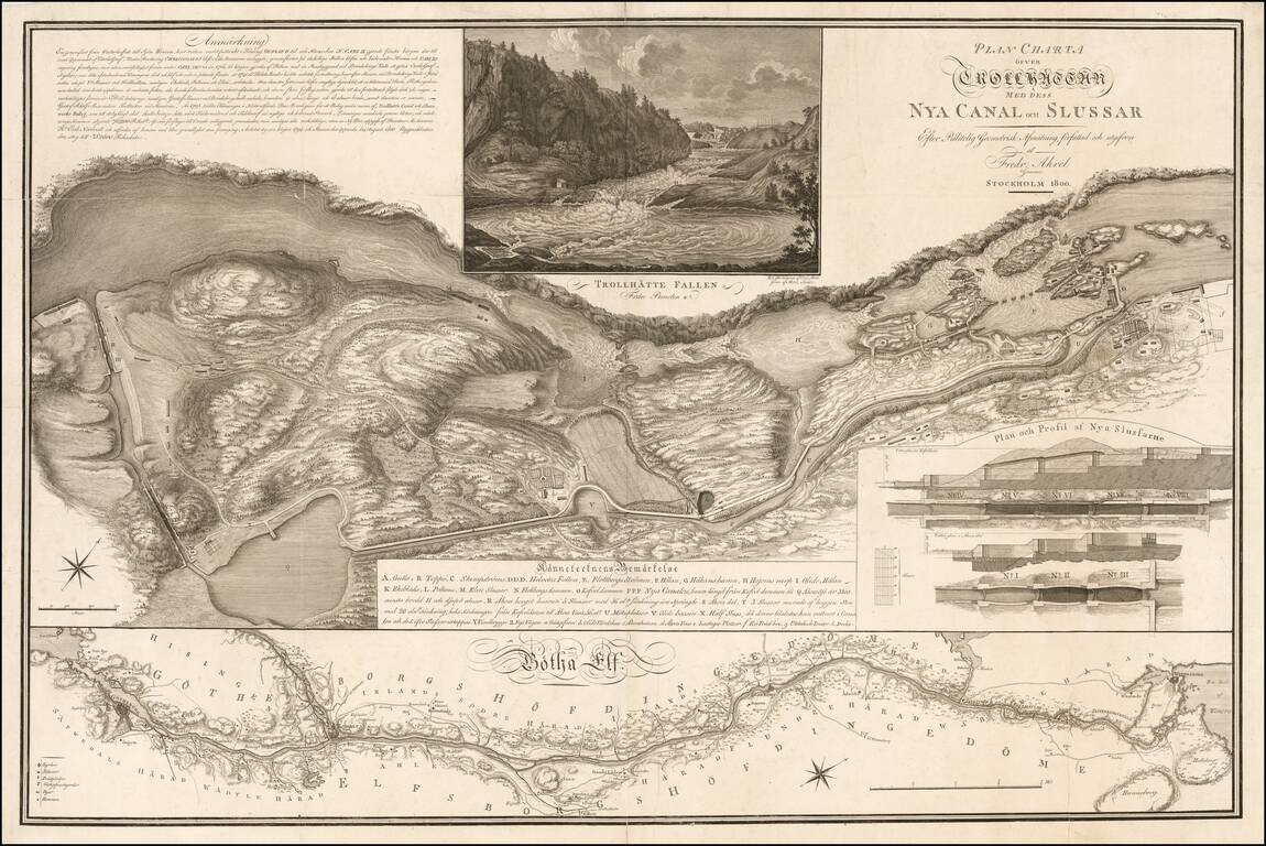
Striking Plan Detailing the Trollhattan Locks & Canal, Published At The Time of the Opening of the Newest Lock System in August 1800 Highly detailed plan of the Trollhattan Canal and Locks by Fridrick Akrel in Stockholm. The upper view...
![Kарта пути или дороги по которой Посольство Английское пролзжая изъ ганж-тшoo-фоо въ канж-тшoo-фоо. [Russian Map Depicting a Journey Through China to Canton.]](/map/small/47671.jpg)
Rare Russian Imprint Depicting Canton and Macao. Detailed map showing the second part of the route across China taken by the George Macartney mission after meeting the Emperor of China. This map represents the overland journey from Hang-Tchoo-Foo to...
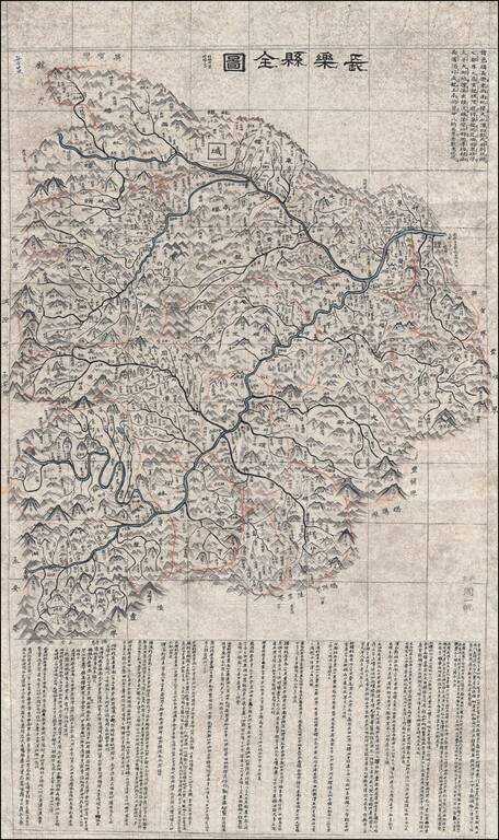
Hand Drawn Map of the Wuhua County in the Guangdong Province Finely executed late Qing Dynasty Chinese manuscript map of Wuhua County, northeast of Hong Kong in eastern Guangdong Province, China. The map, which uses the Qing name of the region,...
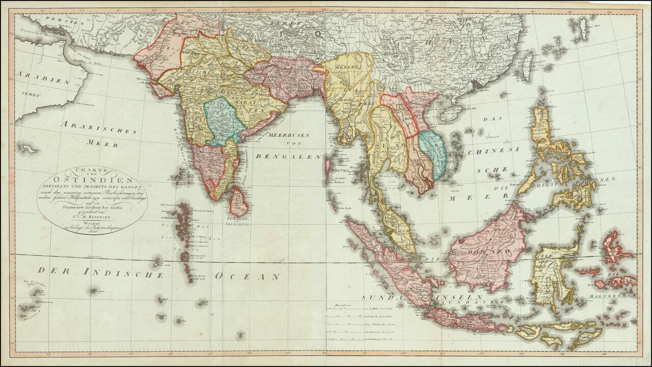
Fine, Rare German Map of South and Southeast Asia Sharply-executed map of the Indian Ocean and Western Pacific regions, encompassing the Indian subcontinent, Mainland Southeast Asia, Indonesia, Malaysia, the Moluccas, and the Philippines. The map is...
![[Arabia / Ottoman Empire] Gli Imperi Antichi Parte Occidentale (and) Gli Imperi Antichi Parte Occidentale](/map/small/70452.jpg)
Scarce pair of maps comprising a remarkable decorative map of Arabia, published in Rome by Cassini. The map covers the Turkish Empire centered on Arabia, from the 'Nuovo Atlante Geografico Universale', with a decorative title cartouche on each sheet....