
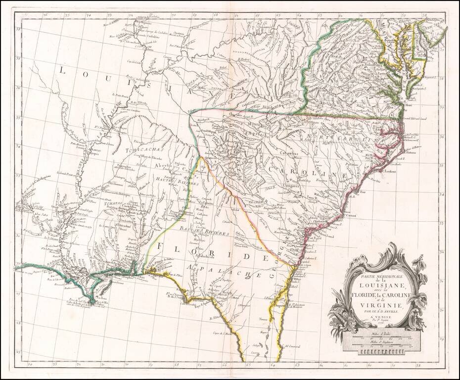
Scarce Italian Map of the Southern Colonies in Colonial America at the Outset of the American Revolution A marvelous map the Southern part of Colonial America, published by Paolo Santini in Venice. The map covers most of Florida, then extending west...
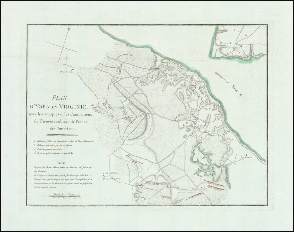
Detailed battle plan of the Battle of Yorktown, the final battle of the American Revolution. The map provides a detailed look at the battle of Yorktown, based upon French sources. The positions of the American, French and English forces and artillery...
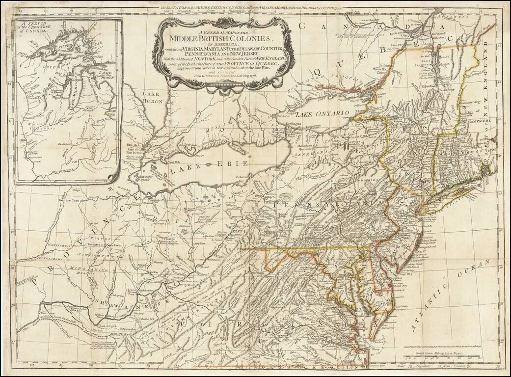
The scarce "Holster Atlas" edition of Lewis Evans' highly important map of the Middle British Colonies, at the start of the American Revolution. This edition of the map was prepared specifically for the American Military Pocket Atlas, an atlas...
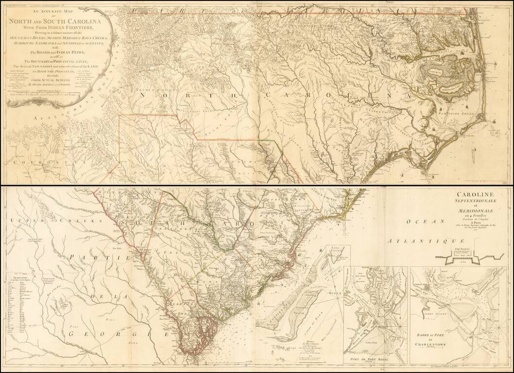
Second edition (first French Edition) of Henry Mouzon's landmark 4-sheet map of the Carolinas, the primary source for the geographical details of the Carolinas for the American, English and French armies during the American Revolution. Le Rouge...
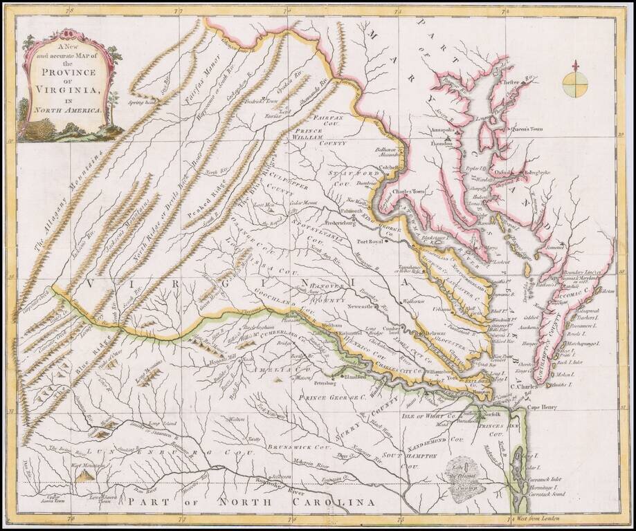
Scarce map of Virginia based largely on the Fry Jefferson map, as revised in 1775. The map is one of the first large format maps of Virginia to have appeared in a British serial publication ( Universal Magazine). It provides an excellent depiction of...
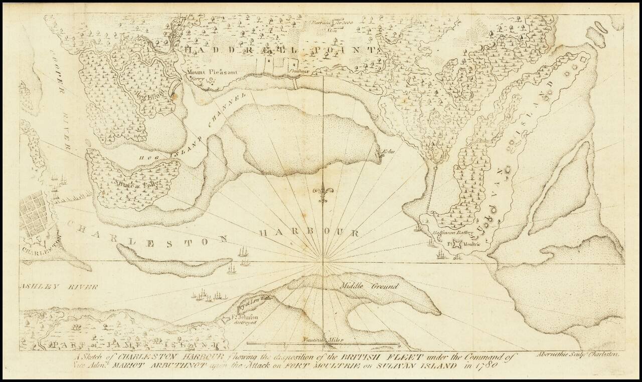
The Second Map Printed South of the Mason Dixon Line. Scarce and important Charleston and Fort Sullivan Battle Plan, issued in David Ramsay's History of the Revolution of South Carolina... . Thomas Abernethie was an early engraver in Charleston,...
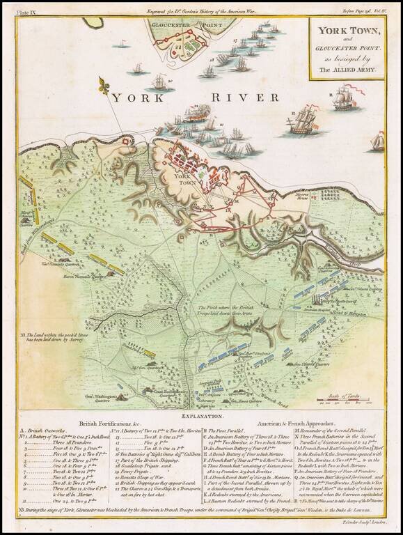
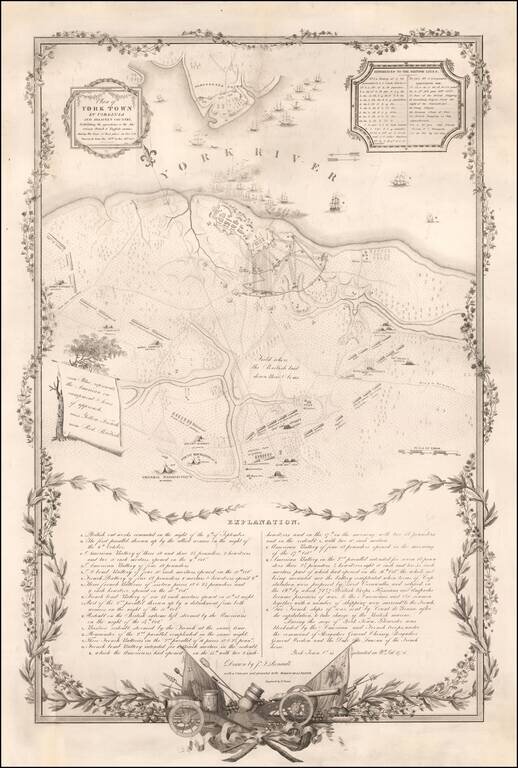
Marvelous detailed map of the Battle at York Town. Includes dozens of ships at anchor, extensive battle notes and troop movements with an explanatory key, the positions of the various armies, General Washington's Quarters, Rochambeaus Quarter's,...
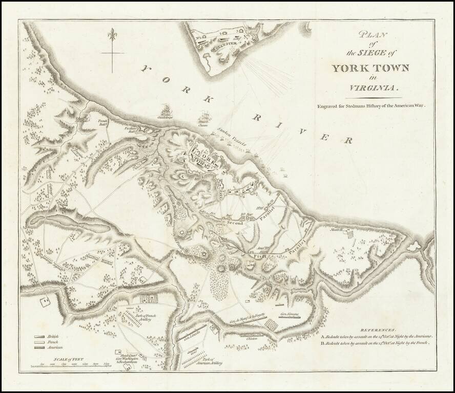
Important battle plan of the Siege of Yorktown This is the second appearance of this plan of Yorktown, which first appeared in Banastre Tarleton's A History of the Campaigns of 1780 & 1781 .... This is the second issue of the map, re-engraved for...
Revolutionary War Battle Plan Published to Commemorate the Marquis De Lafayette's Return To America in 1825 Rare plan of the siege of Yorktown, issued on the occasion of Lafayette's triumphal 1825 visit to America. Drawn by John Francis Renault, a...
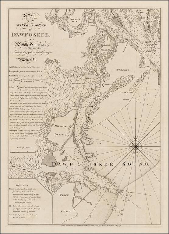
Highly detailed sea chart of the area around Hilton Head, South Carolina, based upon a survey by Captain John Gascoigne. Gascoigne's finely engraved chart was produced at the beginning of the American Revolution, at a time when the outcome among the...
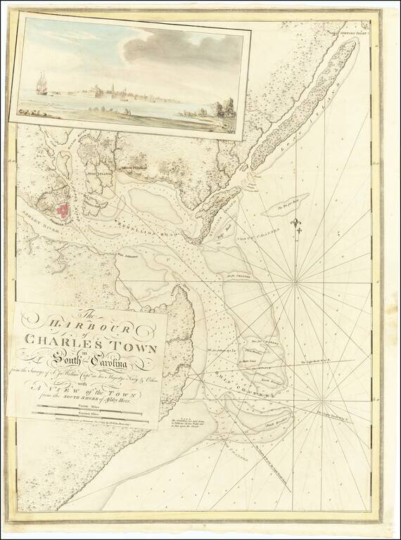
Magnificent Revolutionary War Reconnaissance Chart of Charleston, South Carolina from The Atlantic Neptune Spectacular Revolutionary-era chart of the harbor of Charleston, South Carolina, based on British surveys taken in the weeks prior to...
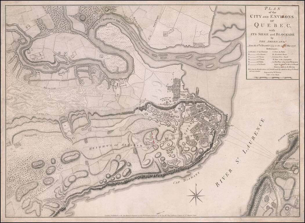
Fine, Detailed, Separately-Issued Plan of the Siege of Quebec (1775-6) Rare, separately-published plan of the Siege of Quebec, published by William Faden in London. The plan shows a pivotal early moment in the American Revolution and highlights the...
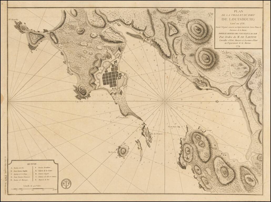
Plan of Louisbourg in 1779 Detailed plan of the town and port of Louisbourg, oriented with west at the top, made by order of the French Depot de la Marine, during the American Revolution. The plan was originally made 2 years prior to the Siege of...
![[East Coast of Prince Edward Island - Rollo Bay to Wood Islands]](/map/small/62849.jpg)
Rare chart of the East Coast of Prince Edward Island, centered on Cardigan Bay and Panmure Island. St. John's Island (Isle of St. John) was renamed Prince Edward Island in 1798, after Edward, Duke of Kent. This fine chart appeared in the Atlantic...
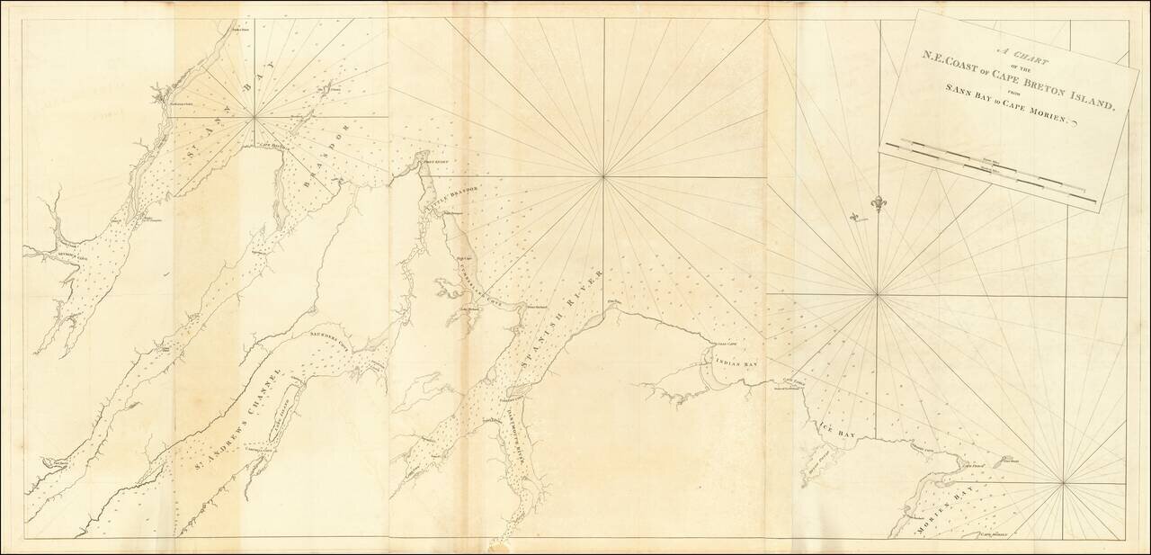
Rare chart of the North East Coast of Cape Breton, from Morien Bay to St Anne's Bay. This fine chart appeared in the Atlantic Neptune by Captain Joseph Frederick Wallet des Barres. The Atlantic Neptune was remarkable, multi-volume set of sea charts...
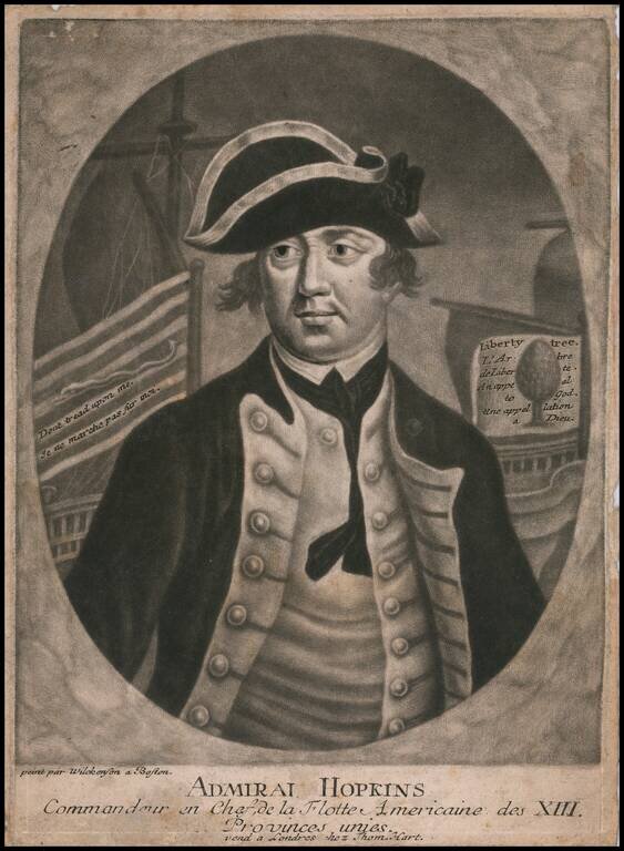
Finely executed mezzotint portrait of Esek Hopkins, the first person to serve as commander of the American Navy, during the American Revolution. The portrait was engraved and offered for sale in London. London publisher Thomas Hart, issued a series...