
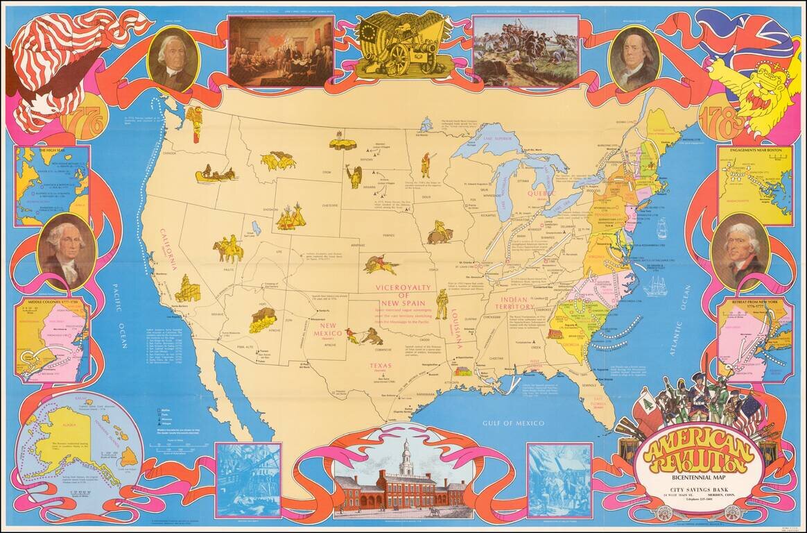
Fine large format map of the United States, featuring vignettes of historical events during the American Revolution and a 1970s style art motif. In addition to Revolutionary War related facts, the map shows information on the California Missions, the...
![(American Revolution) [Manuscript Map of New York City and Northern New Jersey]](/map/small/69609.jpg)
An American Revolutionary War Manuscript Map -- From the Collection of One of the First U.S. Frigate Captains Manuscript map in pen and ink on laid paper of New York City and northern New Jersey, "the cockpit of the American Revolution". The map was...
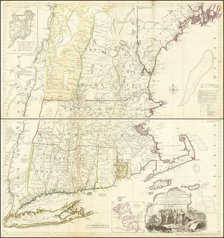
The Most Important Map of New England At The Time of the American Revolution Nice example of Bradock Mead's remarkable large format map of New England & Long Island, the most important general map of the region at the commencement of the...
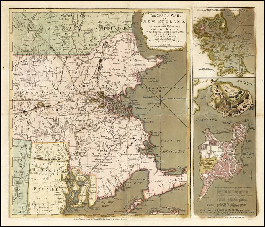
Important early broadside map and plan of the Battle of Bunker Hill and the area around Boston, published by Sayer & Bennett, in London in 1775. Sayer & Bennett's map of the Seat of War is one of the two earliest pictorial accounts of the...
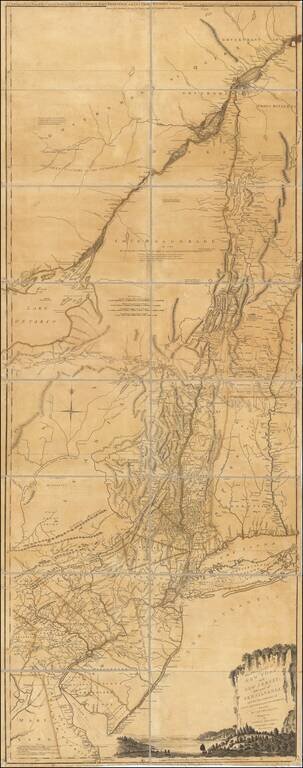
Rare First Edition, Second State, of Samuel Holland's Map of New York, Vermont, New Jersey, etc. Important colonial map of the Hudson River and its tributaries, including the Mohawk, and also with New Jersey and the upper course of the St. Lawrence...
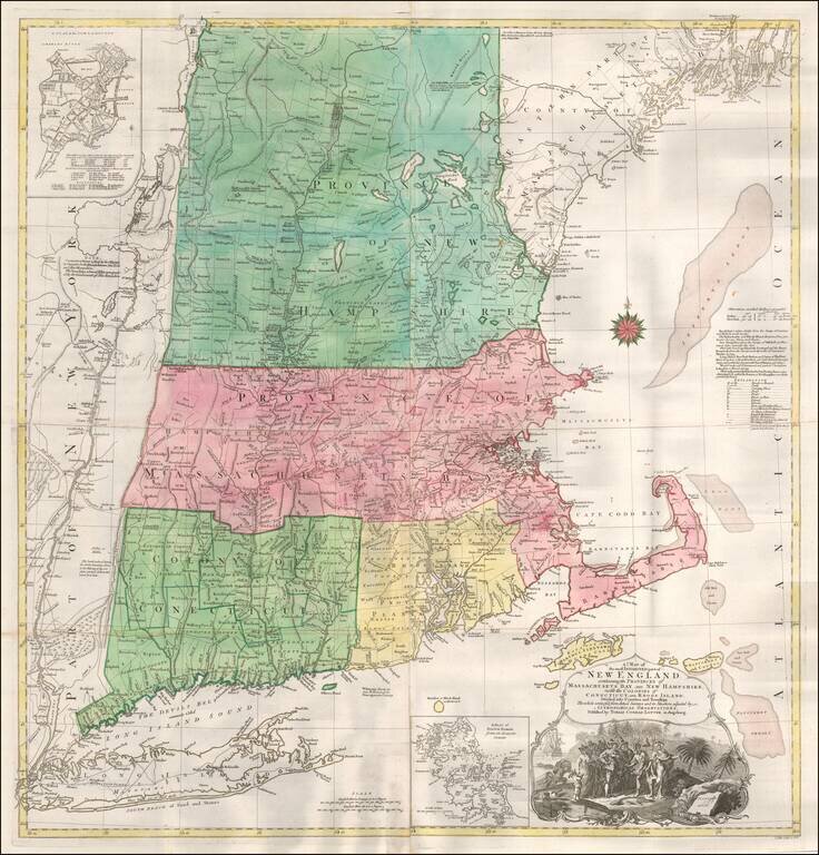
T.C. Lotter Edition of The Most Important Map of New England At The Time of the American Revolution. Fine old color example of the T.C. Lotter edition of Bradock Mead's 4-sheet map of New England & Long Island, the most important general map of...
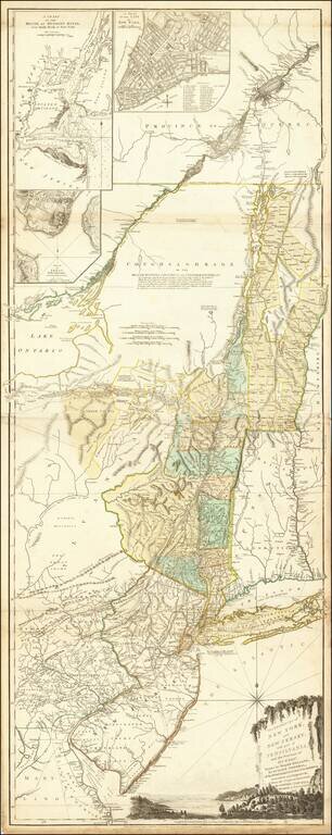
Rare Final State of Samuel Holland's Map of New York, Vermont, New Jersey, etc. Nice example of this important colonial map of the Hudson River and its tributaries, including the Mohawk, and also with New Jersey and the upper course of the St....
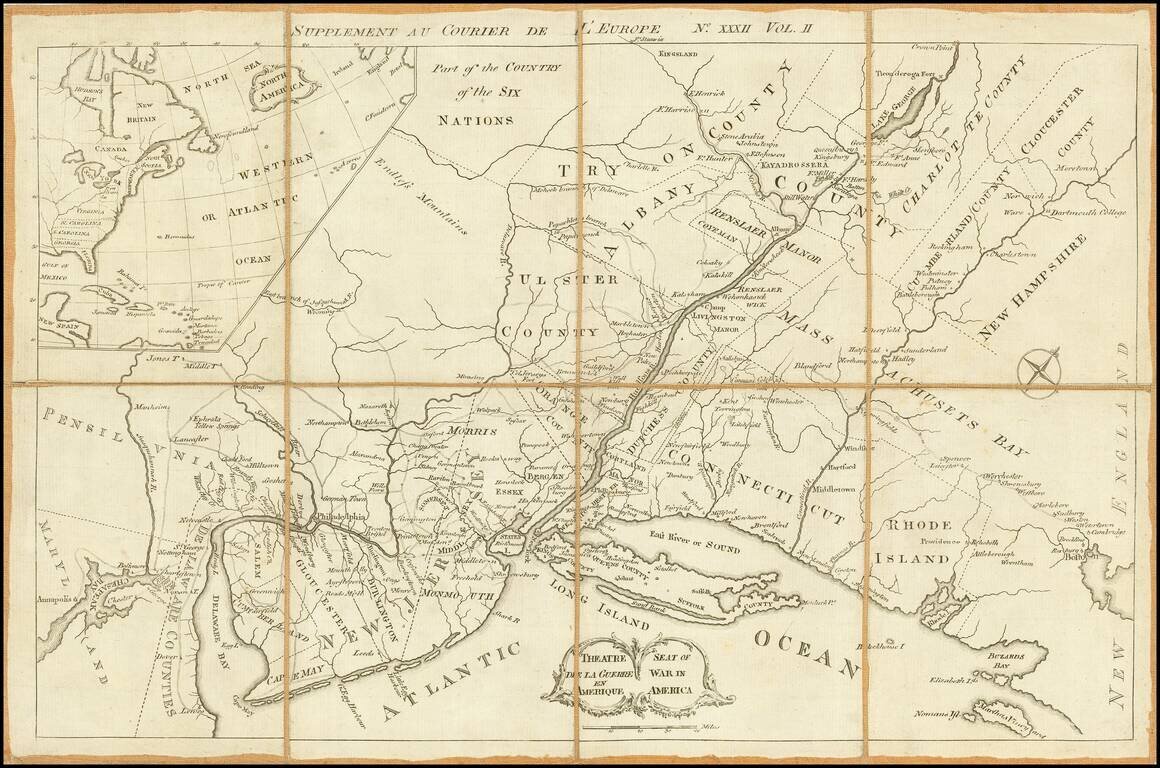
A very rare Revolutionary War map centered on the Mid-Atlantic colonies, which appeared as a supplement to an issue of the British published periodical Courier de L¹Europe. The present map employs a curious angular projection, and is centered on New...
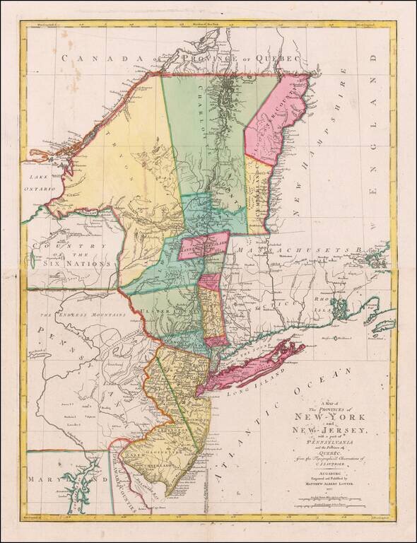
German edition of Sauthier's important map of the Provinces of New York and New Jersey, published at the outset of the American Revolution. A highly detailed extending from Delaware Bay, New Jersey in the South to New York-Canada border, and including...
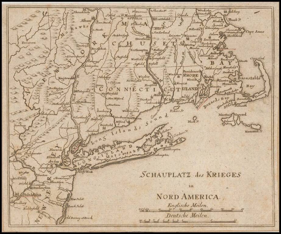
Unrecorded German map of the Theater of War in the northeast during the American Revolution. The towns of Boston, Providence, Newport, New York and Philadelphia are underlined in red. This is the first time we have ever seen the map and we can find...
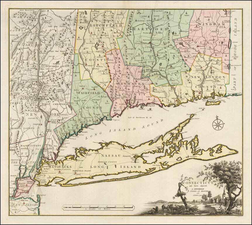
Bernard Romans' Map of Connectiuct -- A Revolutionary War Era Rarity Important early map of Connecticut and Long Island, originally published in New Haven by Bernard Romans and later in Amsterdam. This map was one of four Romans maps parts of the...
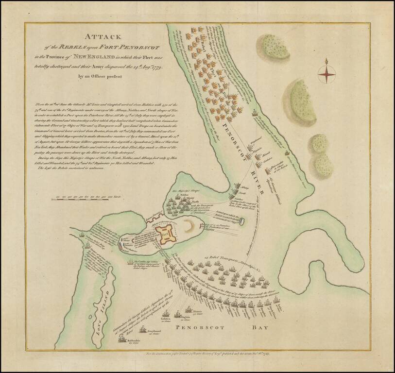
The Battle of Penobscot Bay, Maine -- Lt. Colonel Paul Revere Commanding An Artillery Detachment Interesting American battle plan, showing the action between the British and American Troops at the Battle of Penobscot, during the American Revolution....
![[Cape Elizabeth to Moose Point, Maine]](/map/small/48612.jpg)
The best Revolutionary War chart of southern Maine. Large, two-sheet hand-colored engraved sea chart of part of the Maine coastline. The map illustrates the length of the Kennebec River to Fort Halifax. It also shows Fort Western (now Augusta),...
![[Coast of Maine from Moose Cove to Gouldsboro Bay]](/map/small/62847.jpg)
Important early map of the Coast of Washington County, Maine, from J.F.W. Des Barres Atlantic Neptune. The map includes the areas which would later include the towns of Steuben, Cherryfield, Milbridge,, Harrington, Addison, Jonesport, Beals Jonesboro,...
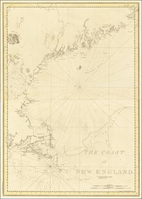
By far the finest 18th-century depiction of the Coast of New England issued in The Atlantic Neptune to meet the needs of British navigators during the American Revolution. This monumental chart depicts the complex coast of New England from...
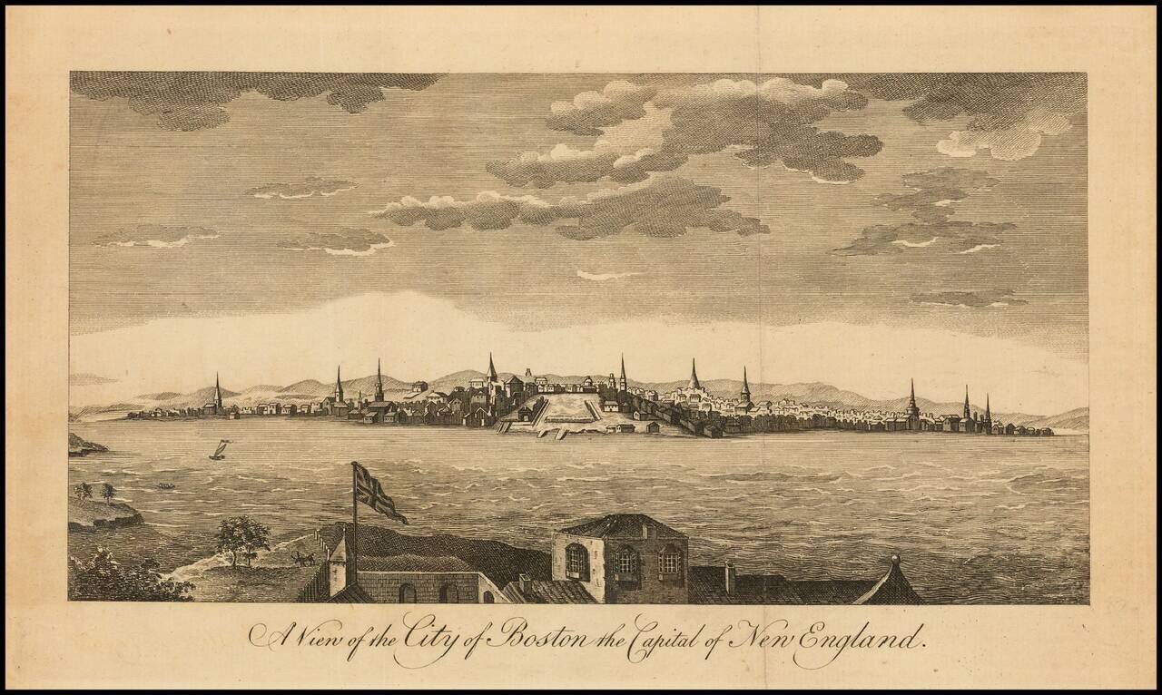
A View of Boston at time of the firing of the first shots of the American Revolution. Fine early view of Boston, published in the Universal Magazine, which also comes with the relevant text section describing the ongoing revolt in the British...