
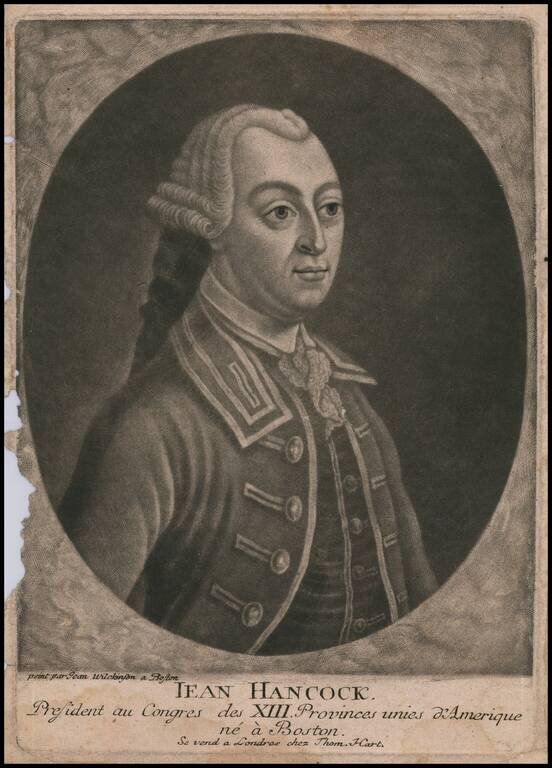
Finely executed mezzotint portrait of John Hancock, based upon a painting by John Wilkinson in Boston. The portrait was engraved and offered for sale in London. London publisher Thomas Hart, issued a series of mezzotints of 'revolutionary rebels',...
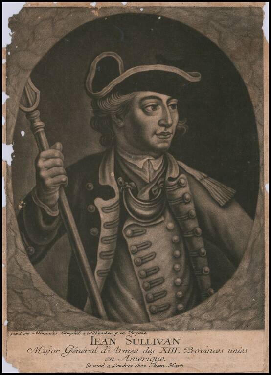
Finely executed mezzotint portrait of John Sullivan, which claims to be based upon a portrait by Alexander Campbell in Williamsburg, Virginia. Half length portrait in an oval within a rectangle, left arm extended, right hand holding pike, looking to...
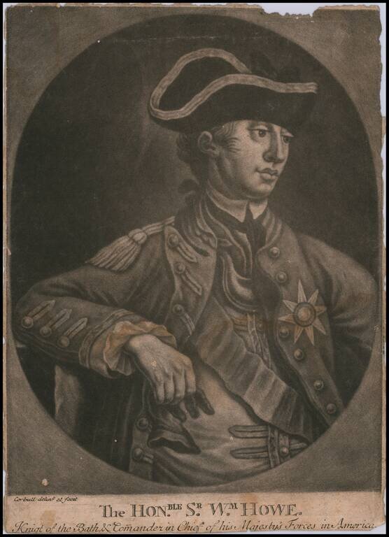
Finely executed mezzotint portrait of Sir William Howe, commanding officer of the British Forces during the American Revolution. An attractive mezzotint portrait of Howe, executed while he was serving as commander of the British forces in America from...
![[General George Washington]](/map/small/62386.jpg)
Striking full length portrait of a uniformed General George Washington, standing atop a hillside, with a battle scene from the American Revolutionary War raging on either side. Drawn from an unknown source. Handwriting on the verso suggests that it...
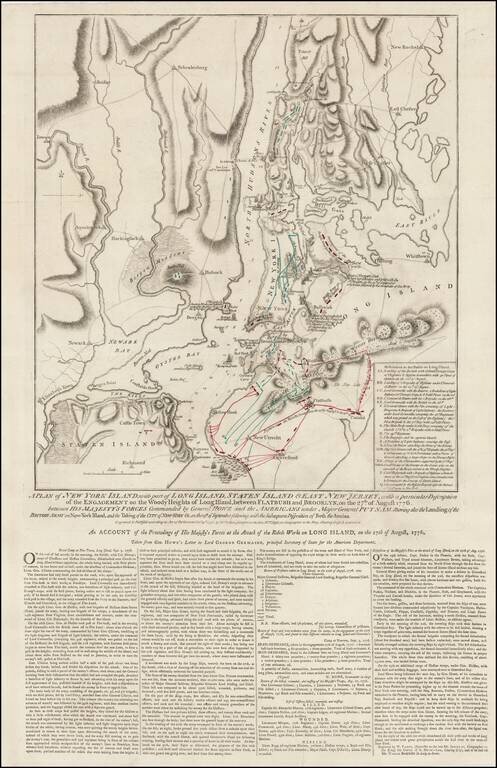
Rare Final State of Faden's Plan of the Battle of New York Fine example of Faden's separately issued broadside map showing the British Invasion of New York City in August and September of 1776. The present example is the final state of the map, with...
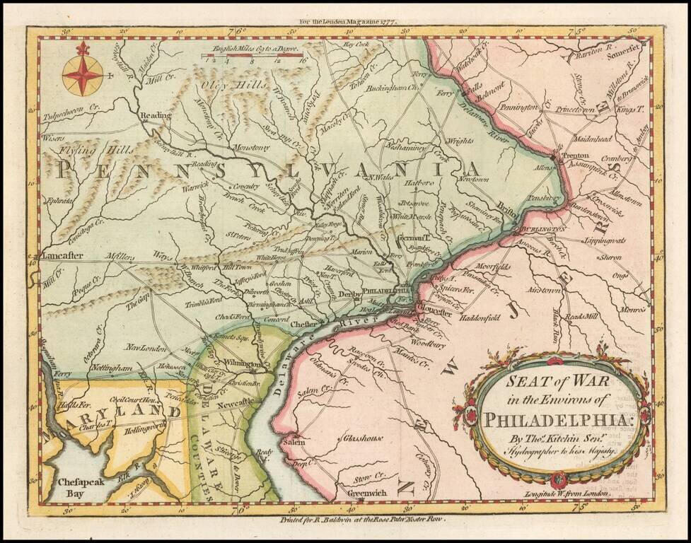
Fine early map showing the Seat of the American Revolutionary War around the Delaware River and Philadelphia, which appeared in the London Magazine in 1777. The map includes the area from Trenton to Lancaster. The road network is shown in detail. It...
![[Long Island Sound from Hampstead Bay to Huntington Bay]](/map/small/51310.jpg)
Rare Des Barres chart of Long Island Sound, covering the coast of the north shore of Long Island roughly from Hampstead Bay to Huntington Bay, and including Oyster Bay and Cold Spring. The present chart constitutes a partial section of Des Barres's...
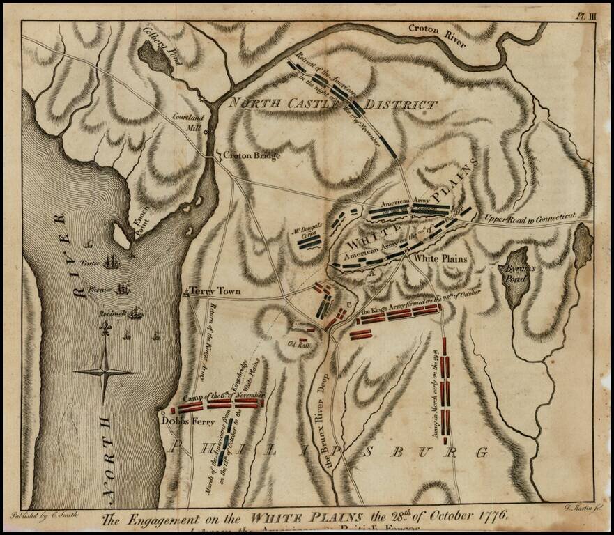
Rare Revolutionary War battle plan of White Plains, from Charles Smith's Monthly Military Repository, the first detailed plan of the battle of White Plains to be printed in the United States. Following decisive victories in Brooklyn and Manhattan,...