
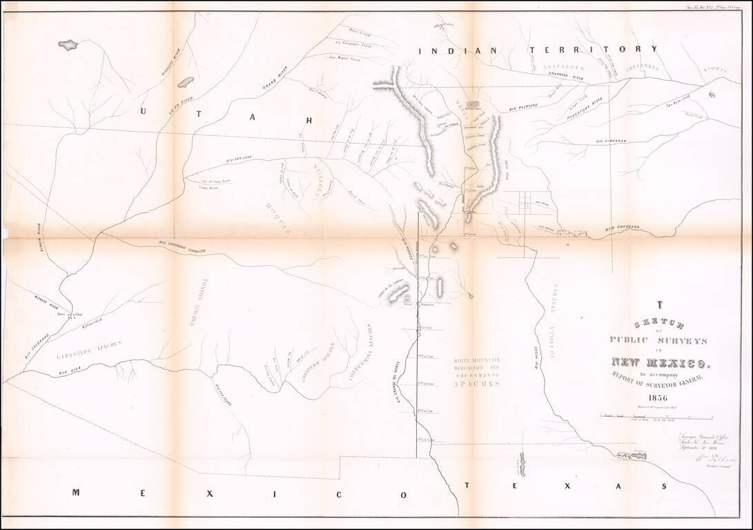
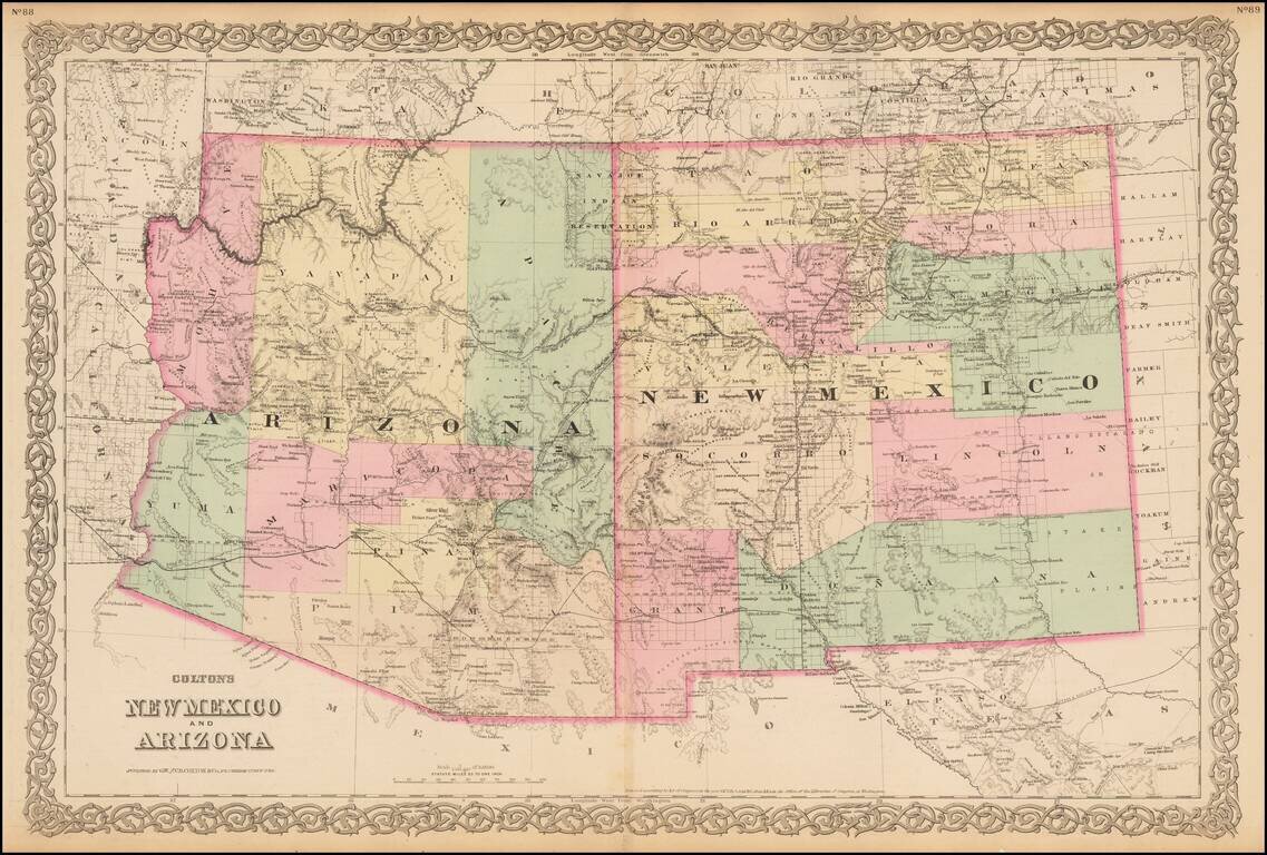
Interesting early map of New Mexico and Arizona, published by the General Land Office. The map extends from the confluence of the Colorado and Gila Rivers to Nicollet River in the northwest, the Rio Pecos in the southwest and Bent's Fort, the...
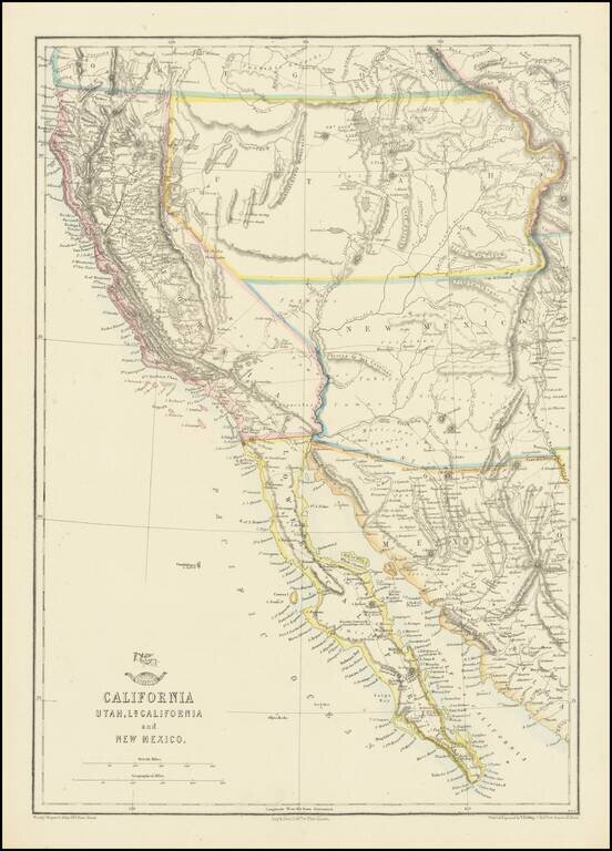
Nice example of the Ettling / Weekly Dispatch map of California and the Southwest, one of first atlas maps published in Europe to focus on the Territories of Utah and New Mexico. The map includes an excellent post Gadsden Purchase treatment of...
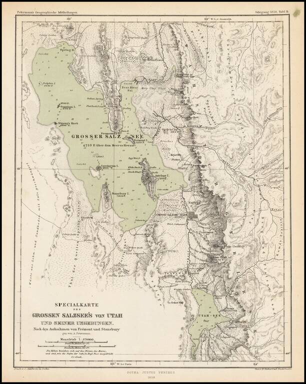
Scarce and highly detailed map of part of Utah in the Salt Lake and Wasatch region, published by Augustus Petermann. The map names numerous early Utah towns, including: Provo Salt Lake City (with a town grid) Springville Brigham City Palmyra Payson...
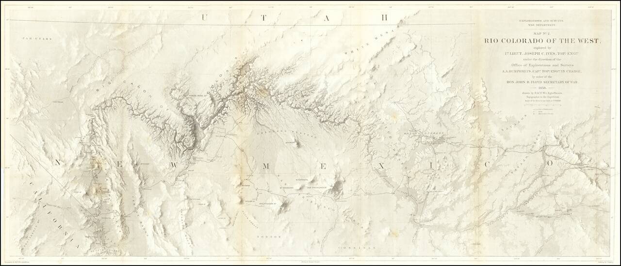
The Earliest Scientific Mapping of the Grand Canyon and Environs. This map is the centerpiece of one of the most important exploring efforts of the American Southwest. The map is one of three maps which accompanied the Report upon the Colorado River,...
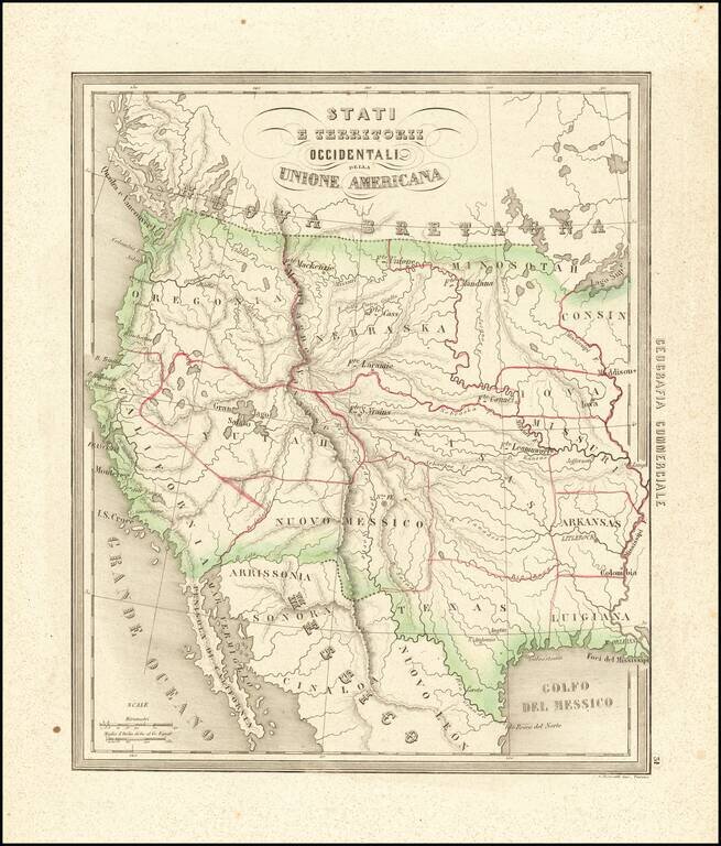
Rare and fascinating map of the Transmississippi West, from Marmocchi's Il Globo--Atlante di carte geografiche . . . , published in Genoa. The map is engraved by Bonatti in Turin. Despite the dating, the map show a pre-Gadsden Purchase border with...
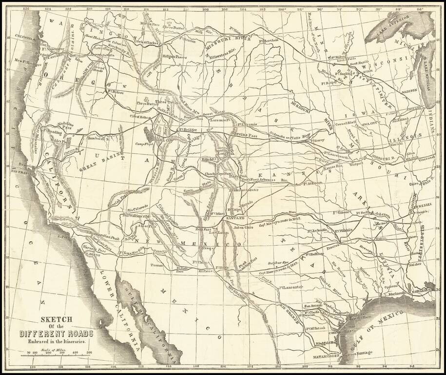
Scarce wood-engraved map of the overland routes to the West discussed in Marcy's The Prairie Traveler: A Hand-Book for Overland Expeditions, with Maps, Illustrations, and Itineraries of the Principal Routes Between the Mississippi and the Pacific...
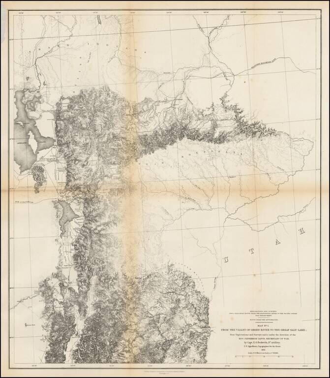
Finely detailed map of the area from Brown's Hole east of today's Vernal to the Great Salt Lake and south to below Fillmore. The map locates the Emigrant Road to California. Several Proposed Railroad lines are shown. One crosses the Green River near...
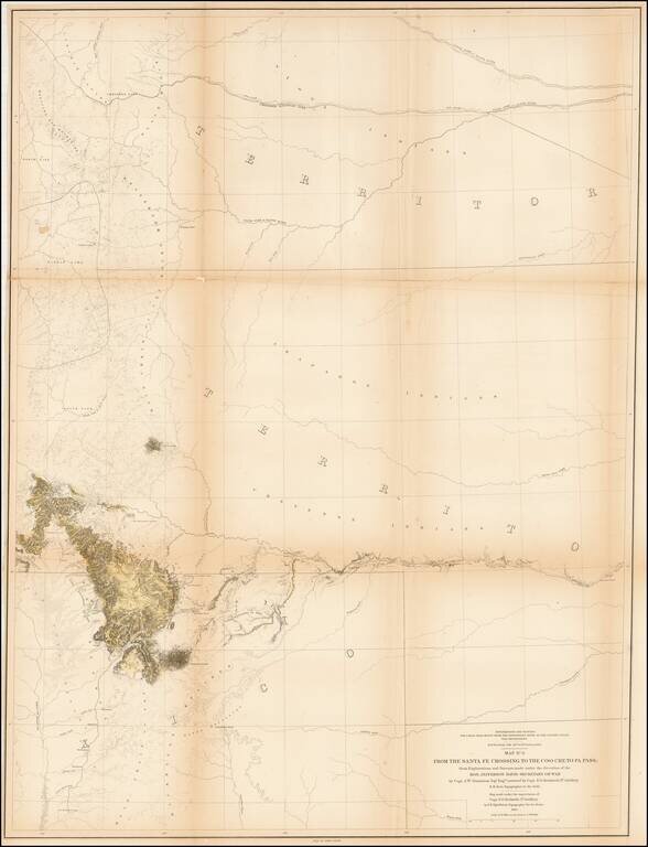
Detailed map showing parts of Wyoming, Colorado, New Mexico and South Dakota, extending west to Rocky Mountains, the Rio Grande River, San Luis Valley and Cheyenne area Shows the proposed raiload lin along the South Fork of the Platte River, extending...
![Map of Mexico, Central America, and the West Indies [Insets of Bermuda, Cuba, Jamaica and Panama Railroad]](/map/small/51948.jpg)
Attractive map of Mexico, the Caribbean and the Gulf Coast, published by SA Mitchell Jr. Includes large insets of Cuba, Bermuda, Jamaica, and the Isthmus of Panama and a small inset of Jamaica. Shows shipping routes from New Orleans to points...
![New Map of the State of California and Nevada Territory Exhibiting the Rivers, Lakes, Bays and Islands, with the principal Towns, Roads, Railroads and Transit Routes to the Silver Mining Districts of Nevada Territory. . . 1863 [Pocket Map]](/map/small/37306.jpg)
Fine example of Ransom & Doolittle's rare pocket map of California & Nevada Territory, published in San Francsico by Warren Holt and focusing on the routes into Nevada and the recently-discovered mining regions. One of the most interesting and...
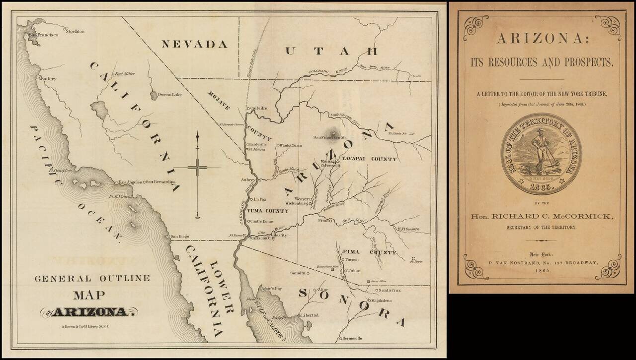
Very early Arizona Territory promotional pamphlet including an unusual pre-1866 map of Arizona inclusive of Mojave County, which would be ceded to the State of Nevada shortly thereafter. Folding map. 22 pages. 8vo, original printed wrappers with...
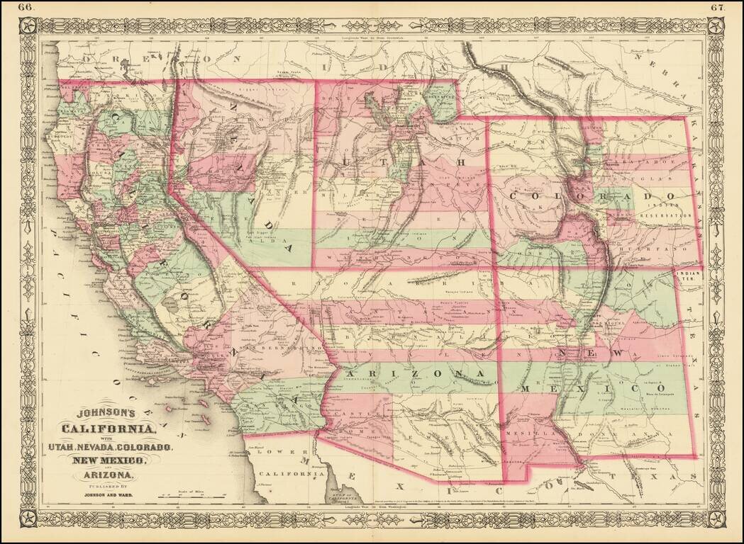
Interesting map of the southwest, hand colored by counties and showing a number of interesting territorial anomalies. Nevada has its lower corner truncated, leaving Las Vegas in Arizona. In each of the states and territories, the county configurations...
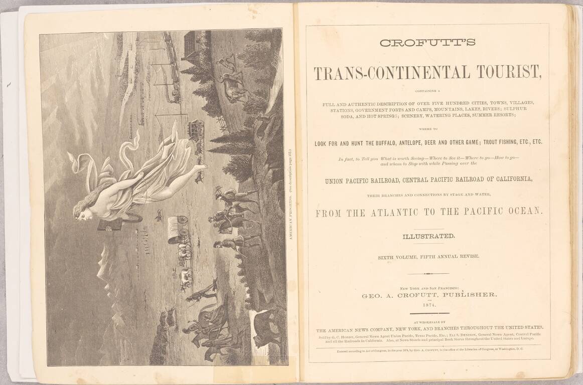
One of the Best Visual Records, In a Single Volume, of American Westward Expansion. This edition of Crofutt's Tourist is an extensive work, showing and describing many of the sites a traveler of the late 19th century would have visited in the US,...
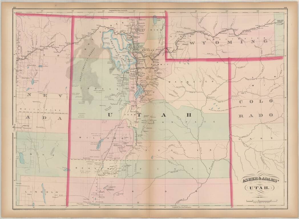
One of the earliest obtainable maps of Utah Territory. Asher & Adams map of Utah is among the earliest map of Utah Territory in its modern configuration to appear in a commercial atlas. The focus of the map is the railroad and related detail...
Gorgeous large format map of Arizona and New Mexico. Shows the proposed routes of a number of early railroads through the region, including the Southern Pacific, Atchison Topeka & Santa Fe, etc., along with the route of the Denver & Rio...
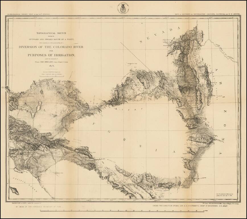
Highly detailed US Geographical Survey Map, tracing the expedition route from Ehrenberg and the Willow Spring area to Los Angeles, via the Coachella Valley and San Bernardino, the North into the Mojave Desert and on toward modern day Las Vegas. The...