
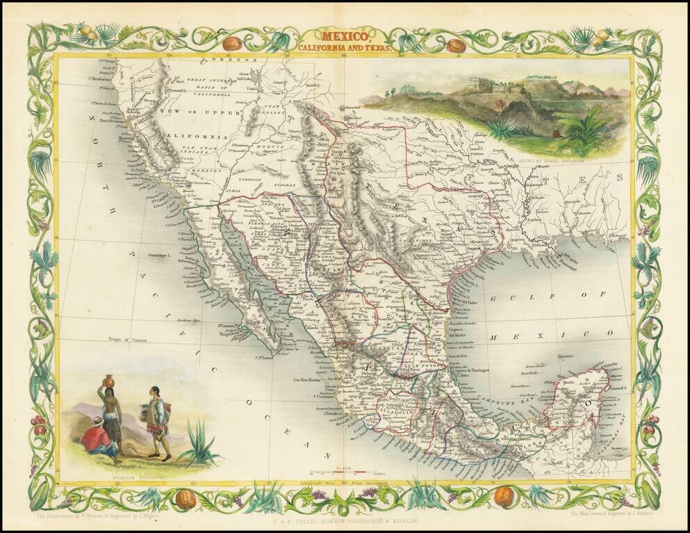
Rare variant edition of this decorative regional map of the Texas, California and the Southwest, featuring Texas in its Republic configuration, with Stovepipe reaching to Wyoming and Colorado. Upper California is shown with the Gold Regions...
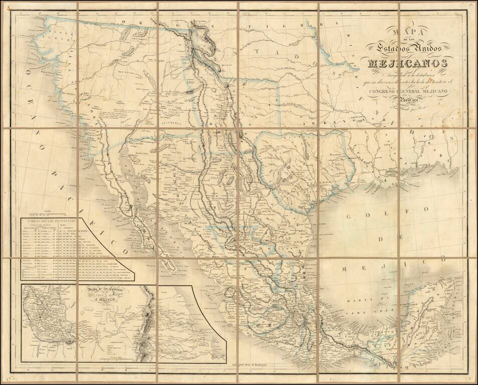
Rare second edition of the so-called Rosa map of Mexico, first published in Paris in 1837 and re-issued in 1851, at the request of the Congress of Mexico. Rosa's map is perhaps the rarest of the so-called Treaty Map sequence, which shaped the original...
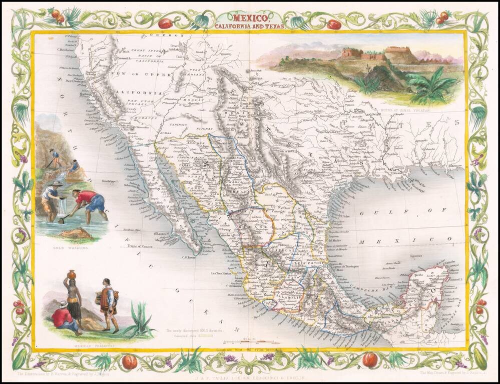
Decorative regional map of the Texas, California and the Southwest, featuring Texas in its Republic configuration, with Stovepipe reaching to Wyoming and Colorado. This is the second edition of the map, which includes the Gold Washing vignette not...
![Karte von Tejas und den angrenzenden Theilen Mejicos . . . [with California Gold Regions Inset]](/map/small/61669.jpg)
Rare Texas Emigrant Map Extremely rare map of Texas, Mexico and contiguous regions, which appeared in volume 6 of Freidrich Heinzelmann's Die Weltkunde in einer planmassig geordneten rundscahu der wichtiigsten neueren Land-und Seereifen für das...
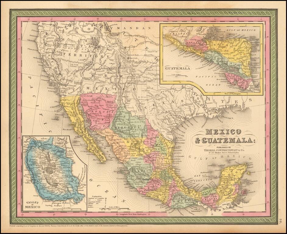
Detailed map of Mexico and the Southwest. Many of the early place names in Texas still appear. Pre-Gadsden Purchase border with Mexico. Large insets of the Valley of Mexico, Isthmus of Tehuantepec, Isthmus of Nicaragua and Guatemala.
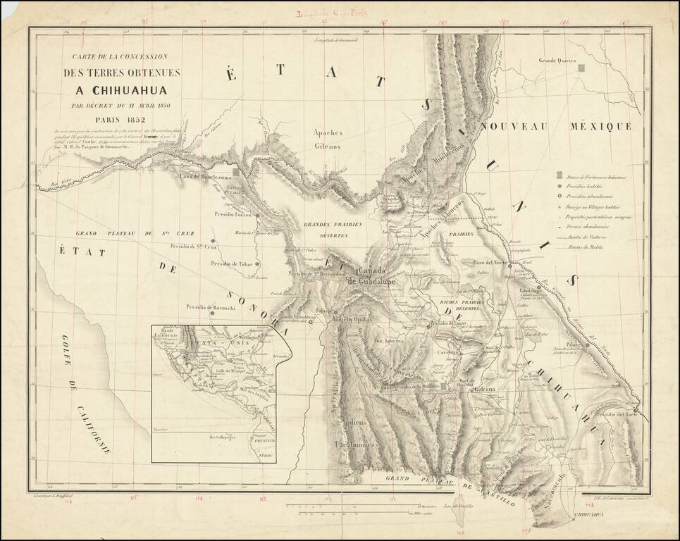
A French European Colony In Sonora and Chihuahua To Resist US Expansionism Scarce map of the borderlands between the United States and Mexico, illustrating the colonization scheme of Frenchman Hippolyte du Pasquier de Dommartin. The map provides a...
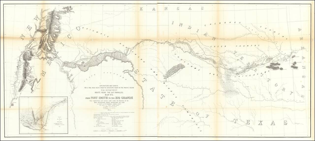
Important early map of the region between Fort Smith Arkansas and the Rio Grande River (Santa Fe, Taos, etc), prepared by the US Pacific Railroad Survey. The primary cartographic detail is in the Rio Grande Valley of New Mexico and along the Canadian...
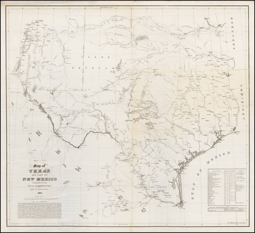
One of the Rarest Great Modern Maps of Texas First edition of this remarkable separately issued map of Texas and part of New Mexico, prepared by the United States Topographical Engineers in 1857 and issued in very small numbers, likely only for use...
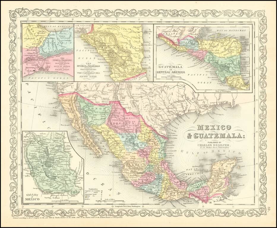
Scarce Charles Desilver map of Mexico and the Southwest. Many of the early place names in Texas still appear. Pre-Gadsden Purchase border with Mexico. Large insets of the Valley of Mexcio, Ithmus of Tehuantepeci, Isthmus of Nicaragua and Guatemala.
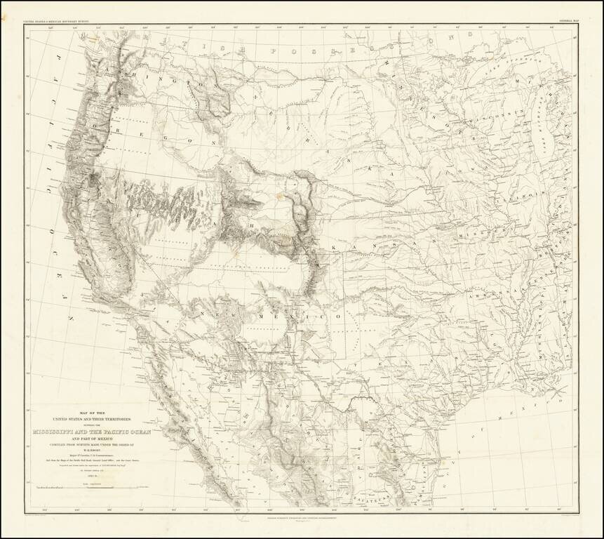
Emory's Map of the Transmississippi West. Marvelously detailed map of the Western Territorial US, published by W.H. Emory in his Report of the United States and Mexican Boundary Survey. The map is one of the fundamental post-Gadsden Purchase maps of...
![[Arizona below New Mexico] Mexique d'apres le grand Atlas Dresse Par A.H. Dufour Grave par ch Dyonet Pubie par A. Le Chevalier . . . 1863](/map/small/64395.jpg)
Scarce map of Mexico and the American Southwest, etc., published in Paris. The map provides nice detail in Texas and along the Rio Grande, with emphasis on the roads and towns. The French Colony In Texas (Col. Francaise) is shown, along with a number...
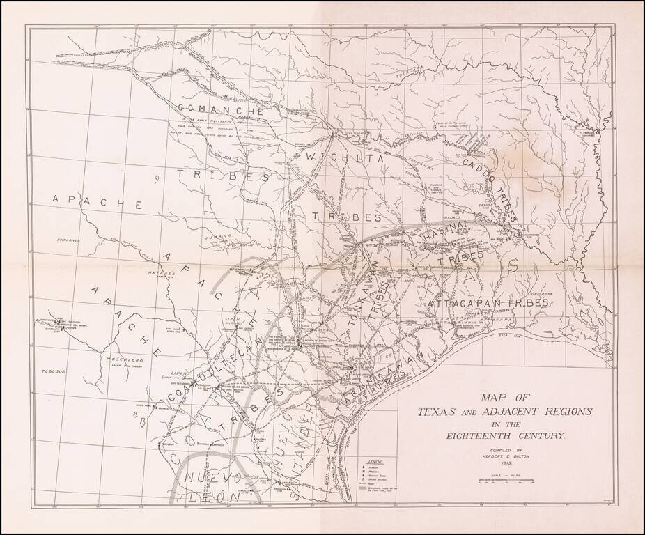
Scarce map showing Texas and adjacent regions as they would have been in the 18th Century. The map was prepared by Herbert Bolton, one of the most prolific and important writer/scholars of the 20th Century. The map shows the major Indian tribes and a...
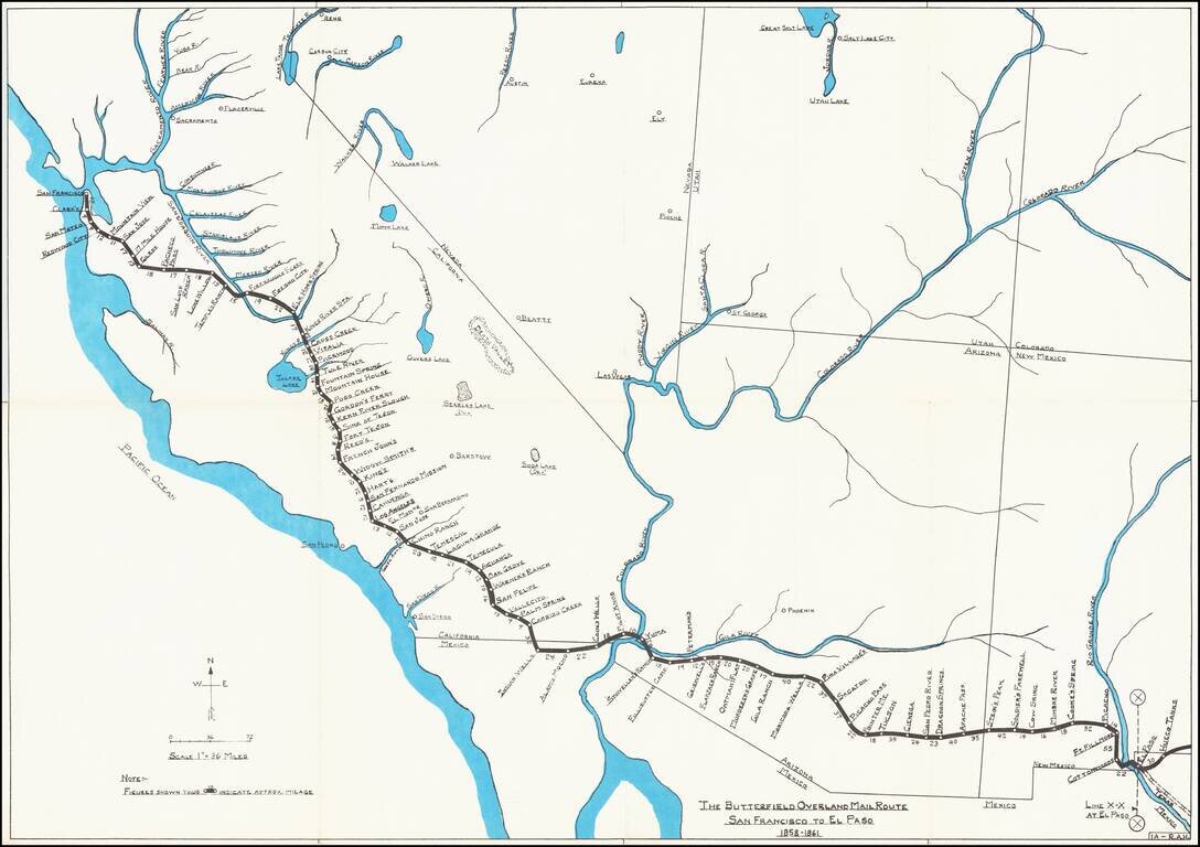
Rare historical / pictorial map of Western portion of the Butterfield Mail Route, drawn by Robert A. Hanson. The map was likely published by the Western Cover Society, a California based society which published the Western Express. Hanson's maps were...
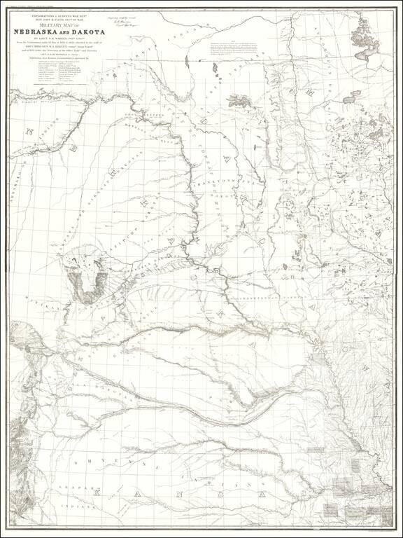
1875 Edition of Warren's Pivotal Map of the American Plains -- Early Reference To the Colorado / Kansas Gold Regions 1875 edition of Gouverneur Kemble Warren's large format map of Kansas, Nebraska, Dakota and part Colorado and Wyoming, based upon...
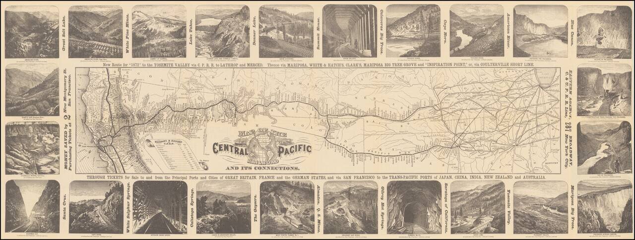
Decorative map of the route of the Central Pacific from the midwest to San Francisco, illustrated with 24 images of the west, primarily of California and Nevada. Decorative and highly detailed map, with vignettes of major points of interest in the...

Rare pictorial map of the Mormon Trail, published by American Pioneer Trail Association. The map includes lively historical vignettes focusing on the early history of the West, Mormon Battalion and Mormon Settlers. "Issued by American Pioneer Trails...