Map size in jpg-format: 56.7779MiB
Click to open in high resolution (open in new tab).
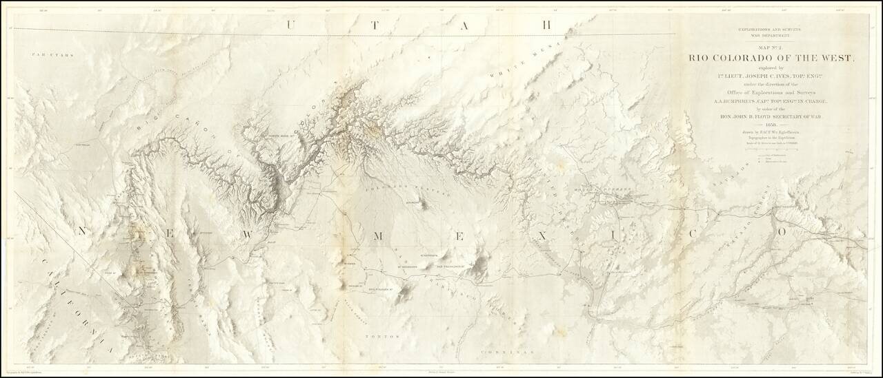
The Earliest Scientific Mapping of the Grand Canyon and Environs.
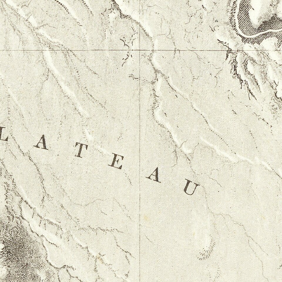
This map is the centerpiece of one of the most important exploring efforts of the American Southwest. The map is one of three maps which accompanied the Report upon the Colorado River, which recorded the activities and scientific findings of the U.S. Army expedition of 1857-58 under the command of Joseph C. Ives. Goetzmann considers the Ives book to be the best of the individual Army reports, "a long, carefully written journal, consciously literary but with a maximum amount of attention to scientific observation." Egloffstein's maps accompanying the report are equally notable for their innovative depictions of the topography and the geology of the Colorado River, the result of Egloffstein's development of a new method for representing topography. He developed a technology that imparts the appearance of depth to the topography and nearly mimics a satellite image.
Map No. 2 depicts the course of the Colorado River across the horizontally configured Territory of New Mexico, a section of land which would later become Arizona Territory. The "Big Cañon of the Colorado," i.e., the Grand Canyon, features prominently as an early attempt at surveying the terrain.
Carl Wheat devotes several pages to the Egloffstein maps. Finely and fully engraved, the map locates Fort Defiance, Campbell's Pass, Zuni, Moquis (Hopi) Pueblos, San Francisco Springs (Flagstaff), Las Vegas, the Mormon Road, numerous Indian tribes, and much more. Several important exploration routes & trails are shown including The Old Spanish Trail, Whipple's trail of 1854 and Beale's trail. Many notations throughout.
If you are a student, write to us in telegram: @antiquemaps and indicate what material you need and for what work you need a map in high detail. We are ready to provide material on special terms. For students only!
![Carte Du Mexique et de la Floride des Terres Angloises et des Isles Antilles du Cours et des Environs de la Riviere Mississipi . . . Rue Des Canettes . . . 1703 [1st State]](/map/small/66307op.jpg)