Map size in jpg-format: 525295B
Click to open in high resolution (open in new tab).
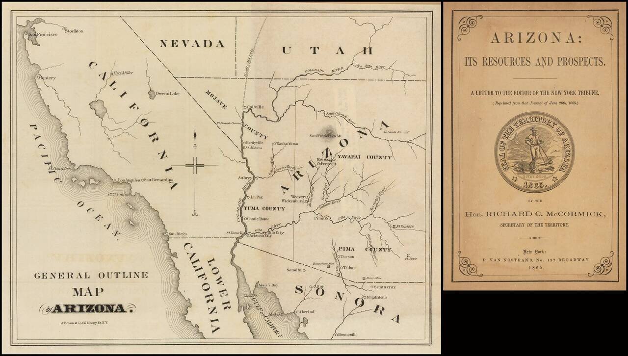
Very early Arizona Territory promotional pamphlet including an unusual pre-1866 map of Arizona inclusive of Mojave County, which would be ceded to the State of Nevada shortly thereafter.
Folding map. 22 pages. 8vo, original printed wrappers with engraved seal of the Territory of Arizona.
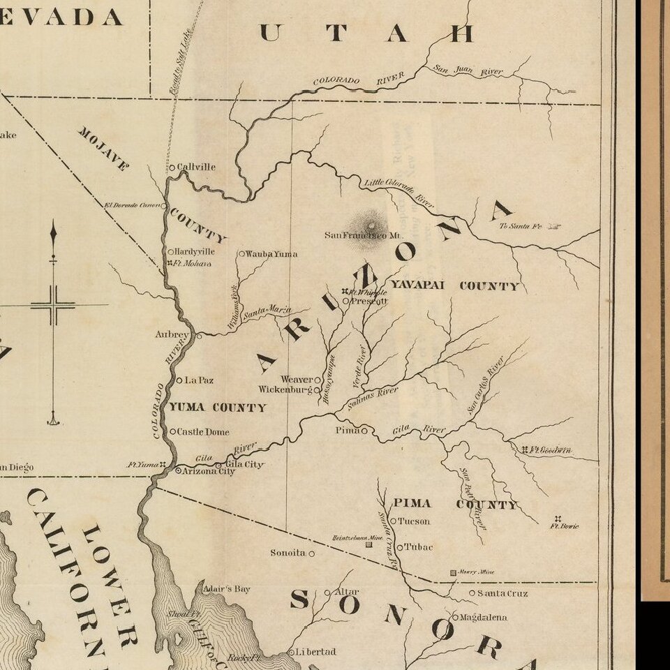
The map is titled: "General Outline Map of Arizona." It shows two mines on the American side of the border.
Forts Whipple, Bowie, Goodwin, and Mohave are shown. The towns of Prescott, Weaver, Wickenburg, Pima, Tucson, Tubac, Castle Dome, La Paz, Arizona City, Gila City, Aubrey, Callville, El Dorado Canon, and Wauba Yuma are shown. Much of California is shown in lesser detail.
Arizona is split into Mojave, Yavapai, Yuma, and Pima counties.
If you are a student, write to us in telegram: @antiquemaps and indicate what material you need and for what work you need a map in high detail. We are ready to provide material on special terms. For students only!
![Carte Du Mexique et de la Floride des Terres Angloises et des Isles Antilles du Cours et des Environs de la Riviere Mississipi . . . Rue Des Canettes . . . 1703 [1st State]](/map/small/66307op.jpg)