

The Second Issue of Fremont's Map of the West--Issued Following the Discovery of Gold in California Nice example of Fremont's seminal map of the West, which focuses on California, Arizona, Utah and Nevada. Wheat dedicates 13 pages and 2...
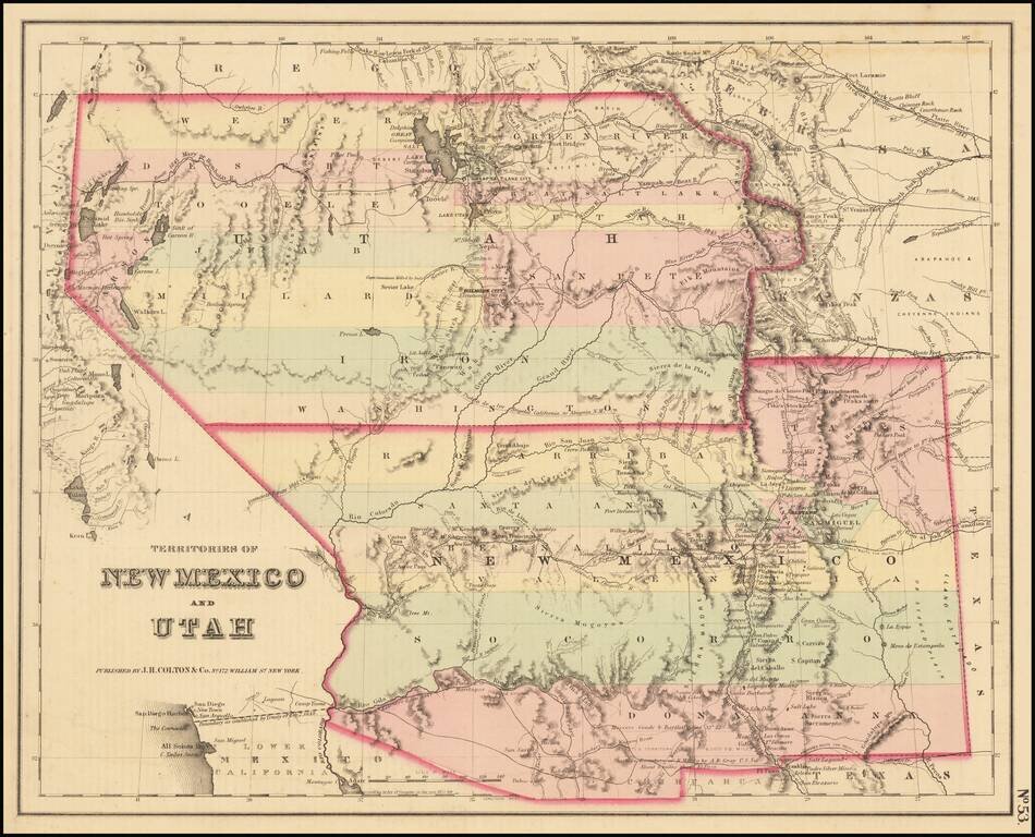
A cornerstone map, exceptionally detailed and showing many routes and places of interest in the settlement of the American West. This map was published several times from the mid-1850s through the 1870s. This map shows Fremont's 1844 and 1845 routes,...
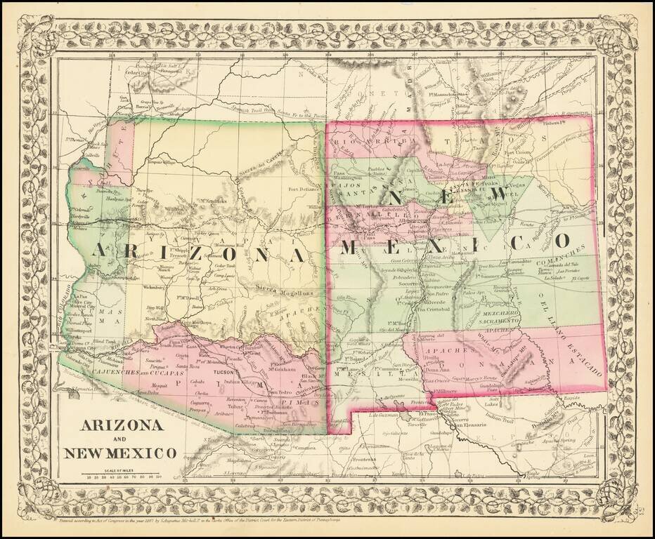
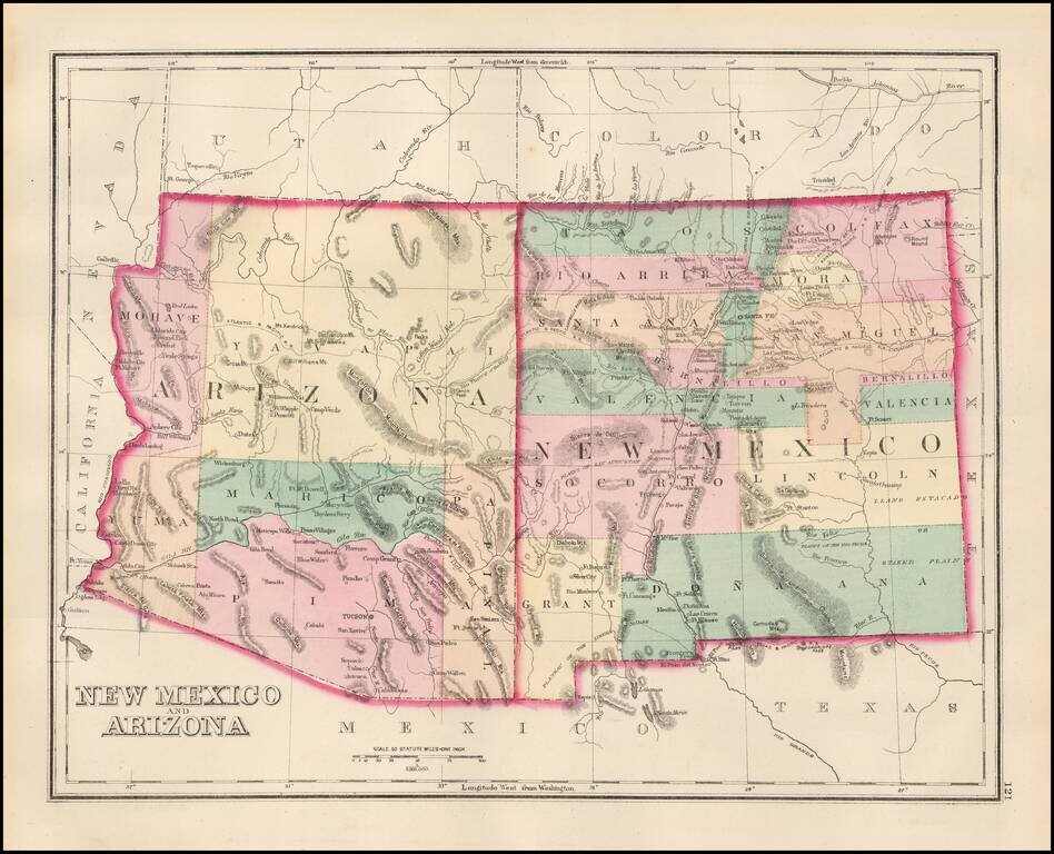
Attractive regional map of New Mexico and Arizona, colored by counties with beautiful decorative border. Shows towns, roads, railroads and rivers. This is a period when western county and state borders were rapidly evolving, such that each year holds...
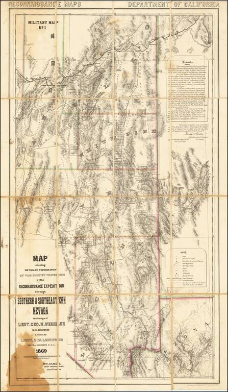
A Nevada & Grand Canyon Rarity -- The Foundation Map for Southern Nevada A remarkable map of the Eastern Half of Nevada, including Las Vegas, the Grand Canyon, Great Salt Lake and Sevier Lake (then called Preuss Lake), being the first scientific...
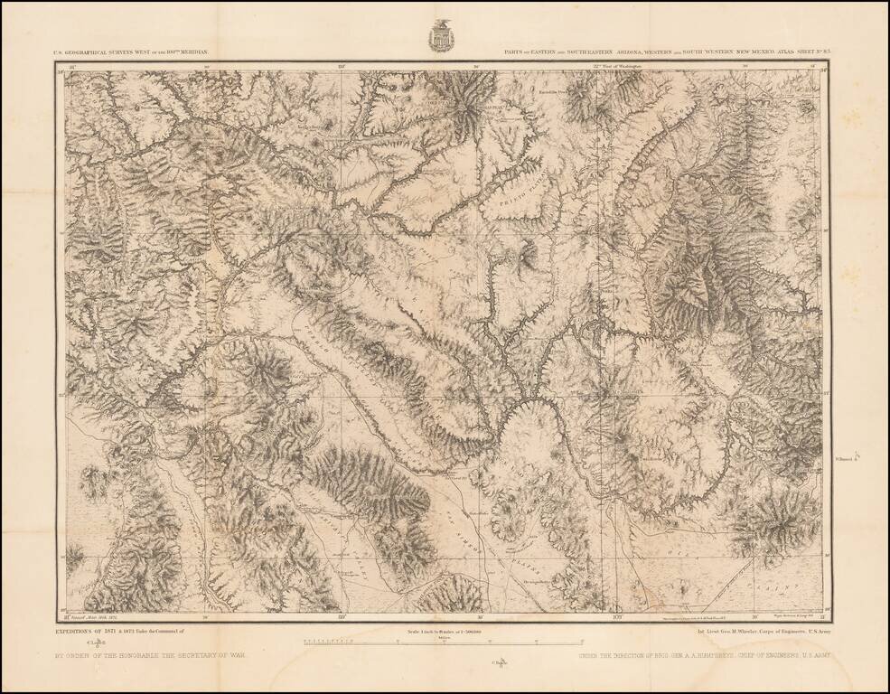
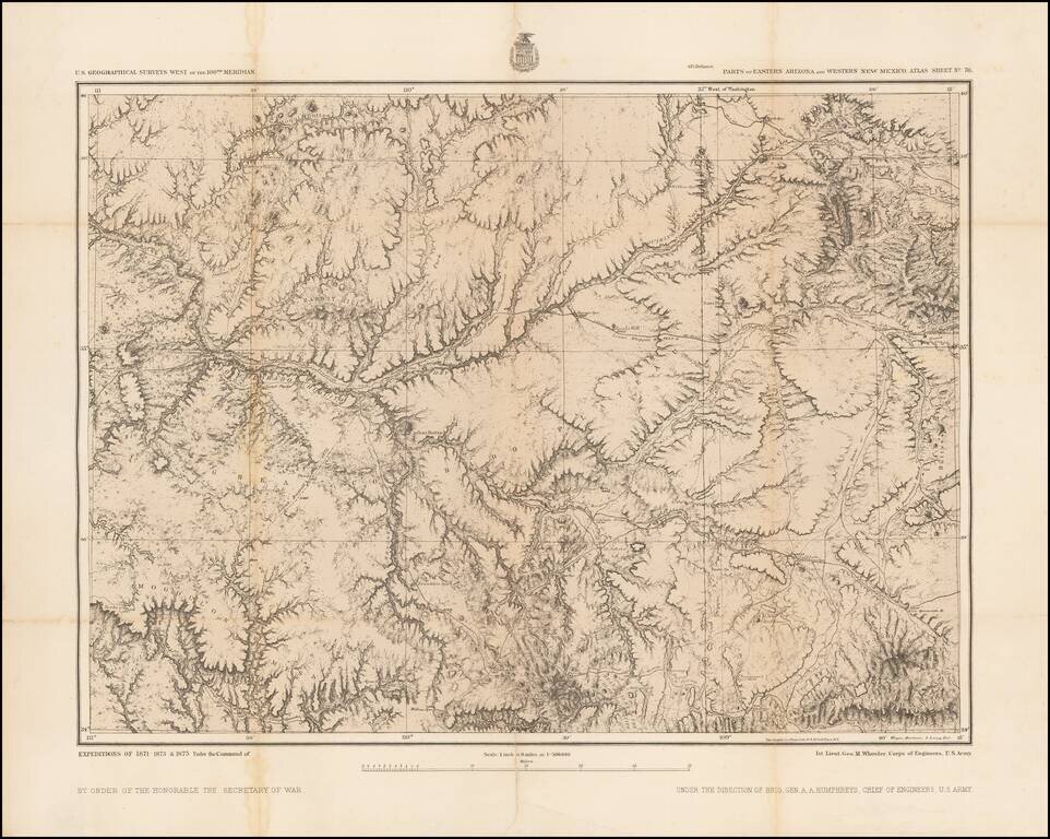
Detailed topographical map showing southwestern New Mexico and southeastern Arizona. Shows towns, roads, mountains, rivers, lakes, hydrographical details, etc. The map was generated during the Wheeler Survey. The Wheeler Survey was a survey of a...
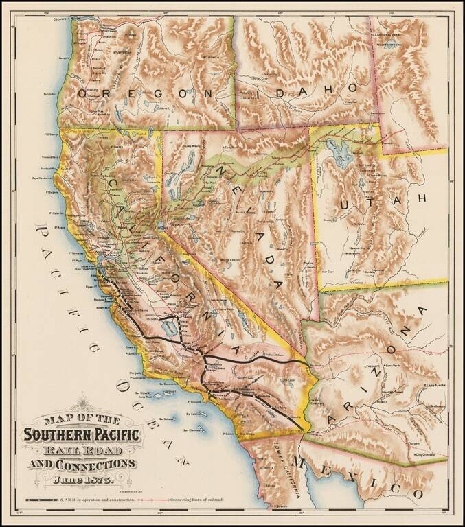
Fine colored chromolithographic example of the earliest known map focused on the general lines of the Southern Pacific Railroad, published more than a year before the line was completed through Los Angeles. Rare promotional map for the Southern...
Detailed map of New Mexico and Arizona, showing a number of newly formed counties and transitional borders in both states. The Southern Pacific is shown running from Yuma, across Arizona with a line splitting off at Deming, and extending to Frontera...
Includes the Phoenix Area Detailed topographical map showing eastern Arizona and western New Mexico. The map extends from the Phoenix area in the southwest (Pleasant Valley) to the Flagstaff area in the northwest, to the Fort Wingate / Gallup, New...
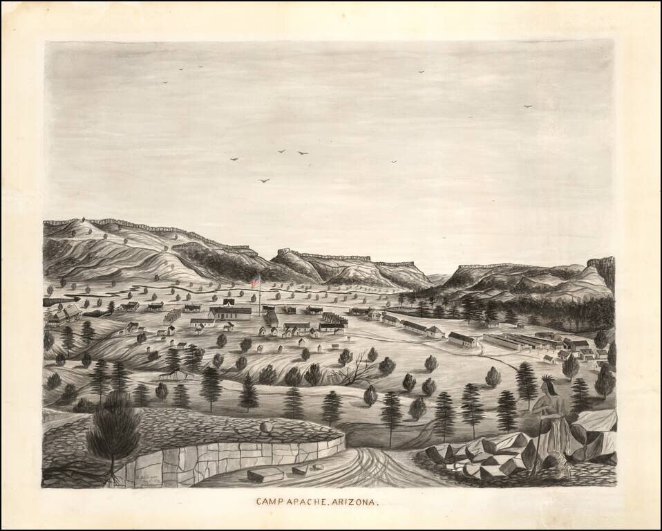
A fine 1876 watercolor view of Camp Apache (later Fort Apache), Arizona Territory. Though somewhat naïve in execution, the view has a wonderfully evocative quality while providing one of the most detailed contemporary images of this storied U.S. Army...
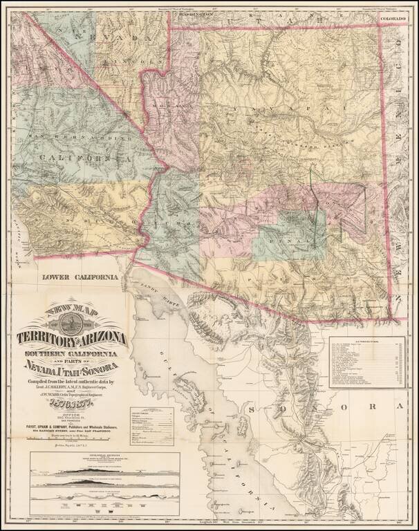
The Finest Large Format Map of Arizona, Southern California and Southern Nevada from the 1870s. Large and striking map centered on Arizona with pieces of the adjacent states and territories, at a time when Arizona was undergoing a mineral boom, and...
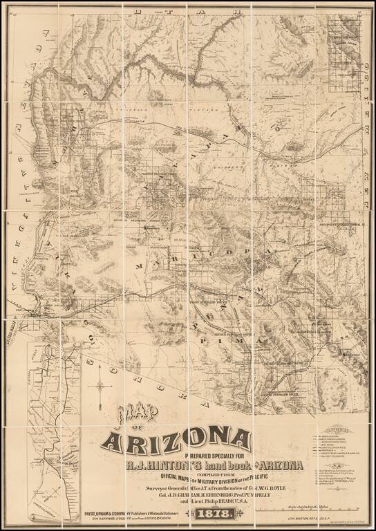
The First Privately Printed Large Format Map of Arizona Territory with Hinton's Hand Book. Hinton's map of Arizona was intended to be published with his hand book. However, as noted by Streeter, the map was accompanied by a note that the book would...
Detailed map of California and the Southwest, colored by Counties.
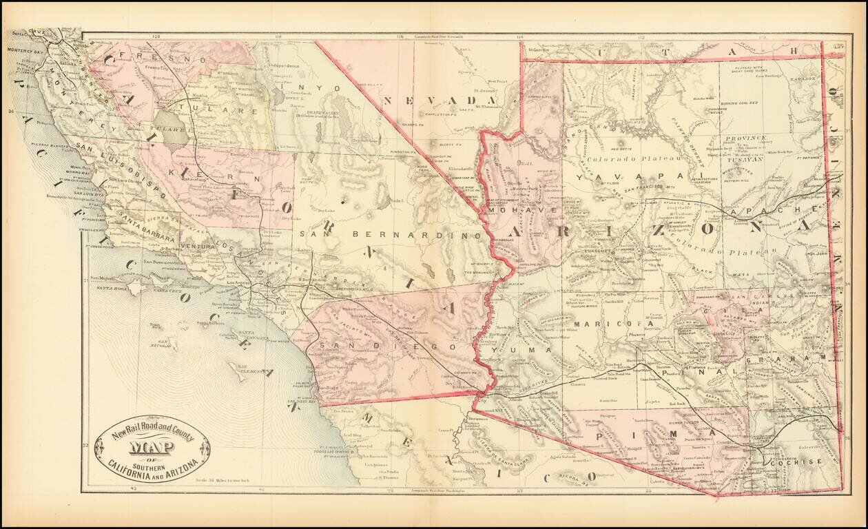
Scarce early map of Southern California and Arizona, focusing on the Railroad Lines then in operation. The map also shows a number of early towns, roads, mountains, lakes, mining regions and other important details. This is the first time we have...
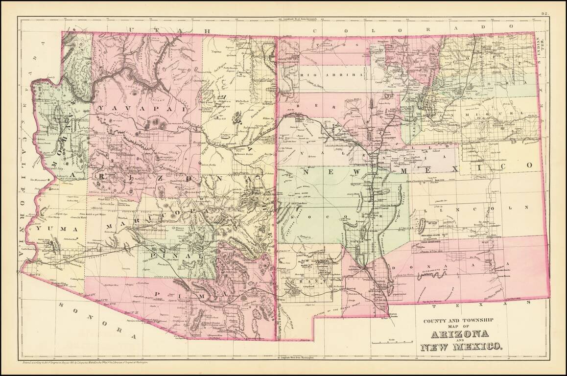
Detailed map of Arizona and New Mexico, colored by counties and showing towns, roads, railroads, rivers, lakes and a host of other information. The map predates the formation of Sierra County, New Mexico in 1884. One of the most detailed maps of the...
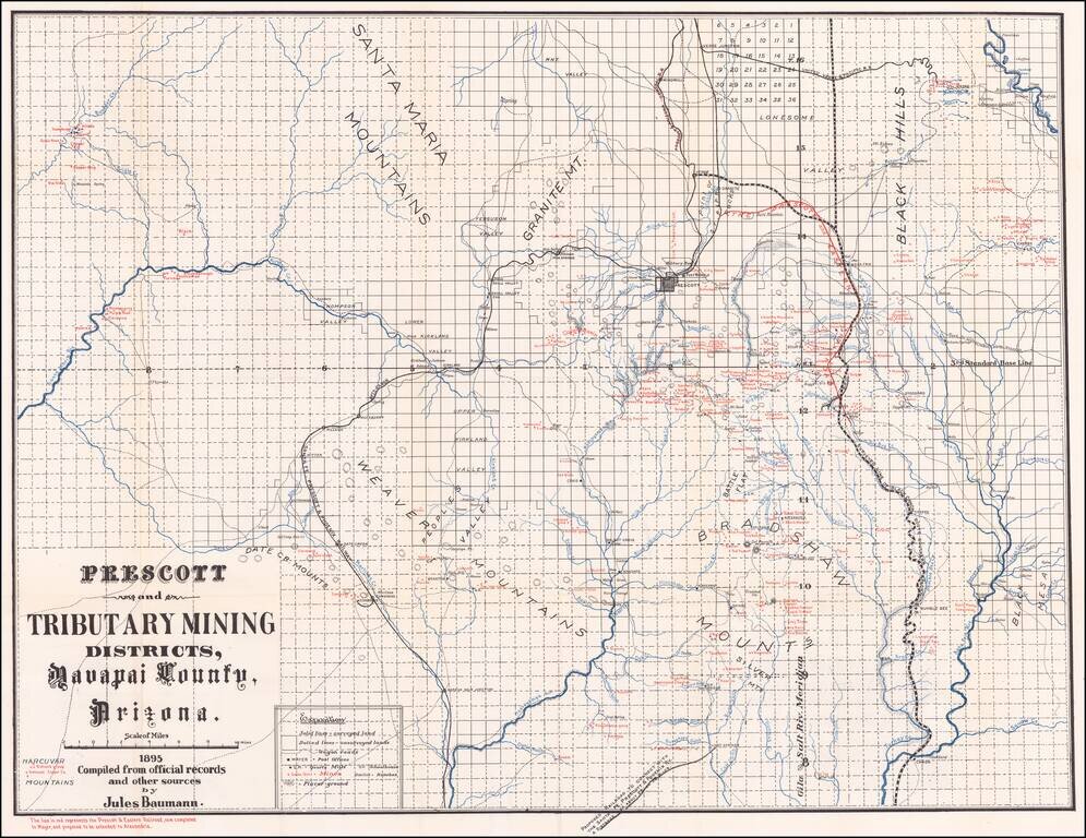
Scarce map of Yavapai County, showing the Prescott and Tributary Mining Districts, overprinted to show the lines of the Prescot & Eastern Railroad. Detailed map locating hundreds of mines, ranches, school houses, towns, railroads, roads, and post...
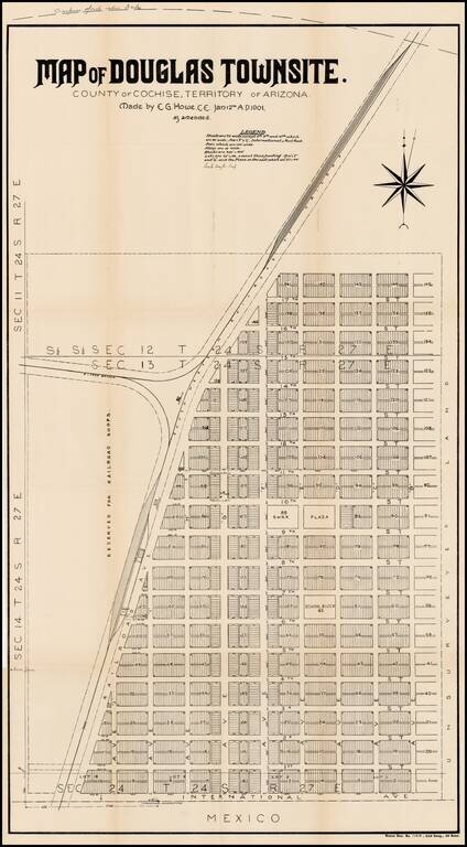
Detailed plan of the town of Douglas, Arizona, on the border with Mexico. In 1878, the place where the town of Douglas now exists was known as Black Water, so called because of a dirty water hole. Water was so scarce that Black Water was much used....