
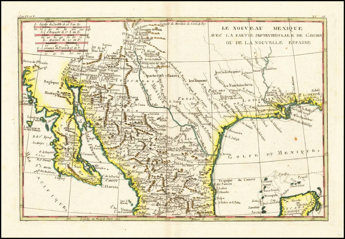
Fascinating map, showing excellent detail in Texas, Arizona and New Mexico. Includes a badly misprojected Baja California, as was normally the case with French maps of the period. Missions and settlements shown in the Texas interior. Indian tribes...
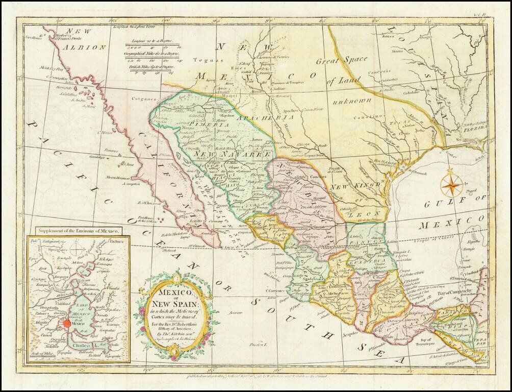
Nice example of the map of Texas, the Southwest, Upper California and Mexico, from Doctor Robertson's History of America. Extends from the Harbor of Sir Francis Drake (San Francisco) and the Farallones to New Orleans in the North and to Guatimala,...
![[California & The Southwest] La Parte Occidentale Dell'Antico, E Nuovo Messico Con Florida E La Bassa Luigiana…. 1798](/map/small/18560.jpg)
Striking full color example of Cassini's map of California, Arizona, New Mexico, part of Texas, Baja California and Mexico. This is perhaps the only 18th Century map of the region to feature a decorative cartouche and vignette. The Rio Grande extends...
The West at the Time of the Louisiana Purchase Detailed map of Mexico and the American West, published in Paris. The map shows the limits of the United States at the Mississippi River, with Louisiana shown to the west, albeit somewhat vaguely. The...
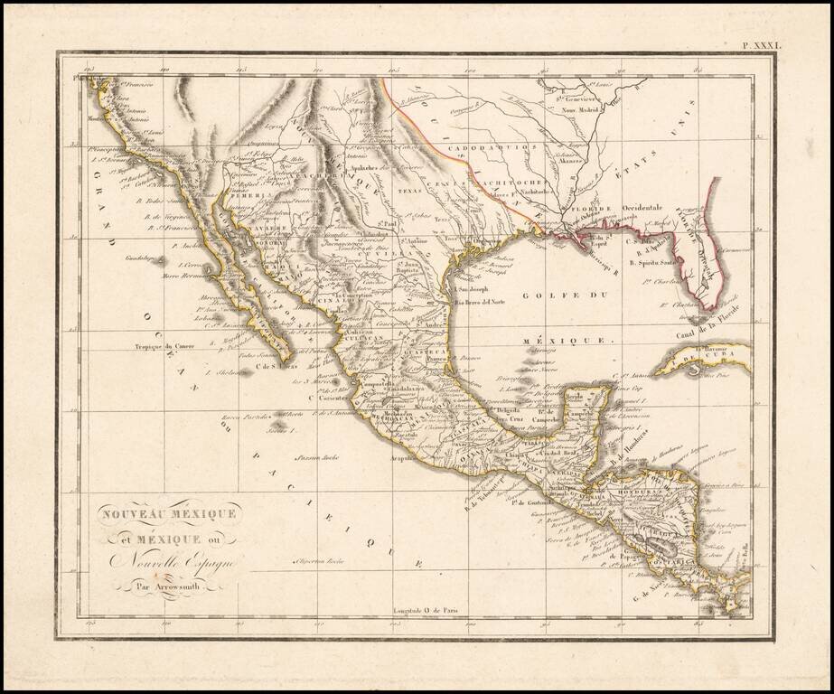
A Fascinating Pre-Louisiana Purchase Map of Texas and the Southwest Scarce early map of Mexico, Upper California, Texas and Louisiana Territory. The map extends on the west coast from San Francisco to Cabo San Lucas, with a detailed account of the...
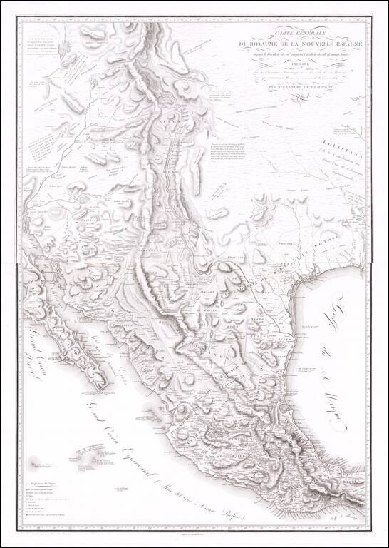
The Most Important Map of the Mexico From The Early 19th Century, By The Father of Modern Geography Nice example of Alexander von Humboldt's monumental 2-sheet map of New Spain. Humboldt's map of New Spain is the first modern geographical treatment...
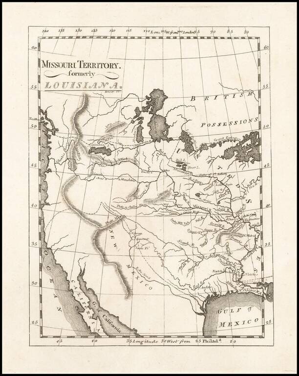
One of the Earliest Maps To Incorporate Lewis & Clark's Reports From Their Expedition Across America To The Pacific Reduced size example of Matthew Carey's map of Missouri Territory, published shortly after the return of Lewis & Clark and in...
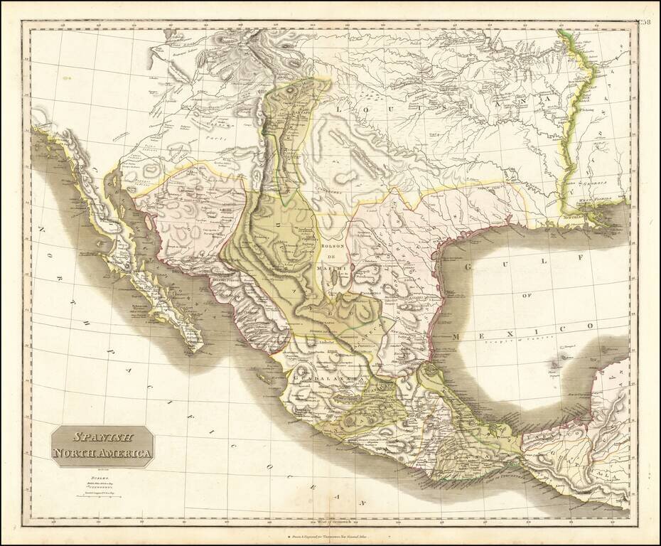
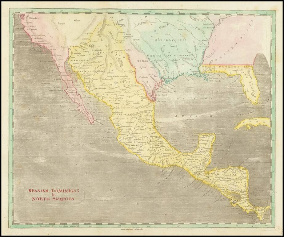
Large detailed English language map of Texas and the Southwest, published in Edinburgh by Thomson. The map is largely based upon the explorations of Humboldt and Long in the Rocky Mountains and the West. It includes extensive notes along the lower...
![[Provincia de Texas] A Map of Louisiana and Mexico. Carte de la Louisiane et Mexique . . . 1820](/map/small/39611dd.jpg)
An Early Appearance of the Provincia de Texas Rare separately issued map of Mexico, Texas, Louisiana, Mississippi, Southern California, Southern Arizona, Southern New Mexico and parts adjacent, published in Paris by Tardieu. As noted on the map This...
Mexico Shortly After Independence From Spain Striking example of Buchon's map of Texas, Upper California and Mexico, from the French edition version Carey & Lea's American Atlas. Both Lake Timpanogos and Teguayo are shown, with still a hint of a...
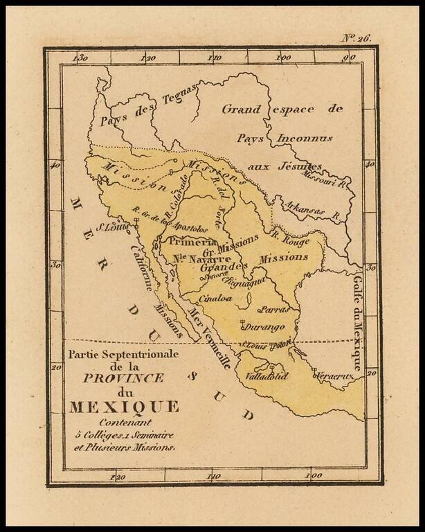
Rare map of Texas, Upper California and Mexico from Louis Denis' Atlas Universel indiquant les établissemens des Jésuites: avec la manière dont ils divisent la terre, suivi desévénemens remarquables de leur histoire. Denis' atlas illustrates the...
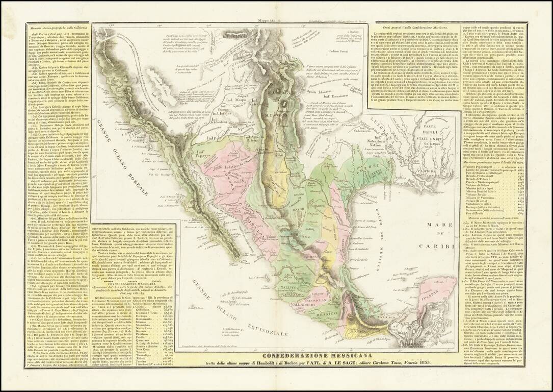
The Reorganization of Mexico Under the Seven Laws & The Republic of Texas A scarce Italian edition of Le Sage's map of Mexico, Upper California and Texas, based largely on Alexandre von Humboldt's map of 1812. The map is richly annotated with...
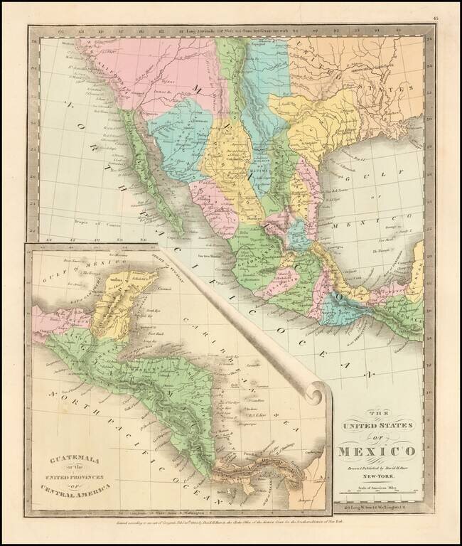
Scarce map of Texas, Upper California, Mexico, etc. from the first edition of David Burr's Universal Atlas. While the map bears the copyright date of 1832, this example is published in 1836. One of the earliest American maps to show Texas in its...
![Mexico & Guatemala [Showing pre-Republic of Texas (Coahuila and Texas)]](/map/small/71256.jpg)
Detailed map of Mexico and the Southwest, featuring Texas and Coahuila, on the eve of Texas Independence. The Austins Colony appears prominently in Texas, along with Austin's Grant, Washington, Houston, Goliad and a number of other early settlements....
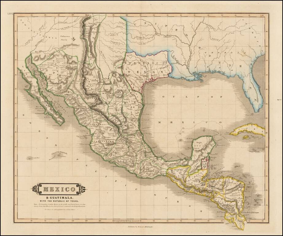
"Republic of Texas" in the Title of the Map Scarce map of Texas, Mexico, Upper California and contigous parts of the Southeastern US, naming the Republic of Texas. The present map is one of the only obtainable printed maps to name the "Republic of...
![Carte Des Etats-Unis Du Mexique…1838 [Republic of Texas]](/map/small/70909.jpg)
Fine example of Alexandre Emile Lapie's map of the Republic of Texas, New Mexico, Upper California and Mexico. One of the best large format maps of Mexico, Texas and Upper California to appear in a commercial atlas in the 1830s. Texas is clearly...