
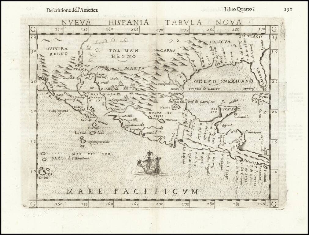
Second Earliest Obtainable Map of Florida, Texas, the Gulf Coast and the American Southwest—Rare Third State! Rare and influential regional map of the American South and Mexico, featured in Ruscelli’s edition of Ptolemy’s Geographia. This is an...
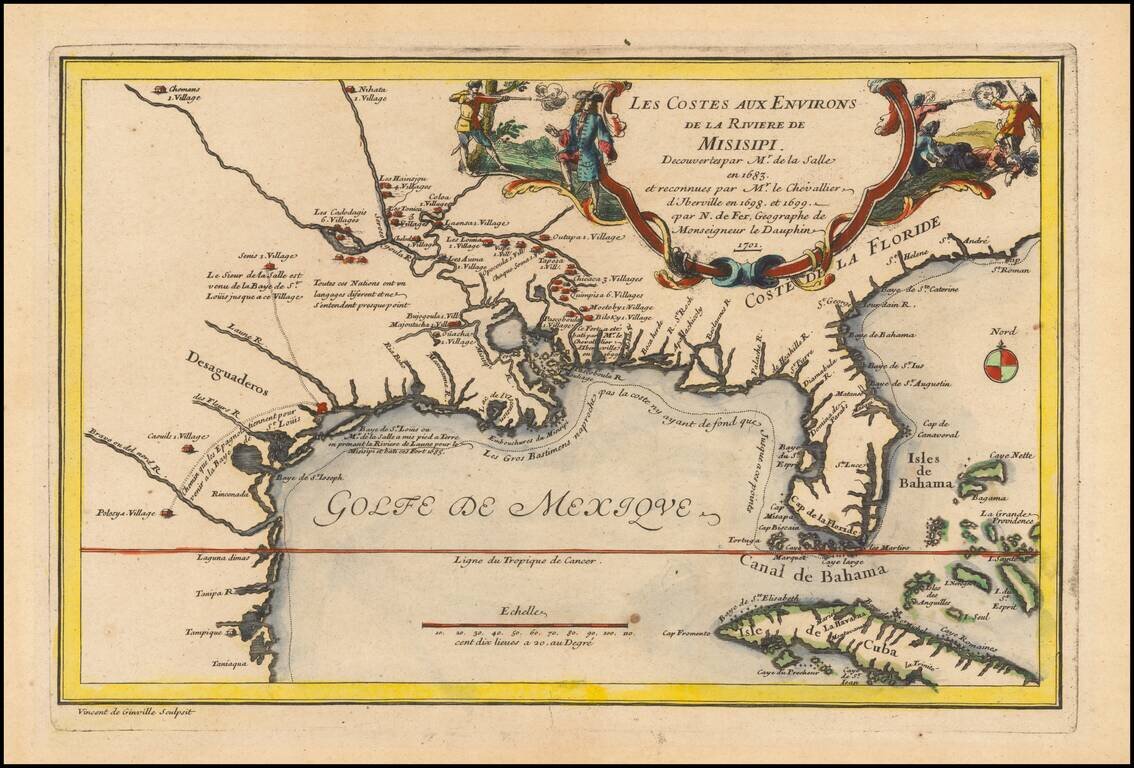
Rare 1701 First Edition Nice example of this historically important and fascinating map of the Gulf Coast and Mississippi River region, from Nicolas De Fer's Atlas Curieux. In preparing this fine map, the leading French cartographer Nicolas De Fer...
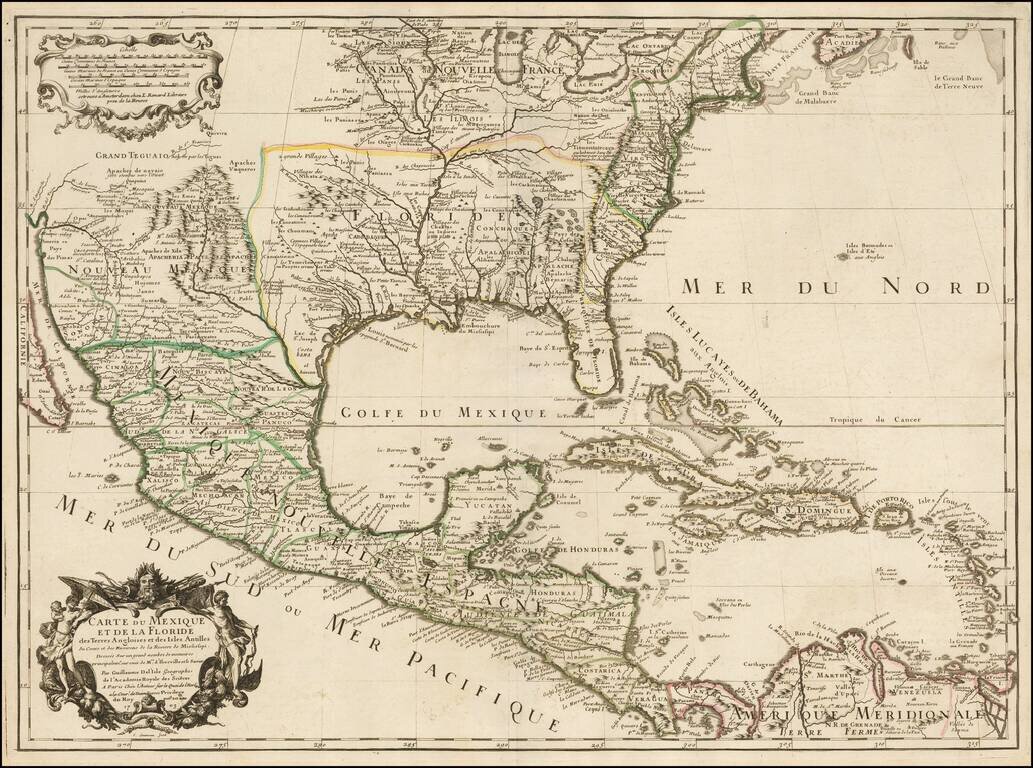
Rare Second State. Fine example of the second state of Guillaume De L'Isle's landmark map, the first printed map to accurately depict the course and mouth of the Mississippi River. De L'Isle's Carte du Mexique . . . is drawn from the reports brought...
![Carte De La Louisiane Et Du Cours Du Mississipi . . . Juin 1718 [1st State!]](/map/small/62086.jpg)
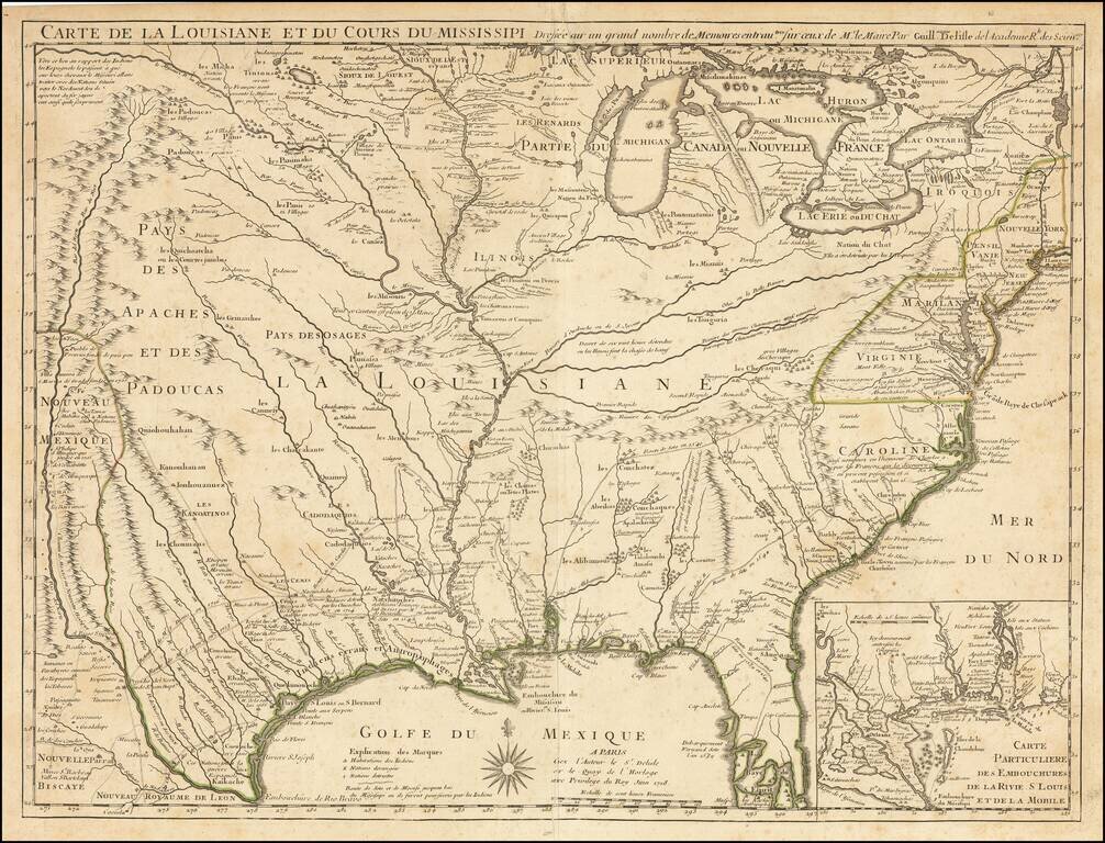
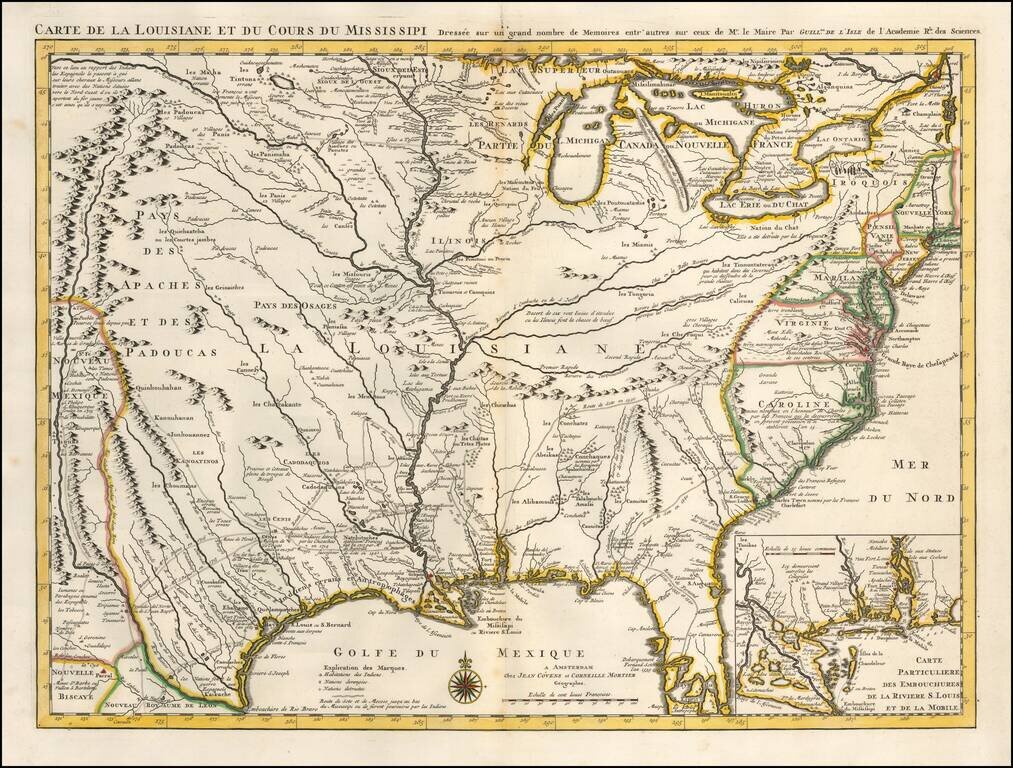
"The Mother and Main Source of All the Later Maps" of the Mississippi River and Interior Parts of the United States and The First Map to Name Texas First state of De L'Isle's seminal map, one of the most important and influential maps of the 18th...
First Map To Name New Orleans -- "The Mother and Main Source of All the Later Maps" of the Mississippi River and Interior Parts of the United States and The First Map to Name Texas Second state of De L'Isle's seminal map, one of the most important and...
One of the Earliest Appearances of New Orleans Nice old color example of Covens & Mortier's fine edition of Guillaume De L'Isle's seminal map, the most significant map of the Mississippi Valley and Great Lakes published in the early part of the...
![A New & Accurate Map of Mexico or New Spain together with California New Mexico &c. [Inset map of the Galapagos Islands]](/map/small/70276.jpg)
Striking map of the Southwestern and Southeastern United States, Baja California, Mexico, Central America and the Gulf Coast region, centered on Texas. Includes nice annotations throughout the map, including annotations describing Kino's expedition to...
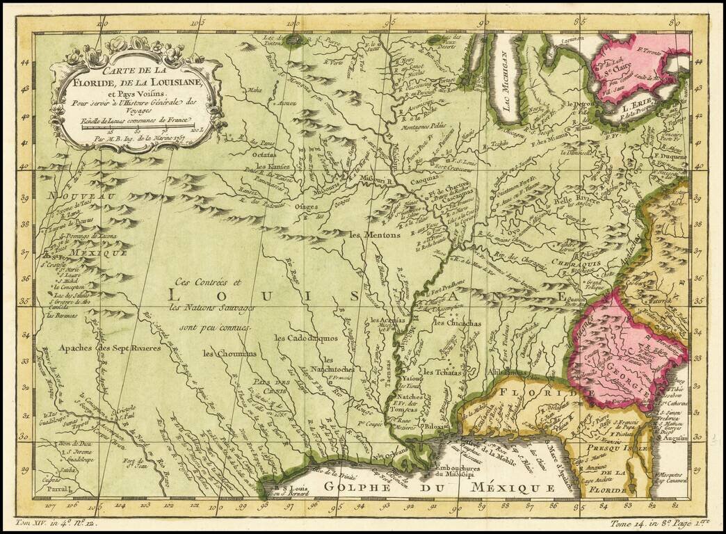
Rare Variant edition of Bellin's map of Mississippi River Valley and environs, with the name "Floride" in the title. The normal title for this map is Carte De La Louisiane et Pays Voisins. Fabulous map of most of the US, based upon De L'Isle's...
18th Century French Map of Texas, Mexico and the Southwest, etc. Decorative map of the Southwest, Texas, the southern United States, Mexico and Central America. Includes excellent detail in Texas and along the Rio Grande River, Rio Colorado and Gila....
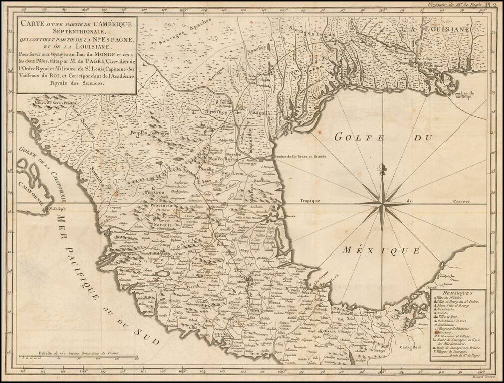
Description of an Overland Expedition Through Texas in 1767. Interesting early map of the Texas, the Gulf Coast and Mexico, from De Pages Voyages Au Tour Du Monde, published in 1782. Pages accompanied the Spanish Governor of Texas on a Journey from...
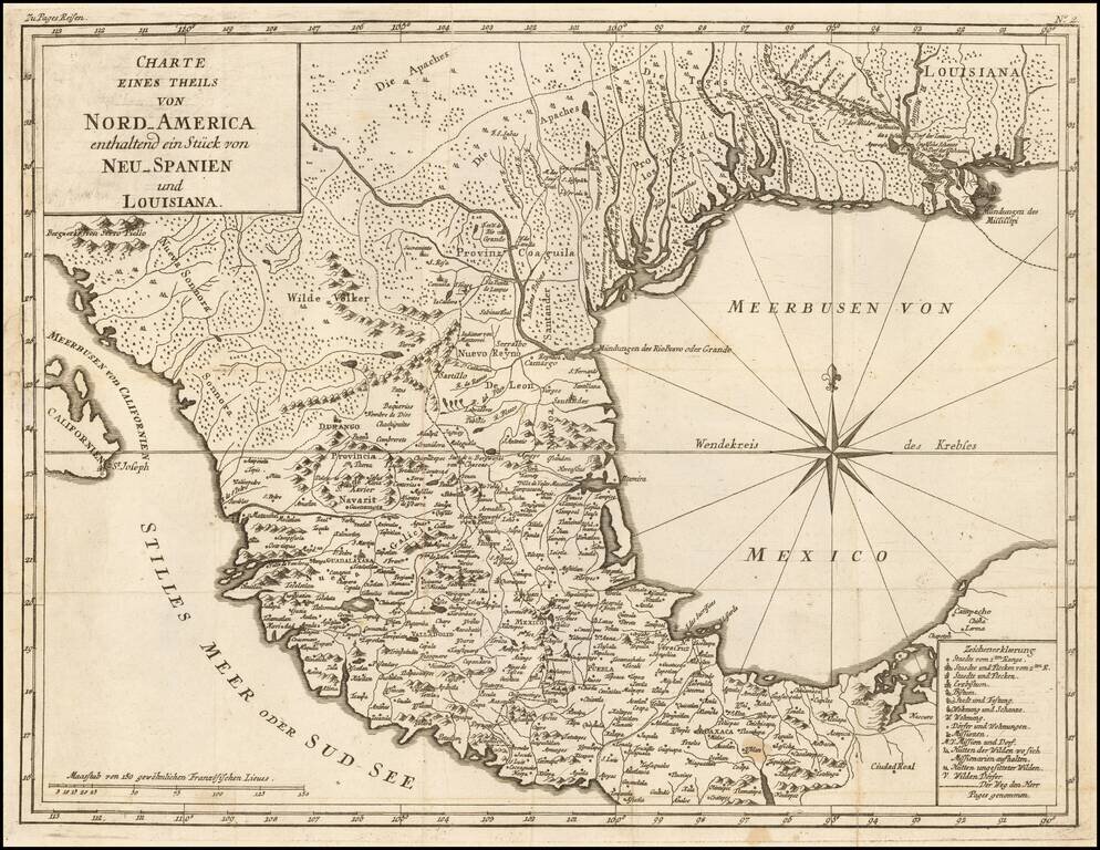
An Description of his Overland Expedition Through Texas in 1767. Interesting early map of the Texas, the Gulf Coast and Mexico, from a German edition of Pierre du De Pages Voyages Au Tour Du Monde, published in 1782. Pages accompanied the Spanish...
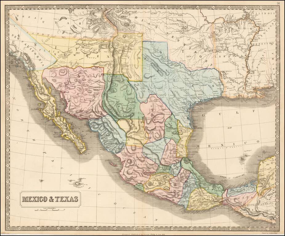
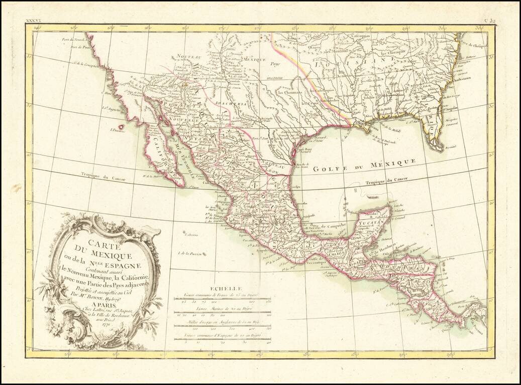
Rare map of Mexico, Texas and the Southwest, from an early edition of Philip's Imperial Atlas. This map is issued shortly before the Gadsden Purchase, and shows a very oddly configured Texas, bounded by a massive Indian Territory and New Mexico...
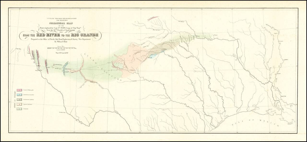
Finely executed Geological Map, centered on Texas and published in conjunction with search for the most practicable route for a railroad line to the Pacific Ocean. Nice example of William Phipps Blake's geological railroad survey of the region between...
French edition of Stephen Long's seminal map of the region drained by the Arkansas, Kansas, Missouri and Mississippi Rivers, one of the most important maps of the American West. Stephen H. Long led a government expedition to the Rocky Mountains in...
![Americque Septentrionale Par le Sr. Sanson d'Abbeville Geographe du Roy . . . 1705 [Rare Peninsular California edition, with unusual Mississippi River depiction]](/map/small/61024.jpg)
Antique Map of North America -- California as an Island Old color example of Sanson's revised map of North America. In 1705, Pierre Moullart Sanson radically revised this map of North America, modifying perhaps the three most significant features of...
![Nuovo Messico appartiene alla Spagna [with] A. Luisiana Inglese B. Luisiana Francese](/map/small/7075.jpg)
Extremely rare pair of miniature maps on one sheet, from a miniature Italian Atlas. The first example we have ever seen. The upper map extends from Baja California and the Pacific to Texas, centered on the Rio Grande. Full of very curious place names....