
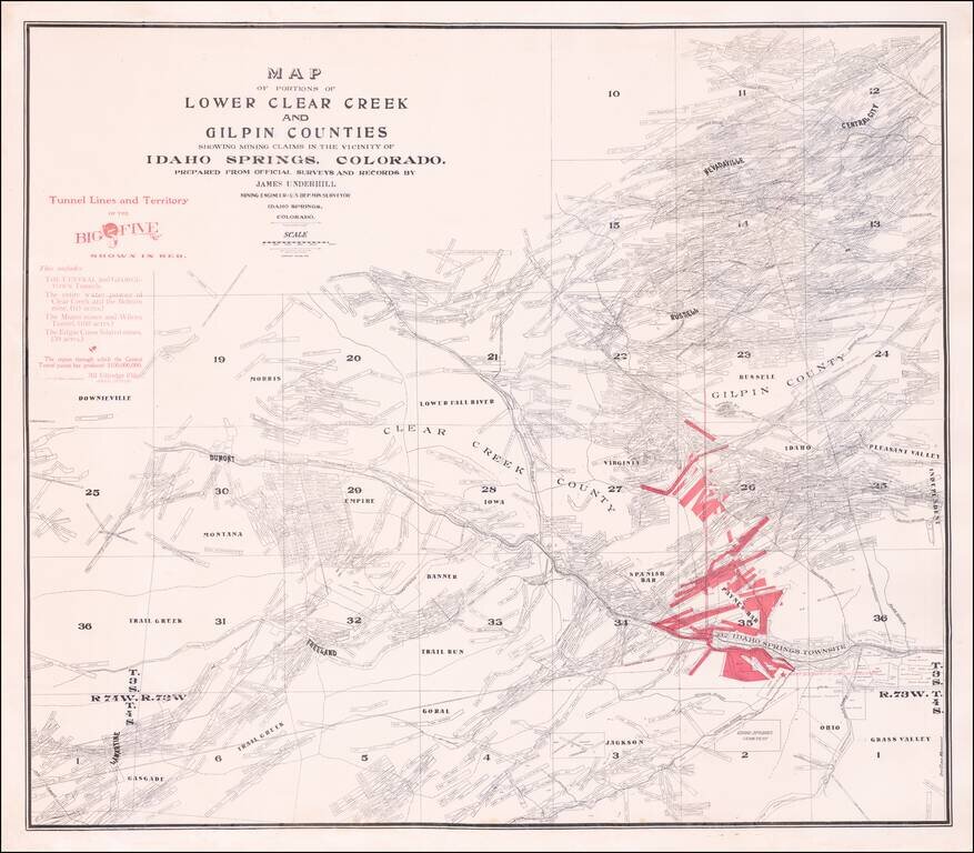
Rare separately published map of the area around Idaho Springs, Colorado, as surveyed by James Underhill. The map extends from Idaho Springs to Lamartine and Downieville and north to Central City, identifying the locations of hundreds of mining...
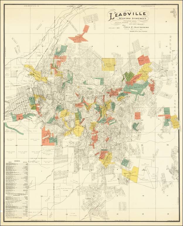
Scarce locally published map of the Leadville Mining District, compiled by Charles F. Saunders and printed by the Denver Litho Co. The map is filled with a vast dense array of mineral claims, perhaps more than one thousand in all, each named and...
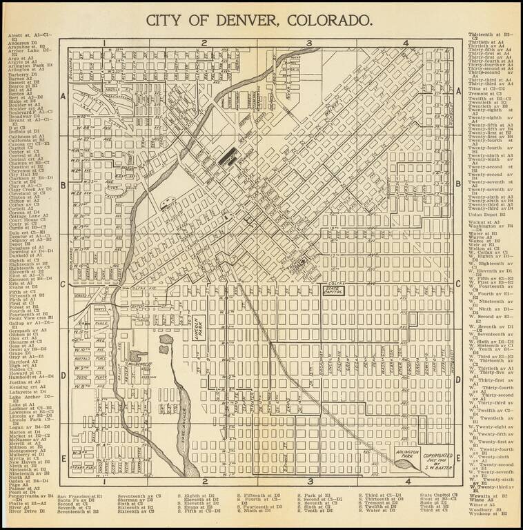
Antique map of Denver, first published in 1901 by S.W. Baxter, and then republished by C.N. Hoover, again in Denver, in 1905. The map extends to Arlington Park in the southeast and the present-day Potter Highlands Historic District in the northwest....
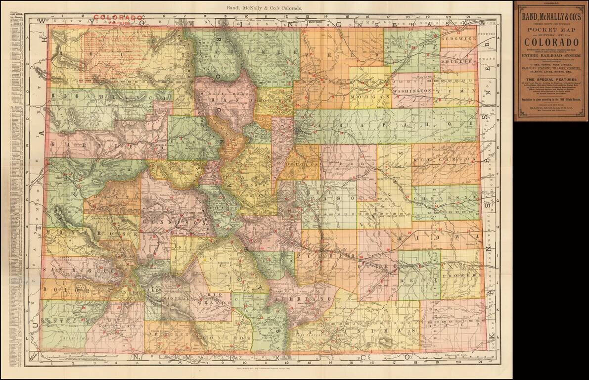
Highly detailed separately issued pocket map of Colorado, showing counties, townships, towns, railroads (numbered), railway stations, rivers, lakes, etc. Includes printed covers and text.
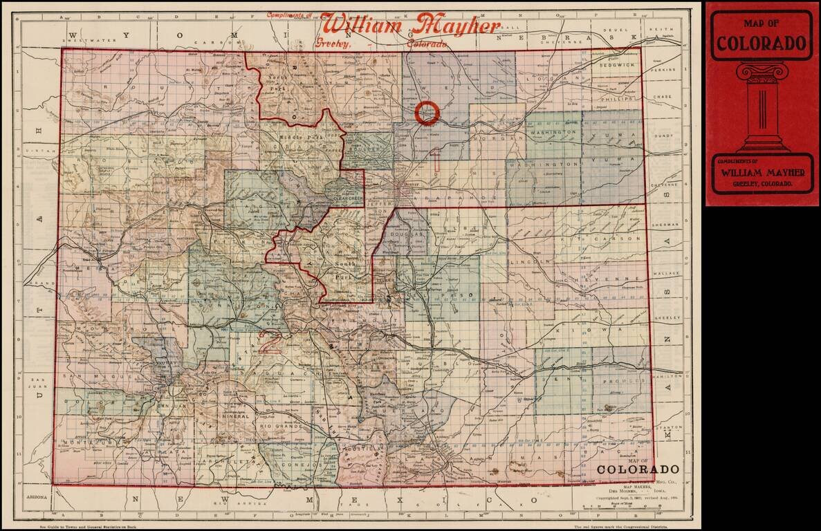
Scarce pocket map of Colorado, first printed in 1902 and reissued in 1904. The map is colored by counties and shows two numbered districts, plus a larger circle around Greeley, Colorado, the location William Mayher, whose name is stencilled onto the...
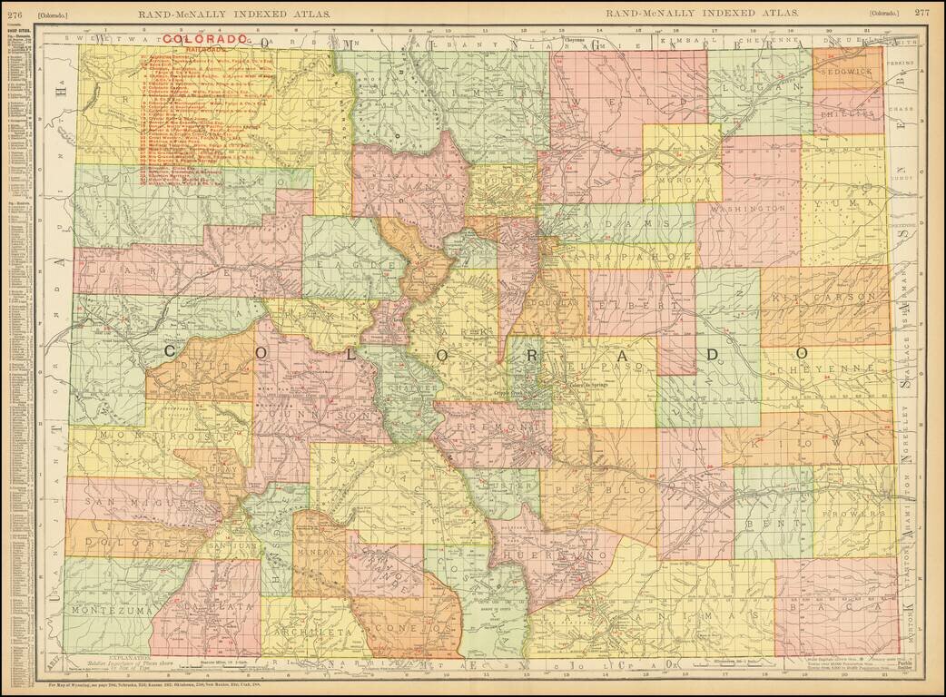
Highly detailed separately issued pocket map of Colorado, showing counties, townships, towns, railroads (numbered), railway stations, rivers, lakes, etc. Includes a list of approximately 30 railroads operating in Colorado at the time.
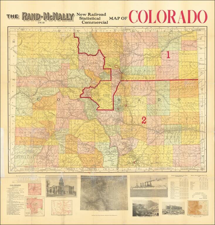
Rare separately issued map of Colorado, published by Rand McNally. Fine large format map on a format we have not seen in a number of years, with interesting information and illustrations below the map. Red overprinting identifies the two...
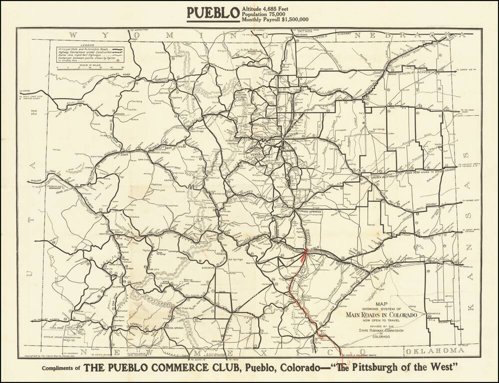
The Pittsburgh of the West Fine early road map of Colorado, published by the Colorado Highway Commission. The map differentiates different types of roads, including: Principal state and automobile roads (fat black line) Highway Connections under...
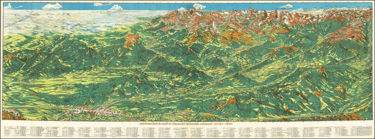
Fine example of Ralph Carlyle Prather stunning view of the Rocky Mountains from Estes Park. At the upper left the view begins Estes Park and the Stanley hotel at the lower left and Fort Colllins and Loveland, with Mount Olympus above. The town of...
![Guide To the Blazed Trails of Montana and Wyoming . . . [Montana, Wyoming, NW Colorado, Eastern Idaho, Northern Utah, NE Nevada] Rand McNally Offical 1923 Auto Trails Map [Yellowstone National Park and Glacier National Park on verso]](/map/small/66099.jpg)
Early Automobile Road Map Detailed map of [Montana, Wyoming, NW Colorado, Eastern Idaho, Northern Utah, NE Nevada, published by the Automobile Club and prepared fkr Kilmer & Sons of Spokane, Washington, The map is scarce -- this is the first...
![[Colorado -- Pike's Peak Region] Detailed Perspective Map of Corley Mountain Highway -- Through the Heart of the Rockies to the Land of Gold . . . .](/map/small/65682.jpg)
Interesting map illustrating the scenic automobile routes in the Pike's Peak region, including the recently constructed Corley Mountain Highway. The map illustrates Colorado Springs the foreground and is centered on Cameron's Cone and Pike Peak,...
![[Southwest Colorado Gold] Map of the Durango and Mancos Colorado District Where Sensational GOLD STRIKE Was Made Oct. 27, 1933](/map/small/69161.jpg)
The Greatest Gold Strike in Forty Years Fascinating promotional piece published by the Lucky Discovery Gold company, promoting a gold strike in Southwestern Colorado. The map pertains to the Placer Gold mining discovery at the Red Arrow Mine in 1933....
![[Southwest Colorado Gold] Mystery Gold Now In The Mancos Sensational Gold Camp](/map/small/69307.jpg)
Mystery Gold -- Red Arrow Bonanza Fascinating promotional piece published by the Mystery Gold Mining Company, promoting a gold strike in Southwestern Colorado. The 2 maps pertain to the Placer Gold mining discovery, which supposedly began at the Red...
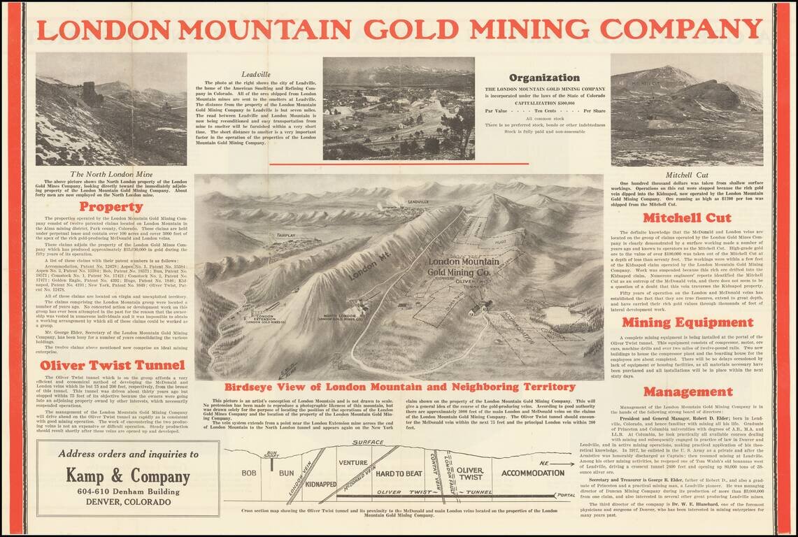
Depression Gold Mining in the Alma District of Colorado Scarce promotional birdseye view map and brochure, promotiong the London Mountain Gold Mining Company The central image includes a detailed view of London Mountain, the claims of the London...
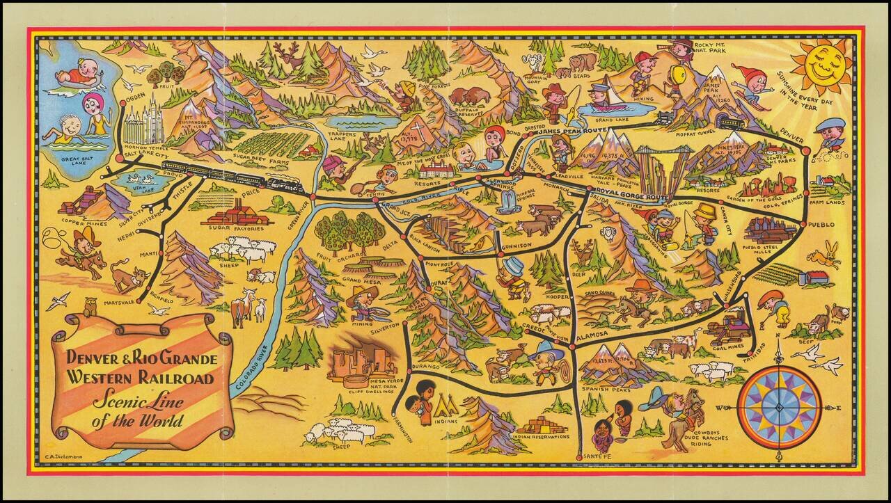
Scarce early Denver & Rio Grande Western Railroad promotional brochure, illustrated with a fine pictorial map of Colorado by Charles E. Dietemann (1902-1973). Focused on the rail lines of the Denver & Rio Grande Western, the map provides...
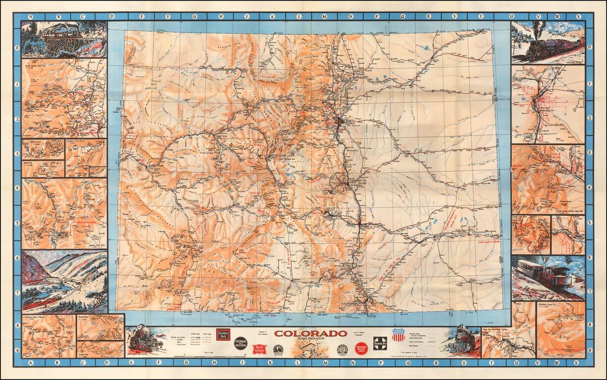
"The Most Complete Railroad Map of Colorado Ever Prepared" Fine large format railroad map of Colorado, with decorative vignettes and details maps along the borders. Inset maps include: Denver and Front Range area Moffat Tunnel Alpine Pass...