Map size in jpg-format: 55.5597MiB
Click to open in high resolution (open in new tab).

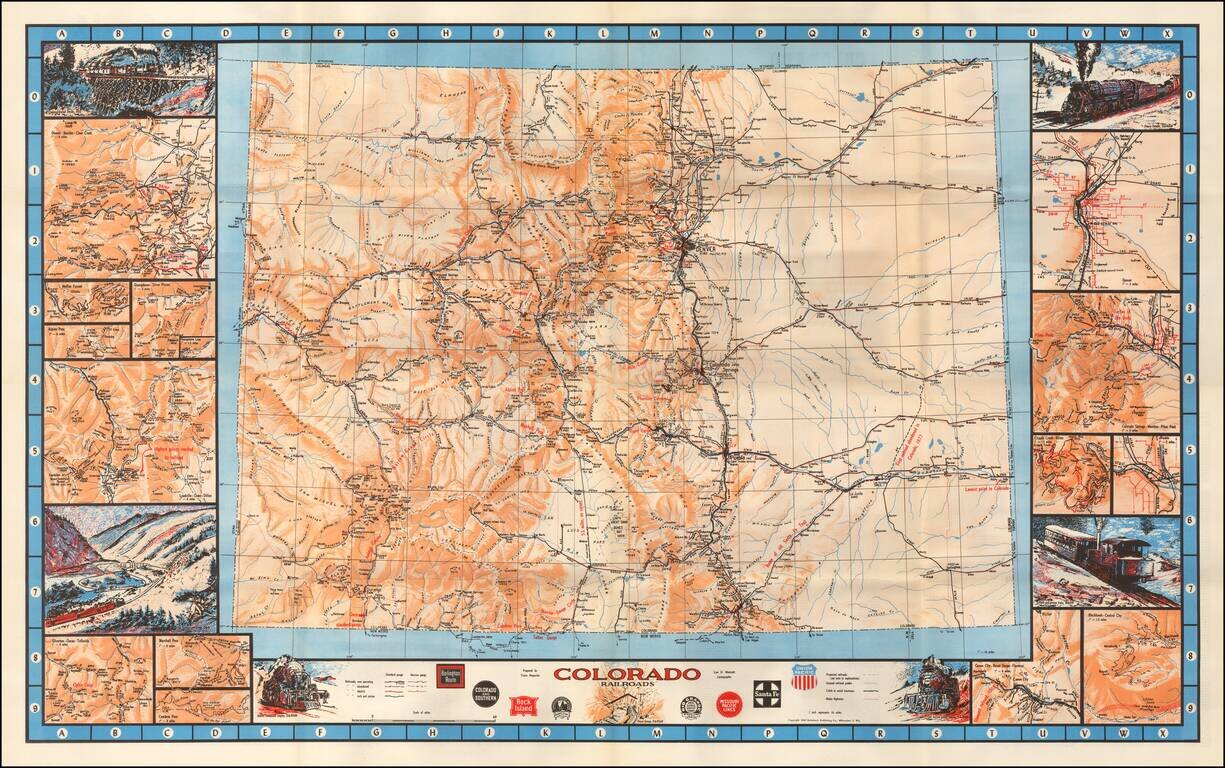
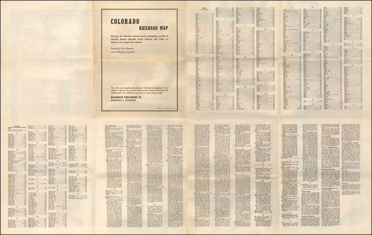
"The Most Complete Railroad Map of Colorado Ever Prepared"
Fine large format railroad map of Colorado, with decorative vignettes and details maps along the borders.
Inset maps include:
The railroads shown are coded as:
Narrow gauge and Standard gauge sizes are noted.
Vignettes shown in include images of Denver & Rio Grande Railway trains, including:
Other vignettes include
The logos of the primary Colorado Railroads are shown along the bottom.
If you are a student, write to us in telegram: @antiquemaps and indicate what material you need and for what work you need a map in high detail. We are ready to provide material on special terms. For students only!
![Mexique par Th. Duvotenay…1843 [Republic of Texas]](/map/small/67925.jpg)
