
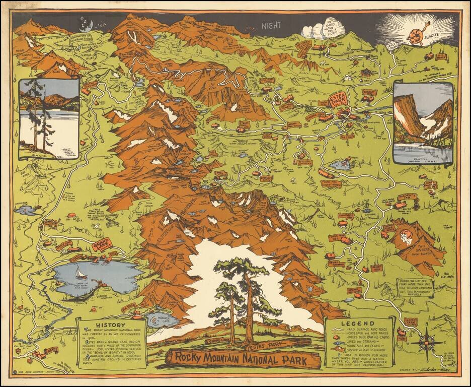
Striking Pictorial Map of Rock Mountain National Park, published by the Rocky Mountain Motor Company. In the foreground is Allens Park Village, Meeker Park, Granby and Reservoir. At the top of the map are the Headwaters of the Colorado River, Red...
![[Tracing Route Map of Colorado] Colorado -- Explore the West with Scenic Guides](/map/small/69878.jpg)
Scarce folding map of Colorado, published to promote Weldon F. Heald's Scenic Guide to Colorado. The map was issued to promote Healds' travel book, highlighting natural points of interest and other details and emphasizing the major routes through...
![[Southwest Colorado] Tourist & Sportsman Guide and Map to Southwestern Colorado](/map/small/66559.jpg)
The Vacation Land That's Really Different . . . Whimsical pictorial map of Southwestern Colorado, illustrating the regions the roads, passes, towns and major peaks. The map is surrounded with ads for local businesses, focused on the sportsman's...
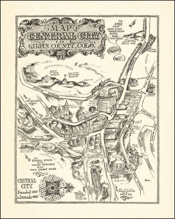
An Early Barbara Remington Illustration Attractive pictorial map of Central City, Colorado, drawn by Barbara Remington. The map is oriented with west at the top, showing the town spreading out along Eureka and Main Streets. Includes a decorative...
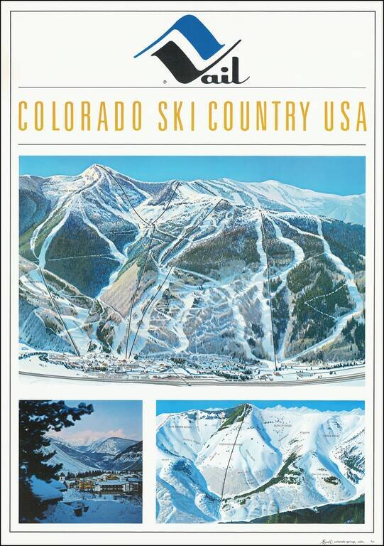
Fine early Hal Shelton Poster, promoting Vail, Colorado. Iconic promotional poster of Vail, published shortly after the addition of Gondola #2. The top image is a large traditional trail map, identifying ski lifts, trails, bowls, etc. with the...
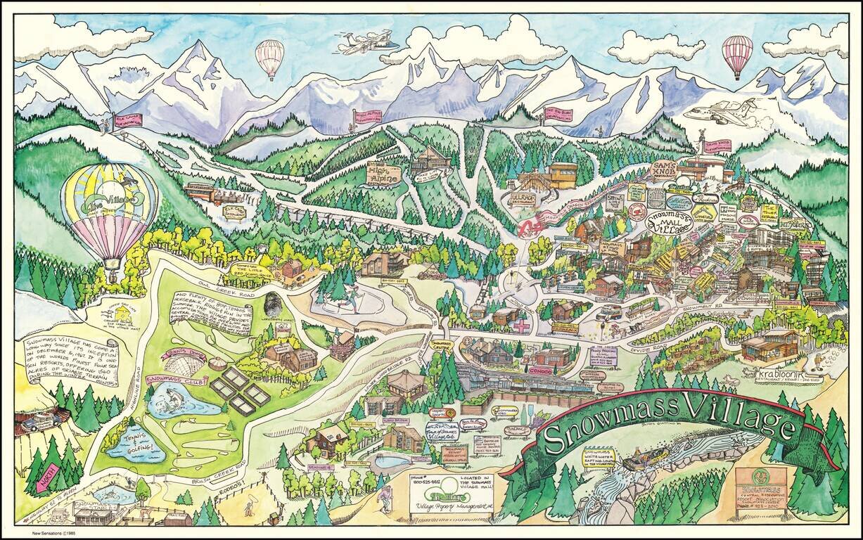
Decorative pictorial map of Snowmass Village, Colorado, drawn by artist James Giattino. The map promotes the recreational industries of Snowmass, both summer and winter. The ski mountain can be seen across the top, highlighting the four peaks...