
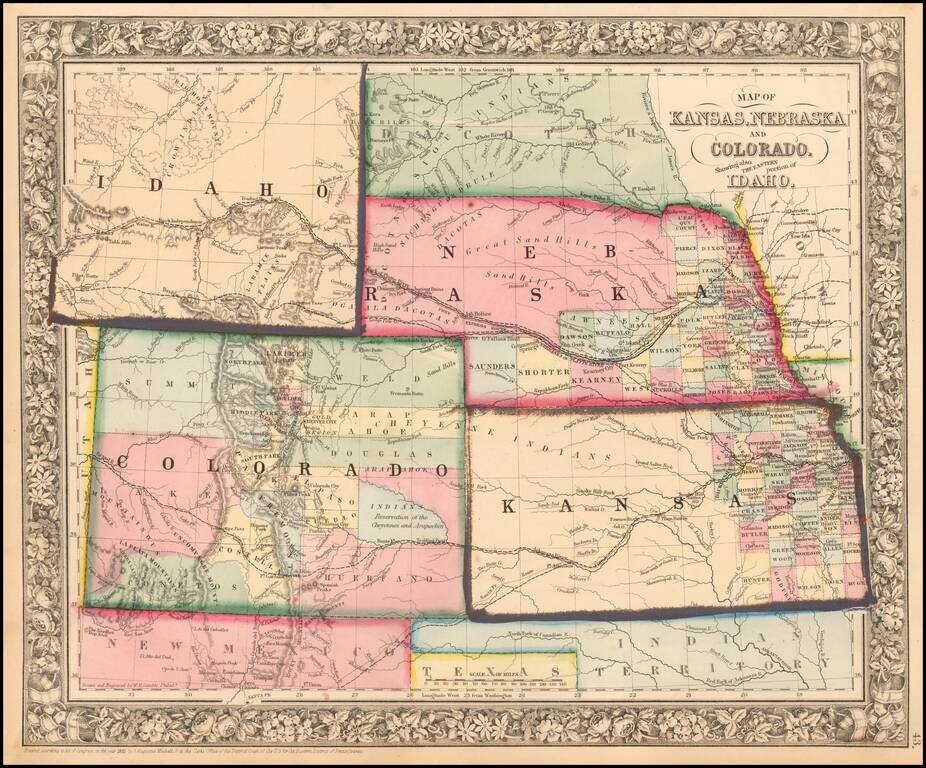
Excellent early map of the region, including an early appearance of Idaho Territory, one of the earliest appearances of this Territory (formed March 1863), on a printed map. Kansas counties cover only the eastern third of the state. Nebraska counties...
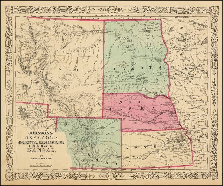
The Earliest Appearance of Idaho Territory--Including The Future Montana & Wyoming Territories Third in series of Johnson maps showing evolution of the mapping of these western territories. The most notable feature of the map is the massive...
![[Indian Territory [with Colorado on verso]](/map/small/69383.jpg)
Highly detailed map of Colorado [and Indian Territory on the back side], hand colored by counties and showing townships, towns, roads, mountains, rivers, lakes, mines, plateaus, railroads, etc. One of the most detailed maps of the period for each of...
![Colorado [with Indian Territory on verso]](/map/small/71186.jpg)
Highly detailed map of Colorado [and Indian Territory on the back side], hand colored by counties and showing townships, towns, roads, mountains, rivers, lakes, mines, plateaus, railroads, etc. One of the most detailed maps of the period for each of...
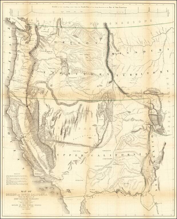
Nice example of Fremont's map of the region west of the Rocky Mountains, widely regarded as the most important and influential map the American West published in the middle of the 19th Century. This example includes the text of the Geographical Memoir...
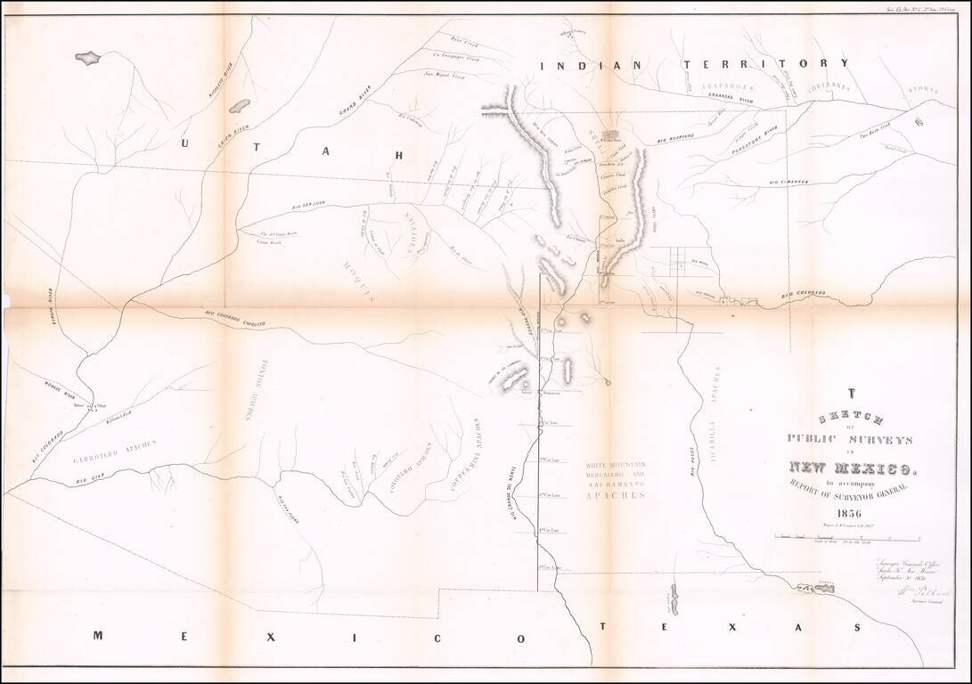
Interesting early map of New Mexico and Arizona, published by the General Land Office. The map extends from the confluence of the Colorado and Gila Rivers to Nicollet River in the northwest, the Rio Pecos in the southwest and Bent's Fort, the...
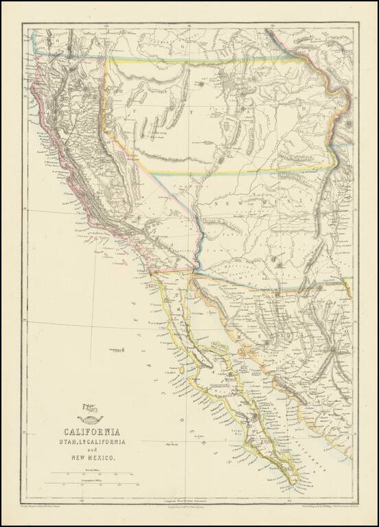
Nice example of the Ettling / Weekly Dispatch map of California and the Southwest, one of first atlas maps published in Europe to focus on the Territories of Utah and New Mexico. The map includes an excellent post Gadsden Purchase treatment of...
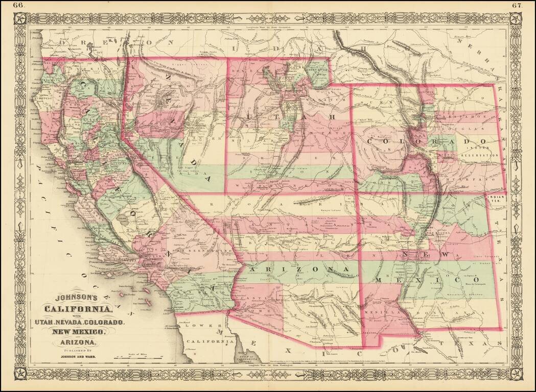
Interesting map of the southwest, hand colored by counties and showing a number of interesting territorial anomalies. Nevada has its lower corner truncated, leaving Las Vegas in Arizona. In each of the states and territories, the county configurations...
A cornerstone map, exceptionally detailed and showing many routes and places of interest in the settlement of the American West. This map was published several times from the mid-1850s through the 1870s. This map shows Fremont's 1844 and 1845 routes,...
Detailed map of California and the Southwest, colored by Counties.
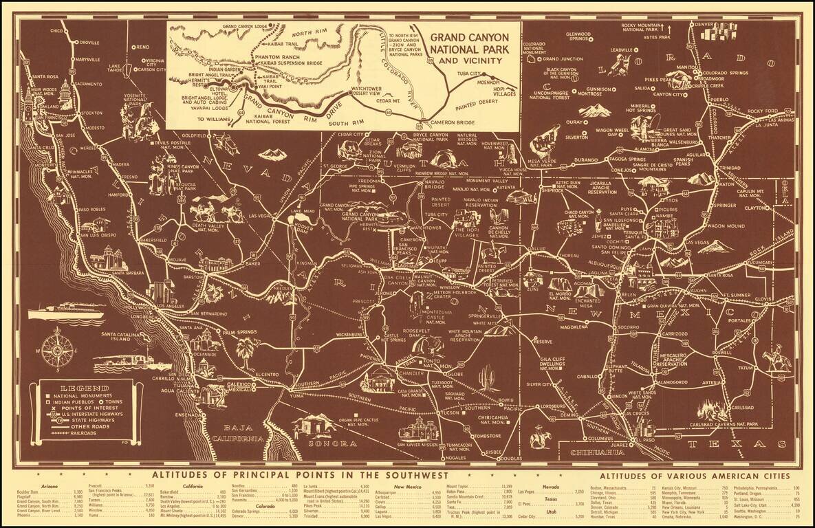
Scarce pictorial map of the American Southwest, published by Fred Harvey. The map provides a detailed pictorial image of the American Southwest, with an inset of the Grand Canyon. The verso includes a table of Indian Signs and Symbols, along with...
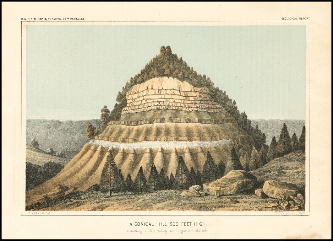
Detailed view of the Valley of the Kah Wee Yah River (Tulare River) and the Kings River. The expedition surveying the southern route along the 35th parallel, led by Lieutenant Amiel Weeks Whipple, explored from Little Rock, Arkansas, through Oklahoma,...
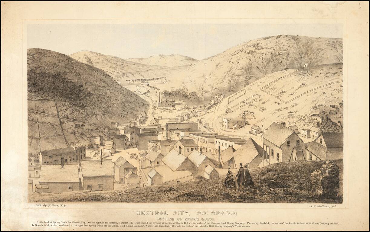
Nice example of this important early birdseye view of Central City, Colorado, from Alfred Edward Mathews Pencil Sketches of Colorado, published in 1866. The map shows Central City during its early boom period, looking toward Missouri City and Quartz...
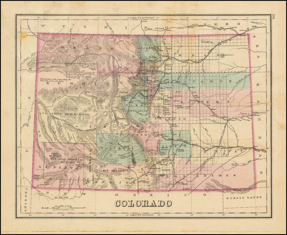
Interesting early map of Colorado, colored by counties. Shows towns, rivers, lakes, roads, mountains, and other details. In Southwestern Colorado, there is still no evidence of the coming mining boom which would be centered in areas such as...
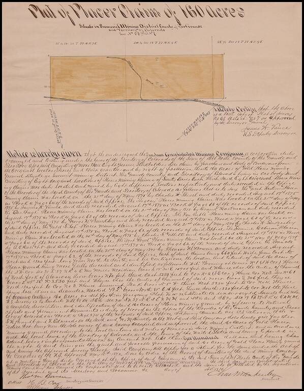
Fascinating manuscript survey issued by the San Juan Consolidated Mining Company, showing a plat of 160 acres north of the North Fork of the Alamosa River in Rio Grande County, Colorado Territory, signed by Thomas Meade Bowen, H.B. Cox and William...
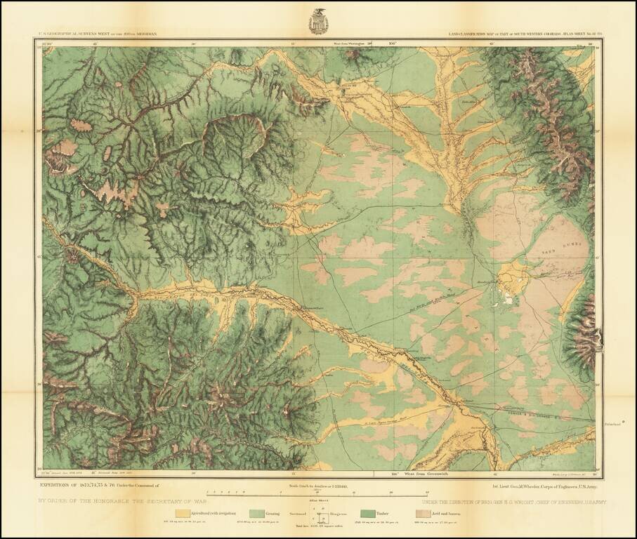
Detailed topographical map showing the region centered on Saguache County, Colorado. Shows towns, roads, mountains, rivers, lakes, hydrographical details, etc. The map was generated during the Wheeler Survey. The Wheeler Survey was a survey of a...