Map size in jpg-format: 96.4206MiB
Click to open in high resolution (open in new tab).
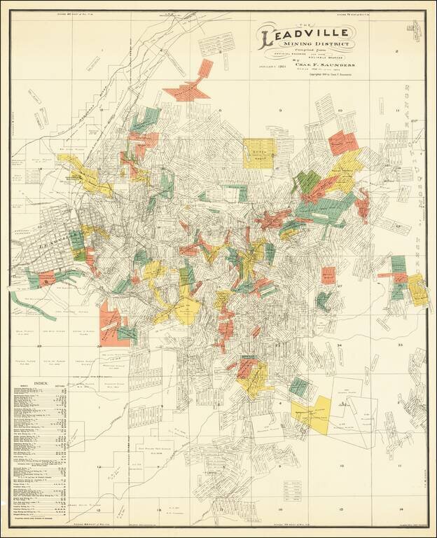
Scarce locally published map of the Leadville Mining District, compiled by Charles F. Saunders and printed by the Denver Litho Co.
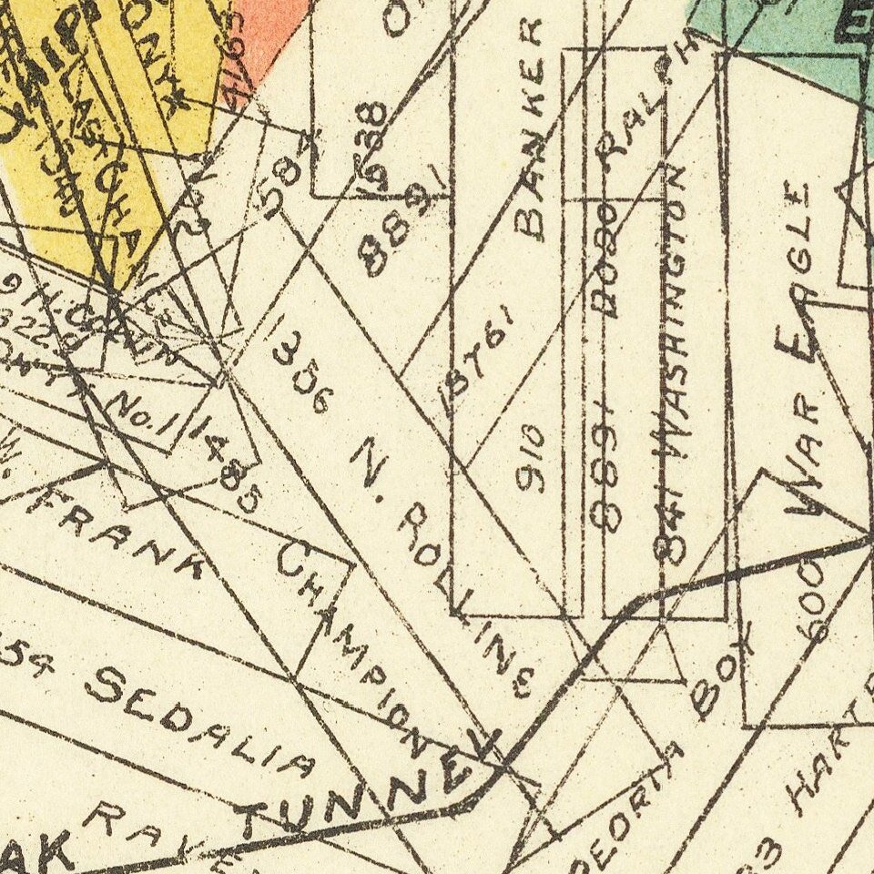
The map is filled with a vast dense array of mineral claims, perhaps more than one thousand in all, each named and numbered. T
There is an index of mining company holdings at lower left. Shows an area of 56 square miles bounded by the Arkansas River to the north, the crest of the Mosquito Range to the east, Leadville to the west, and Little Union Gulch to the south.
Leadville
The story of Leadville is as varied as the search for gold and silver. It began as a placer gold camp in the 1860's, with the discovery of gold in California Gulch. A small mining camp sprung up, called Oro City, which nearly died within a decade.
In 1874, with H. A.W. Tabor running the only general store, geologist Alvin Wood and William Stevens bought out the local ditch company and ran the placer mines by themselves. They quickly noticed that the black sands in the bottom of the sluice were a bit unusual and of a different character, so they assayed the black sand and found it contained 40 ounces of silver per ton. They traced the sand to outcrop and began mining, and with that, came the first Leadville Silver rush in 1877. Oro City was about to become Leadville. Within a year, with the rush underway, the world began to learn about the rich silver deposits at Leadville. By 1879, the US Geological Survey was created, and under the guidance of Clarence King, skilled geologists were sent to the most important mining regions of the Country to begin a detailed geologic study that the Government hoped would lead to the discovery of ore deposits. Frank Emmons, a Harvard graduate, was put in charge of the Rocky Mountain Region. Emmons had worked with King and Arnold Hague on the Fortieth Parallel survey. In 1879 he proceeded to begin the study of Leadville, one of about a dozen spots chosen for the first work by the USGS.
Leadville is composed of at least six different mining districts historically, including: California [Gulch], Oro, Iowa Gulch, Carbonate Hill, Fryer Hill, Breece (Breeze), and Battle Mountain (not to be confused with Battle Mountain of Cripple Creek.)
Emmons completed the Geologic work at Leadville by 1881, though the Administration withheld publication for another 5 years. His work led to the rapid development of the ores and production of hundreds of millions of ounces of silver bullion.
If you are a student, write to us in telegram: @antiquemaps and indicate what material you need and for what work you need a map in high detail. We are ready to provide material on special terms. For students only!
![Mexique par Th. Duvotenay…1843 [Republic of Texas]](/map/small/67925.jpg)
