
Map size in jpg-format: 45.1701MiB
Click to open in high resolution (open in new tab).
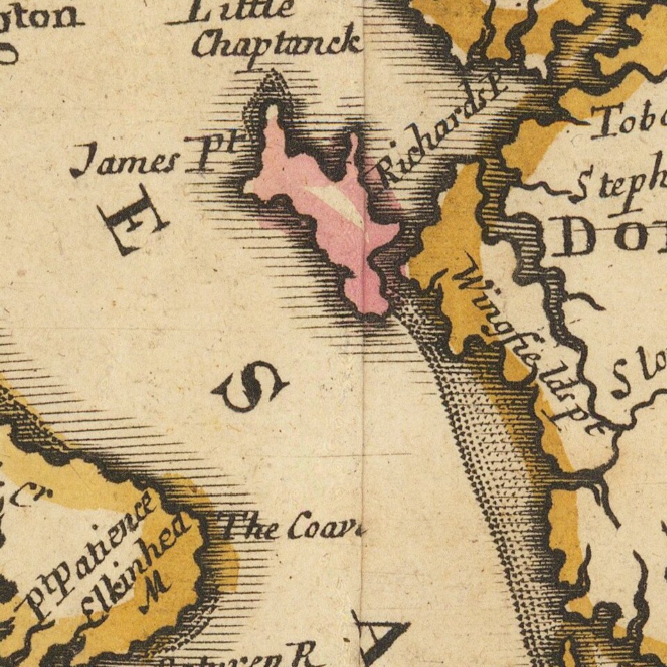
John Senex's edition of the Augustine Hermann Map of the Chesapeake.
An antique map of the Chesapeake Bay from John Senex's edition of Christopher Browne's seminal map. Includes the Delaware Bay, Maryland and parts of Pennsylvania and New Jersey, this map was first issued in 1685.
Browne's map is the last major derivative of the Augustine Hermann Map of 1673, reoriented with north at the top and reduced to a single folio sheet. Philadelphia appears on the map. The Northern and Eastern boundaries of Maryland are shown. The boundary for Delaware (then part of Pennsylvania) is shown favoring the claims of Lord Baltimore, rather than the Cape Henlopen boundary, which was finally ratified by the British Courts when the dispute was settled in the 1730's and finally mapped by Mason & Dixon several decades later.
New Jersey is divided into East and West Jersey. While the two provinces had been amalgamated in 1702, the resulting land disputes were not completely settled until the adoption of the Lawrence Survey in 1855 by the New Jersey Supreme Court. The shoals and soundings are drawn directly from the Hermann map. The cartouche depicts tobacco and shellfish, two of the significant products of the region during colonial times. This edition is the only edition to include longitudinal lines at the top and bottom of the map.
An essential map for Chesapeake Collectors.
If you are a student, write to us in telegram: @antiquemaps and indicate what material you need and for what work you need a map in high detail. We are ready to provide material on special terms. For students only!
![[Wall Map] West-Indische Paskaert waer in de graden der breedde over weder zyden vande middelyn wassende so vergrooten dat die geproportioneert syn tegen hunne nevenstaende graden de lengde.](/map/small/60169.jpg)

![[The First Maps in a la poupée Printed Color] Cartes en Couleur des Lieux Sujets aux tremblements de Terre Dans toutes les parties du Monde Selon le Sisteme de l’impulsion Solaire](/map/small/52293op.jpg)