
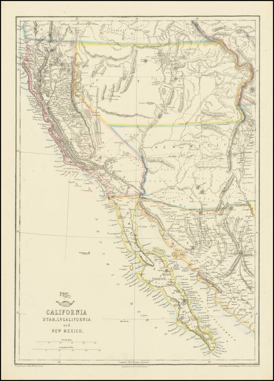
Nice example of the Ettling / Weekly Dispatch map of California and the Southwest, one of first atlas maps published in Europe to focus on the Territories of Utah and New Mexico. The map includes an excellent post Gadsden Purchase treatment of...
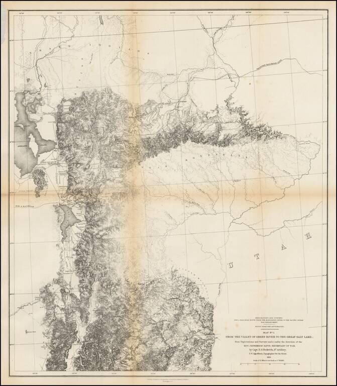
Finely detailed map of the area from Brown's Hole east of today's Vernal to the Great Salt Lake and south to below Fillmore. The map locates the Emigrant Road to California. Several Proposed Railroad lines are shown. One crosses the Green River near...
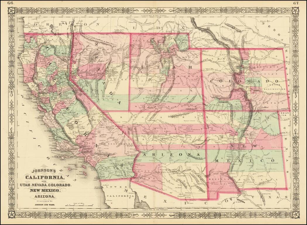
Interesting map of the southwest, hand colored by counties and showing a number of interesting territorial anomalies. Nevada has its lower corner truncated, leaving Las Vegas in Arizona. In each of the states and territories, the county configurations...
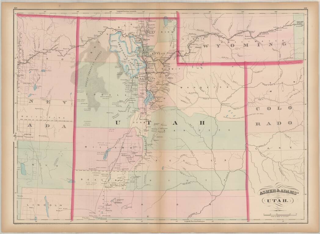
One of the earliest obtainable maps of Utah Territory. Asher & Adams map of Utah is among the earliest map of Utah Territory in its modern configuration to appear in a commercial atlas. The focus of the map is the railroad and related detail...

Rare 1876 edition of Bancroft's map of California & the Southwest. The map is hand colored by counties and shows tremendous detail, one of the best maps of the Western United States published West of the Mississippi during the period. Early roads,...
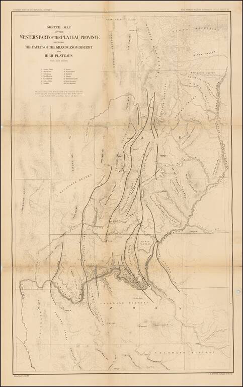
Finely detailed map of parts of Arizona and Utah, which appeared in the United States Geological Survey's At las To Accompany The Monograph On The Tertiary History Of The Grand Canon District By Capt. Clarence E. Dutton. The map provides a finely...
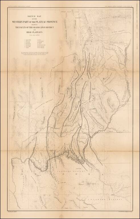
Finely detailed map of parts of Arizona and Utah, which appeared in the United States Geological Survey's At las To Accompany The Monograph On The Tertiary History Of The Grand Canon District By Capt. Clarence E. Dutton. The map provides a finely...

The Second Issue of Fremont's Map of the West--Issued Following the Discovery of Gold in California Nice example of Fremont's seminal map of the West, which focuses on California, Arizona, Utah and Nevada. Wheat dedicates 13 pages and 2...
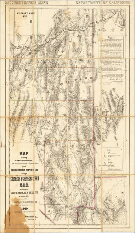
A Nevada & Grand Canyon Rarity -- The Foundation Map for Southern Nevada A remarkable map of the Eastern Half of Nevada, including Las Vegas, the Grand Canyon, Great Salt Lake and Sevier Lake (then called Preuss Lake), being the first scientific...
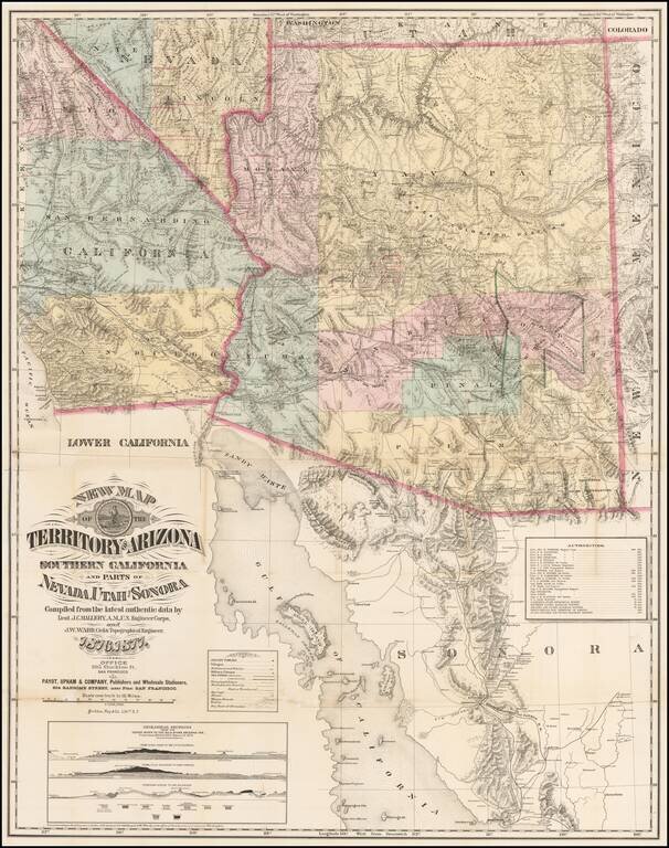
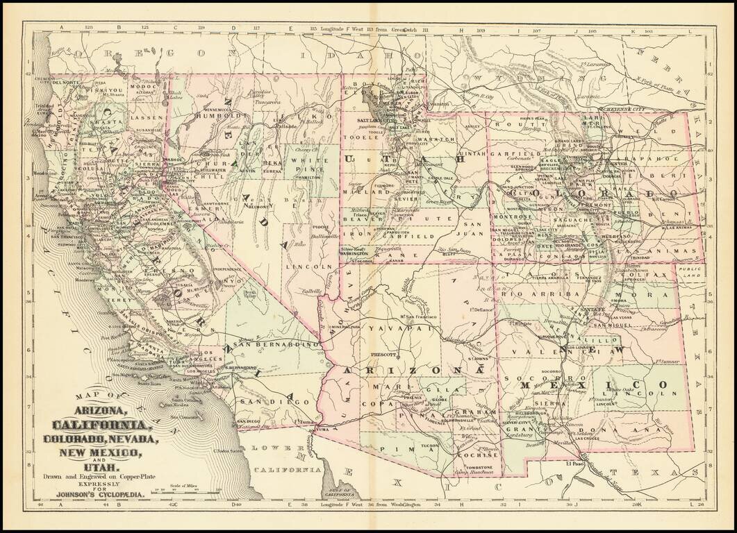
The Finest Large Format Map of Arizona, Southern California and Southern Nevada from the 1870s. Large and striking map centered on Arizona with pieces of the adjacent states and territories, at a time when Arizona was undergoing a mineral boom, and...
Detailed map of California and the Southwest, colored by Counties.
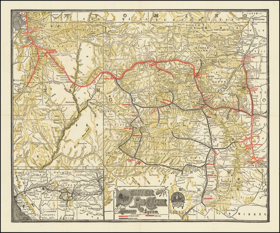
Detailed railroad map of Colorado and part of Utah. Promotional map for the Denver & Rio Grande Railroad. The border of Grand and Unitah Counties suggests a date of 1889 to 1890. The map was produced in numerous editions over the decades.
![Guide To the Blazed Trails of Montana and Wyoming . . . [Montana, Wyoming, NW Colorado, Eastern Idaho, Northern Utah, NE Nevada] Rand McNally Offical 1923 Auto Trails Map [Yellowstone National Park and Glacier National Park on verso]](/map/small/66099.jpg)
Early Automobile Road Map Detailed map of [Montana, Wyoming, NW Colorado, Eastern Idaho, Northern Utah, NE Nevada, published by the Automobile Club and prepared fkr Kilmer & Sons of Spokane, Washington, The map is scarce -- this is the first...
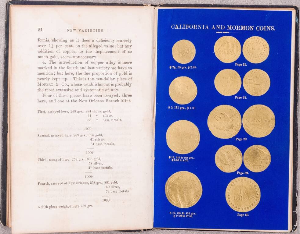
One of the Great American Numismatic Books of All Time, with Special Relevance for the California Gold Rush and Mormon Coins. Superb book on gold and coinage, by the official assayers of the Philadelphia Mint, Jacob R. Eckfeldt and William E. Du Bois....
![[Mormon State of Deseret] Nord America mit Westindien](/map/small/69513.jpg)
Detailed map of North America, published in Weimar in 1852. The map identifies the newly formed Territories of the western United States. Most notable is the location of the massive Utah oder Deseret Terr. (Utah or Deseret Territory). To the south,...
![Map of the Great Salt Lake and Adjacent Country in the Territory of Utah [with] The Great Salt Lake (Mormon) City And Surrounding Country](/map/small/67084.jpg)
The Earliest Atlas Map To Focus on The Salt Lake City Region and Mormon Settlements Two excellent early regional maps of the Salt Lake area. The upper map extends a bit west of the Lake to the Uintas and South to Lake Utah, as well as considerably...