
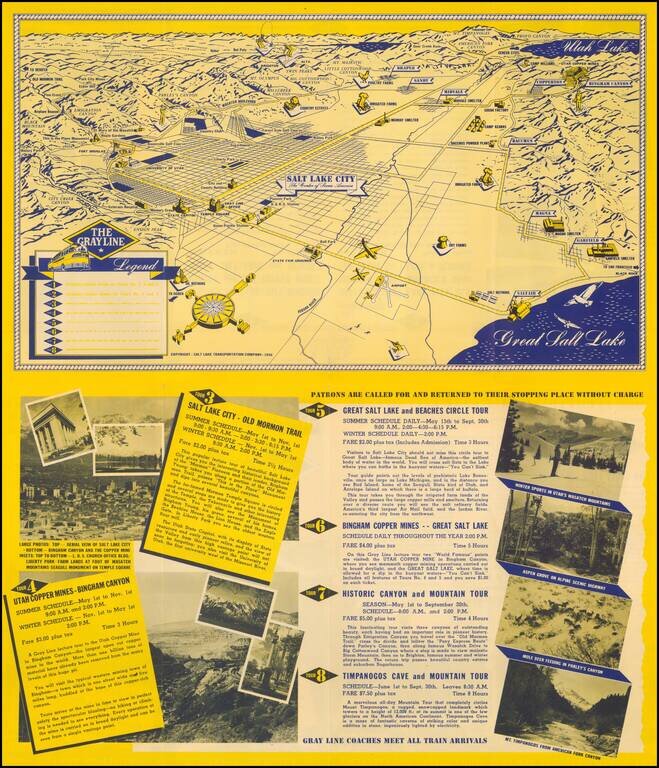
Fine promotional view map of Salt Lake, published for The Grayline. The Legend identifies 8 different tourism lines within the city.
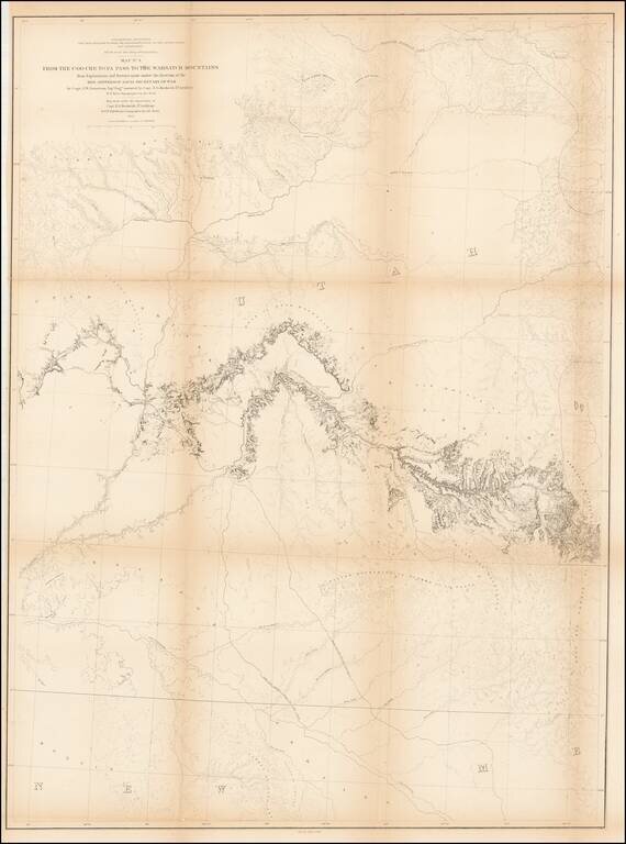
Detailed map extending from Bridger's Pass in the north to New Mexico, centered on the Sawatch and Wasatch Mountains. Shows proposed railroad line through Bridger Pass in Northeast Utah Territory, including parts of present day Colorado and Wyoming...
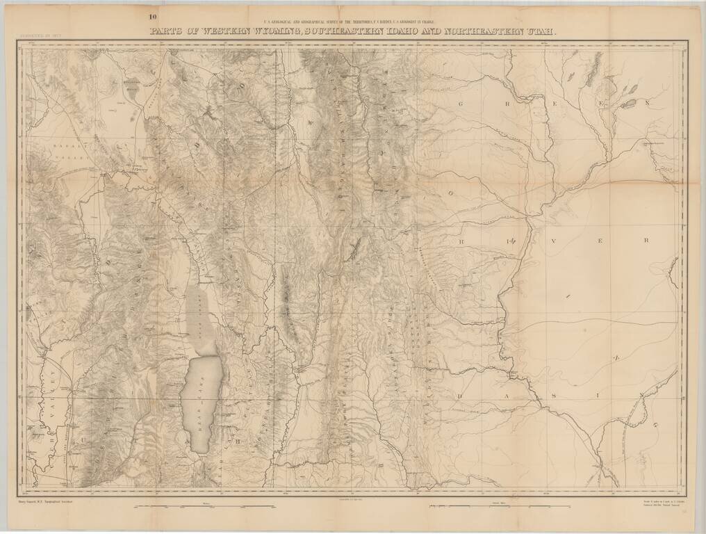
Fine large format map of the region just south of Yellowstone National Park, as surveyed in 1877 by the Hayden Survey. The map extends from Logan, Utah and the Black Foot Marsh (now Reservoir) in the West, to Fremont Lake Wyoming, and the confluence...