logo

1887. Map of Kansas City, Missouri and Vicinity. Compiled from Official Records and Actual Surveys.

  • Map of Kansas City, Missouri and Vicinity.  Compiled from Official Records and Actual Surveys.

Map of Kansas City, Missouri and Vicinity. Compiled from Official Records and Actual Surveys. information:

Year of creation: 
Resolution size (pixels): 
 17294x12698 px
Disk Size: 
 56.2707MiB
Number of pages: 
 1
Place: 
 Philadelphia
Author: 

Print information. Print size (Width x height in inches):
Printing at 72 dpi 
  240.19 х 176.36
Printing at 150 dpi 
 115.29 х 84.65
Printing at 300 dpi 
 57.65 х 42.33

An example of detailing the file of this map of in a printable high-resolution:

Click to open in high resolution (open in new tab).
Attention! this is just the central piece (central area 960x960 px) of the map file!
This is an example, so that you can see and study the level of detail of a given map. The entire Map will be fully available after payment!

Map of Kansas City, Missouri and Vicinity.  Compiled from Official Records and Actual Surveys.

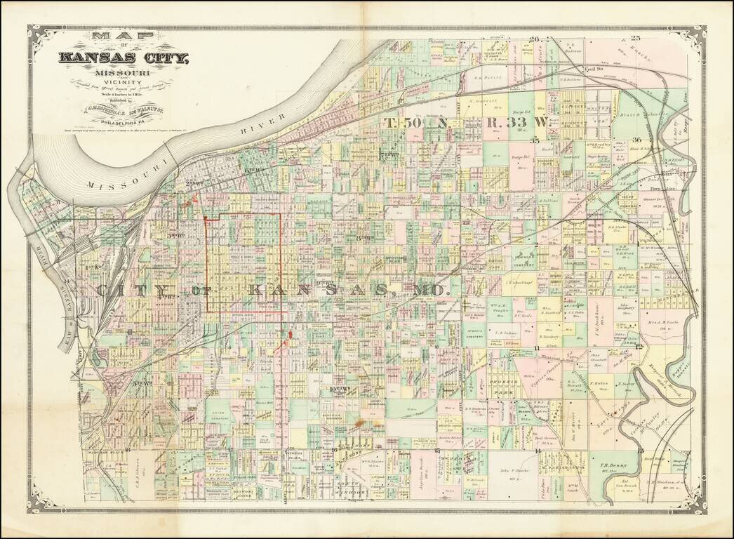
Scarce early map of Kansas City and environs, published by G.M. Hopkins of Philadelphia and promoting Geo. F. Winter & Co.

The map shows the area around Kansas City in fine detail ad includes the names of many larger land owners.


Special conditions for students!

If you are a student, write to us in telegram: @antiquemaps and indicate what material you need and for what work you need a map in high detail. We are ready to provide material on special terms. For students only!

Item information:

Year of creation:
Size:
17294x12698 px
Disk:
56.2707MiB
Number of pages:
1
Place:
Philadelphia
Author:
G.M. Hopkins.
$14.99

Related item