Map size in jpg-format: 1.89131MiB
Click to open in high resolution (open in new tab).
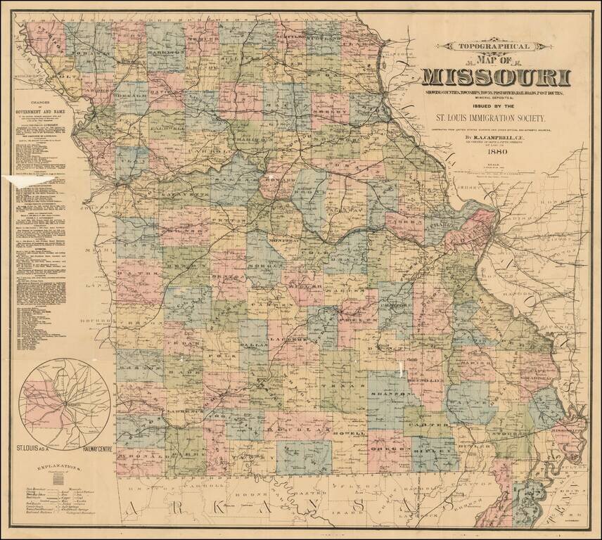
Rare separately published map of Missouri, published by the St. Louis Immigration Society.
Inset map shows small map of Missouri, Illinois and nearby states, including the St. Louis railroad lines converging in St. Louis.
The statistical table shows changes of government and name of the territory formerly associated with, and now comprising the State of Missouri, and a list of the Chief Executives.
We locate only a single institutional copy at the St. Louis Public Library.
If you are a student, write to us in telegram: @antiquemaps and indicate what material you need and for what work you need a map in high detail. We are ready to provide material on special terms. For students only!
![[Missouri named Jefferson] Etats-Unis par A.M. Perrot](/map/small/69488.jpg)
![[The Mississippi-Missouri: A Geographical Blunder -- An Illustrated Argument For Renaming The Lower Mississippi River Put Forth By A Prominent American Educator To The Author of a Best Selling American School Geography]](/map/small/56241.jpg)