Map size in jpg-format: 51.1109MiB
Click to open in high resolution (open in new tab).

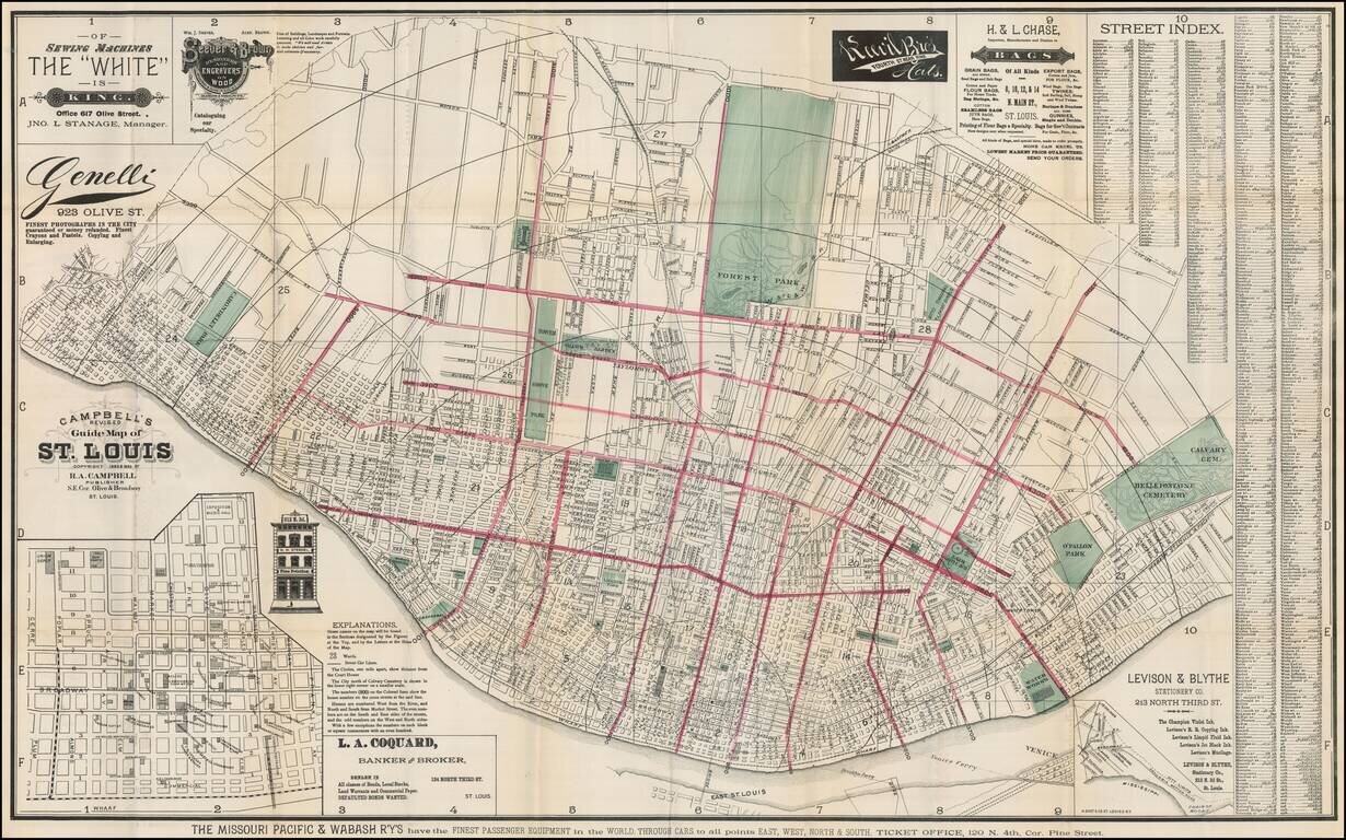
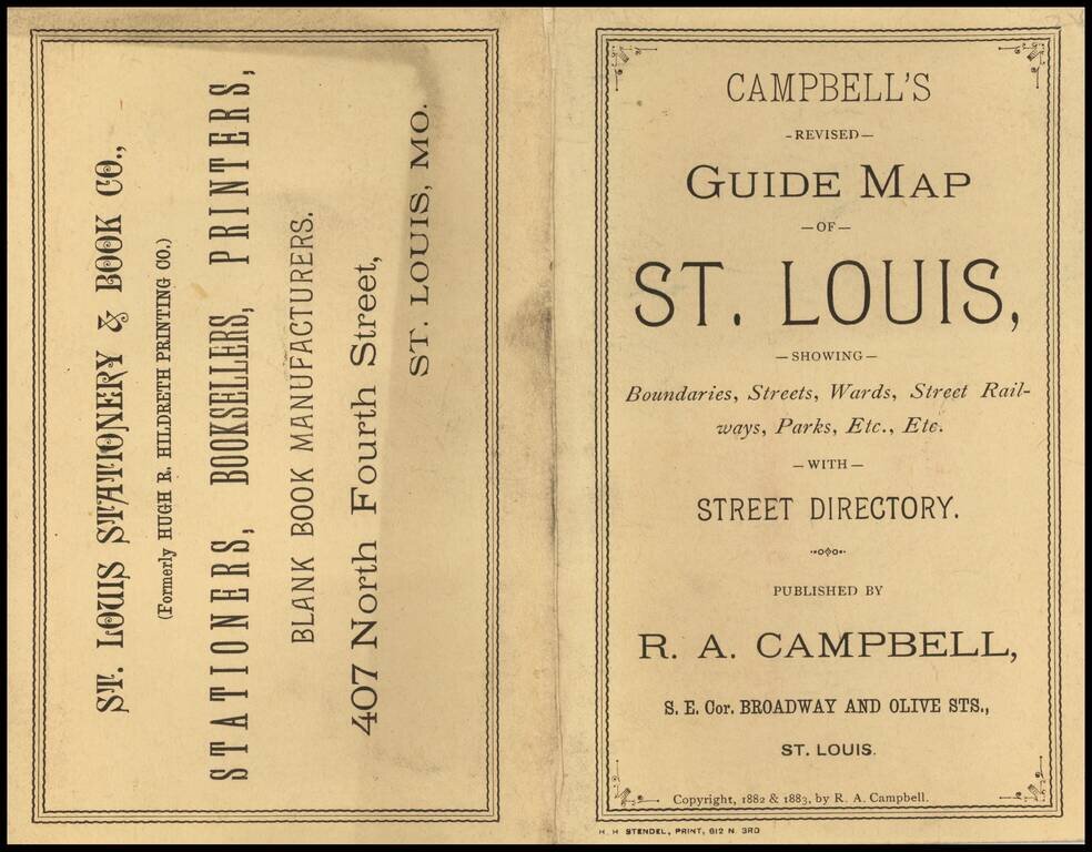
Scarce map of St. Louis, published by R. A. Campbell.
Includes significant local advertising.
Outline color highlighting each ward with parks in green. Street index included on map which folds into a 16x10 cardboard cover entitled "Campbell's Revised Guide-Map Of St. Louis Showing Boundaries, Streets, Wards, Street Railways, Parks, Etc., Etc. With Street Directory. Published For Planter's House, News and Cigar Stand. St. Louis. Copyright, 1882 & 1883, By R. A. Campbell."
Second edition, after the first edition of 1882.
If you are a student, write to us in telegram: @antiquemaps and indicate what material you need and for what work you need a map in high detail. We are ready to provide material on special terms. For students only!
![[Missouri named Jefferson] Etats-Unis par A.M. Perrot](/map/small/69488.jpg)
![[The Mississippi-Missouri: A Geographical Blunder -- An Illustrated Argument For Renaming The Lower Mississippi River Put Forth By A Prominent American Educator To The Author of a Best Selling American School Geography]](/map/small/56241.jpg)