
Rare old maps of the United States.
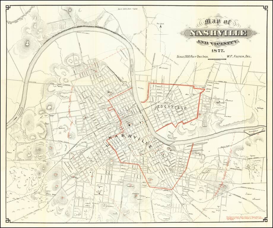
Showing Flooding Region of the Cumberland River Scarce early map of Nashville, with redlines illustrating the High Water Mark of the Cumberland River -- 57 feet above the low water mark. A highly detailed map of Nashville, showing streets, public...
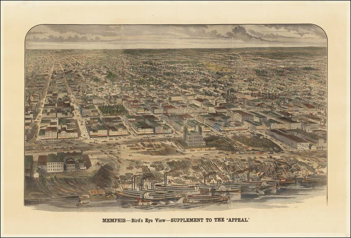
An Early Memphis Birdseye View Published in Memphis Rare view of Memphis, Tennessee, published as a supplement to the Memphis Appeal, October 15, 1887. The map shows an up-close view of the paddlewheeler's on the river, with a bustling waterfront...
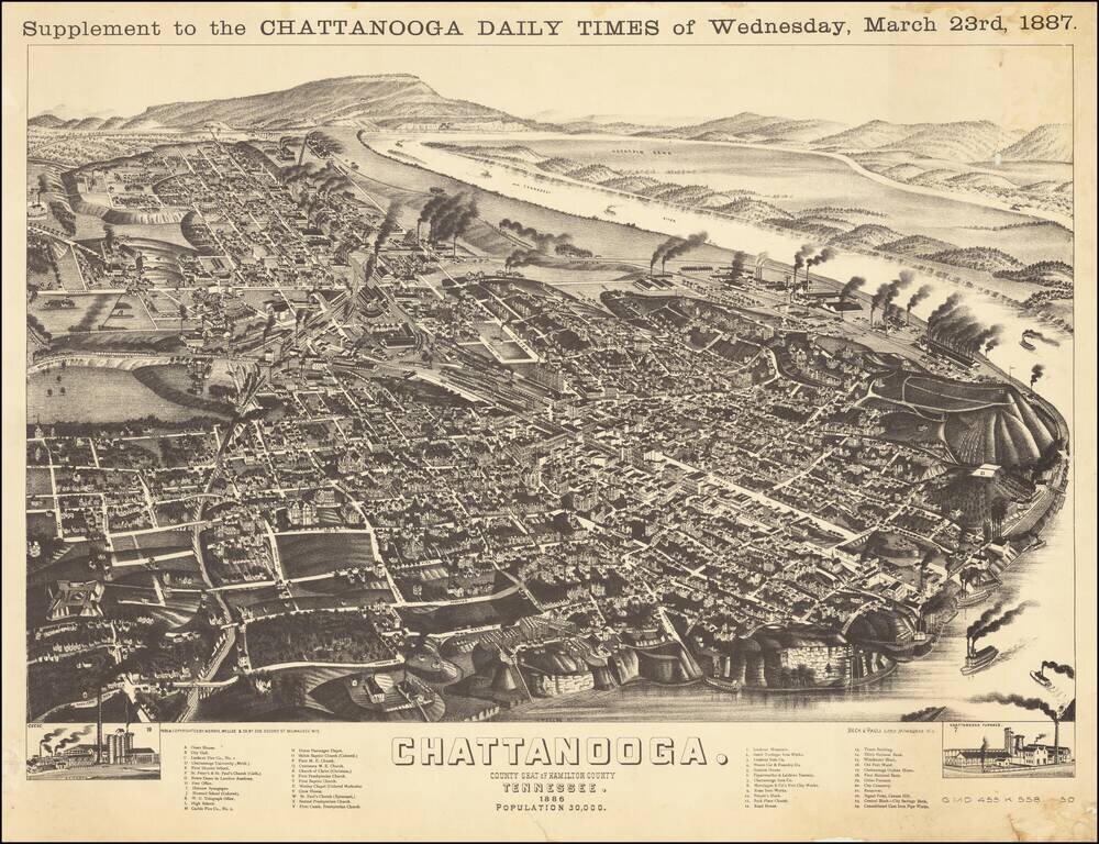
Wellge's bird's-eye-view provides a fine large view of City of Chattanooga, with significant buildings, streets, rivers, rail roads, and other geographical points of interest labeled. States of the View This is a later state of the view, which was...

Decorative and unusual trading card map from this famous series. Map is surrounded by decorative vignettes.
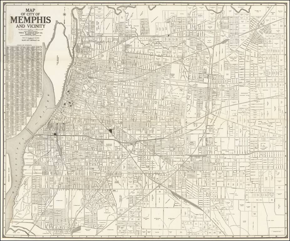
Marvelous separately published map of the City of Memphis, published by the Theo W. Ohman Map Company of Memphis, Tennessee. The map lays out the city proper, with a detailed street index. Downtown, near the water, a number of public and private...
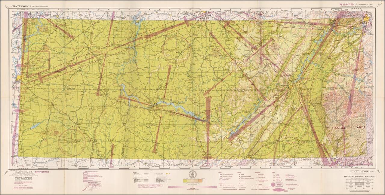
Restricted World War II Aviation Map Detailed aeronautical map of the Chattanooga, Tennessee area. The chart is a font of information about civil and military aviation during WWII. It was intended for civil aviators flying by visual navigation and...
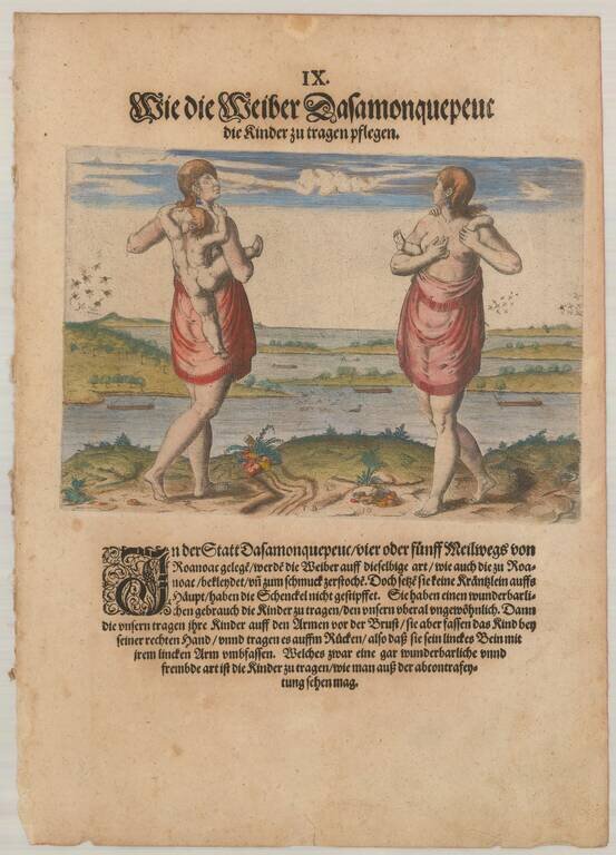
Virginia Indians: Woman with Child Fine copper plate engraving showing Theodore De Bry's version of John White's painting. Theodor de Bry's engraving shows a native American woman of Dasamonguepeuc carrying a child. In 1585, Governor John White,...
Early Seventeenth Century Map of Carolina and Virginia Fine old color example of Jodocus Hondius's important map of Virginia and the Carolinas, from the Mercator-Hondius A tlas Sive Cosmographie . . . Hondius utilized John White's map of Virginia and...
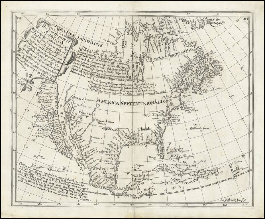
The Most Important Map of North America Published in England in the Seventeenth Century Fine example of Henry Briggs’ famous map of North America, one of the most important and influential printed maps of the seventeenth century. It was included in...
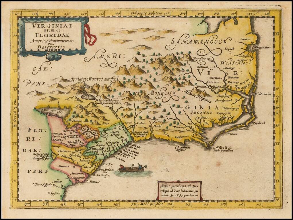
Rare second state of Cloppenberg's map of the Carolinas and parts of Virginia and Georgia, first issued in the Cloppenburg edition of Jansson's Atlas sive Cosmographie in 1630. The map extends from St. Augustine in the south to just north of...
Nice example of Jansson's map of the Southeast. Jansson's map of the Carolinas and Blaeu's map of the Carolinas are virtually indistinguishable cartographically, although there are a number of minor differences in the embellishments. Both maps are on...
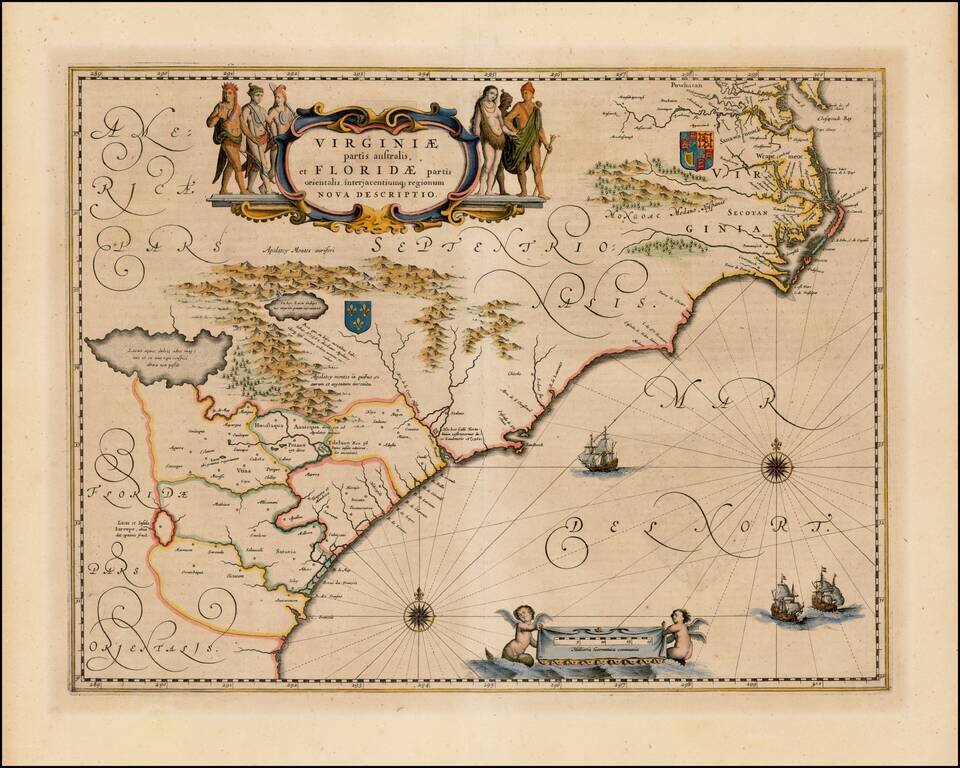
![[Carolinas, Georgia, etc] Virginiae Partis australis, et Floridae partis orientalis, interjacentiumqus regionum Nova Descriptio](/map/small/51779.jpg)
The Second Earliest Dutch Map of the Carolinas, Southern Virginia & Georgia. Fine old color example of Blaeu's map of the Southeast. This map is based on the 1606 Mercator-Hondius map, but with significant improvements. The map covers an area...
![[Port Royal, South Carolina]](/map/small/65162.jpg)
Finely engraved view, based upon original watercolor painting by Jacques Le Moynes de Morgues, an official French artist, who accompanied two important French Expeditions to North America in the 1560s. The image shows the French landing at Port Royal,...
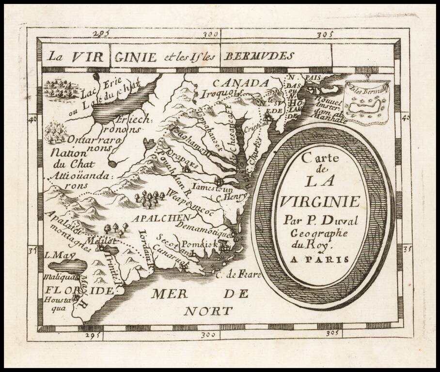
Early regional map from Duval's Le Monde Terrestre, first published in 1659, although no copy located pre-dates 1660. Includes an early depiction of the Chesapeake region, the mythical Lake May above Floride, Jamestown, Cape Henry, Secot, Pomeiok, an...
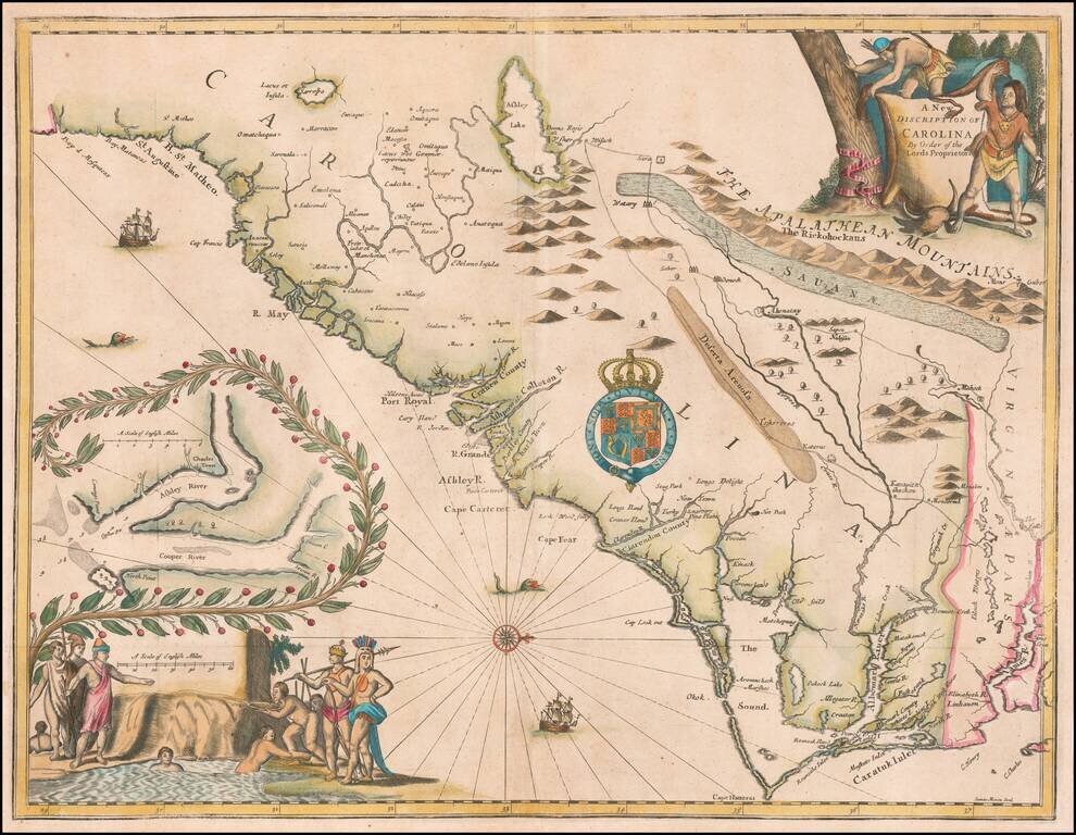
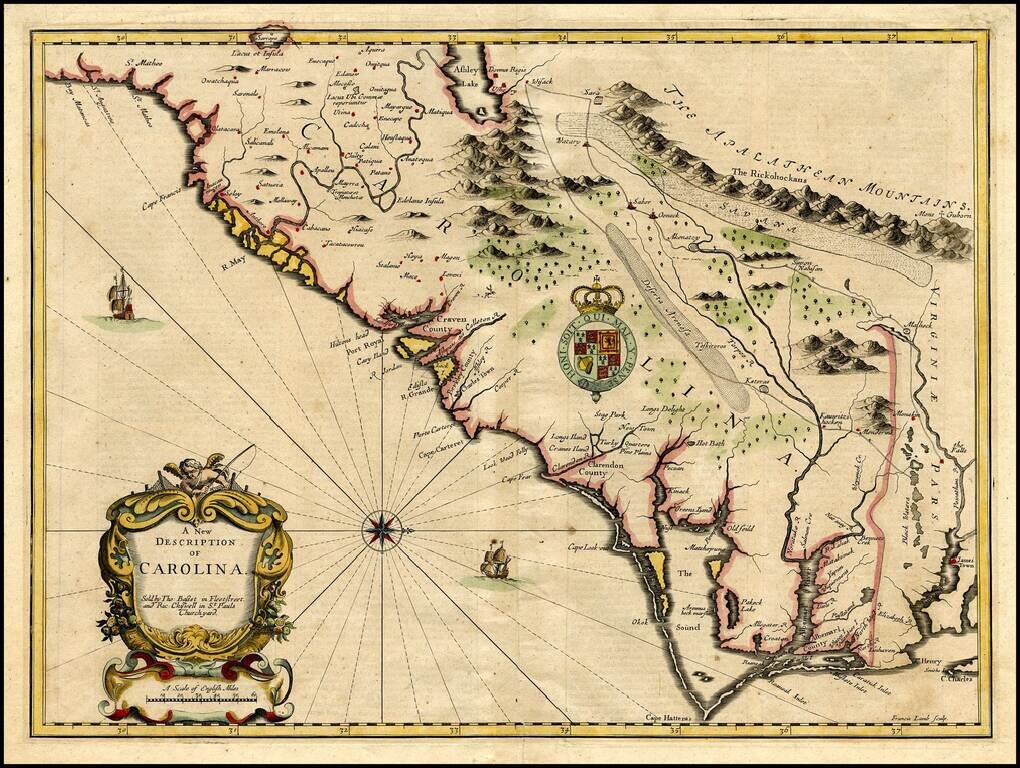
Rare and important early promotional map of the Carolinas, from the coast of the Appalachians, prepared by James Moxon to promote the newly established Carolina Colony. This map is the first large format map of the newly settled Carolina Colony,...
Important early map of the Carolinas, engraved by Francis Lamb for the 1676 edition of Speeds A Prospect . . . of the World. The map is Speed's edition of the famous Lords Proprietors' Map of Carolina, based upon Charles II's grant to 8 of his...