Map size in jpg-format: 17.1377MiB
Click to open in high resolution (open in new tab).
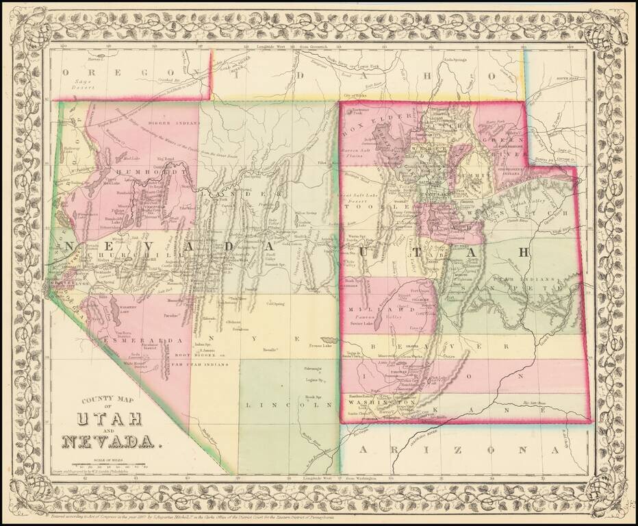
Detailed map of Nevada and Utah, colored by counties and showing towns, mountains, rivers, railroad lines, Indian Tribes, mining districts, etc.
The first map of the region to appear in a commercial atlas.
Decorative floral border.
Samuel Augustus Mitchell Jr. inherited the Mitchell Company from his father in 1860. For over thirty years, the company had specialized in the production of school atlases and wall maps of America. They were one of the pioneers on engraving on steel plates. In 1860, Samuel Jr. released the New General Atlas, which had been compiled in house and replaced a previous atlas by Tanner. The elder Mitchell died in 1868 and Samuel Jr. continued the business until the 1890s. At its height, the Mitchell Company employed 250 people and sold 400,000 publications annually.
If you are a student, write to us in telegram: @antiquemaps and indicate what material you need and for what work you need a map in high detail. We are ready to provide material on special terms. For students only!

![[Mormon State of Desert] Die Vereinigten Staaten von Nord America nebst Canada . . . 1852](/map/small/69483.jpg)
![Mexique par Th. Duvotenay…1843 [Republic of Texas]](/map/small/67925.jpg)