
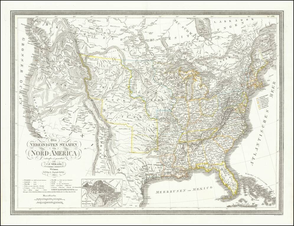
Rare old maps of the United States.
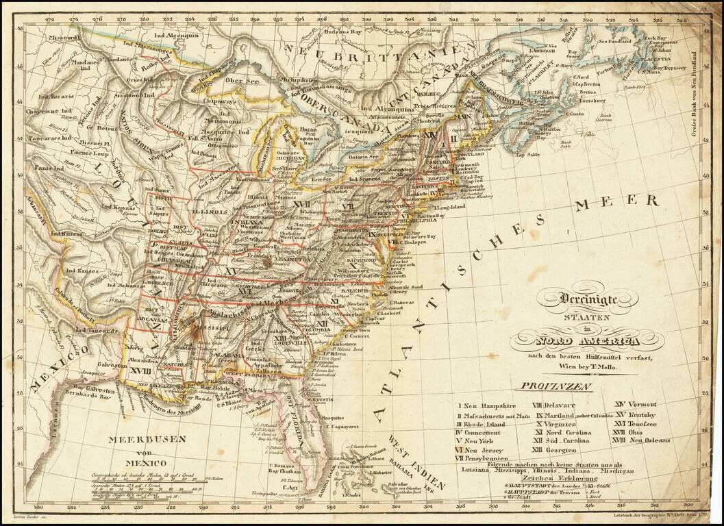
Scarce & interesting map of the United States, published in the decade following the Louisiana purchase. Among the more notable features of the map are the many interesting mountain ranges in the Plains regions, the early appearance of Michigan...
![[Missouri named Jefferson] Etats-Unis par A.M. Perrot](/map/small/69488.jpg)
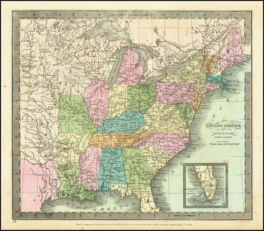
Missouri as the state of Jefferson Fascinating early map of the United States, which names the present state of Missouri as Jefferson. The outline color clearly delineates Missouri, as formed in 1821. Other features include a 54-40 or fight boundary...
Shows Huron Territory -- The Future Wisconsin Territory Scarce map of the United States, showing a massive Missouri Territory, Huron Territory and Texas. The map provides fine details in the Northwestern part of the map, corresponding to the old...
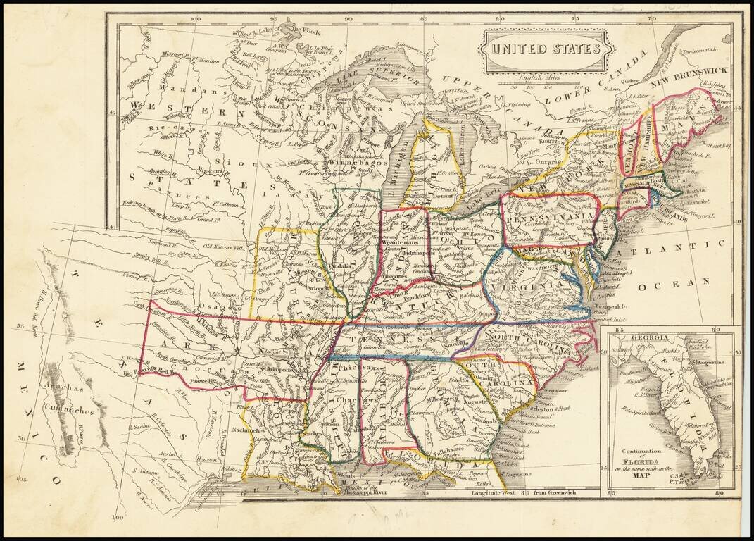
Fascinating map of the United States and Texas, published about the time Texas became a Republic. The map names "Wisconsan", suggesting the map was published about the time Wisconsin was becoming a Territory. In Texas, the Houston and Austin are...
![[Republic of Texas] Carte Des Etats-Unis D'Amerique. . . .1838](/map/small/70864.jpg)
An Early Coast To Coast Map of the United States -- Republic of Texas Fine map of the United States from Coast to Coast, also showing the Republic of Texas just two years after its declaration of independence in 1836. During the 1820s to 1840s, the...
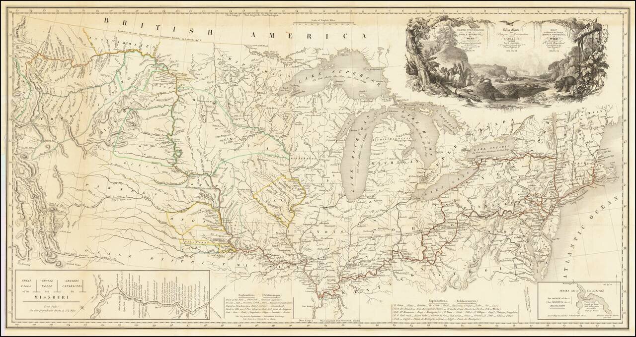
One of the Finest Early Maps of The Missouri Valley & American Plains Nice example of this remarkable map illustrating the account of the travels of Prince Alexander Phillip Maximilian, of Wied's, in the Plains and Rocky Mountain regions, in the...
Republic of Texas Fine dark impression of this early coast to coast map of the United States, issued just after the declaration of Independence for the Republic of Texas in 1836. Marvelous large format map of the United States and the Republic of...
![Vereinigte Staaten von Nord-Amerika [Views of New York City and Back Country Scenes]](/map/small/25442.jpg)
Decorative set of illustrations, including a view of the State House in New York, and views of Niagara Falls, Saratoga, the Mississippi Valley, a wagon train headed west, a buffalo hunt and a series of indigenous Indian scenes.
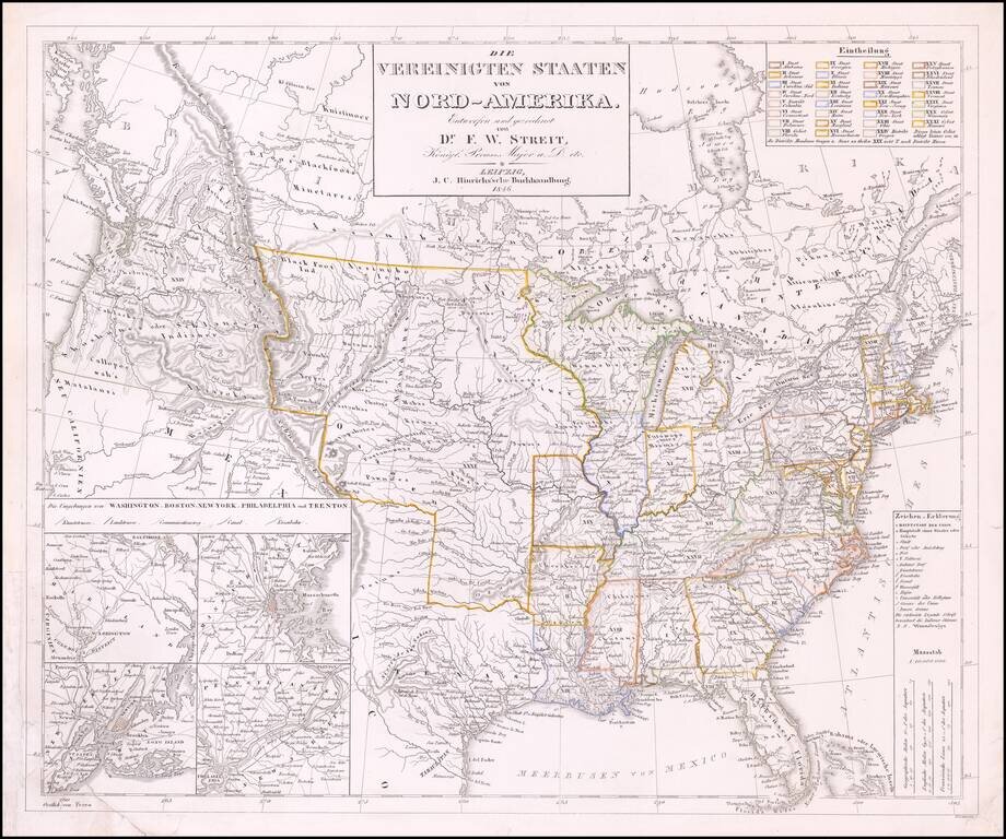
Rare late edition of Streit's fascinating map of the United States with inset maps of the region around Washington DC, Boston, Philadelphia and New York. Very nice detail along the Upper Missouri River and in Oregon Territory. The west is configured...
![[United States, Texas & Upper California] Central America](/map/small/69646.jpg)
Scarce coast to coast map of the United States, showing a massive Texas and Upper California, both recently part of the United States, published in London in 1848. Texas is shown 2 years prior to statehood, with a massive oversized northwestern...
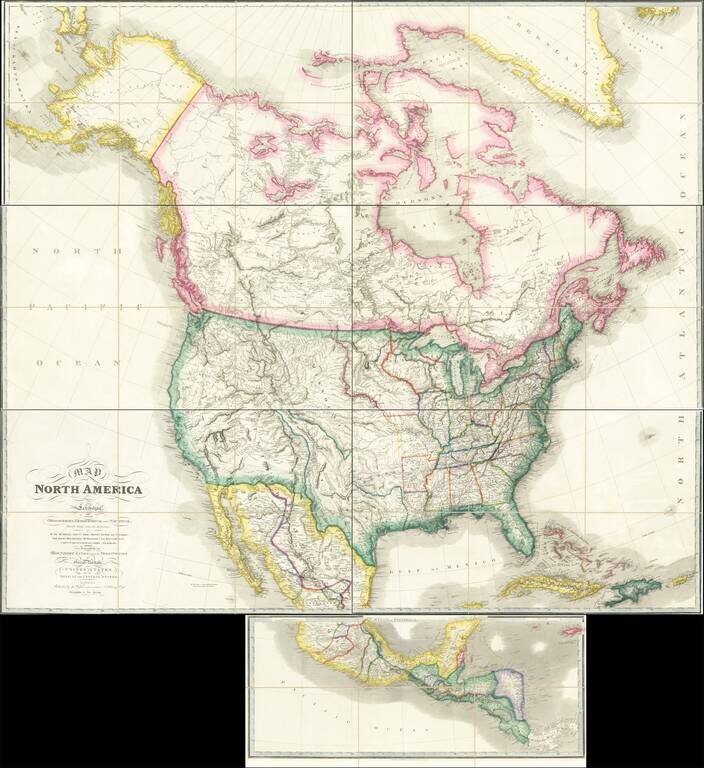
Rare Large Map of North America from a Royal Library Fine example of the circa 1850 (our dating) edition of Wyld's massive map of North America, which includes the extra panel at the bottom, adding Central America, first issued in 1824. John Wyld was...
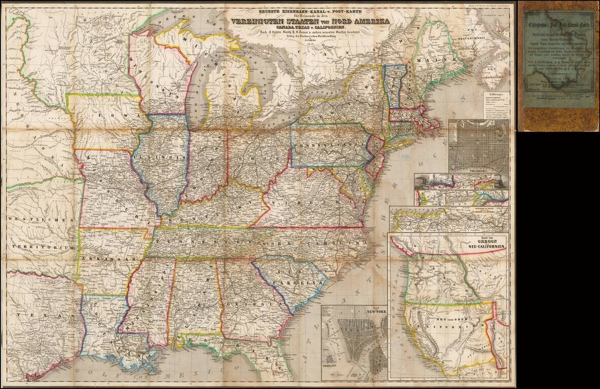
Rare Early of the Bamberg Emigrant Maps Rare Bamberg published Railroad, Canal and Post Route map of the United States, published in 1852. While later versions of the map are recorded, this 1852 edition is extremely rare, especially with the...
![[Mormon State of Desert] Die Vereinigten Staaten von Nord America nebst Canada . . . 1852](/map/small/69483.jpg)
A Rare Depiction of Deseret Detailed map of the United States, including the Mormon State of Deseret and an alternative name for Utah Territory, which is also shown newly divided from New Mexico Territory, to the south. Kiepert's map depicts "Alta...
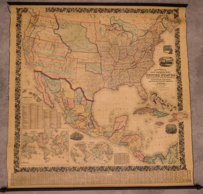
Fine Example of Mitchell's National Map of the United States Fine wall map of the United States, illustrating the transitional western Territorial and State borders, published by S A Mitchell in 1858. First published in 1856, Mitchell's remarkable...
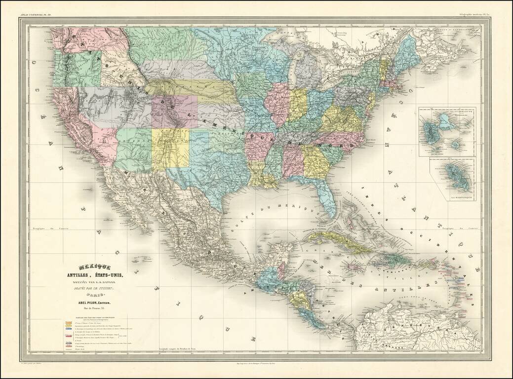
A Fascinating French convolute of Shoshone, Idaho & Montana Territories. Finely colored large format map of the United States, depicting the evolution of the Western Territories, as they were created in the 1860s. Includes marvelous ephemeral...
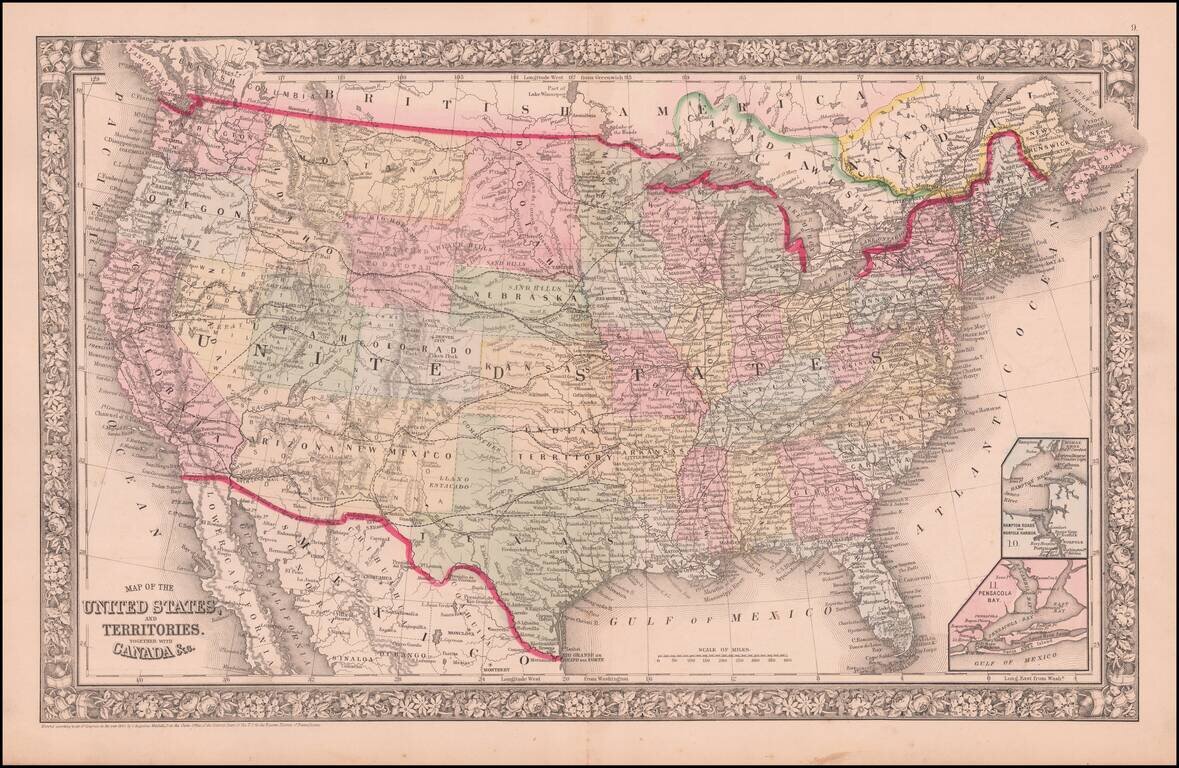
An Early Appearance of Wyoming Territory Rare intermediate state of Mitchell's map of the United States, the first map to include the territory of Wyoming, 3 years before it's official creation, based upon a failed 1865 congressional act. The map...