
Rare old maps of the United States.
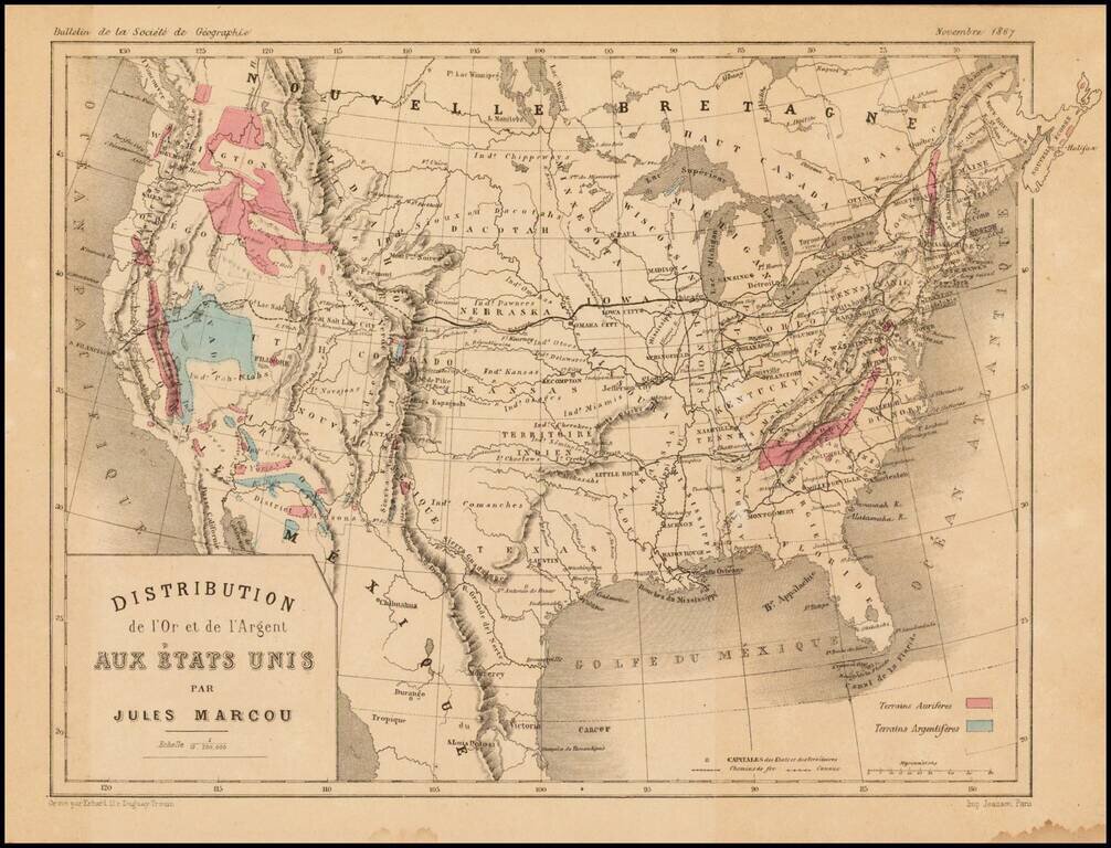
Scarce map of the United States, showing the distribution of Gold (red) and Silver (blue) in the United States. The map appeared in the November 1867 edition of the Bulletin de la Societe de Geographie, published in Paris. Jules Marcou was perhaps...
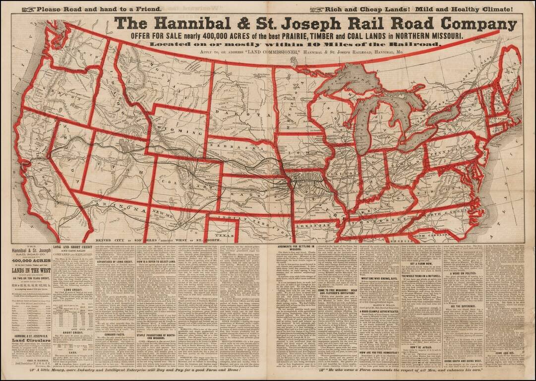
Advertising broadsheet map published by the Hannibal & St. Joseph Railroad, promoting land in Northern Missouri. The map notes the Railroad offering more than 400,000 acres of land for sale along the Hannibal & St. Joseph Railroad in...
![[The Mississippi-Missouri: A Geographical Blunder -- An Illustrated Argument For Renaming The Lower Mississippi River Put Forth By A Prominent American Educator To The Author of a Best Selling American School Geography]](/map/small/56241.jpg)
"The Geographer who shall first have the boldness to teach the truth . . . will be opposed for a time by interested book publishers and conservative pedagogues, but will triumph as Galileo did in the end." The Mississippi-Missouri: A Geographical...
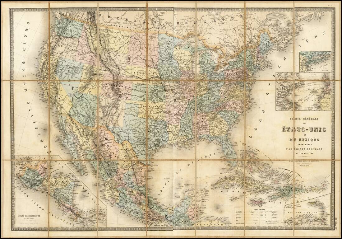
Stunning full color example of Andriveau-Goujon's 2-sheet map of the United States. The map shows the nearly finished territorial changes in the west in fine detail.
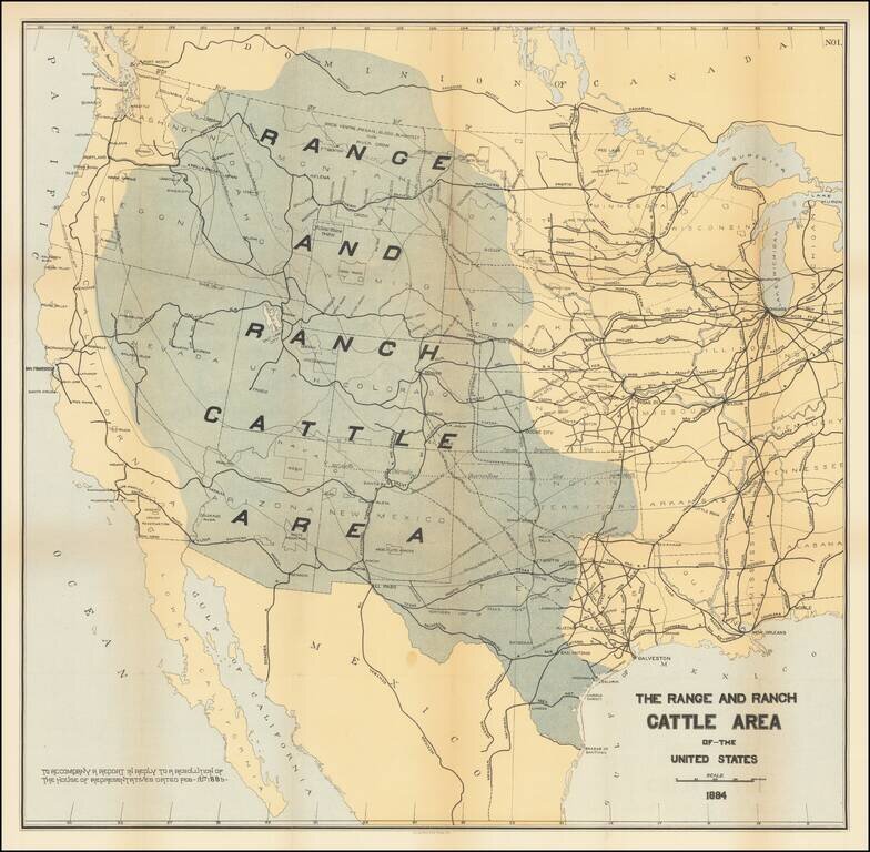
Rare map of the US, focusing on the Ranch and Cattle Industry. From Nimmo's Report on the Internal Commerce of the United States. Nimmo's book is held to be perhaps the most important of the cattle books. Nimmo's essay on the range and ranch cattle...
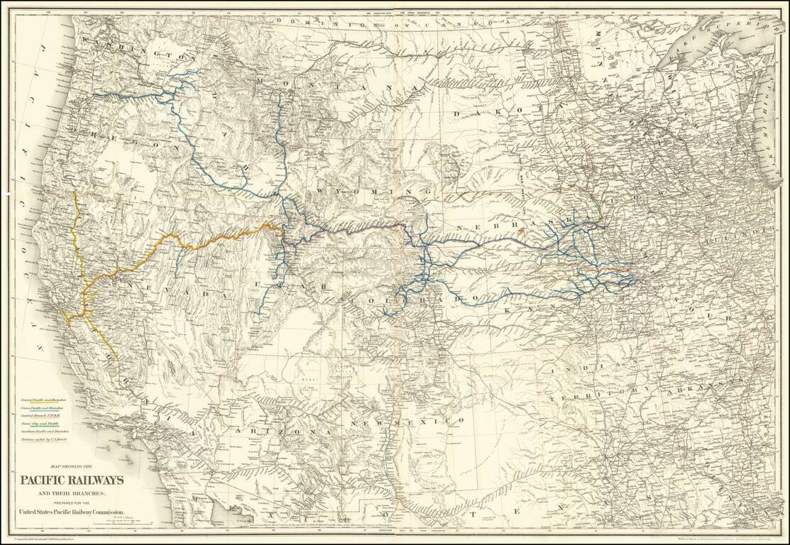
Mapping the Railroads of the Transmississippi West. Highly detailed map of the Western United States, illustrating the railroads in operation and under construction west of the Mississippi River. The key at the lower left identifies the Central...
![[Map of the United States, illustrating the routes of the Candian Pacific Railway and the Seattle, Lake Shore and Eastern Railway]](/map/small/71080.jpg)
Interesting lithographed map of the United States and southern Canada illustrating the main railways emanating from Seattle, as well as the length of the Canadian Pacific. The map was issued in the 1888 Report on Washington Territory, along with a...
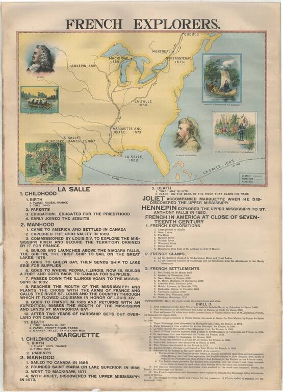
Rare Large Educational Map, With Pictorial Map Illustrating French Exploration of America and Illustrated Historical Chart of the United States. Decorative large format image, printed in color on both sides, almost certainly for educational purposes....
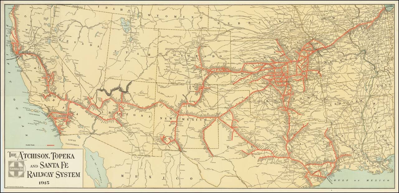
Fine example of The Atchison, Topeka and Santa Fe Railroad's general promotional map for 1915. Includes all the routes and train stations along the route in fine detail.
![[Come To Dallas] Easy To Reach -- Hard To Leave](/map/small/63387.jpg)
Pictorial map of the United States, focusing on Dallas as the center of the country. The map shows distances from Dallas to many other major cities in the United States. The map was published as part of the centennial of the Republic of Texas...
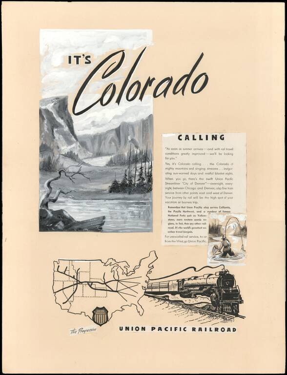
An Interesting Part of U.P.R.R. Advertising and Mapmaking History. This is a circa 1946 manuscript proof for a print advertisement promoting Union Pacific rail service from Chicago, Illinois to Denver, Colorado on the Union Pacific Streamliner 'City...

Detailed, Early Map of Oregon and Washington Territories Striking early J.H. Colton map of Oregon and Washington Territories published four years before Oregon statehood. The map is dated 1853, but it was first published in 1855. Oregon and...

Detailed, Early Map of Oregon and Washington Territories Striking early J.H. Colton map of Oregon and Washington Territories, published four years before Oregon statehood. The map is dated 1835, but it was first published in 1855. Oregon and...
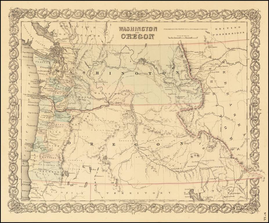
Detailed, Early Map of Oregon and Washington Territories Striking early J.H. Colton map of Oregon and Washington Territories, published four years before Oregon statehood. The map is dated 1835, but it was first published in 1855. Oregon and...
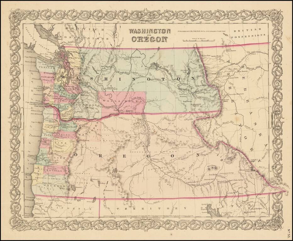
Detailed, Early Map of Oregon and Washington Territories Striking early J.H. Colton map of Oregon and Washington Territories published four years before Oregon statehood. The map is dated 1853, but it was first published in 1855. Oregon and...
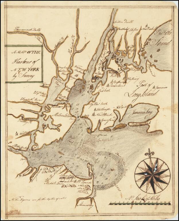
An Early Manuscript Map of Present-Day New York City. With Provenance to One of The U.S. Navy's First Frigate Captains. An early manuscript map of what is now New York City, based closely on William Bradford's New Map of the Harbour of New York, one...