logo

1954. Map of Bow Hunting Areas Courtesy of Washington State Bowhunters Association 1954

  • Map of Bow Hunting Areas Courtesy of Washington State Bowhunters Association 1954
  • Map of Bow Hunting Areas Courtesy of Washington State Bowhunters Association 1954

Map of Bow Hunting Areas Courtesy of Washington State Bowhunters Association 1954 information:

Year of creation: 
Resolution size (pixels): 
 14586x11429 px
Disk Size: 
 55.5054MiB
Number of pages: 
 2
Place: 
 n.p.

Print information. Print size (Width x height in inches):
Printing at 72 dpi 
  202.58 х 158.74
Printing at 150 dpi 
 97.24 х 76.19
Printing at 300 dpi 
 48.62 х 38.1

An example of detailing the file of this map of in a printable high-resolution:

Click to open in high resolution (open in new tab).
Attention! this is just the central piece (central area 960x960 px) of the map file!
This is an example, so that you can see and study the level of detail of a given map. The entire Map will be fully available after payment!

Map of Bow Hunting Areas Courtesy of Washington State Bowhunters Association 1954

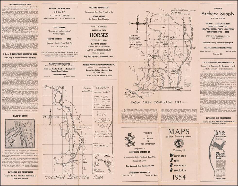
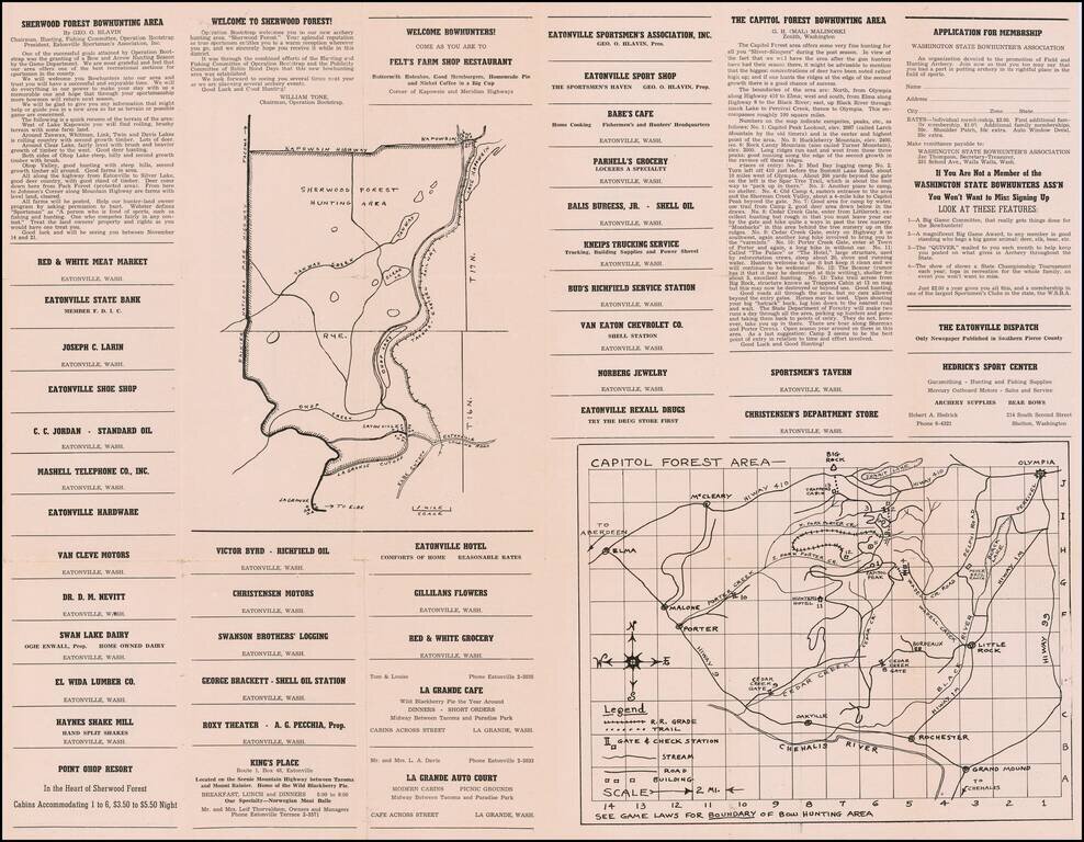
Washington State Bow Hunters Map

Interesting guide and advertising map for Washington Bow Hunters, published in 1954.

Includes maps of the following bow hunting areas:

  • Tucannon
  • Nason Creek
  • Sherwood Forest
  • Capitol Forest'

Rarity

We were unable to locate any references to the map on line or in OCLC.


Special conditions for students!

If you are a student, write to us in telegram: @antiquemaps and indicate what material you need and for what work you need a map in high detail. We are ready to provide material on special terms. For students only!

Item information:

Year of creation:
Size:
14586x11429 px
Disk:
55.5054MiB
Number of pages:
2
Place:
n.p.
Author:
Washington State Bowhunters Association.
$14.99

Related item