
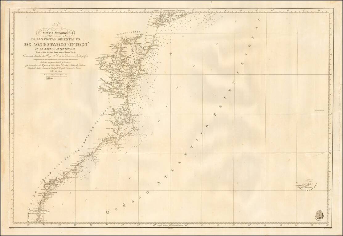
Scarce coastal chart of the United States Coastline, published in Madrid. The map shows the region between New York and Long Island in the north to the San Juan River in Florida. Spanish Sea Charts of this region in the early-19th Century are quite...
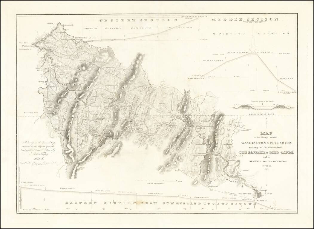
Rare separately issued map showing the route of the proposed Chesapeake and Ohio Canal, likely published as a presentation piece. After the Revolutionary War, George Washington was the chief advocate of using waterways to connect the Eastern Seaboard...
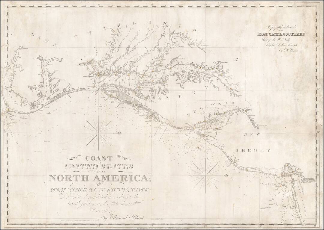
Nice example of Edmund Blunt's chart of the central portion of the coastline of the United States, from Cape Hatteras to Long Island. Blunt's chart was one of the most commercially successful and enduring American Sea charts issued in the first half...
![[Virginia, Carollinas, Georgia, Florida] Carte de la Cote Orientale De L'Amerique Septentrionale Partie Comprise Entre New York Et La Riviere Saint Jean ...1834](/map/small/17290.jpg)
Rare French Sea Chart of the Atlantic Coast, from New York City to the mouth of the San Juan River, in Florida. Includes 2 large inset maps, one of the Chesapeake Bay and one of New York Harbor, from Manhattan to Sandy Hook. The map is a fine example...
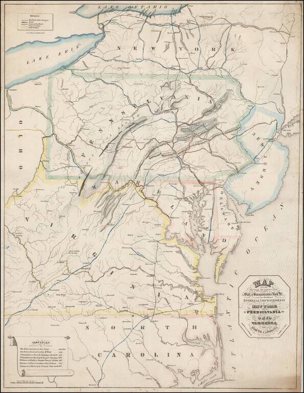
Rare Promotional Map for the Baltimore & Susquehanna Railroad, drawn by I.A. Soiecki. This map is quite possibly the earliest printed map to focus on the Baltimore & Susquehanna Railroad, focusing on railroad lines extending from New York to...
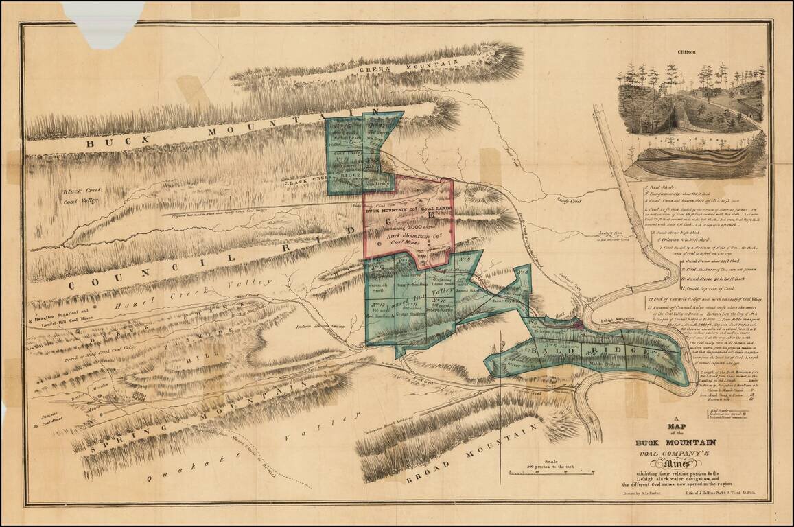
Detailed map of the mines of the Buck Mountain Coal Company, with names of owners, mountain ranges, etc.
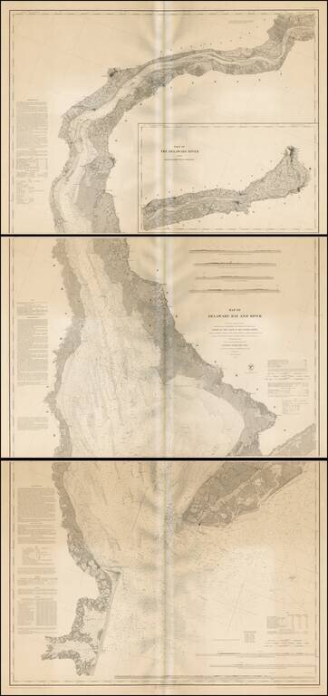
Fine example of this extremely scarce separately issued engraved nautical chart on 3 sheets, covering Delaware Harbor and Bay from the mouth of the harbor to Trenton. While the map appears occasionally on the market bound into an early coast survey...
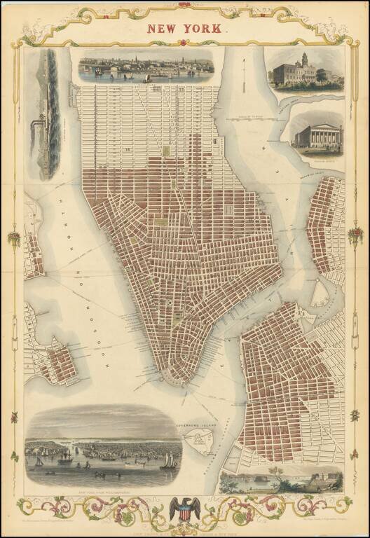
Striking full-hand-color example of Tallis's town plan of New York City, one of the few double-page plans published by Tallis. Includes vignettes of City Hall, the Custom's House, the Narrow's from Fort Hamilton, a New York Steamer, and two larger...
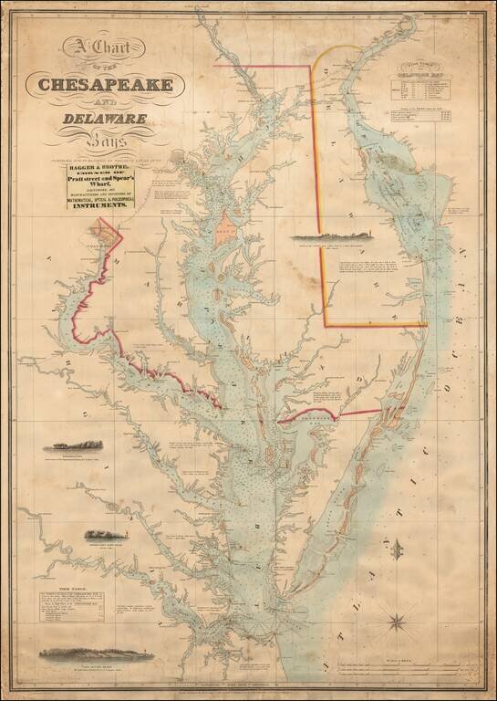
The Most Important Sea Chart of the Chesapeake Published In the 19th Century Scarce and highly desirable chart of the Chesapeake and Delaware Rivers by Fielding Lucas. One of the most decorative and sought after 19th Century charts of the Chesapeake,...
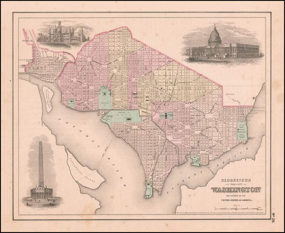
Interesting map of the Capitol, colored by wards, from one of the most prolific 19th Century American publishers. JH Colton was one of the pre-eminent American map publishing firms in the mid-19th Century.
![Delaware and Maryland [with large District of Columbia Inset]](/map/small/51024.jpg)
First edition of Colton's map of Delaware and Maryland. Detailed map of Delaware and Maryland, colored by counties. Shows towns, roads, railroads, rivers, etc. Inset of District of Columbia. Decorative border.
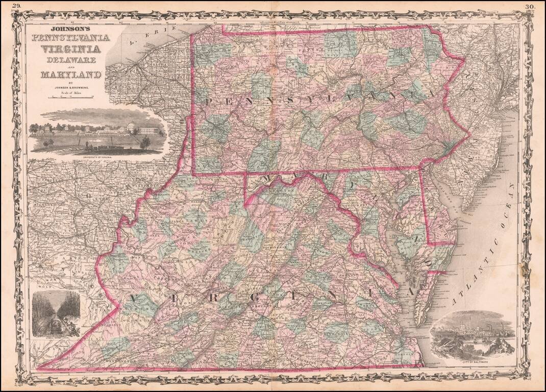
Highly detailed regional map, hand colored by counties, with 3 large vignettes.
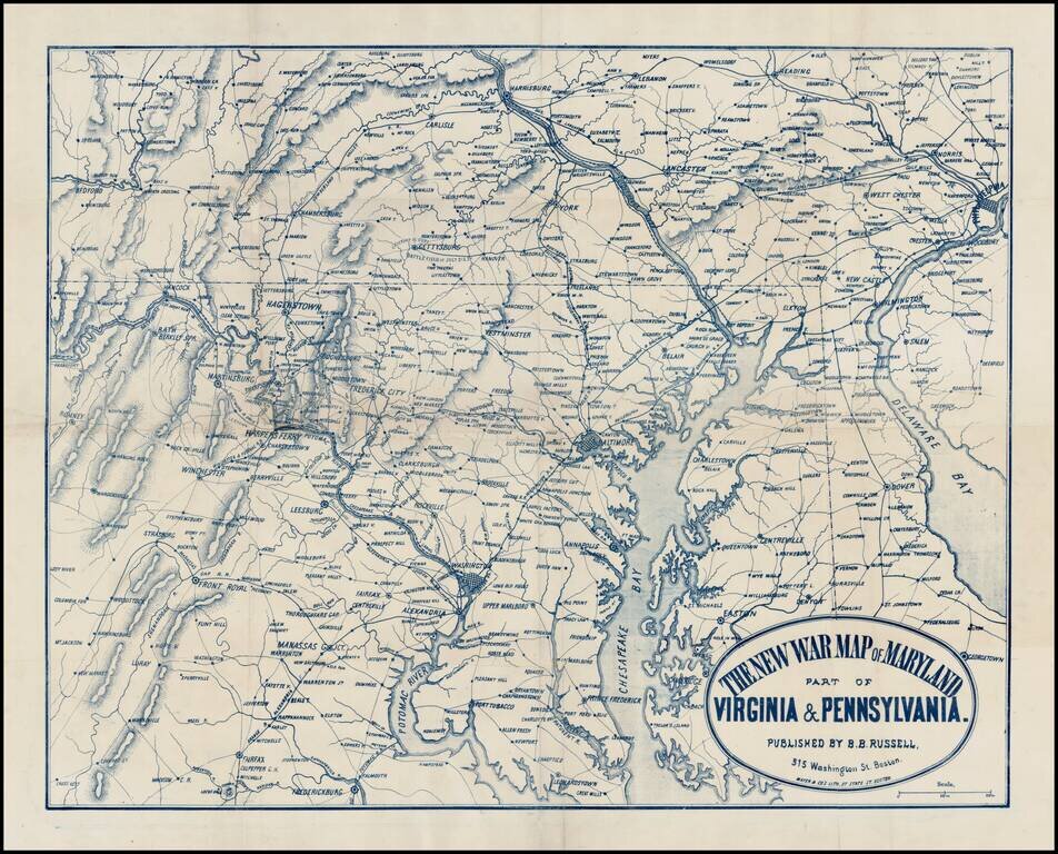
Rare separately issued map of the Mid-Atlantic theater of the American Civil War, published in Boston by Mayer & Co. The map extends south to Fredericksburg and Fairfax and north to Harrisburg and Reading and East to Philadelphia and Delaware Bay,...
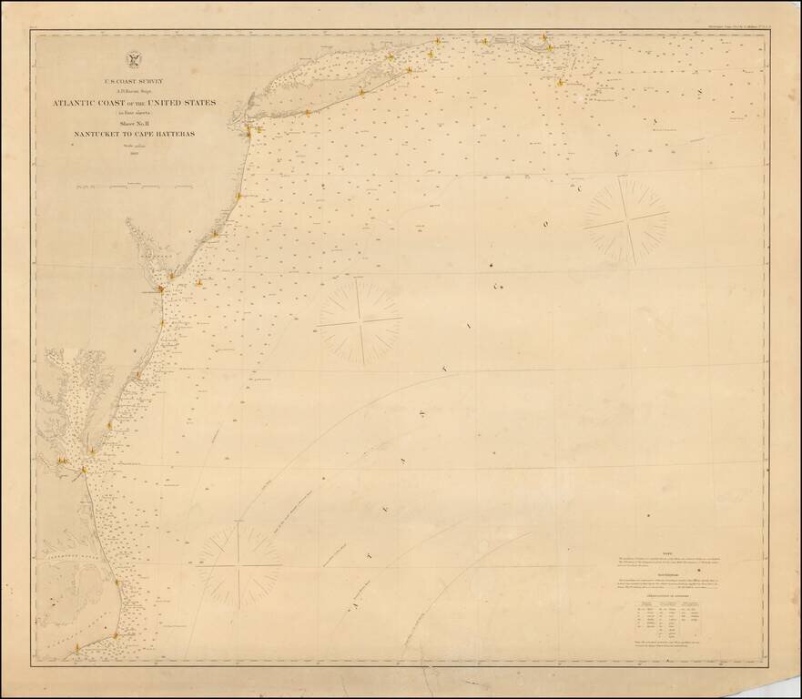
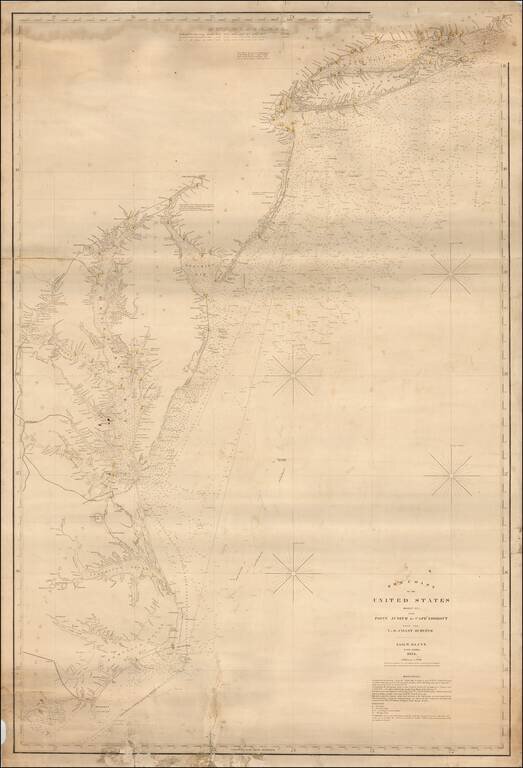
Rare separately issued coastal chart of the Coast of the United States, from Nantucket to Cape Hatteras. Includes lighthouses, soundings, place names, notes and sailing directions. The present example is published on thick paper and was never folded,...
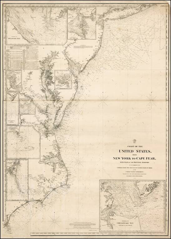
Extremely rare separately issued chart of the eastern part of the United States, from Long Island to Cape Fear, published in New York by Charles Copley. Includes an extensive table of tides and inset maps showing bays and entrances, including...
Fine large format sea chart of the coastline from Long Island Sound to the Outer Banks of North Carolina, published by Blunt in New York City, the most famous of American Chart makers of the period. The map shows light houses, light ships and channel...