logo

1845. A Map of the Buck Mountain Coal Company's Mines exhibiting their relative position to the Lehigh slack water navigation and the different Coal mines now open in the region

  • A Map of the Buck Mountain Coal Company's Mines exhibiting their relative position to the Lehigh slack water navigation and the different Coal mines now open in the region

A Map of the Buck Mountain Coal Company's Mines exhibiting their relative position to the Lehigh slack water navigation and the different Coal mines now open in the region information:

Year of creation: 
Resolution size (pixels): 
 2580x1712 px
Disk Size: 
 1.15274MiB
Number of pages: 
 1
Place: 
 Philadelphia
Author: 

Print information. Print size (Width x height in inches):
Printing at 72 dpi 
  35.83 х 23.78
Printing at 150 dpi 
 17.2 х 11.41
Printing at 300 dpi 
 8.6 х 5.71

An example of detailing the file of this map of in a printable high-resolution:

Click to open in high resolution (open in new tab).
Attention! this is just the central piece (central area 960x960 px) of the map file!
This is an example, so that you can see and study the level of detail of a given map. The entire Map will be fully available after payment!

A Map of the Buck Mountain Coal Company's Mines exhibiting their relative position to the Lehigh slack water navigation and the different Coal mines now open in the region

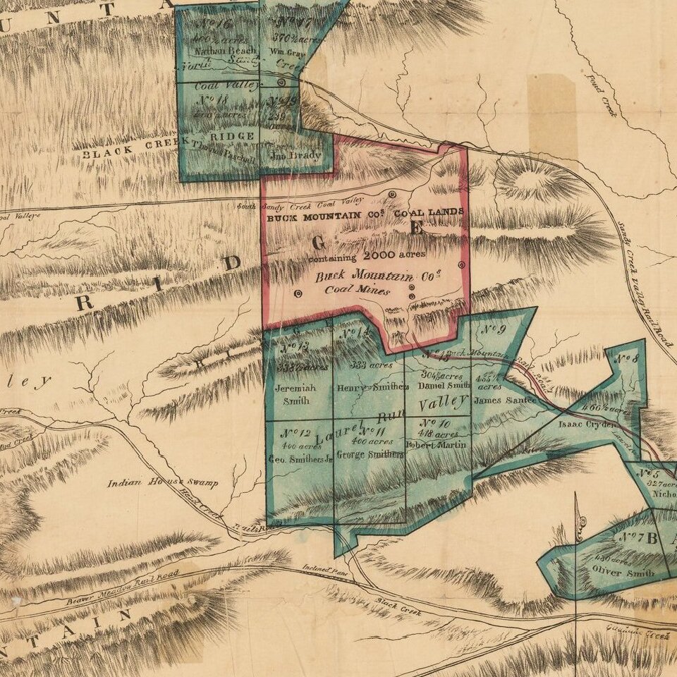
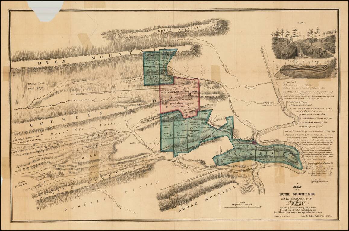
Detailed map of the mines of the Buck Mountain Coal Company, with names of owners, mountain ranges, etc.


Special conditions for students!

If you are a student, write to us in telegram: @antiquemaps and indicate what material you need and for what work you need a map in high detail. We are ready to provide material on special terms. For students only!

Item information:

Year of creation:
Size:
2580x1712 px
Disk:
1.15274MiB
Number of pages:
1
Place:
Philadelphia
Author:
A. L. Foster.
$9.99

Related item