Map size in jpg-format: 20.9458MiB
Click to open in high resolution (open in new tab).
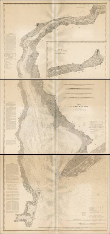
Fine example of this extremely scarce separately issued engraved nautical chart on 3 sheets, covering Delaware Harbor and Bay from the mouth of the harbor to Trenton.
While the map appears occasionally on the market bound into an early coast survey volume, the thin paper and browned folds invariably leaves it in problematic condition. The present example is a separately issued example on very heavy paper. Many of the coast survey maps were issued in very limited number on heavy paper for presentation purposes or use at sea. We note 3 examples on the market in the past 30 years, including a copy in Arkway Catalog XXVII, in 1986, priced at $1,500 and noted as being browned and wrinkled.
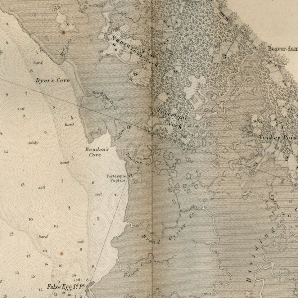
Relief shown by hachures; depths by soundings. Includes 7 coastal views and descriptive notes on the survey, sailing directions, tides and currents. Oriented with north toward upper left. Prime meridians: Greenwich and New York. In upper margin "Presented under authority of an act of Congress of the United States of June 3d 1844 by direction of the Treasury Department, A.D. Bache Superintendent Coast Survey."
Full Title: Map of Delaware Bay and River. Founded upon a trigonometrical survey under the direction of F.R. Hassler and A.D. Bache, Superintendents of the Survey of the Coast of the United States. Triangulation by F.R. Hassler, assts. J. Ferguson, E. Blunt, C.M. Eakin, F.H. Gerdes, J.J.S. Hassler & J.E. Johnstone, Capt. Topl. Engrs. Topography by assistants W.M. Boyce, F.H. Gerdes, J.J.S. Hassler, H.L. Whiting, G.D. Wise & B.F. Sands, U.S.N. Hydrography by the party under the command of G.S. Blake, Lieutenant U.S. Navy. Soundings outside the capes under the direction of T.R. Gedney and G.M. Bache, Lieutenants U.S. Navy. Published in 1848. A.D. Bache, Superintendent. Final reduction for engraving of topography by W.M.C. Fairfax, asstist. & of hydrography by Lt. J.B. Dale, U.S.N. Engraved by F. Dankworth, assisted by O.A. Lawson. Views engraved by O.A. Lawson. Lettering by J. Knight. (with logo) U.S. Coast Survey Depot. Electrotype copy no. 4 by G. Mathiot, U.S.C.S.
If you are a student, write to us in telegram: @antiquemaps and indicate what material you need and for what work you need a map in high detail. We are ready to provide material on special terms. For students only!
![[Wall Map] West-Indische Paskaert waer in de graden der breedde over weder zyden vande middelyn wassende so vergrooten dat die geproportioneert syn tegen hunne nevenstaende graden de lengde.](/map/small/60169.jpg)

![[The First Maps in a la poupée Printed Color] Cartes en Couleur des Lieux Sujets aux tremblements de Terre Dans toutes les parties du Monde Selon le Sisteme de l’impulsion Solaire](/map/small/52293op.jpg)