

A View of Newark looking North To Brooklyn & Manhattan Fine large-format chromolithographic view of Newark, Kearny, Harrison, Jersey City, New York Bay, Manhattan and Brooklyn. A wonderful view showing Newark, Kearny, Arlington, Jersey City and...
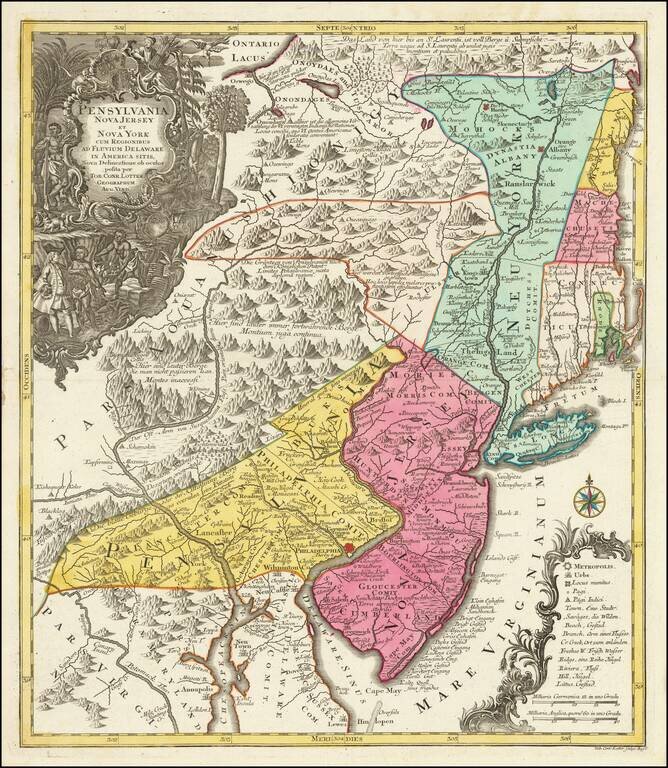
![[Rare Early State!] Pensylvania Nova Iersey et Nova York cum Regionibus Ad Fluvium Delaware In America Sitis, Nova Delinatione ob oculos posita . . .](/map/small/63399.jpg)
Rare Early State of Seutter's Map of New Jersey, New York and Eastern Pennsylvania Rare early state of Seutter's map of the Middle British Colonies, based upon Lewis Evans' extremely rare map of 1749. The present example differs by the spelling of...

Detailed map of the Ohio Valley and regions to the East Nice example of Robert de Vaugondy's map of the Northern British Colonies, French interests to the North of the Great Lakes, and contested "Back Settlements," including a fine detailed treatment...
Fascinating Colonial Map of New Jersey, New York and Eastern Pennsylvania Nice example of T.C. Lotter edition of Seutter's map of the Middle British Colonies, based upon Lewis Evans' extremely rare map of 1749. Seutter's map is a notable...
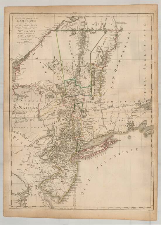
Rare French edition of this important early Revolutionary War map, published to illustrate the Northern Theater of War in the early years of the American Revolution, shortly after the French entered the conflict in alliance with the American...
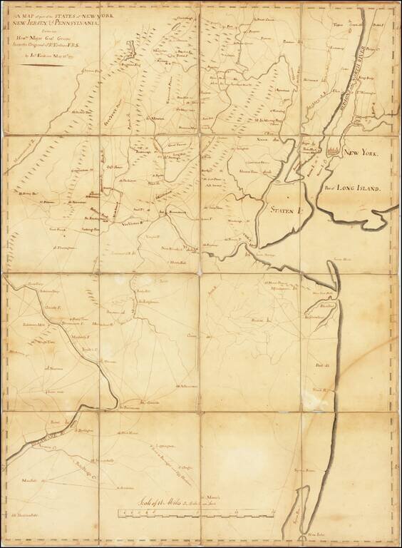
One of a Few Surviving Manuscript Maps Made For The Continental Army To Remain in Private Hands Large manuscript map of northern New Jersey and southern New York (including New York City), “the cockpit of the American Revolution”, drawn by John...
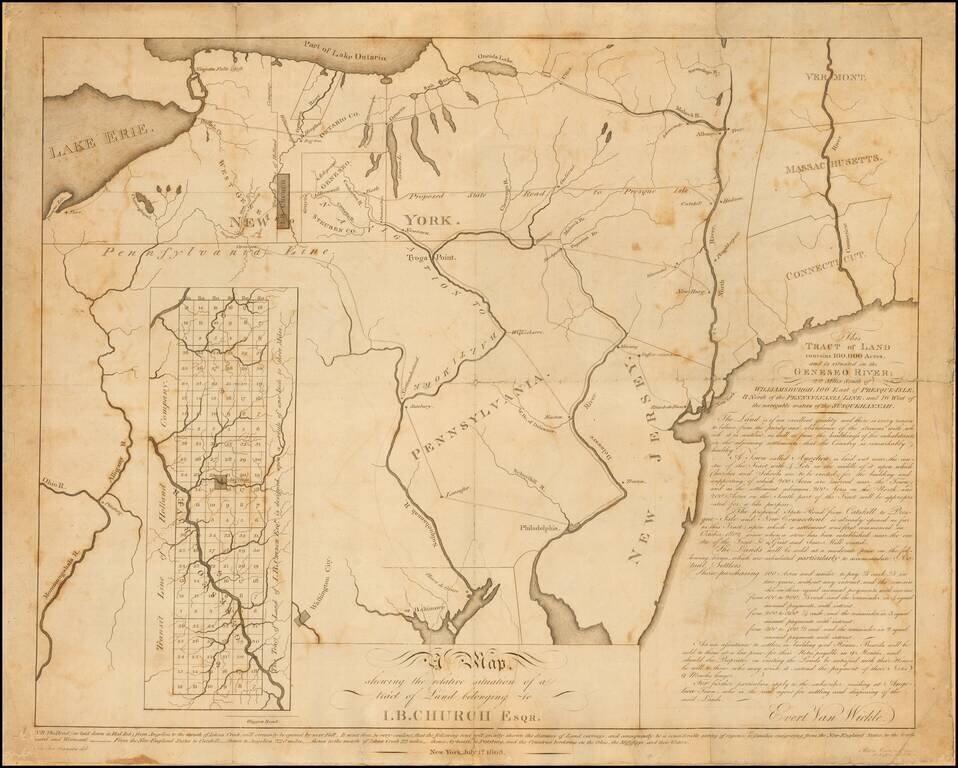
Rare early 19th Century map relating to the early settlement of western New York. This undeveloped 100,000-acre tract on the Genesee River in western New York had been used to repay a debt to John Barker Church from financier Robert Morris. Church was...

A Rare British Sea Chart of the Southeast and Mid-Atlantic Regions (The Colonial Williamsburg / William Wooldridge Copy) Extremely rare separately issued chart of the coast from New York to North Carolina, which was issued separately and in Laurie...
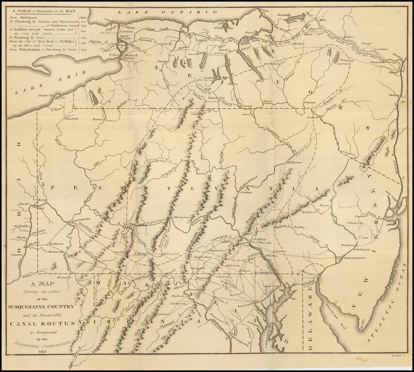
Fine large folding map, illustrating the work of the Commissioners appointed in December 1822 to survey the route of a Canal which would connect the Susquehanna River with the City of Baltimore. Published by Fielding Lucas Jr. in Baltimore, this rare...
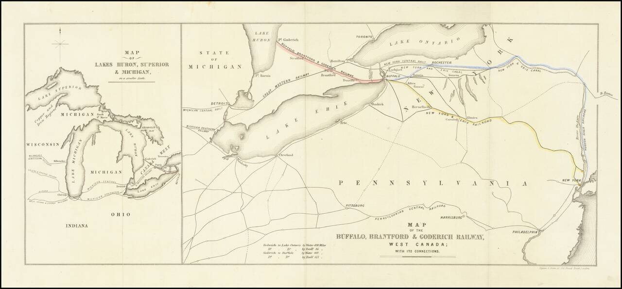
Interesting map of the Buffalo, Brantford and Goderich Railway, likely published either in its earliest incarnations in 1852 or at the time of its reorganization in 1856. The Buffalo, Brantford & Goderich Railway operated between 1852 and 1856,...

Detailed road map of the Great Lakes Region, constructed by Canada's Department of the Interior. Includes Provincial Routes, Federal Routes and State Routes.
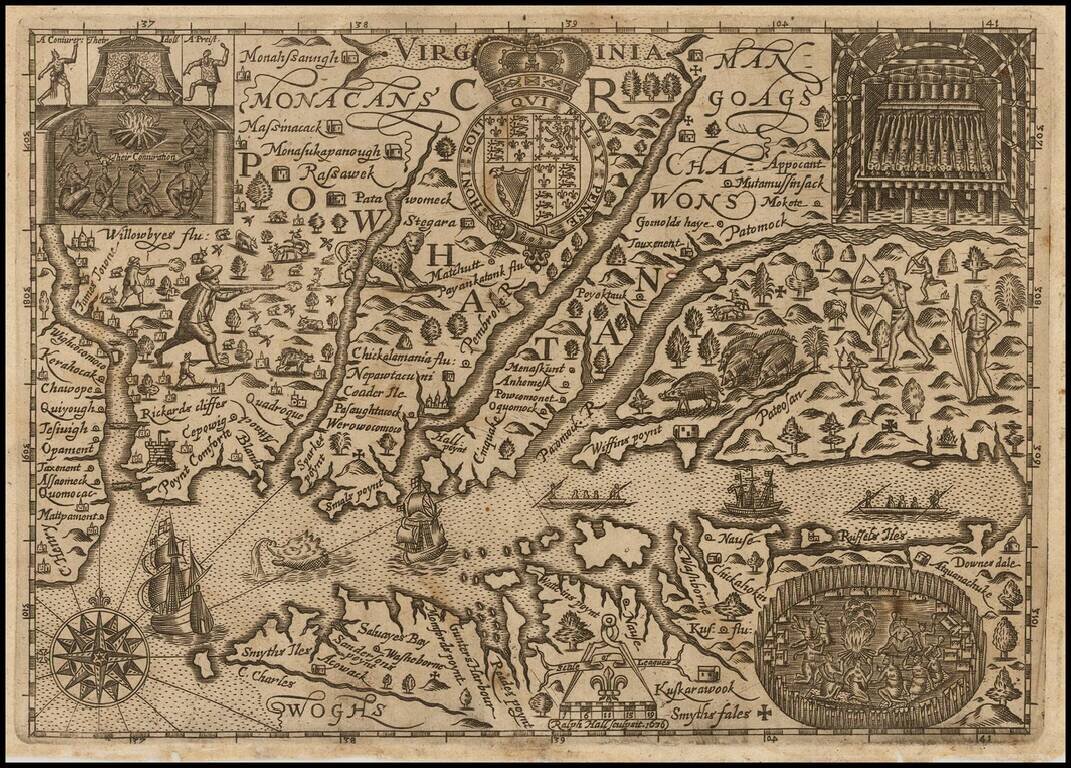
Early English Colonial Map of Virginia Rare map of Virginia, engraved by Ralph Hall, for Wye Saltonstall's Historia Mundi. This remarkable map of Virginia is based in part upon John Smith's map of Virginia, embellished with a lively and unique...

The First Dutch Map of Virginia Fine, wide-margined, old color example of Blaeu's map of Virginia, and the Chesapeake region, based upon John Smith's map of Virginia, the most important map of Virginia published in the 17th Century. This is the...

A highly decorative and important sea chart showing Florida, the Gulf Coast, Caribbean, Central America and the region from south of the mouth of the Delaware River. This fine separately published map was first engraved around 1650, but is based...
![A New Map of Virginia [and the Chesapeake]](/map/small/48950.jpg)
First State of Morden's Map of Virginia. Fine example of Robert Morden's map of Virginia, one of the earliest obtainable English maps of the Chesapeake region. Beginning in the 1670s, the English fortunes in North America took a dramatic turn...
Early map of the region from New York City to Cape Henry, centered on the Cheaspeake and Delaware, from Abraham Wolfgang's L'Amerique Angloise, ou Description des Isles et Terres dur Roi Angleterre, dans L'Amerique, published in Amsterdam in 1688. The...