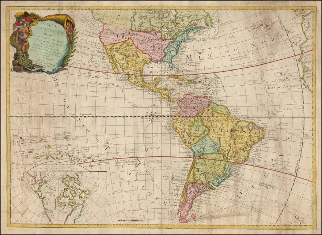
Rare and antique old maps of the South America
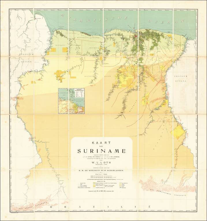
The First Modern Map of Suriname Fine example of W. L. Loth'a large map, generally regarded as the first 'modern' map of Suriname. The vast majority of information depicted on the map appears along the major Rivers in the interior of the country,...
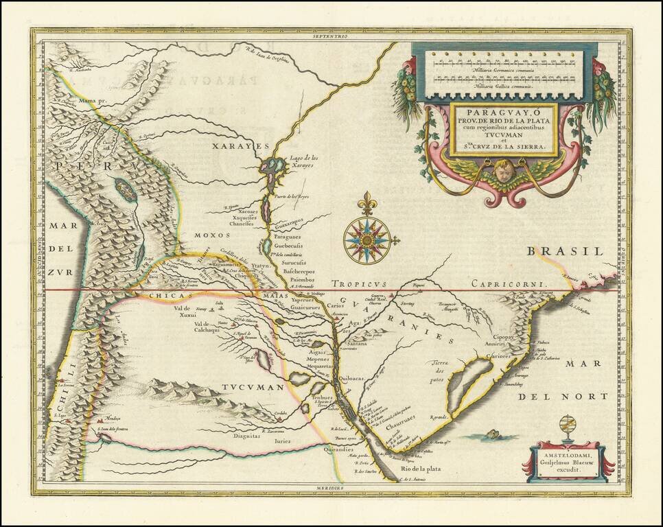
A Decorative Map of Central South America from the Golden Age of Dutch Cartography. A fine example of Blaeu’s atlas map of Paraguay, the Rio de la Plata region, and the surrounding area. The principal focus of this double-page map is the river...
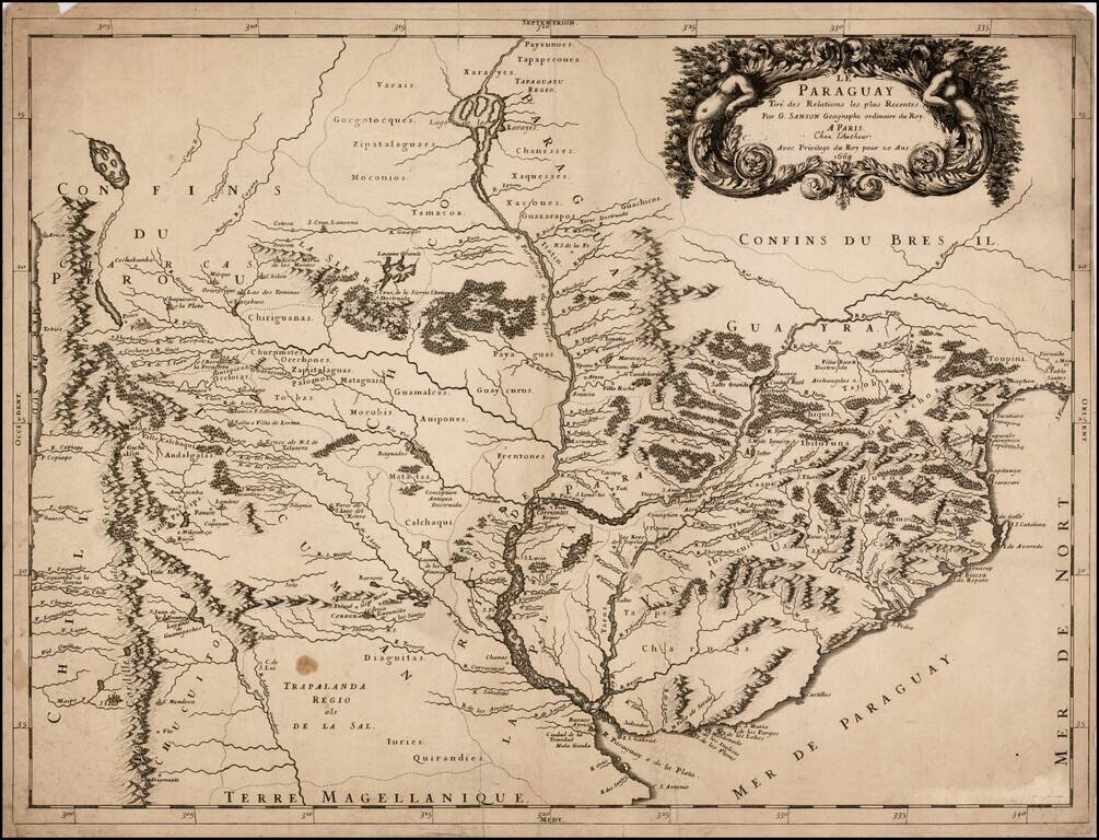
Rare map of the region around the Rio de la Plata, which is shown extending north to Lago de los Xarayes. Extends north on the coast to S. Vicente, Conception and Parnaiba, South to C.S. Antonio and Buenos Ayres and west to Chile. One of the most...
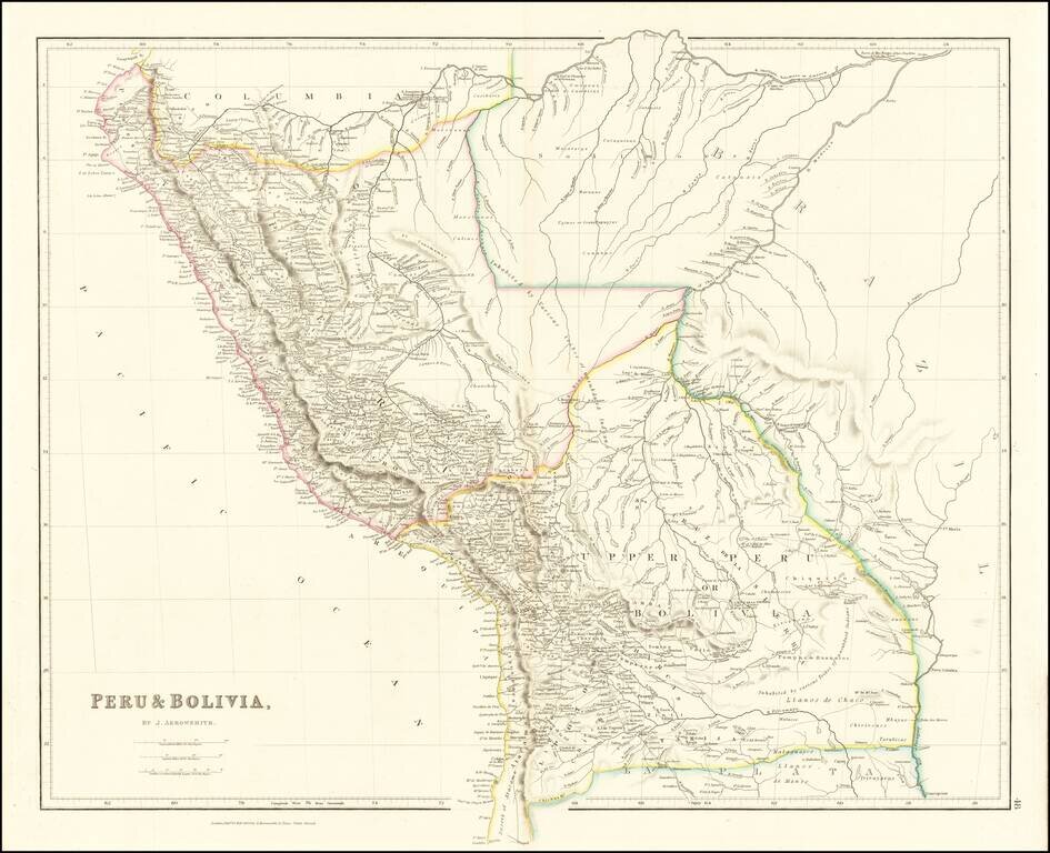
A marvelous highly detailed map of Peru and Bolivia, colored by regions. Arrowsmith's map is perhaps the single most detailed atlas map of the period.

Striking full color example of David Burr's map of Peru and Bolivia, which first appeared in David Burr's Universal Atlas, in 1836. Burr's Atlas was perhaps the most elegant American commercially published atlas of its time, utilizing wonderful wash...
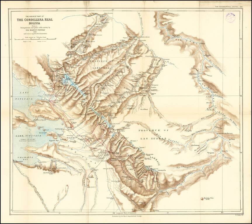
Finely executed map of the area around La Paz and the eastern part of Lake Titicaca, extending north to the Rio Mapiri and Rio Beni regions, published by the Royal Geographical Society. The map illustrates the expedition of William Martin Conway, 1st...
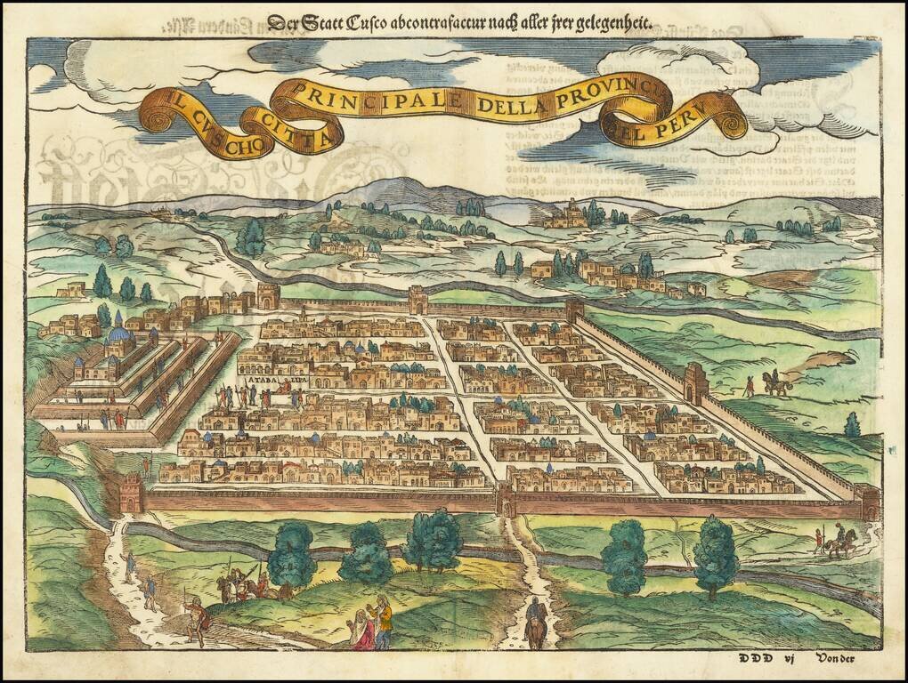
Early decorative birdseye view of Cusco, from a German edition of Munster's Cosmographia, one of the most influential geographical works of the 16th Century. One of the earliest obtainable views of the New World. Munster's Geographia was a...
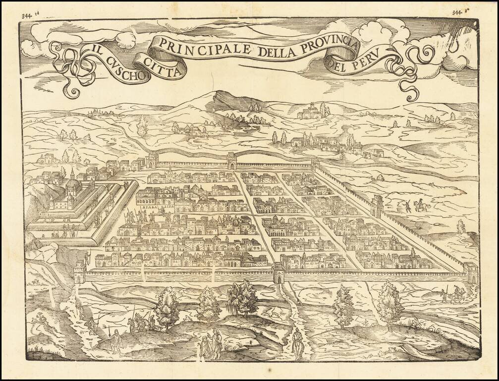
Fine example of this influential and decorative birdseye view of Cusco, from Ramusio's Raccolta di Navigationi et Viaggi., one of the most influential geographical works of the 16th Century. The view would later be copied by Munster and other 16th...
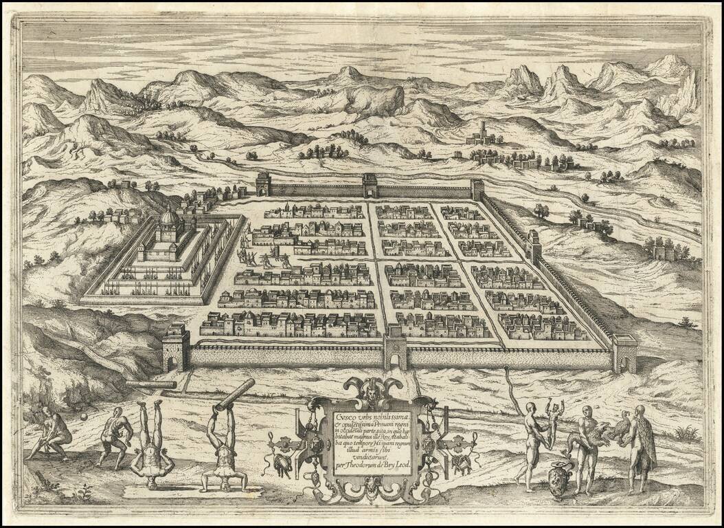
Detailed view of the town of Cusco in Peru, then one of the largest cities in the Americas. The view shows the indigenous Inca king being carried in his elevated chair near the town center. In the foreground Inca people playing a ball game and showing...
Important early map of Peru, one of the earliest obtainable maps to focus on the region and the first to rely upon the work of Hessel Gerritsz. This remarkable early map pre-dates the maps of Peru issued by Blaeu and Jansson. Johannes De Laet's...
Striking, Early Map of Peru from the Dutch Golden Age Fine old-color example of Blaeu's map of Peru, one of the best early decorative maps of the region. This is one of the two earliest atlas maps to focus on Peru, along with the map by Henricus...
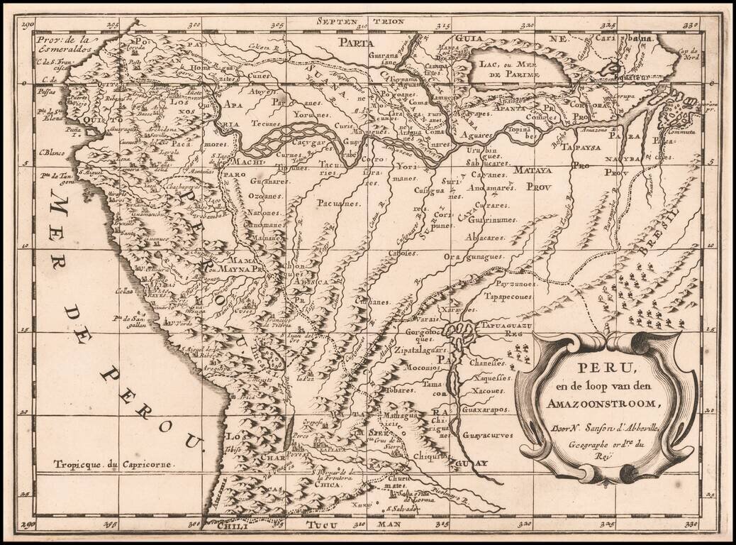
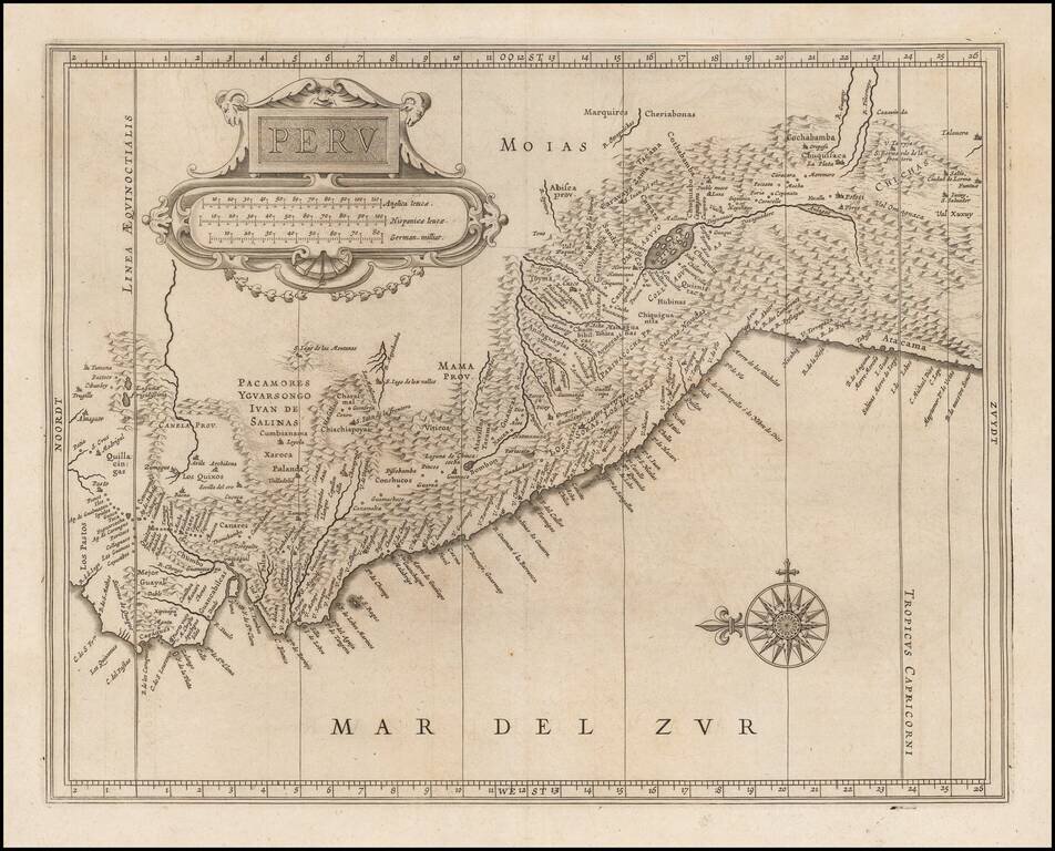
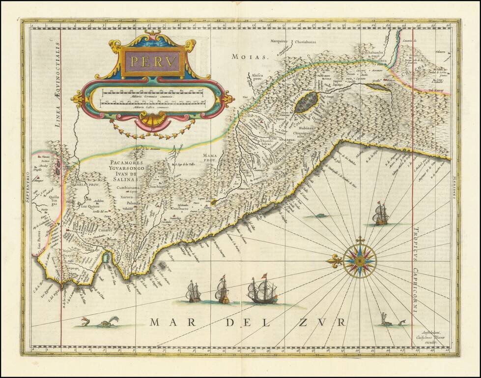
Dutch edition of Sanson's map of Peru and the Amazon region, showing the extensive rivers and tributaries which extend to the Andies, along with the rich details of the mountainous regions of Peru, then the most affluent of all of the Early Spanish...
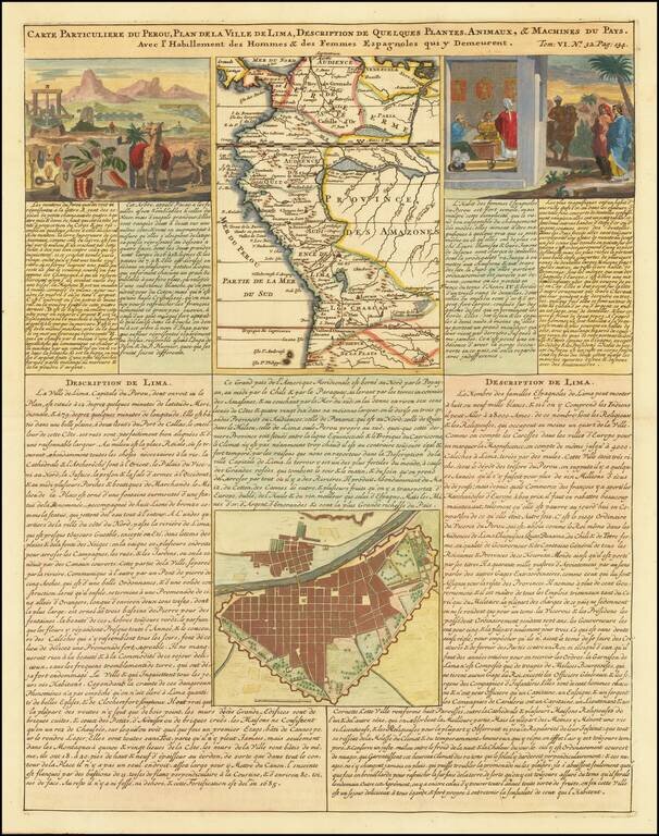
Detailed plan of Lima and regional map of Peru, published in Henri Chatelain's 7 volume Atlas Historique. The sheet also includes two views showing indigenous flora and fauna and the manner of living of the Spanish women in Peru.

Detailed map of Peru, pubished in Paris by a young Philippe Buache, who would go on to become the pre-eminent French mapmaker of the middle of the 18th Century, along with J.B.B. D'Anville.
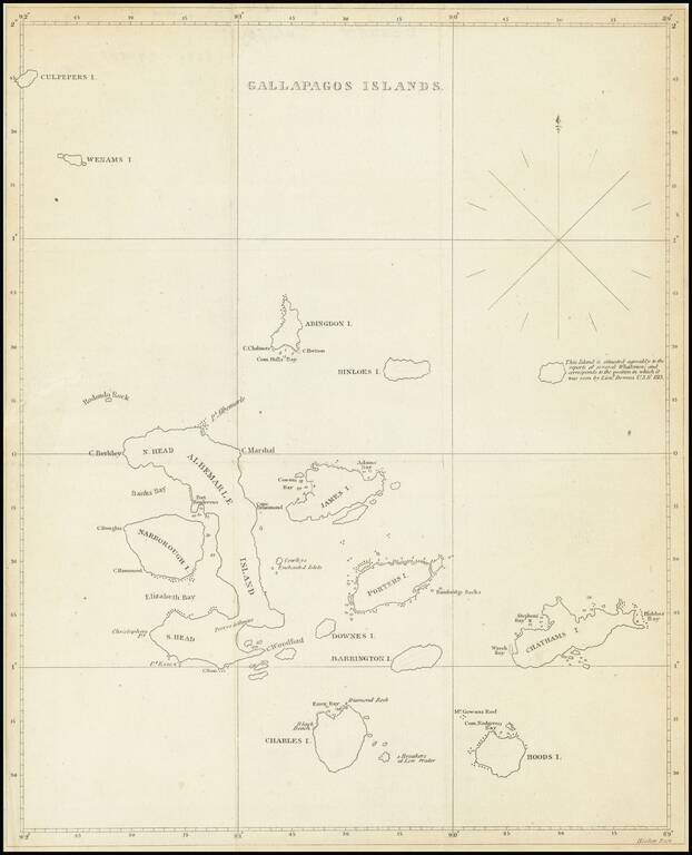
The First American Map of the Galapagos Islands Scarce early 19th Century map showing the Galapagos Islands in detail. An unnamed island (the modern Genovesa) is shown with a note that it "is situated agreably to the report of several Whalemen and...
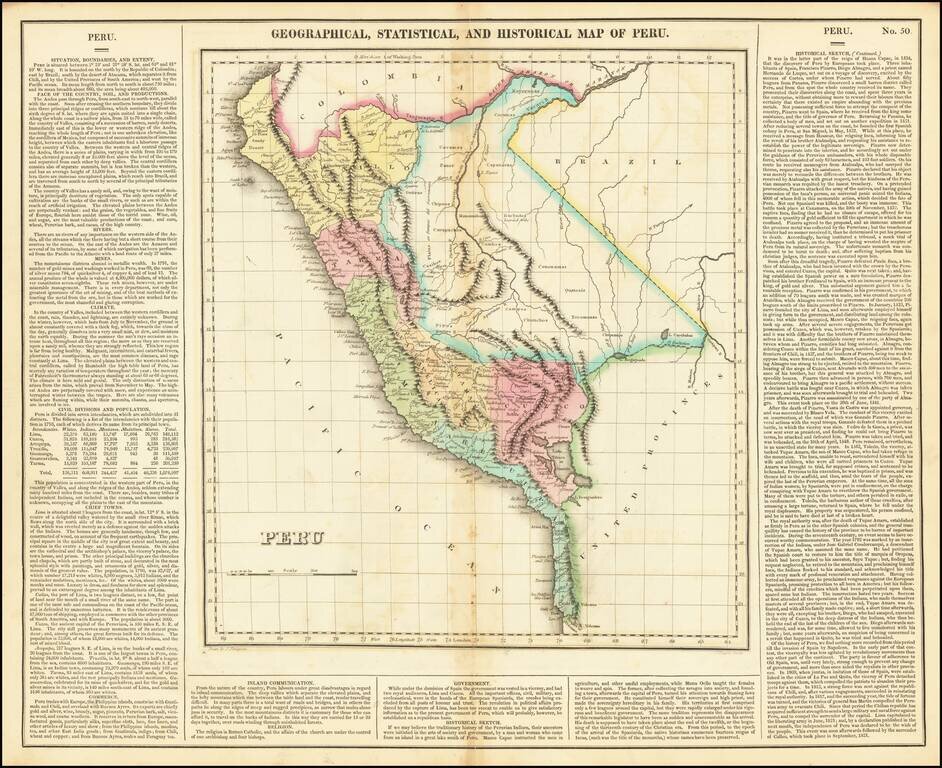
Full color example of this interesting map of Peru, from the second edition of Carey & Lea's Atlas. One of the first separate maps of the newly independent Peru, which was still steeped in Revolution under the irrepressible work of San Martin. The...