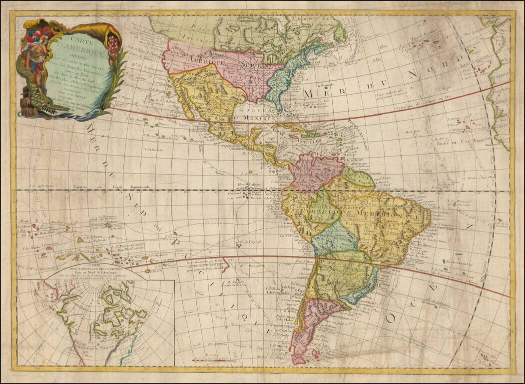
Rare and antique old maps of the South America
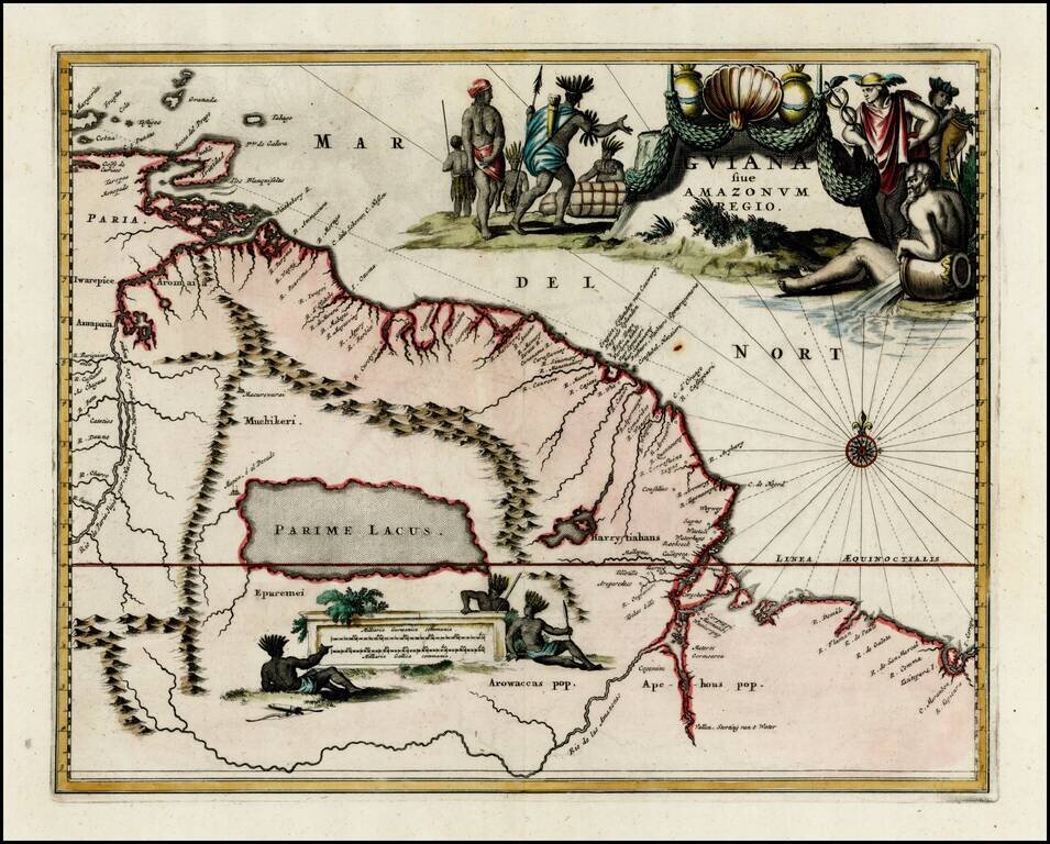
El Dorado Shown on Lake Parime -- Fine Old Color Example Terrific early regional map of the Northeastern part of South America, extending from Trinidad and Margarita Islands in the north to the mouth of the Amazon and Lac Caribes or Parime. The map...
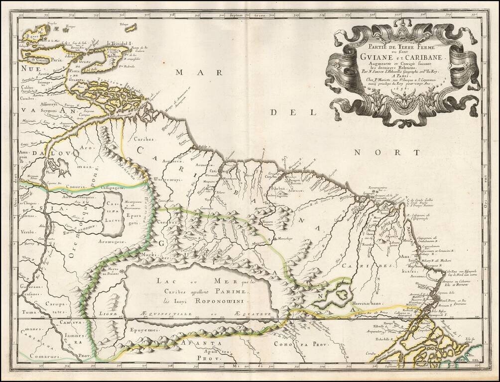
Striking full color example of the map of the coast between the Orinoco River and the Amazon, centered on Parime Lacus, from Ogilby's Complete History of America. Very large decorative cartouche, compass rose and large second cartouche showing...
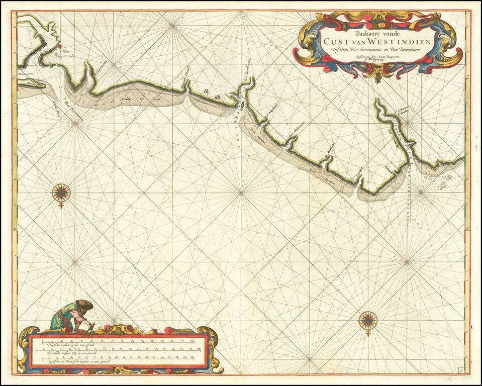
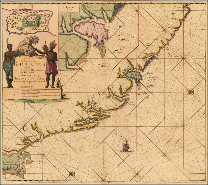
The First Detailed Sea Chart of the Coastline of Surinam Extremely rare early sea chart by Arent Roggeveen, showing the coast Surinam. The chart is oriented with south at the top. Roggeveen's chart is the first detailed sea chart of this region....
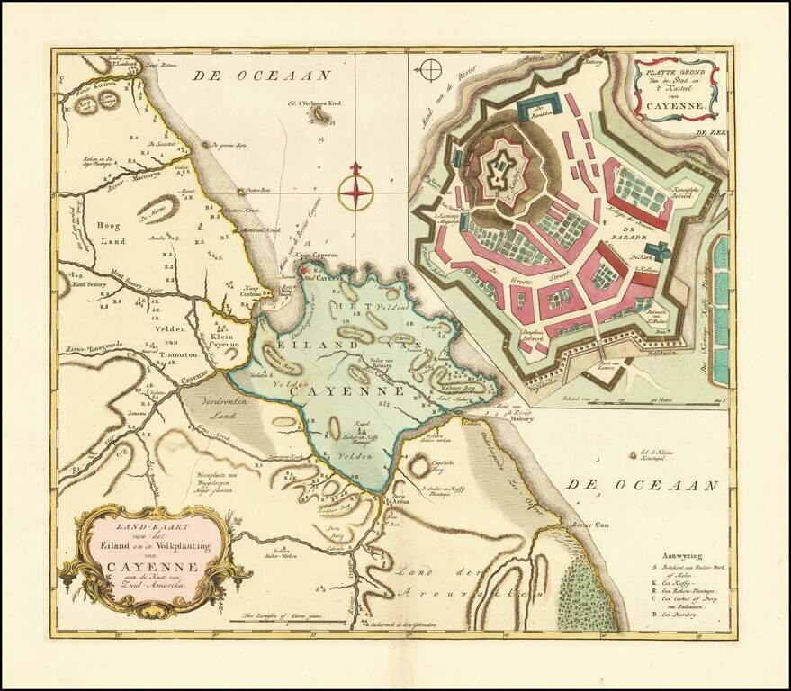
Fine Dutch sea chart of the coast of French Guyana, with insets of both the island and fort of Cayenne. French Guiana was the location of the only successful, long-term French colony in South America. Though the earliest French settlements here were...
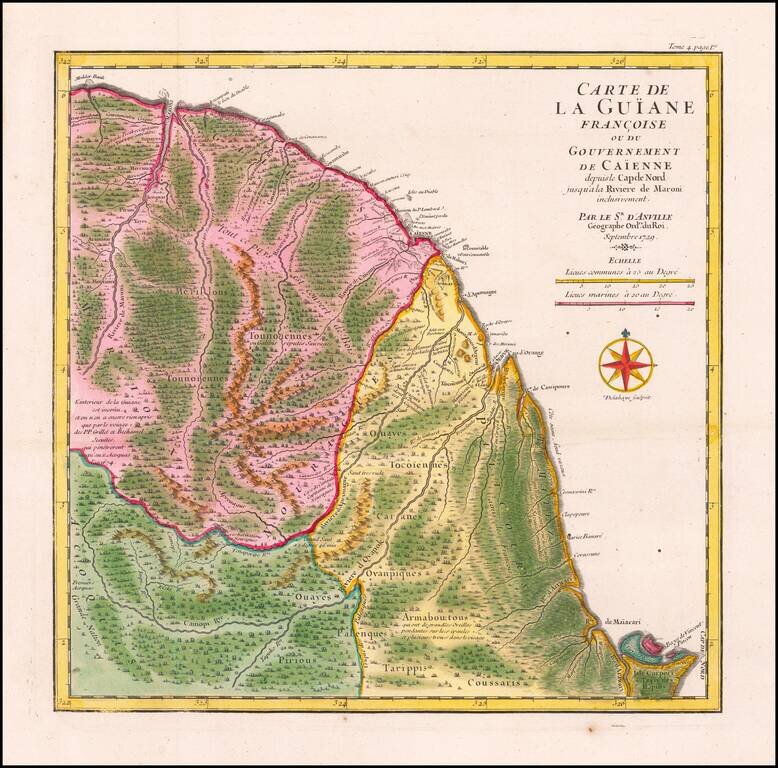
Striking Map of French Guiana Showing Jesuit Influence in the Region Fine, old color map of French Guiana by D’Anville showing this seldom-mapped region. The map was included in a travel account by the navigator and slave ship captain the Chevalier...
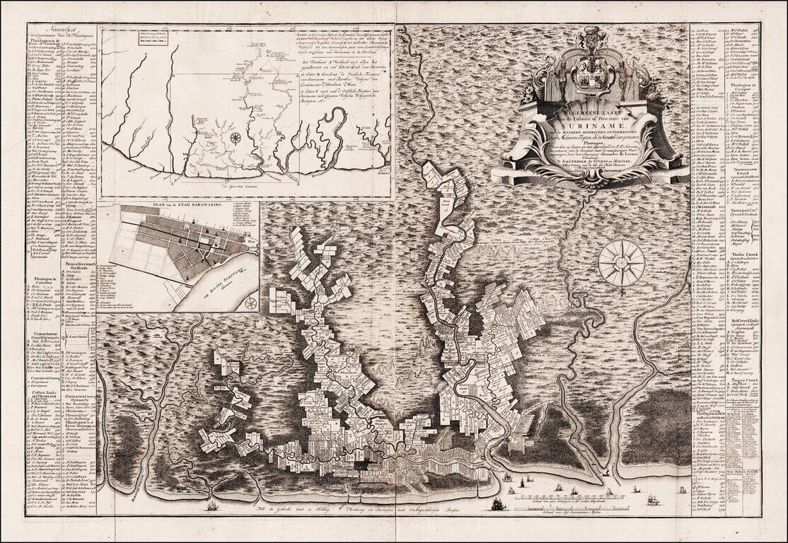
Rare Edition of Alexander de Lavaux's Map of Surinam An attractive and remarkably-informative map of the Dutch colony of Surinam, which in the 17th and 18th centuries was home to the earliest, largest and most significant Jewish population in the...
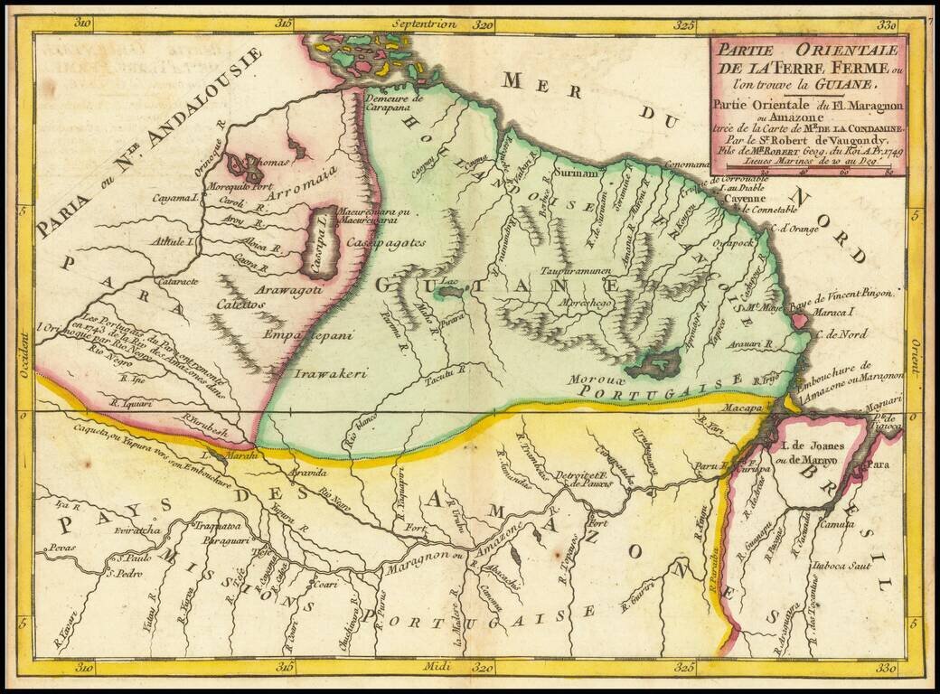
Attractive antique engraved map of region between the Amazon and Orinoco Rivers, published by the Vaugondy firm in Paris around 1749. The map shows much of the interior including forts and towns on the Amazon and Orinoco, interior lakes, and mountain...
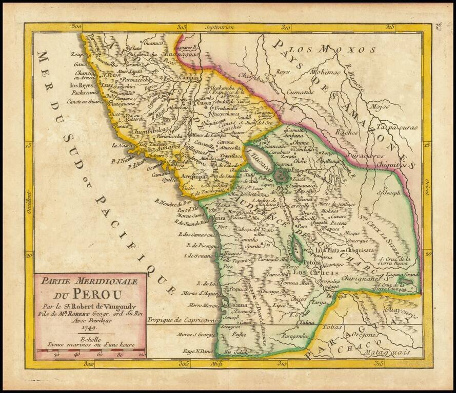
Attractive antique engraved map of the "Southern Part of Peru", to translate the French title, published by the Vaugondy firm in Paris around 1749. The map shows the "Audience de Los Charcas" and the "Audience de Lima", as well as the cities of Cusco...
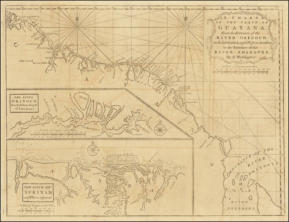
Scarce early English sea chart showing the coast of Guyana, with insets of the River Orinoco, published in London by Mount & Page. The map extends from the entrance thereof to St. Thomas, and the River of Surinam and places adjacent.
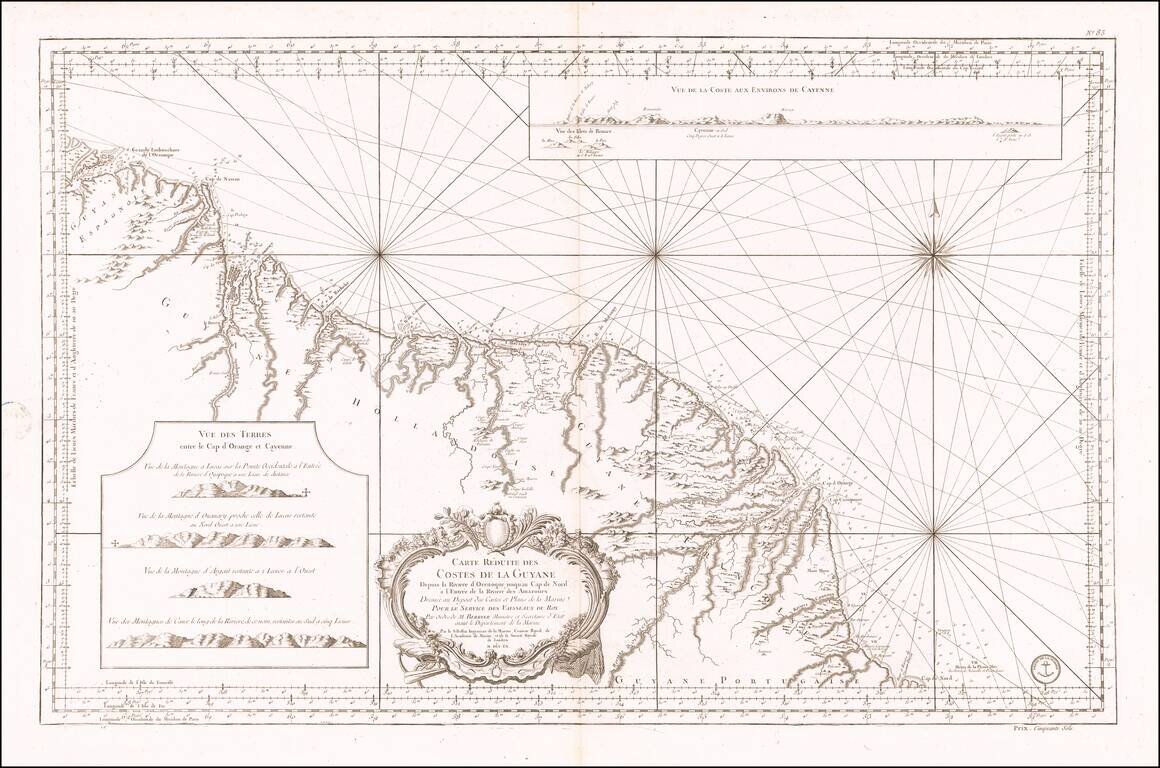
Antique Sea Chart of the Coast of Guyana, French Guiana, Suriname and the Brazilian State of Amapa Finely executed French sea chart of a portion of the northeast Coast of South America, from the mouth of the Orinoco River to the mouth of the Amazon...
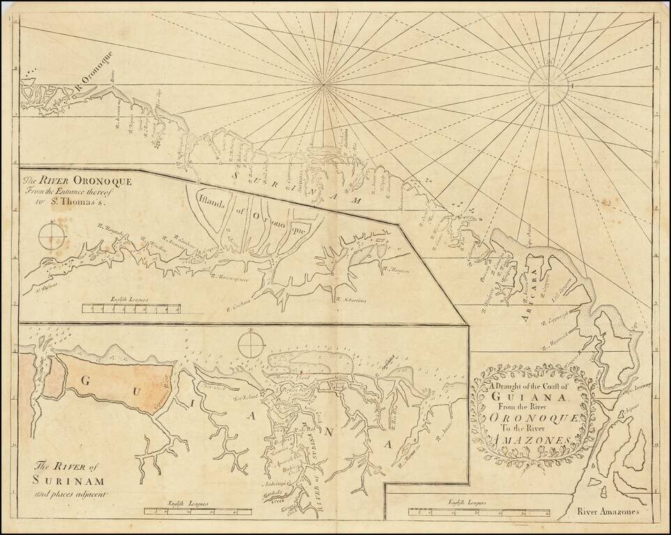
English Sea Chart of The Coast of South America, from the Orinoco River to the Amazon River. Early English sea chart of a portion of the northeastern coast of South America, centered on Guyana, Suriname and French Guiana. The map includes two inset...
Fine old color example of Tirion's map of French Guiana, with a large inset map of Cayenne. Includes a meticulous depiction of the Plantations in the region.
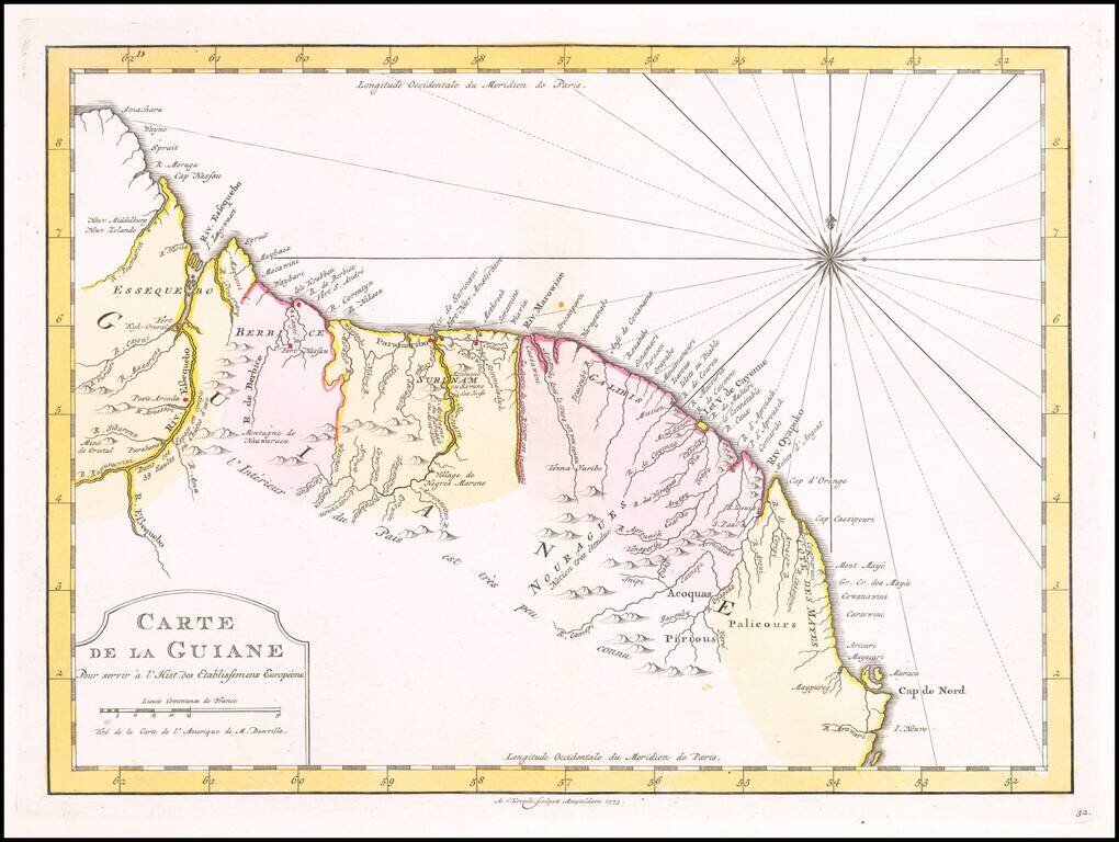
Detailed regional map, extening from Amacahra and Riv. Essequebo to Cap de Nord and R. Arawari, with a decorative compass rose. Scarce Dutch map, based upon an earlier map by Nicholas Bellin.
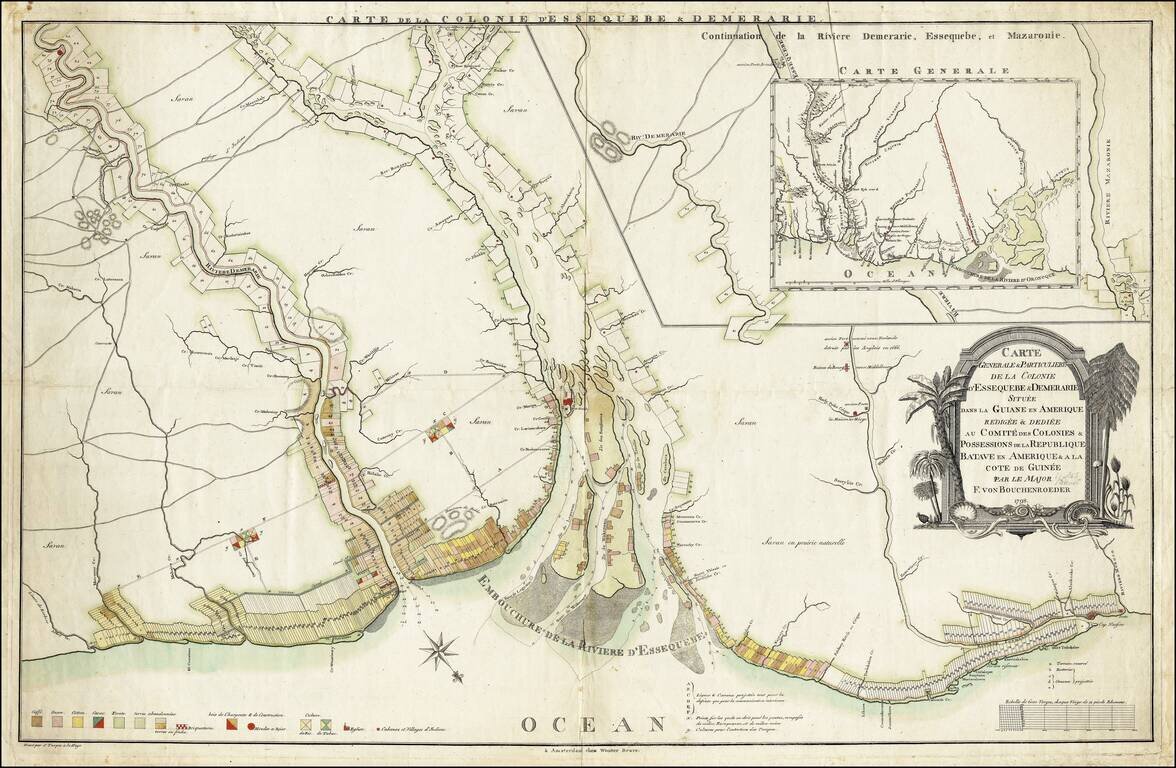
Highly detailed and informative map of the Dutch colonies of Essequibo and Demerara by Friedrich von Bouchenroeder, an officer in the Dutch Army and would-be settler. Essequibo and Demerara were settled by the Dutch in about 1616 and remained in Dutch...
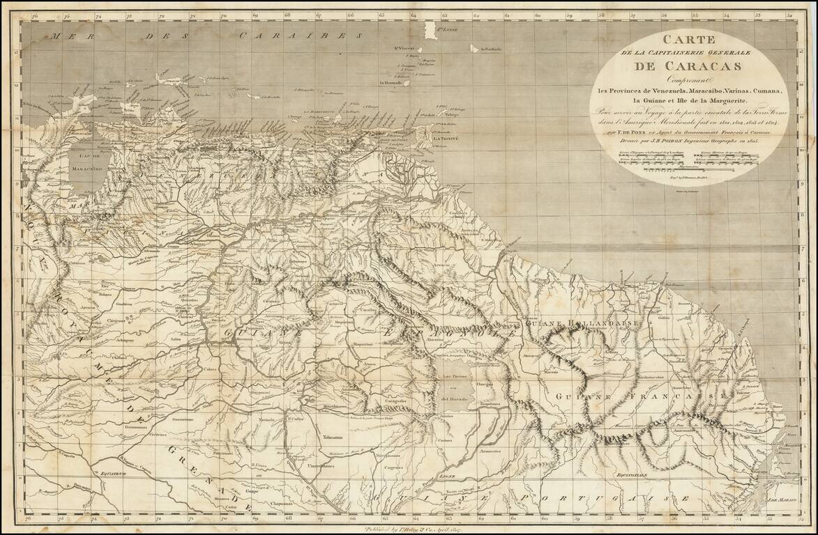
A Rare Early New York Imprint -- Includes A Reference To El Dorado Scarce and highly detailed map of the Captaincy of Caracas, published by I Riley & Co, April 1807. The map covers the area from Maracaibo and Curacao to the mouth of the Amazon...
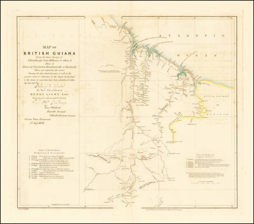
Scarce map of British Guiana, first published in 1838. The English made at least two unsuccessful attempts in the 17th century to colonize the lands that would later be known as British Guiana, at which time the Dutch had established two colonies in...